Frosty Mountain (True Summit)
February 2, 2016
2426m
Manning Provincial Park, BC
Thank to the proximity to Manning Park’s core area and the inclusion in Matt Gunn’s Scrambles in Southwest British Columbia the east peak of Frosty Mountain is among the most popular in the park, but the traverse to the west (true) peak involves 3rd class scrambling on loose terrain and thus, not-so-often attempted. The west peak itself also boasts a direct route via NW Ridge and is briefly documented in John Baldwin’s Exploring the Coast Mountains on Skis and through examining both the topographic map and the satellite images I figured it should be a fairly straightforward objective given the “moderate” avalanche rating and an “above average” weather forecast.

Frosty Mountain ascent route via NW Ridge. GPX DL
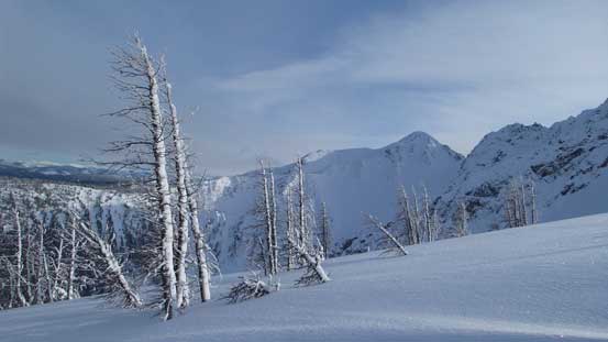
In fact, the west peak of Frosty Mountain is the highest inside Manning Park’s boundary so I was much more keen on this one as opposed to the lower, tourists’ east peak. The drive to Manning Park was long, but uneventful and I parked at Lightning Lake’s campground and started my day at 9:30 am under a partly cloudy sky. The first business was plodding across the entire length of Lightning Lake and I have to say that this lake is a long one… The views weren’t particularly inspiring neither with mostly forested hills around to see. But on the other hand, the multiple sets of tracks on the lake did help me maintain a fast pace so I managed to make to the far end in good time.

Morning view from Lightning Lake. There’s not much to see

Plodding across Lightning Lake. My objective looms behind
The next section involved over 500 m elevation gain through steep forested terrain. The general direction was following the NW Ridge up but everything seemed a bit more confusing in the forest and I had to regularly check my GPS to correct my bearing. The snowpack had done its job covering the underbrushes but I still had to deal with the tight timbers. The bushwhacking was nothing major by SW BC standard but as someone coming from the Rockies I had to say this’s among the few bushier ascents I’ve done on snowshoes. On top of that the terrain was pretty steep throughout but on the other hand, the solid layer of rain crust did provide some easy travelling condition as the post-holing was nearly non-existence. Eventually the forest started to thin out as I approached the treeline.
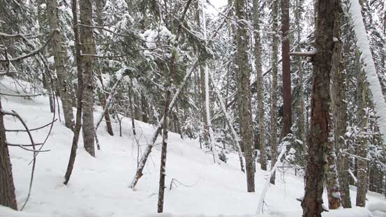
The typical forest

The trees finally thinned out as I approaching treeline
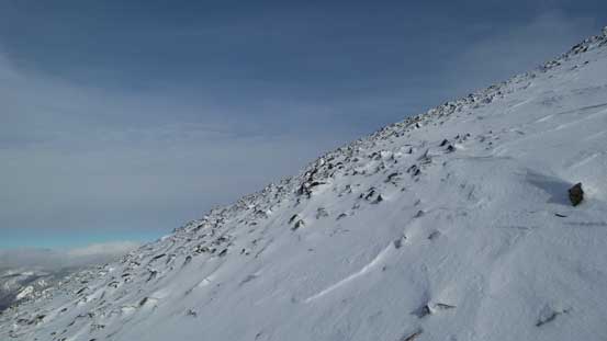
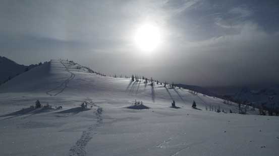
There were a few more rolls that I had to ascend through sparsely treed larch country and after that I made to a long and flat bench above treeline. My objective was straight in front and appeared nothing tricky, albeit there’s still a fair amount of elevation gain to cover. I snowshoe’d up another roll and then the ridge narrowed down with some increasing exposure to either side. The terrain ahead appeared rocky and corniced so the snowshoes were quickly ditched. At this point I thought it’d be an easy scree/snow plod to the summit but turned out a bit more involved. My soft hiking shoes performed poorly on the icy snow and it’s starting to get pretty sketchy. I was glad I brought my aluminum crampons even though I wasn’t expecting to use them.

Travelling through a larch forest

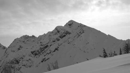
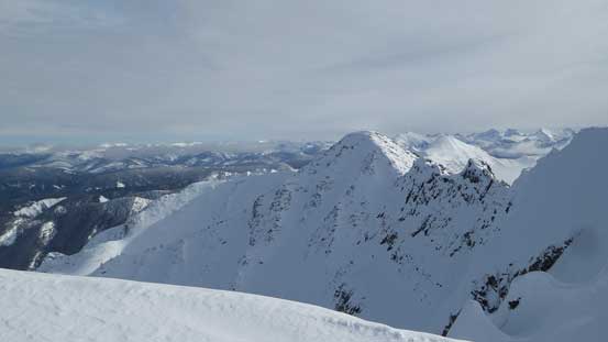
A view of Silvertip Mountain with Mt. Rideout to its left

Looking across to the east peak of Frosty (the tourists summit)
The N. Face of Frosty’s west peak.

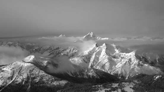
This is a group of remote peaks in North Cascades – Mt. Redoubt, Mt. Spickard, Mt. Custer

The south peak of Hozomeen is one of the most difficult in Washington by easiest route

The north (main) peak of Hozomeen is considerably easier, but still a difficult ascent

Plodding up the broad ridge/plateau
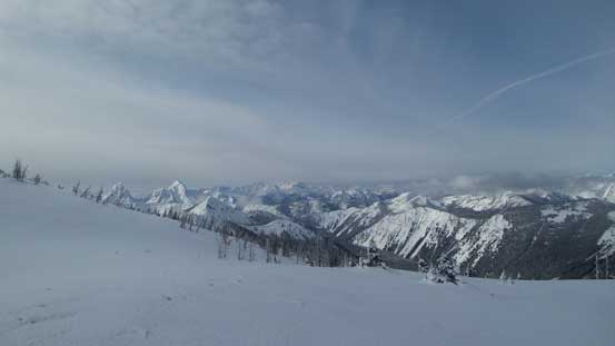
Another view from this plateau

The double-summit shot of Hozomeen Mountain
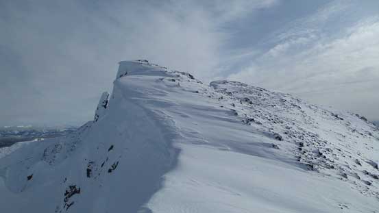
After donning crampons I resumed the ascent. I stayed more on snow from here on and didn’t have any further issue reaching the final summit ridge. There were at least 2 or 3 bumps along the ridge that I couldn’t tell which was higher from below so checked out the farthest first, bypassing the first few on the climber’s right side. The far one did turn out to be the true summit and I stayed there for about half an hour soaking in the views.

Looking back along the ridge. Here’s where I donned crampons

Looking across the face towards south into peaks in Washington

I’d follow the ridge up

This is an impressive slide path!
Higher up, looking back
The upper mountain is a plod on frozen scree
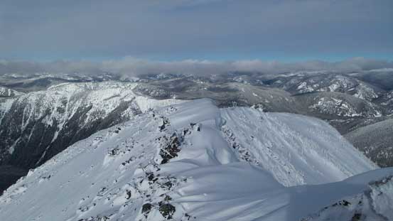
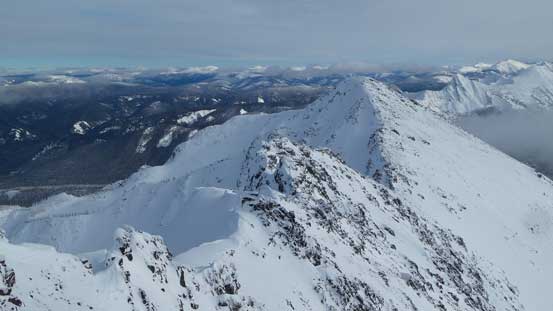
Finally hitting the summit ridge, looking towards the east peak
It’s not there yet!

Bypassing one of the few false highpoints

The final traverse towards the true summit

Summit Panorama from Frosty Mountain. Click to view large size.
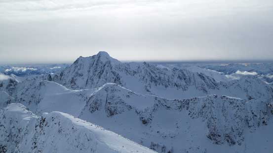
Castle Peak in Washington dominates the view looking south

The steep N. Face of Castle Peak

Looking over Mt. Winthrop (fg) towards the distant peaks in eastern Cascades (Lago, Carru, etc.)
The jagged ridge connecting the east peak

Manning Park classics – Snow Camp, Lone Goat and Red in foreground.
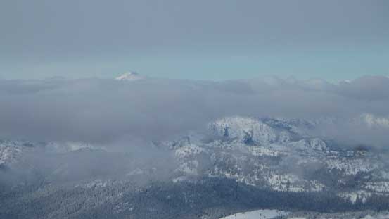
The tip of Mt. Outram sticks above the first layer of clouds
Another view of Silvertip Mountain

Looking down Frosty Mountain’s north face.
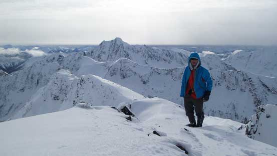
Me on the summit of Frosty Mountain

Another panorama from the summit. Click to view large size.
Eventually it’s starting to get chilly so I started the descent. I basically followed my footprints down the upper ridge and kept my crampons on all the way to where I ditched snowshoes. Another few minutes were spent switching gears and then the next 200 vertical meters or so was a fast plunge down the powder. There’s a firm crust about 30 cm down acting like a smooth platform. I could glide a bit for every step forward and adding the light powder on top that’s what I called the best “downhill snowshoeing” conditions (for grade that’s not too steep). The final 300 vertical meters was getting more “character-building” as expected. The thick rain crust prevented me from gliding so every step down would impact on the knees (similar to descending a steep trail in summer). But at least I was not on skis for this part and I was super happy about that… And then the rest was that lake plod which again, took a while.
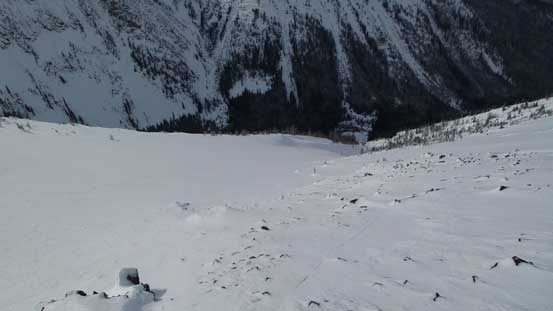
Another picture of this slide path. Might be a good run in the right conditions…

Looking back towards my objective

The Frosty Mountain’s double-summit shot. East peak on left and west peak on right
Looking back at my tracks
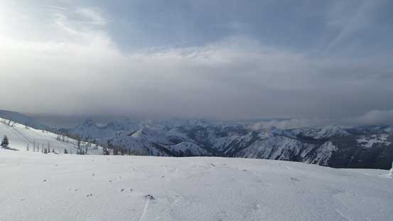
This thick layer of cloud was hovering around for all day…

Plunging down into the trees
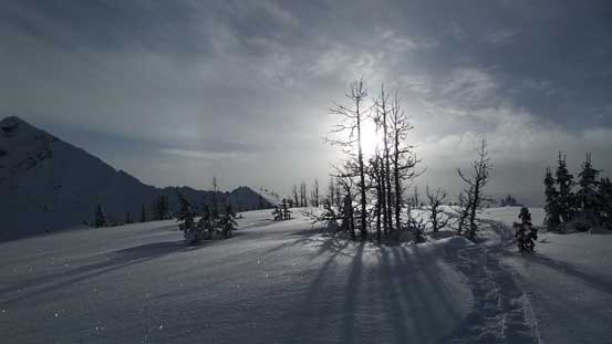
One of the many larches around
One last look at the east peak

Lightning Lake appears like 3 lakes from here, but actually just one.

Not the most pleasant forest travel…

Down to Lightning Lake

Another view from Lightning Lake

This is that bridge where the trail crosses the (narrowest section) of the lake
My round trip time was under 7 hours on a fast pace and overall I have to say this is a great winter objective. While I can see that a few spots might go wrong in some certain conditions there’s overall minimal avalanche terrain involved. The alpine is usually blown bare by the south-westerlies and all you need is some winter scrambling experience. I wouldn’t recommend the same route in summer time though due to the bushwhacking involved and for the same reason I’d say snowshoes work the best for most peak-baggers except for the ones who’re really good at tree skiing (or when the condition is favourable for other ski descent routes such as the Frosty Creek exit).
