Black Peak
August 13, 2019
2734m
North Cascades Highway, WA
Black Peak is one of the highest non-volcanic summits in Washington state but also one of the easier Bulgers and for that matter, this peak sees fair amount of traffic. The standard route is a mere day-trip via south slopes from Rainy Pass on North Cascades Highway. For climbers seeking a more interesting route the NE Ridge offers an intro-level alpine climb that shares the same approach as the standard route. The NE Ridge sounds like a fun climb and fully within my capability but I’m not a route-bagger. The NE Ridge doesn’t offer much of physical efficiency over the standard route and to squeeze peaks like Black Peak into my busy summer schedule I really didn’t want to pay more effort than absolutely necessary. My way of peak-bagging is to tag a summit and descend by route of 1. the highest chance of success and 2. the most physically efficient and then move on to the next peak, and repeat the cycle.
Mel O. had a day-off in the middle of the week and Black Peak was an easy sell. We actually had discussed this objective a couple weeks prior and the conclusion was to take a small pack and do the standard route, as a day-trip from Vancouver. There wasn’t much needed to research neither because all we needed was the Gaia GPS app and some pre-downloaded maps and GPX tracks, which were easily obtained from peakbagger.com. Given the paved status of the access road neither my Tacoma nor Mel’s Jeep was fuel efficient but Mel had some good deals to rent a car. We left at 4 am from my home in White Rock and the drive to the trail-head was long and tiring.

Black Peak standard route. GPX DL
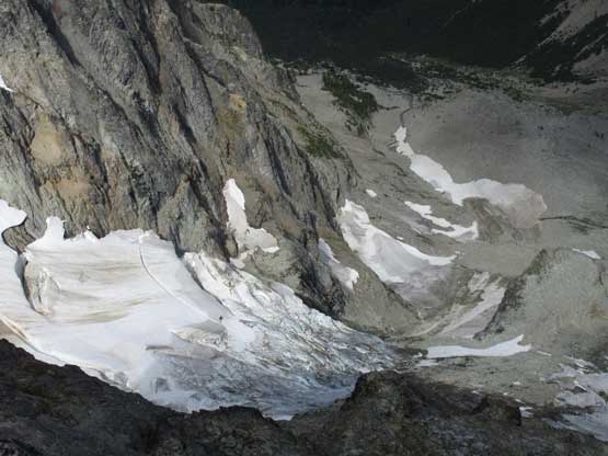
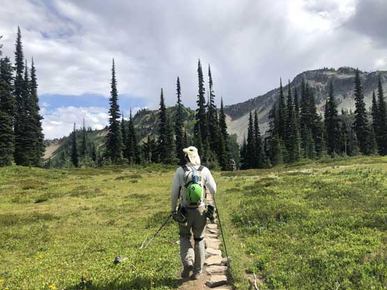
The first stage of the approach followed Lake Ann trail and then branched off towards Heather Pass. This is one of the most popular zones in the North Cascades for hiking and the trail condition didn’t disappoint us. The portion of the trail from Heather Pass down to Lewis Lake was much worse with lots of confusing stretches on boulder fields. Because of the zero research we were expecting a “good trail” all the way to Wing Lake at Black Peak’s base, but apparently the maintained trail only reaches Heather Pass. The boulder fields were tedious to negotiate on trail-runners and we also had to deal with at least 150 m of elevation loss. Thankfully the stretch from Lewis Lake to Wing Lake was in a much better shape that we were able to cruise. Arriving at Wing Lake we took the first long break of the day.

Looking down at Lake Ann from Heather Pass Trail
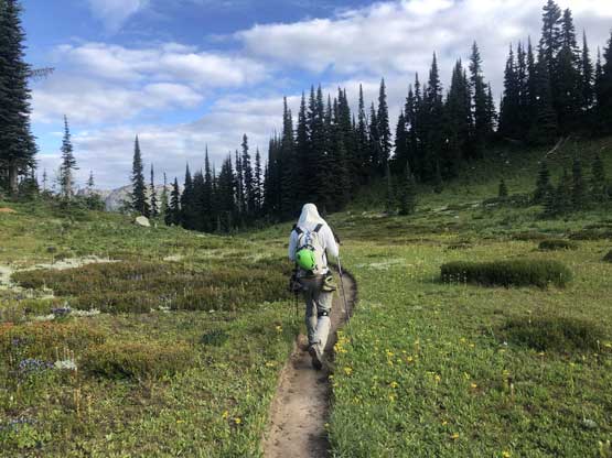
Me arriving at Heather Pass. Photo by Mel O.

Our first view of Black Peak. South Ridge on left; NE Ridge on right
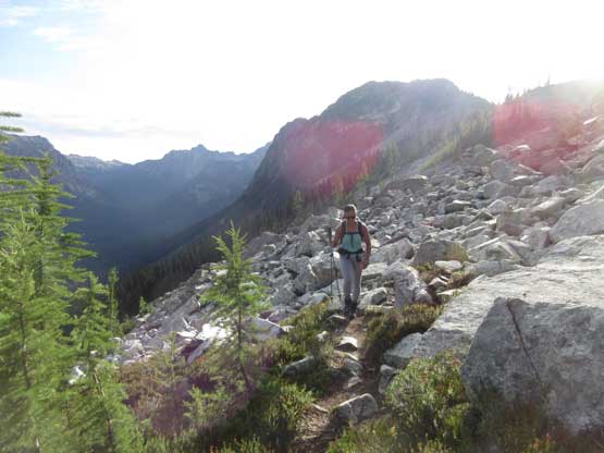
Mel finishing the annoying descent/traverse on talus field

Me with Black Peak ahead. Photo by Mel O.

Arriving at Lewis Lake
The trail traverses around the north shore of Lewis Lake

Looking back at Lewis Lake

The section between Lewis and Wing Lakes

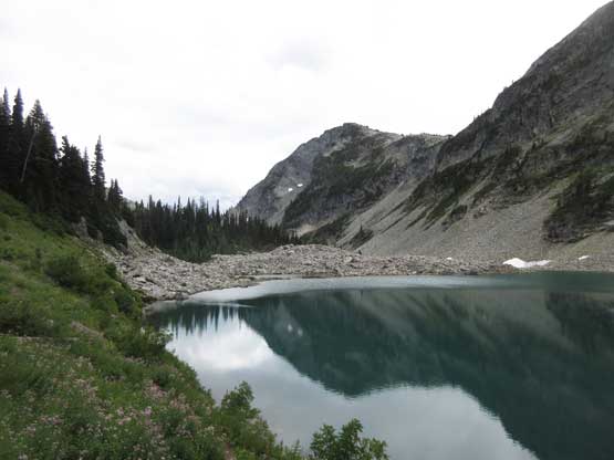
Mel almost at Wing Lake. Black Peak ahead

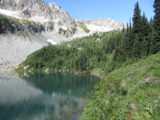
Panorama of Wing Lake. Click to view large size.
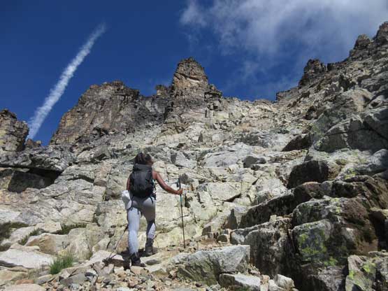
I swapped trail-runners for mountaineering boots as soon as the scree started. The slog to the shoulder of Black Peak’s south ridge appeared very ugly but actually wasn’t that bad, probably because of the high volume of traffic. For most parts we could stay on some foot paths that significantly reduced the pain of scree slogging. There was some unavoidable compact dirt type of choss near the top but those were short-lived. At the col we got our first view onto the NE Buttress of Goode Mtn. but resumed the ascent without doing much of a stop. The south ridge/slopes was mostly “class 2” on ledges and the route-finding was easy given the paths and cairns.
Leaving the trail behind at the base of our objective

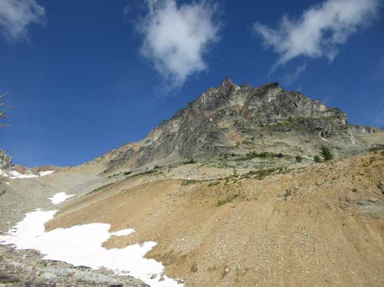
Our aim was the col in the distance

Mel utilizing snow for as much as possible

Me ascending compact choss. Photo by Mel O.

Mel almost arriving at the high col
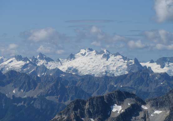
Our best view of Dome Peak on this day
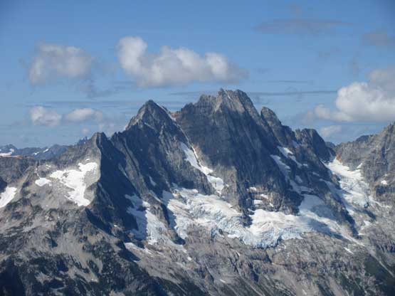
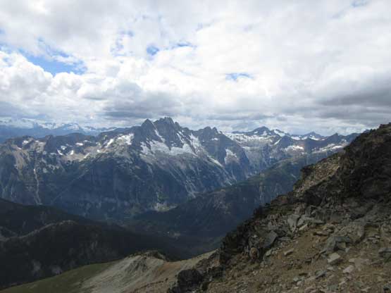
Goode Mountain and its NE Buttress
The massif of Mt. Logan
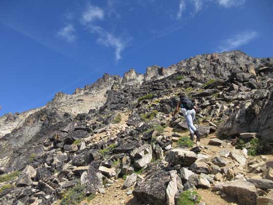
Mel charging up the foreshortened south ridge/slopes

A sideways view from partway up the south ridge

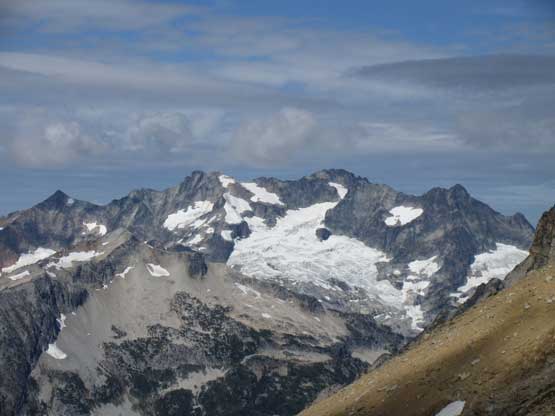
A wider view towards Goode Mountain and Bridge Creek valley
Midway up the south ridge. This is the typical terrain

Mel higher up on the south ridge.
About 100 m below the summit I ran out of gas and had to call for a break. The terrain wasn’t exciting that I felt deprived in energy. The route steepened a little bit near the summit ridge but never exceeded “low 3rd class”. At the summit ridge we weren’t sure what exactly to do so followed cairns and paths traversing a long ways under the ridge crest due climber’s right, until the path ran out at a 4th class corner. We weren’t sure if that’s indeed the right way but the scrambling looked solid and fun and in short time we were at the summit. We lingered on the summit for over an hour taking some much-needed naps. The long drive and slog was surely exhausting.
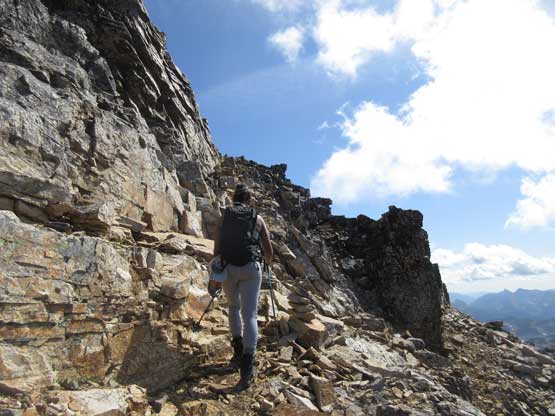
Traversing a key ledge immediately underneath the summit ridge
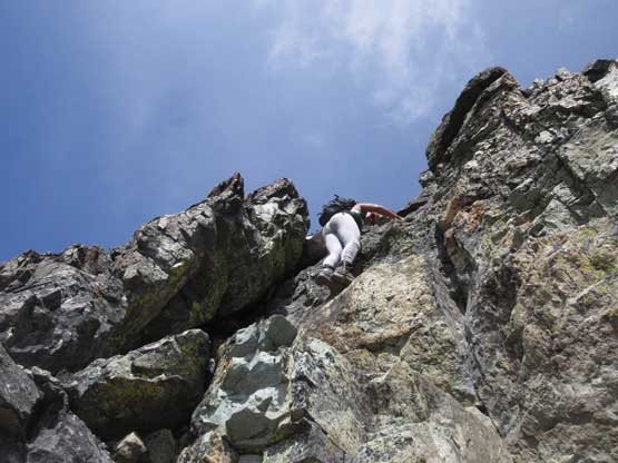
Mel leading the 4th class crux to gain the summit
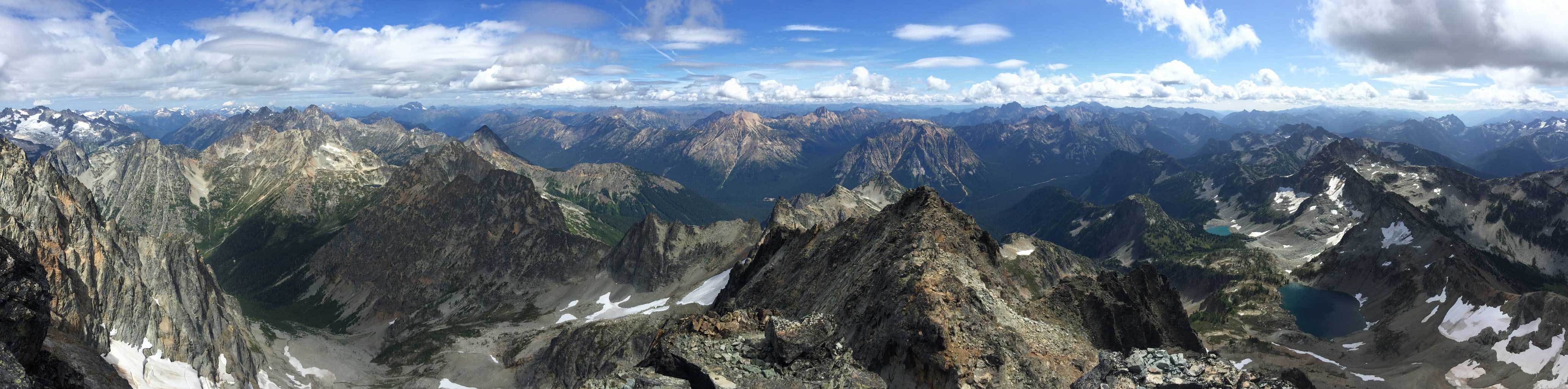
Partial Summit Panorama from Black Peak. Click to view large size.
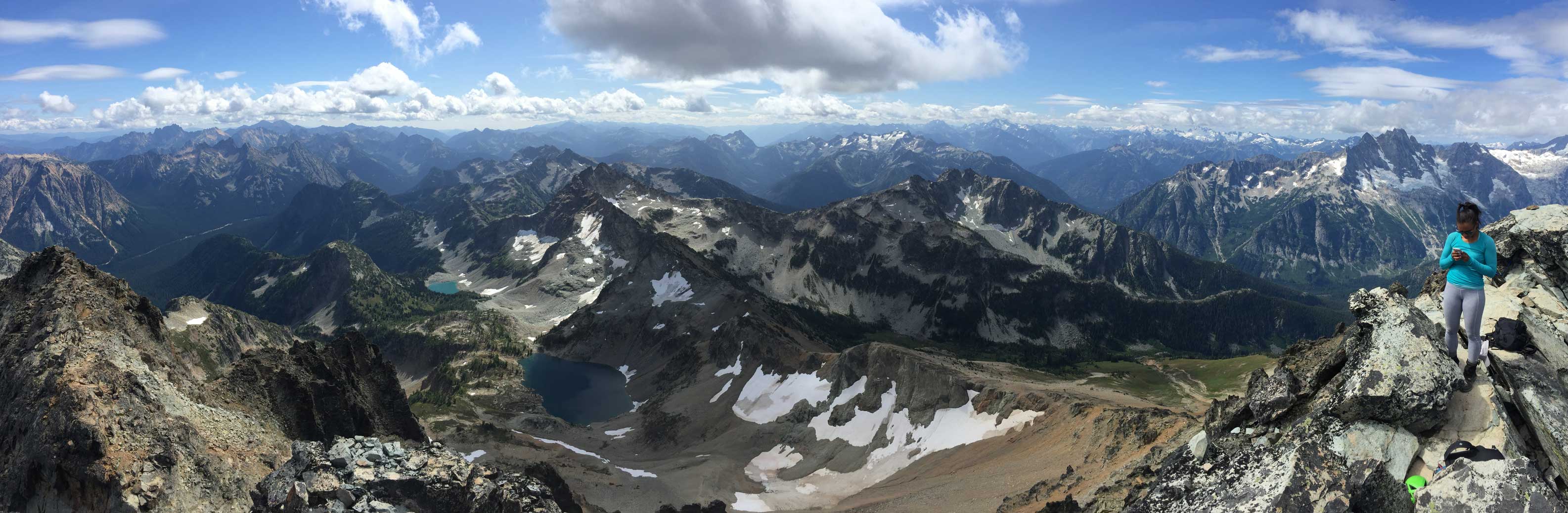
Partial Summit Panorama from Black Peak. Click to view large size.

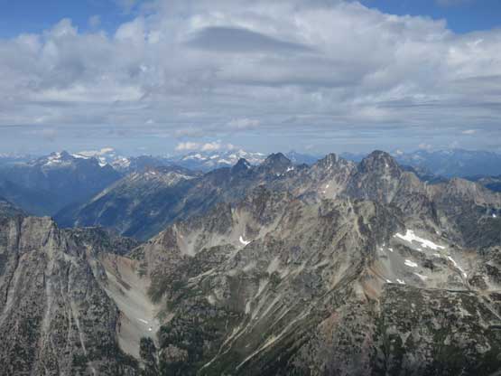
A view down towards Golden Horn and Tower Mountain
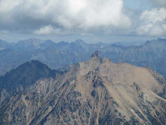
The four Bulgers on Ragged Ridge

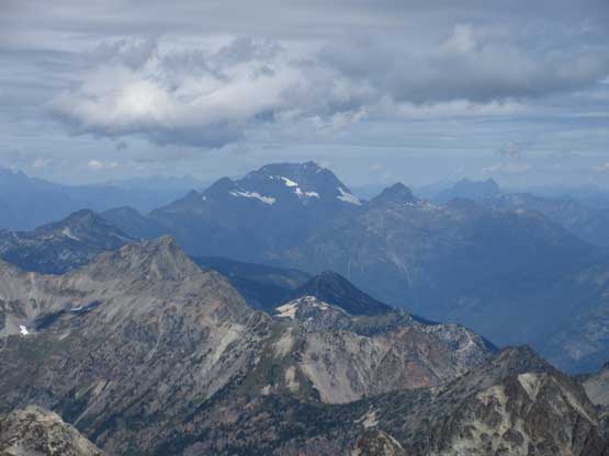
Mt. Logan
The massif of Jack Mountain to the north

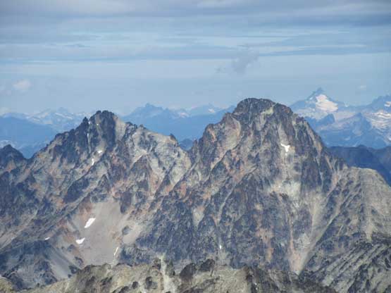
Mt. Ballard (L) and Azurite Peak (R) in the distance

A closer look at Tower Mountain

Wing Lake where we came up from
A zoomed-in view of Katsuk Peak (L) and Meshachie Peak (R) on Ragged Ridge
The north face of Black Peak is a sheer vertical wall
Golden Horn in the foreground
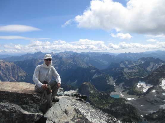
Me on the summit of Black Peak

Another photo of me on the summit of Black Peak

Mel and I on the summit of Black Peak
It appeared that the “mostly sunny” skies had gradually turned into “mostly cloudy” so there wasn’t much point in lingering any longer. The class 4 down-climb was fun but too bad, that was the only exciting portion of the whole descent. The rest of the scramble back to the col and then down to Wing Lake was fast, but tedious. The hike-out was even more tedious and I wasn’t particularly happy about the uphill portion, especially considering I had Slesse Mtn. lined up with only a mere day of resting in between. The day became even cloudier. Near the end of the trail Mel took off to start the car while I leisurely slogged to the finish line, surprised by some rain drops.

Mel down-climbing the 4th class crux

Me starting down the south side route. Photo by Mel O.
One last view of Goode Mountain

Hiking down between Wing Lake and Lewis Lake
Back at Lewis Lake in overcast sky
Almost back at Heather Pass now. Photo by Mel O.

Hiking down Heather Pass trail

Lake Ann from high up on Heather Pass trail

One last photo of Heather Pass trail descent.
The rest of the drive back home was not to our surprise, long and exhausted. Thank Mel for driving the whole way. Without her I surely wouldn’t be able to arrive back home by dinner time…
