Mount Dewdney
December 12, 2020
2244m
Manning Provincial Park, BC
Not to be confused with the lowly forested summit of Dewdney Peak near Mission that is famous for its “Dewdney Grind”, Mt. Dewdney locates on the western edge of Manning Park and is significantly more prominent. This peak is however, much less frequently ascended because the off-trail travel and the shear amount of elevation gain. The least technical route is probably the west ridge from Ghost Pass but the more commonly used route is the south slopes accessed from Dewdney Trail in Snass Creek drainage. The advantage of the latter is the possibility to combine with Mt. Ford making a two-peak-outing (which is basically my deciding factor) and the shorter distance. The disadvantage is the ascent from Snass Creek up onto Dewdney/Ford col being a very steep 1000 m grunt. There’s a user-maintained flagged “trail” on this stretch so at least the bushwhacking is minimal.
My plan for Mt. Dewdney had always been the south slopes route combined with Mt. Ford but in winter time. I figured there’s no need to waste a sunny summer day for peaks that I could bag in winter. The route on Mt. Dewdney involves fair amount of travel in avalanche terrain on multiple aspects, so I had to play the timing game. The stable conditions came towards the second weekend of December. For a couple days the avalanche rating had dropped to Low/Low/Low across all zones. It jacked up a little bit to Moderate/Low/Low at the last minute but I figured it was still safe enough to go. I originally planned this outing with Vlad but Winnie also decided to join at the very last minute. The three of us left Vancouver at around 5 am and made to the trail-head two hours later. There was already fair amount of snow but I was able to drive to the actual trail-head about 100 m from the highway thank to some recent tire tracks.
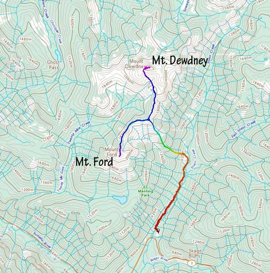
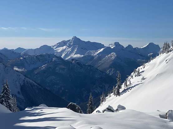
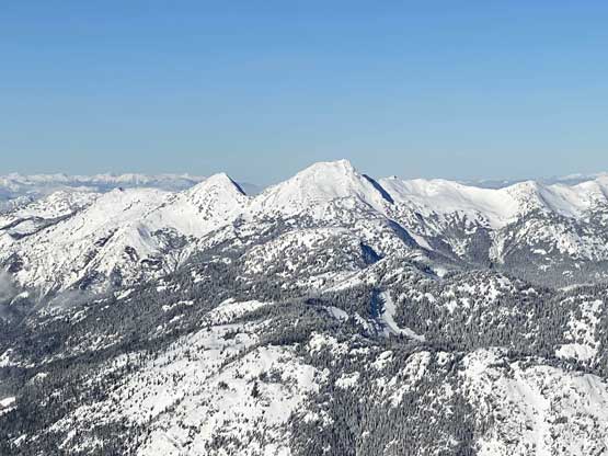
Mt. Dewdney and Mt. Ford from Dewdney Trail. GPX DL
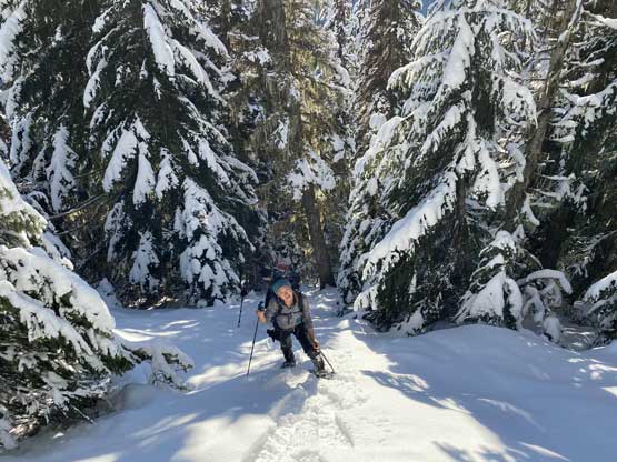
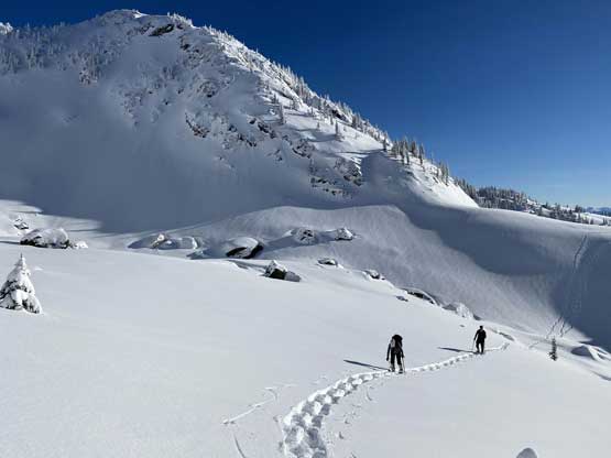
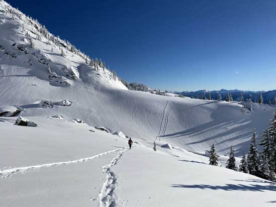
We made to the trail-head late enough to not need to use head-lamps but that meant we probably would have to use head-lamps on the return, which was fine. The first stretch was a boring plod up Dewdney Trail for a few kilometers past the Whatcom Trail junction to Dry Lake. There was enough foot traffic that snowshoes weren’t needed on this trailed portion of the hike. The exact spot to leave the trail was unclear so I just followed the GPS track given by Al. The spot where Al bailed into the forest looked open enough so we did the same. The snow was more icy than powdery that the snowshoes weren’t really needed at this point, but we opted to strap them on anyway to increase traction. The forest became steep in no time. For a long section it reminded me Mt. Coulter although the average slope of this route was not as steep. We were able to follow the flagged route for at least 300 vertical meters up and once the snow became thick enough to completely cover the brush and dead-falls we just went straight up sticking as close to the ridge crest as possible. About halfway up the grunt we started to encounter open slopes here and there.

The typical plod on Dewdney Trail at the start

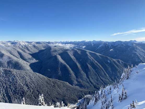
The first view of Mt. Dewdney
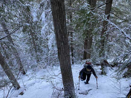
This picture sums up the lower 300 m or so in the forest

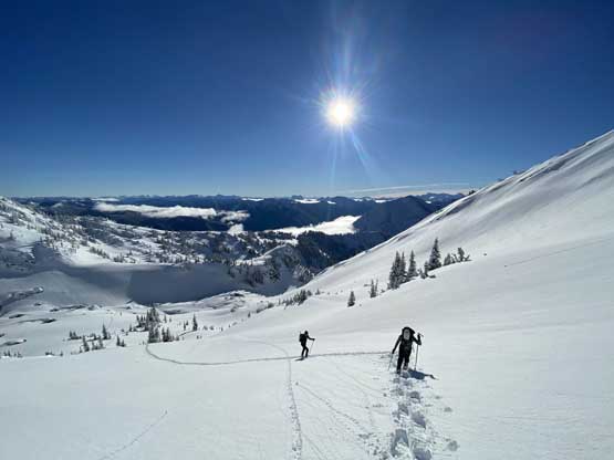
Our first taste of sunshine
Winnie didn’t seem very stoked about this trip…

One of the sub-summits of Snass Mountain across Snass Creek

Vlad snowshoeing up

Winnie charging up the first major open slope
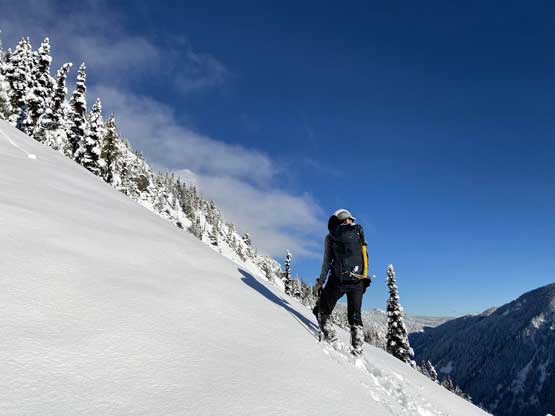
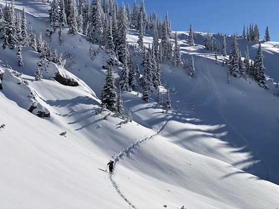
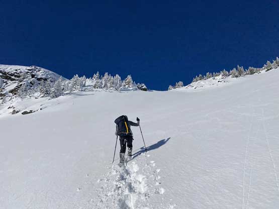
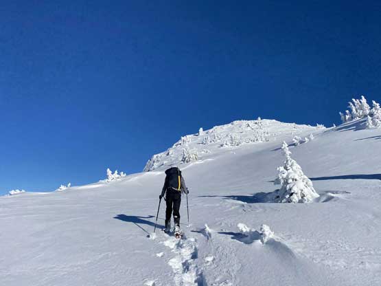
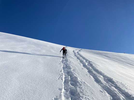
The condition was mostly 20 cm of dry powder on top of a very supportive crust so the snowshoeing was a fairly challenging that we all slipped and tripped a few times. The grade was sustained 35 degrees and there’s even some exposure and run-outs on a few open areas. About 3 hours into the trip we made to within 100 vertical meters from Dewdney/Ford ridge and decided to take a lengthy energy break. I then took over the lead charging up onto the ridge and without doing any unnecessary lingering, turned right onto the flattish, undulating ridge towards Mt. Dewdney. We plodded up and over a few minor bumps to the base of a substantial sub-summit SE of the main peak.
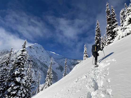
The typical terrain and conditions of the upper 500 m or so of this rib
Winnie posing for a shot
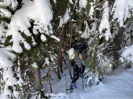
We had to deal with some bushwhack at times
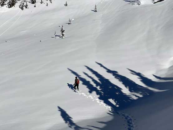
As you can see, the exposure and run-outs were real

Vlad plodding up

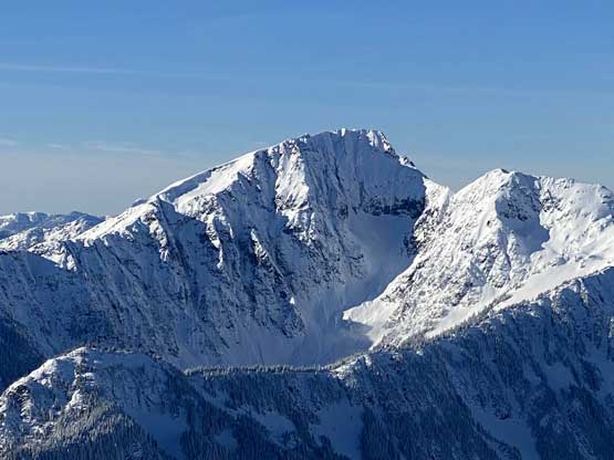
The NE Face of Mt. Ford.

The plod seemed never-ending…

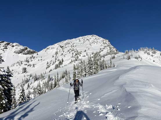
Mt. Ford is a bigger and more attractive mountain than I thought

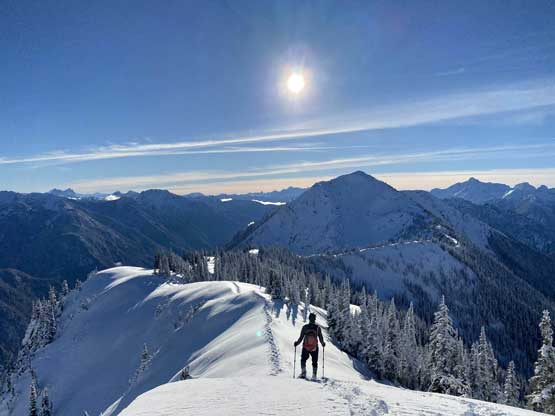
Finally made to Dewdney-Ford Ridge
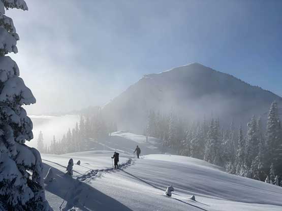
Mists came in and out while we traversed the ridge
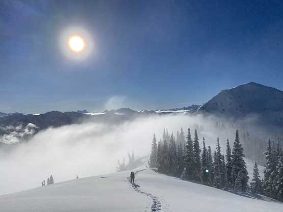
The midday mist and Winnie

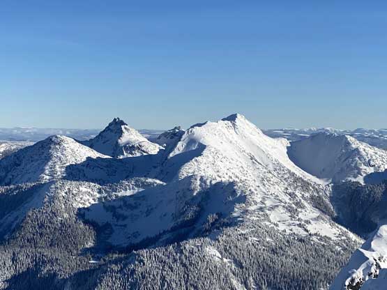
A view of Snass Mountain with its multiple sub-peaks

Me and Winnie plodding towards Mt. Dewdney. Photo by Vlad M.
The correct route was not to follow the ridgeline over this sub-summit and instead, we picked a steep and traversing line cutting down into the massive bowl south of the massive. This section involved two stretches of elevation loss as well as fair amount of side-hilling. From the middle of the main bowl I then led a line diagonally traversing the entire bowl into what seemed like a broad, 35+ degree gully/ramp that eventually led us to the uppermost west ridge. Once onto the upper west ridge we only had a short plod to the summit.
Winnie descending into the first bowl
Vlad breaking trail across the first bowl
Winnie then descending into the second (main) bowl
From the lowest point in the bowl, looking south towards Silvertip Mountain
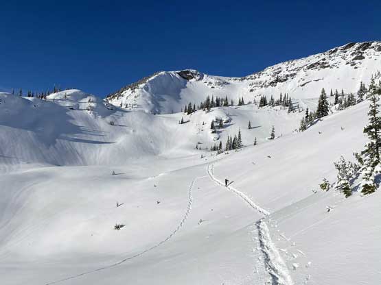
Winnie and Vlad plodding across the main bowl
We traversed into the broad gully left of center in this bowl
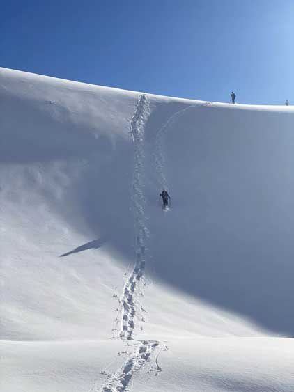
Winnie post-holing up the 35 degree gully like a champ
Winnie continuing charging the uppermost west ridge
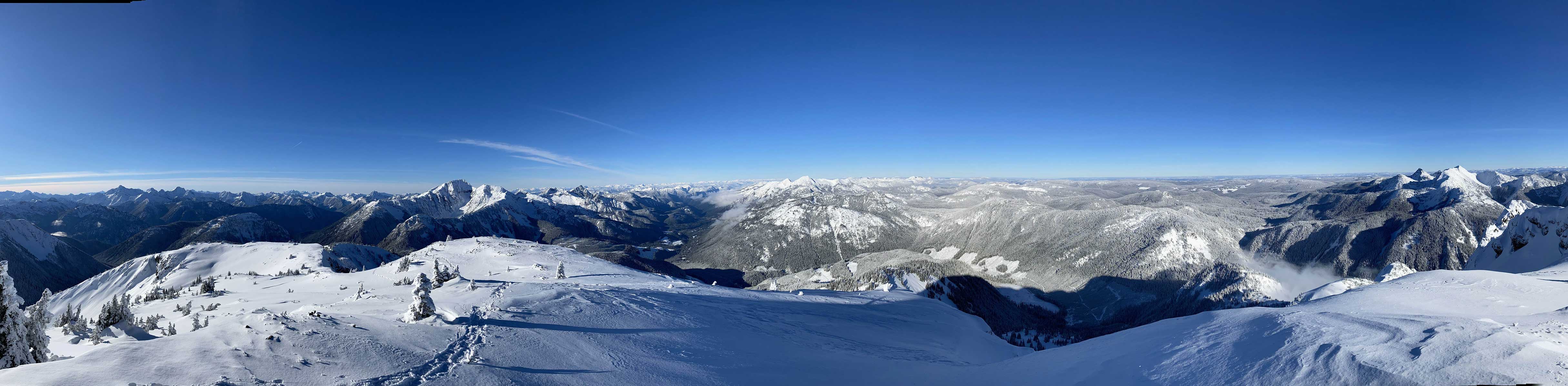
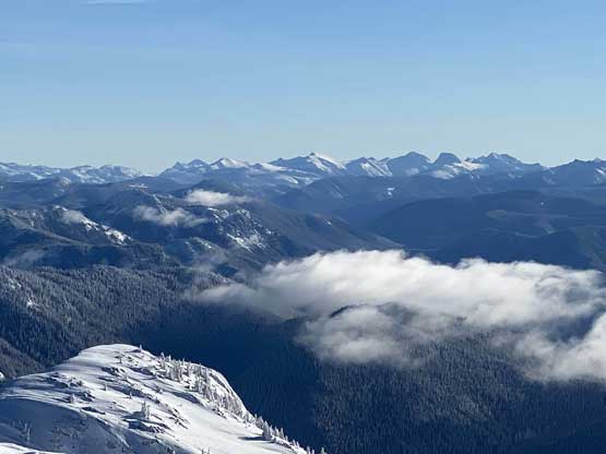
Partial Summit Panorama from Mt. Dewdney. Click to view large size.

Partial Summit Panorama from Mt. Dewdney. Click to view large size.
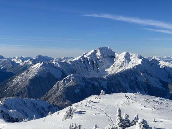
The east aspect of Mt. Outram
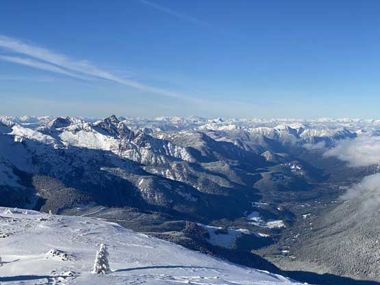
The Sowaqua Creek drainage that drains to the Coquihalla Highway
The south aspect of Tulameen Mountain looks rather tame

Mt. Hatfield and Macleod Peak
A closer look at the east face of Mt. Outram
Snass Mountain and “Snazzy Peak”
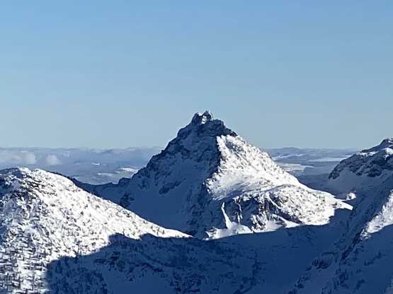
A closer look at “Snazzy Peak” that I ascended three years ago
The group of Washington Bulgers – Lago, Ptarmigan etc. on the horizon
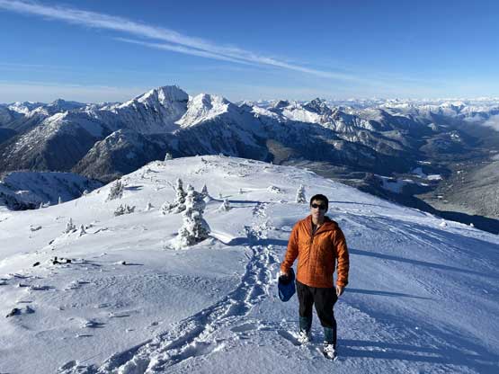
Me on the summit of Mt. Dewdney
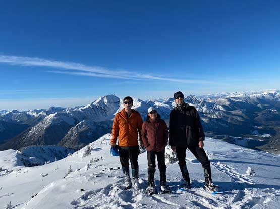
Our group shot on the summit of Mt. Dewdney
We didn’t stay too long up there because we still had to do Mt. Ford and we certainly weren’t doing super great on time. It had taken us 5 hours to reach the summit of Mt. Dewdney and we only had three hours of daylight time left. Plodding down the south slopes of Mt. Dewdney took literally no time and the two sections of re-ascending were actually not that bad. Once back onto Dewdney/Ford ridge we plodded down to the low point for as fast as possible. I even ditched my backpack and immediately started charging towards Mt. Ford.
Vlad plodding back down into the pristine bowl
In the middle of this bowl. Why I don’t hear skiers coming up here?!

Winnie in the bowl
Vlad on the first of the two elevation-regains
Winnie looks tiny comparing with the terrain
Winnie plodding back onto the Dewdney-Ford ridge
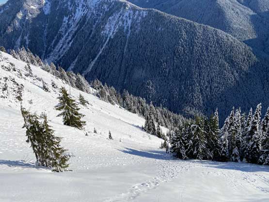
The typical Manning Park scenery
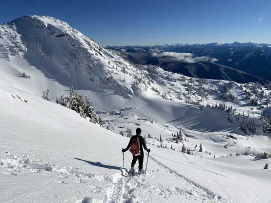
Vlad plodding towards out next objective – Mt. Ford
