Peak 2732 (Little Maria Mountains)
December 31, 2021
833m
Blythe, CA
This is an unnamed summit in the Little Maria Mountains about 50 km to the NW of Blythe. The only significance is the 300+ meters of prominence. If not because of Adam’s suggestion I would never come across this objective but I did not regret doing it. It’s far from the prettiest peak by any measure, but the scramble was unique and memorable in some ways. The only reason we headed north from Blythe was to dodge the rapid-moving weather system. Adam had previously been to this area and subsequently bagged the better and more significant objectives, so the two objectives he pointed out sounded rather tame, but I did no research about the area so I just needed to follow.

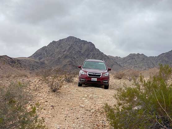
We drove north out of Blythe in the late afternoon and that would give us enough time to eventually set up camp before dark. Adam decided to head towards “Peak 2732” first so we aimed at the broad pass between Big Maria and Little Maria Mountains. The travelling was mostly on a paved road but near the pass it eventually turned gravel. The going was still easy until we located that spur road heading SW towards our objective. This spur road was not even shown on the Gaia map, but I did download the USGS topo map which had it correctly labelled. The condition was rough and overgrown, such that the other drivers had abandoned the road and just driven on the desert floor. After about 1 km I decided to start tracking the drive-in as we might need this GPS track for the way out, as we were clearly not following the road at some spots. A few kilometers into the drive we came to a major ditch/wash-out. We got out and inspected the depth, and decided to pile some rocks into the ditch to build a temporary bridge. Adam then drove the Subaru across but it appeared like he did bottom out the vehicle. We continued pushing for another 1 km before calling it a day, as going any further seemed rather silly in the vehicle we had. The sunset views were gorgeous, but a system would move in overnight and it did drop rain on the second half of the night, but only lightly.


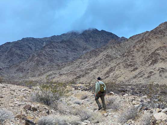
The next morning we did not bother to wake up too early as the forecast was calling for a clearing trend throughout the day. The weather was 100% overcast when we got out to cook breakfast and did not improve during this ascent. We did not bother to break camp as this spot was too remote for vandalism activities. After plodding up the remaining 2 km of the road we entered a major wash/gulch that eventually brought us to the east-facing gully that came down directly from the summit. There was some micro-terrain and up-and-downs while traversing into this gully. The scrambling in the gully was not bad with lots of hands-on sections to overcome dry falls. A few spots were definitely class 3.


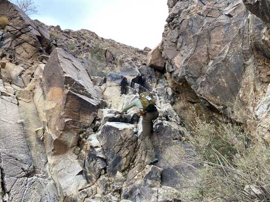
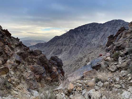
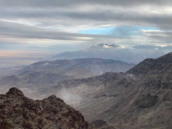
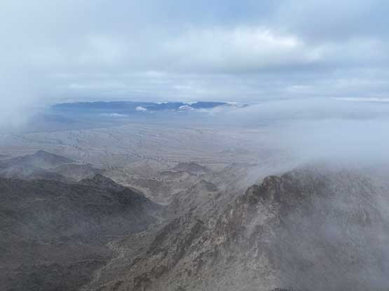
The rock formation in this range is entirely granite which felt like a drastic change from the previous few days. About 200 m below the summit we sort-of exited this gully onto the east face and the scrambling had suddenly become shitty. The terrain was shockingly loose especially considering the rocks being granite and the grade was quite steep. We veered climber’s left slightly to eventually pop out onto the uppermost south ridge. By this point we had entered the cloud layer so the rest of the ascent was done in a white-out, which must be rare for this part of the desert. The south ridge had a knife-edge finish in the end. I attacked the knife-edge head-on, which had a few very loose class-3 moves. I told Adam to find another way and he came up from the east side. We eventually found the easiest way on the descent which was on the west (climber’s left) side.

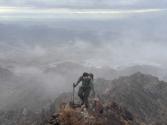
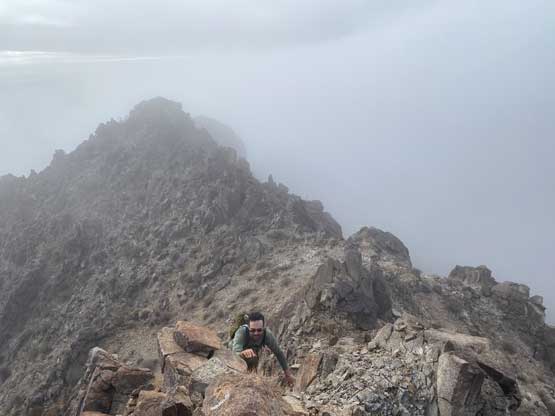

After signing the register we decided to start the descent as it’s apparent the weather would not improve. As mentioned earlier we found a better way to get off the summit block but then made a spontaneous decision to scramble straight down the east face to avoid traversing the rest of the south ridge. This was my decision and I cannot comment whether we saved time or not. The descent route was considerably steeper than the one used on the ascent, and the terrain was just as loose, if not worse. It took us a while to get off this crappy face to enter the gully, and thankfully the scrambling in the gully was quite fun. There was lots of boulder-hopping lower down in the gully thank to the granite rock formation. The final plod back across the desert floor and the road was rather uninspiring.


Overall this objective turned out more than I thought with over 500 m elevation gain on a variety of terrain. The drive-in (and the drive-out) was also an adventure so this was definitely a worthy experience. We reinforced that “bridge” and I think Adam did not bottom out the Subaru on the drive-out. The GPS track I recorded also came handy as that’s the only way for us to retrace the exact line we took. I never thought one needs a backcountry GPS device to navigate the driving but apparently this is a common practice in the desert. After getting out of the crappy roads we turned our attention to the Big Maria Mountains.