Merlon Peak
September 5, 2020
1813m
Vancouver Island, BC
“Merlon Peak” is the unofficial name of the second highest summit of Haihte Range on the northern Vancouver Island. The highest peak in this range, Rugged Mountain catches most peakbaggers and climbers’ attention for various obvious reasons and very few do actually bother to even think about other summits in this range. This is unfortunate as the other “minor” peaks do offer quality and sometimes, more challenging climbs. “Merlon Peak” actually consists of three summits – South, Central and North. The easiest is the south summit but it’s also clearly the lowest of the three. The central and north summits are roughly equal in height that one cannot visually tell, but the general consensus is the north summit being the highest. The information of these summits are limited.
Winnie and I came to Haihte Range also to climb Rugged Mountain but we had budged three days there. This meant we could have a full day on the second day up in the alpine. The ascent of Rugged Mountain took us only a couple hours so to not waste the day we wanted to explore a route up Merlon Peak. The goal was to ascend the main (north) peak but we ended up climbing both central and north peaks.
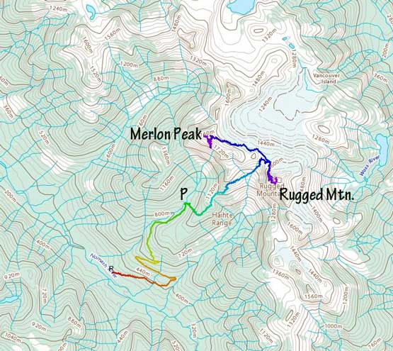
Ascents of Rugged Mountain and Merlon Peak. GPX DL
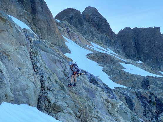
We had came with Matthew Lettington’s GPS tracks and his trip reports, as well as beta in Phil Stone’s Island Select Alpine, but we were still not very sure about what exactly to expect on the upper sections. The approach direction was clear though, that we just needed to navigate and traverse the glacier aiming somewhere towards Merlon North/Central col. From our camp at Nathan Col we descended some low-angled snow and ice, wrapping around the lower east face of “Nathan Needles”. We briefly considered climbing the east face of the big needle but the terrain appeared very run-out. We were also not very sure where exactly to start the climb, so after a bit of hesitation we moved on. The glacier travel towards the base of Merlon Peak wasn’t as straightforward as expected due to the late-season conditions. There weren’t much in terms of crevasses navigation but we did have to deal with long stretches of low-angled ice and a few snow-to-rock transitions. This was Winnie’s first time cramponing on ice.

Me with Ya’ai Peak ahead. Photo by Winnie M.

Winnie traversing around the base of “Big Nathan Needle”

Winnie with “Big Nathan Needle” behind
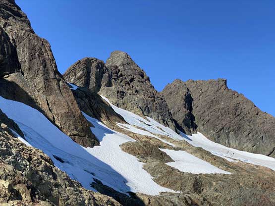
The central and north summits of Merlon Peak ahead

There were a number of snow-to-rock transitions
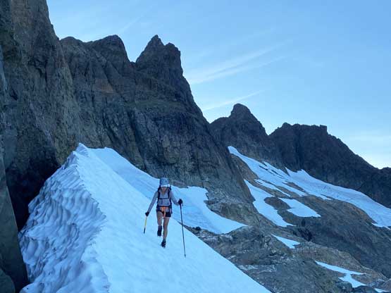
Winnie traversing the typical slopes on this long glacial bench

A bit of ascending here, with that iconic lake behind

Getting closer to Ya’ai Peak. We both agreed to come back for that one.

The last section of glacial traverse
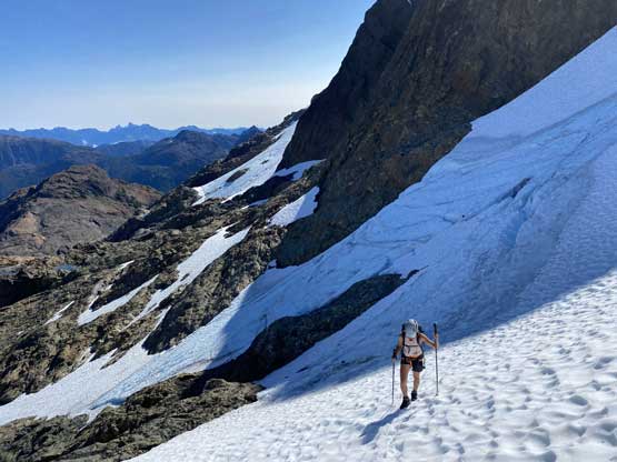
Winnie testing her crampon skills on the dry ice

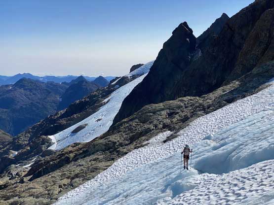
Another photo of Winnie traversing the glacier.
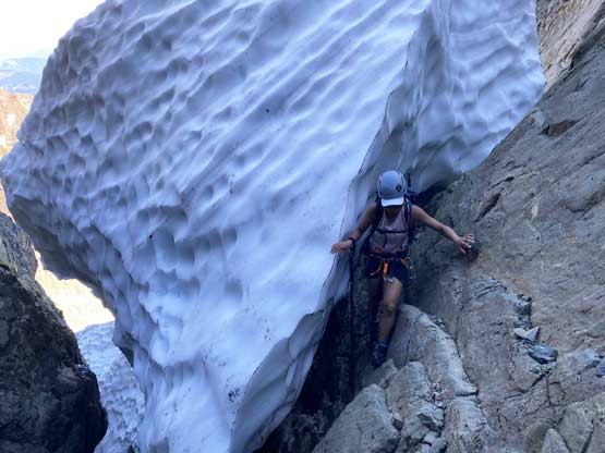
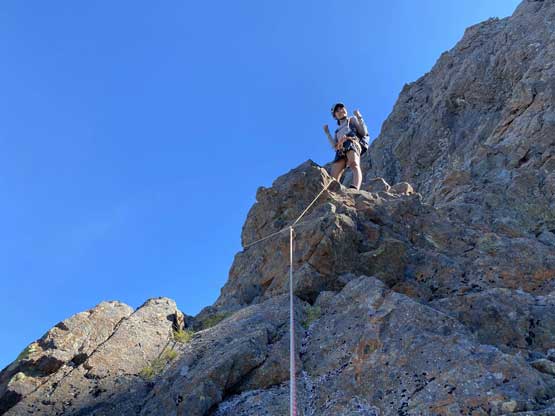
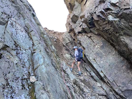
At the base of the snow gully under Merlon North/Central col I was still not quite sure where did Matthew’s group access the rocks. The only way that made sense for us was to ascend the steep snow (40 degrees) towards the col, but deep moats had prevented us from hopping onto the rocks on the north side. We were forced to ascend pretty much to the end of the snow passage but the uppermost lip under the col was also blocked by 5-meters of moat. We did locate a reasonable spot to hop onto the rock (on Central summit) side, followed by some 3rd class scrambling on down-sloping and wet terrain. We down-climbed and squeezed into the moat and then scrambled up some shitty compacted hard moraine type of choss to Central/North col. At this point we were very off-route from Matthew’s GPS track but I also knew there was no way to access his route, so we had to figure everything out on our own now.

The top of the snow couloir trying to hop onto rock
We eventually had to squeeze through this moat

Then, scrambling up this shitty compact hard gully.
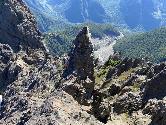
I spent at least 10 minutes investigating the south/west side of the north peak trying to see if we could link up some ledges and chossy couloirs but to no avail. I couldn’t not make that commitment as the terrain appeared very shitty. The direct attack (south ridge) out of the notch required at least one pitch of technical climbing and then I wasn’t sure what to expect higher up. I then made the call to climb the central summit to scope things out. The north face of the central peak was by no mean “easy” but the rock quality was much better than the south face of the north peak. Winnie and I swapped footwear for rock shoes but we opted to scramble. The lower 1/3 had a few stiff 4th class or low 5th class moves and sure enough, we came to an old rappel station. The middle 1/3 was mellower but exposed. We climbed a bit out towards right onto a small shoulder feature, and then there came the upper 1/3 where we had no choice but to solo one pitch of low 5th class to the summit.

The typical exposed 4th class terrain on the north face of Merlon Central

Winnie handling another exposed move

There were a few 5th class moves here with deadly exposure

Topping out on the summit ridge
Winnie approaching the summit of “Merlon Central” with north peak behind

Rugged Mountain pokes behind “Merlon South”

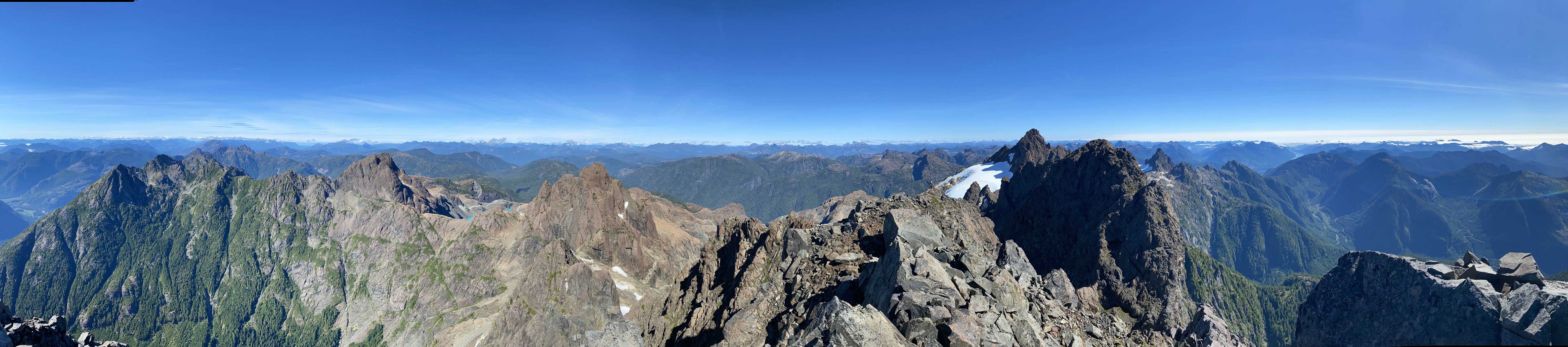
Partial Summit Panorama from “Merlon Central”. Click to view large size.
Partial Summit Panorama from “Merlon Central”. Click to view large size.

A closer look at Rugged Mountain, our previous objective

The fog was still there obscuring our views into the ocean

Ya’ai Peak now looks much smaller
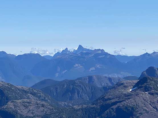
Victoria Peak and Warden Peak in the distance

I’m not sure about the name of this lake but it’s really, really cool

“The Blades” in the foreground

Me on the summit of “Merlon Central”
From the summit of “Merlon Central” we determined that the most reasonable route to get up “Merlon North” was to ascend the south ridge directly out of the notch. We made two rappels using two 30-m ropes combined in addition to some sketchy and committing down-climbing to get us back down to Merlon North/Central col.

The first rappel off the north face of “Merlon Central”

Winnie at the end of the first rappel

We couldn’t find an anchor so there came one exposed 5th class down-climb

More class 3 and class 4 down-climbing in the middle of the face
We were relieved to find an additional anchor so there’s the 2nd rappel
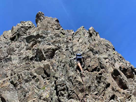
Winnie offered to lead what seemed like chossy low 5th class pitch out of the notch on the north peak. The pitch turned out a bit stiffer than it looked but the main problem was the difficulty in building a trad belay station once the 30-m rope ran out. It took her a while to build a soso station. She did tell me that the station was sketchy so I pretty much climbed the pitch with the same mentality as if I soloed it. I climbed passed Winnie and immediately started to look around for rappel stations but other than some old slings (that weren’t even slinging on a horn) I couldn’t find anything. We opted to worry about the rappel later. The terrain ahead looked more “scrambling” than “climbing” but the route-finding wasn’t very straightforward. I opted to lead a line staying entirely on the spine of the south ridge, partially for aesthetic purposes. I figured that we were doing an exploratory route on our own then might as well sticking onto the ridge for as much as we could.

Winnie gearing up for the pitch out of the col
Winnie leading the pitch out of the col, south ridge of “Merlon North”

Winnie at the questionable belay station
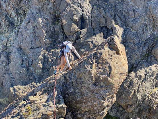
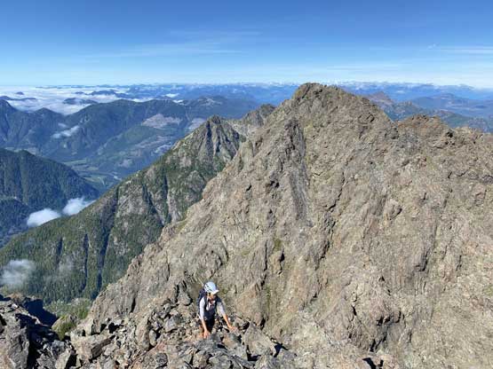
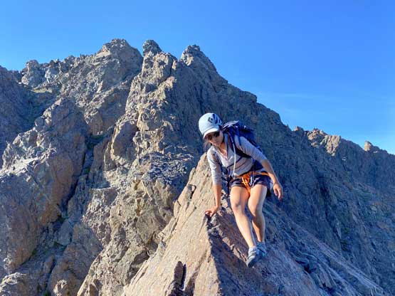
We continued climbing the south ridge in simul-climbing fashion
More about the south ridge of “Merlon North”
We didn’t know what to expect but things didn’t get too complicated

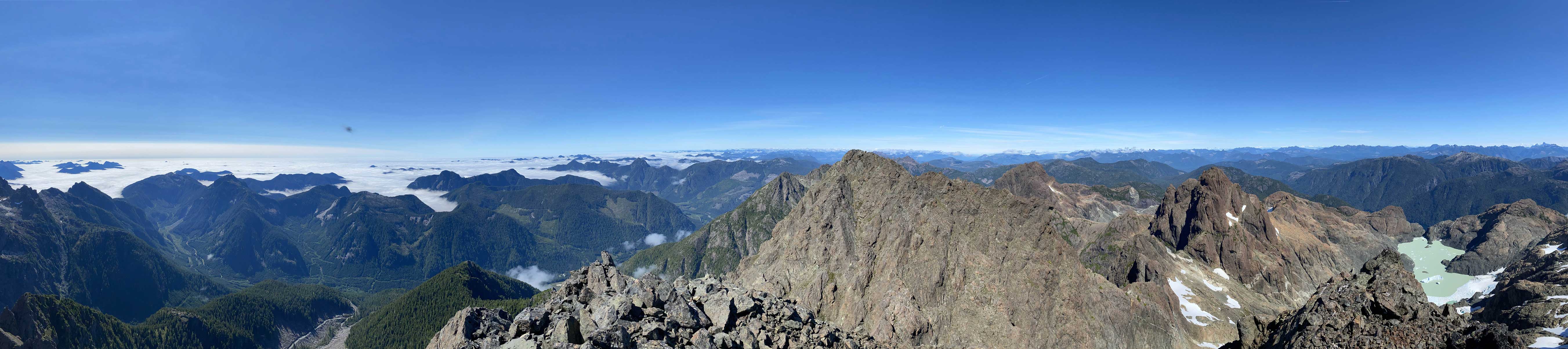
Partial Summit Panorama from “Merlon North”. Click to view large size.
Partial Summit Panorama from “Merlon North”. Click to view large size.

The fog finally lifted to reveal a bit of the inlets

Another photo of “The Blades” in southern Haihte Range

Rugged Mountain

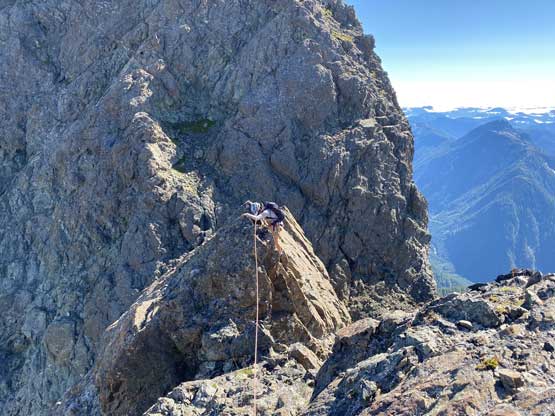
Winnie sky-walking on Merlon Peak

“Haihte Spire” to the north

Winnie approaching the summit of “Merlon North”

Me on the summit of “Merlon North” (Main Merlon Peak)
We lingered on the summit for a while. I managed to catch some cell phone signals so did some reconnection with the society. We also evaluated a few descent options. I insisted to try out descending/rappelling off the sunny west side using the couloir systems but we turned around after spending 15 minutes investigating that option. The rock quality was absolutely garbage even for Rockies standard. The only other option was to descend the same route we came up, which meant we must find a way to build a rappel station. The down-climb to the technical pitch was mostly 3rd class but required lots of caution due to loose rocks and exposure. We did find a big horn that’s strong enough to trust, but I wasn’t 100% sure whether that spot could get us all the way down to the col. However, we really didn’t have other choices so we must commit. I left my 240 cm sling behind and committed into the overhanging rappel. I thought I for sure needed to find another station for a second rappel, but to my surprise the rope did (barely) reach the bottom of the notch, so problem was solved and the stress was relieved.

A bit of exploring on the very loose south face

We decided to get down the same way

Another photo of that iconic lake

This is one exposed but fairly easy section
Winnie concentrating

Me looking for a rappel option… Photo by Winnie M.
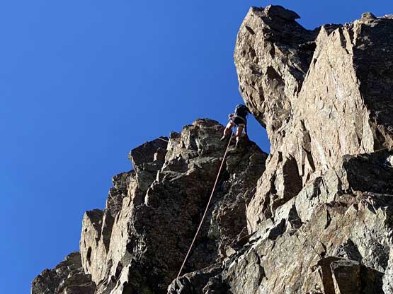
Winnie on the overhanging rappel

Winnie back at Central/North col looking happy
None of us looked forward to down-climb the shitty compacted choss back into the snow gully so we found a boulder that’s far away from the notch and made another rappel into the gully. Winnie went down first. I was honestly not expecting to be able to pull the ropes and sure enough, the rope was 100% stuck, so I batman up the ropes. I figured that I should be able to down-climb that stretch so cleaned the anchor. The down-climb was actually not too bad. We then made some careful work squeezing through the moat and down-scrambling a long stretch of 3rd class before putting crampons back on for the snow descent. The rest of the descent back to camp was uneventful but did require a lot of careful crampon work thank to the long side-hill traversing/descending on bare ice.
Winnie rappelling into the gully

Scrambling back through the moat

Down-climbing steep snow

Traversing bare glacial ice, for a lot of it…
Practicing putting crampons on rock
More about the snow traverses

Finally back to the base of Rugged Mountain
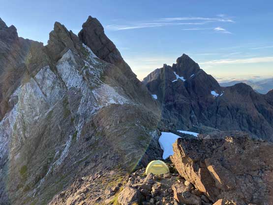
Our camp at Nathan Col
Overall the ascent of Merlon Peaks Central and North turned out a lot more involved and memorable than I was expecting. I was treating this peak as a simple “add-on” summit in addition to the main prize – Rugged Mountain, but this “add-on” turned out to be a lot harder than the main objective itself. I do believe that in earlier season when the moat hasn’t opened yet, by following Matthew’s GPS track the ascent of Merlon North should be mostly just a scramble, but for us that route wasn’t an option.
