Ford Mountain
April 24, 2020
1420m
Chilliwack / Chilliwack Lake Road, BC
Ford Mountain is rather just a wooded bump on the west end of Williams Ridge about 30 km east of Chilliwack in the middle of Chilliwack River Valley, but the status of this name is official and there’s a decent trail that goes up to the summit. The summit offers some decent views of the rugged peaks to the south, and the trail-head is accessed by driving up Ford Mountain FSR, which requires a HC 4×4 vehicle even in its best conditions. This Friday saw a brief break in the persistent dreary weather so Alex and I were set on another morning mission to bag a peak. I had to be back home by 3 pm for work as usual, and I did not feel like waking up super early so we agreed on this lazy objective. I had hoped to drive most of the way up the access road but we did plan enough contingency for the worst case scenario, that was to walk up from the bottom.
The morning was sunnier than forecasted and we made to the start of Ford Mountain Road at around 7 am. After two easy switchbacks we encountered a long section of deep ruts that almost stopped my Tacoma. Alex went off and pushed away some bushes and I gave it three tries using 4Low and barely crawled through. The stock tires really weren’t doing good on the loose sand. I worried that there might not be a better turnaround spot but it turned out that the condition actually improved for the next few switchbacks. Eventually at around 650 m elevation, about halfway up the road we were forced to park by a deep washout. I had to carefully back down for about 100 m to find a good turnaround spot. A lifted Taco with all terrain tires could probably make it through but not my stock one.
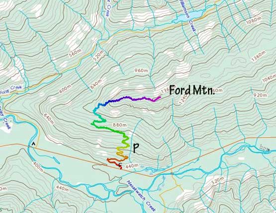
Ford Mountain via Ford Mountain FSR. GPX DL
We quickly geared up and started the plod up this road. The grade was pretty damn steep from a road’s perspective. On the positive side, we actually got some nice views from this road. Had we driven all the way to the trail-head we probably wouldn’t make the stops for these photos. Higher up on the final switchback before the trail-head we encountered patchy snow but the snow never became deep nor continuous. The start of the trail was actually on another (spur) road that none of us was expecting. The end of this shitty spur road was already high up on the west ridge and that’s actually where the marked trail started. The trail was pretty easy to follow and seemed to have decent amount of traffic. We encountered continuous snow at around 1150 m elevation but with the abundance of tracks we did not need to don snowshoes. We followed the tracks due east all the way to the summit. The map suggested there’s another bump with equal height further down the ridge, so we strapped snowshoes on and went for another 200 m or so with some up-and-downs. Eventually we determined it’s pointless to keep going any further so turned around back. The first highpoint had the best views. It also seemed like the woods were somewhat cut for the views.
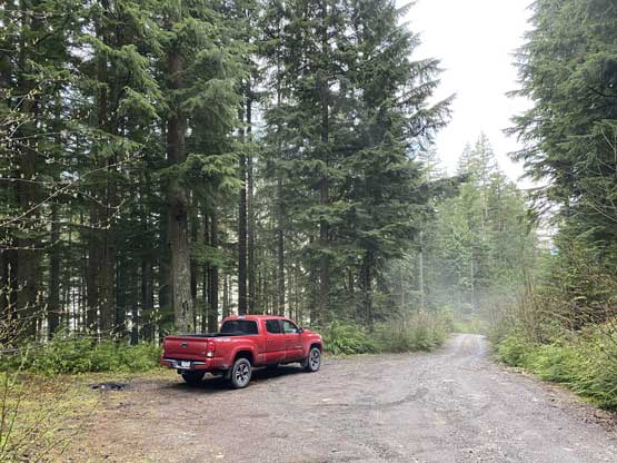
Taco parked at around 650 m elevation
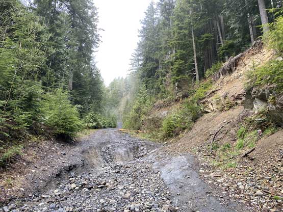
This is the washout that stopped my Taco…
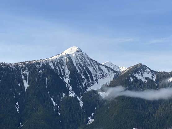
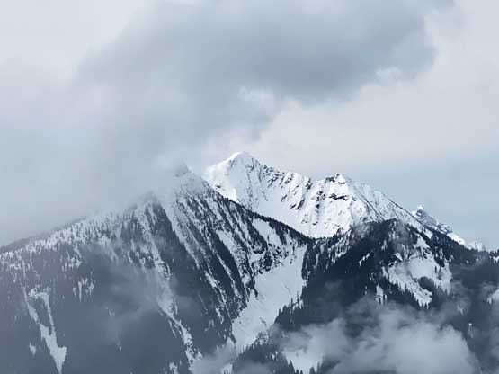
Mt. Pierce across the valley

This is zooming-in down Nesakwatch Creek drainage

A wider view of the north flanks of Mt. Pierce

Looking back from the upper section of Ford Mountain FSR

This clear-cut offers some neat views
Not much view on the actual trail. It’s rather boring

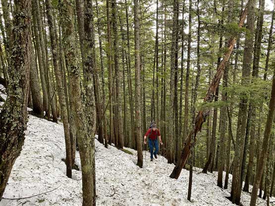
Alex following the beaten path on the ridge
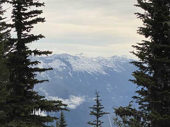
A glimpse of Mt. MacFarlane through the thickening clouds
This is zooming-in east towards peaks east of Chilliwack Lake

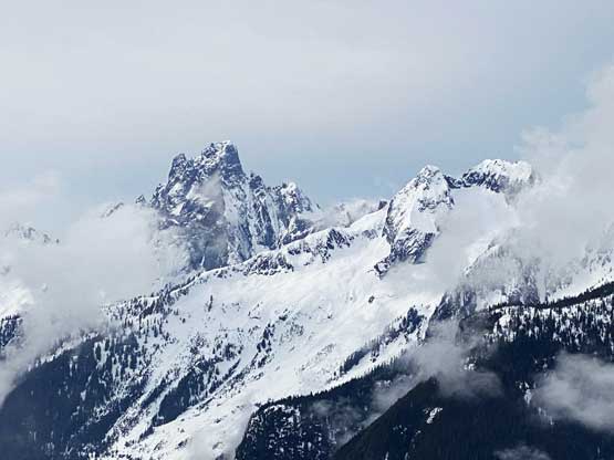
Lady Peak, Knight Peak and Baby Munday Peak

Welch Peak is the highest in Cheam Range

Me on the summit of Ford Mountain
Slesse Mountain and Crossover Peak
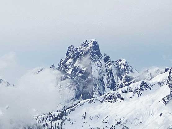
A very zoomed-in view of Slesse Mountain
The views were better than expected even with the overcast sky, with Slesse Mtn. stealing the show to the south. Eventually it became a bit too chilly to linger so we reluctantly slogged back down the trail and then down the road. We passed two hikers going up but saw nobody else. However, we saw 4 SUVs parked on various stages of the road. We had no idea where the others were going. Driving down that deep rutted section was actually pretty easy and the rest of the drive back home was uneventful. I got back home at 12:10 pm ish with plenty of contingency to take a (much-needed) nap before work.

Me heading down in the forest. Photo by Alex R.

Running out of snow now. Photo by Alex R.

Alex hiking down the typical road…
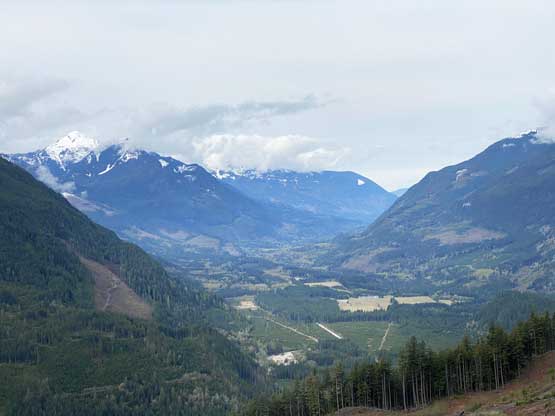
A view from a clear-cut. Chilliwack Valley with Mt. McGuire on left
