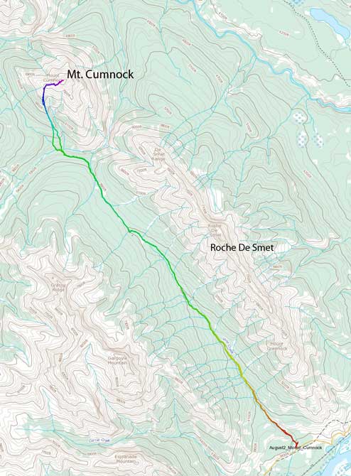
Mount Cumnock
August 2, 2013
2460m
Jasper, AB
Mount Cumnock is another no-beta mountain in Jasper. But unlike the other exploratory ascents, I wasn’t very interested in. The reason is very simple. It has a long approach that’s potentially bushy, and it’s not the tallest mountain in that area, and the scrambling looks to be very straightforward. It’s something that I’d kinda want to save for off-season. However, after finishing the ascent I had other opinions. It turned out to be much more satisfactory than expected. The summit register was placed in 2000, and we were the 2nd party signing it. We also discovered that Vine Creek Trail not just being in good shape, but continues down the other side of Vine Pass and curves west around Redan Mountain. We didn’t go far into that direction but it has the potential to be an excellent approach trail for Whitecap, Haultain, and peaks in that area.
After finishing a one-day ascent of Mount Cline, I still had energy for another trip. My primary trip, Mount Bryce, got cancelled so it was left to Ben and I figuring out something to do with questionable weather forecast for pretty much all areas. Jasper’s forecast seemed to be better so we decided to go that way. Knowing well ahead that another group would do Mount Edith Cavell, I was very tempted to go there. But after thinking twice we opted for something less demanding. After debating between Sirdar, Emigrants, and Cumnock, we opted for Cumnock which would also serve as a recon trip for that area. Did we pick an easier day? Technically yes, but physically, mmm, probably not.
Mt. Cumnock scramble route. GPX DL
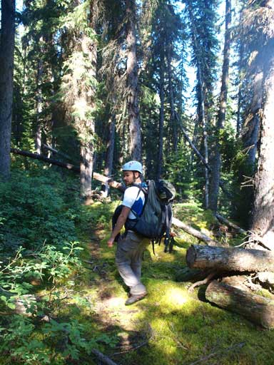
We intended to start at 4am, but our alarm failed. Well, we eventually woke up at 7… The first 8km or so was on the Vine Creek Trail. This trail is no longer maintained but still in a good shape (at least for now). It’s a bit overgrown at places but easy to follow. What we couldn’t believe was the elevation gain on this trail. It did constantly go uphill but by the time we made to the warden cabin we’d already gained almost 700 vertical meters. It was humid in these days and the sky was clear overnight. The next 2km or so was gonna be very wet and we would be soaked soon. Next time when I come back here I will wear my alpine pants… Ben switched to sandals at a couple marshy sections but it wasn’t necessary. I managed not to get my boots wet while hiking through that area. Though overgrown, the trail was still obvious and we were very surprised that it actually continues down the other side, straight towards our objective! Oh wow, that gonna save us a lot of time in the bush.
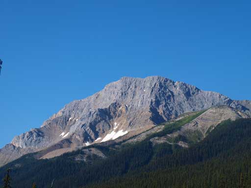
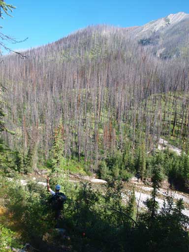
Great view towards Gargoyle Mountain from Vine Creek Trail
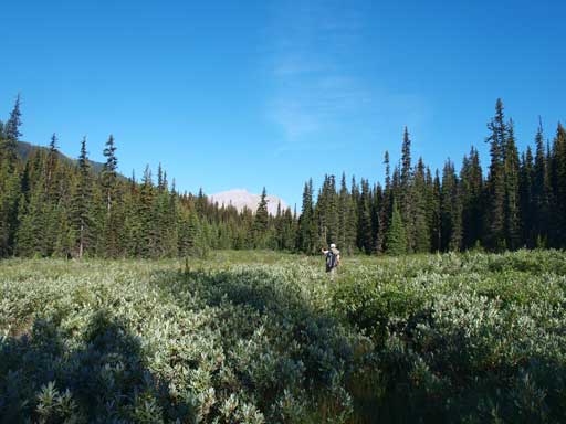
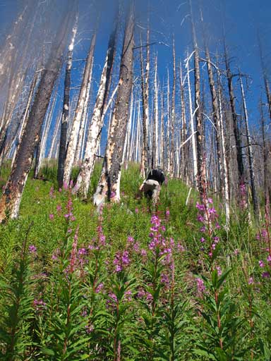
Ben hiking on the overgrown trail. Believe me or not the trail is not hard to follow…

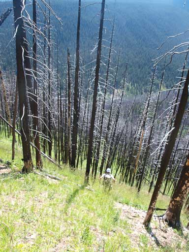
Still on the overgrown trail. Cumnock ahead
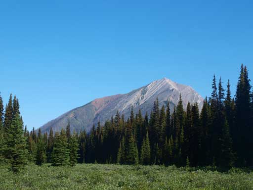
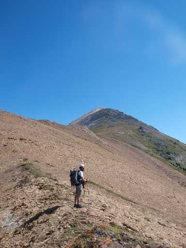
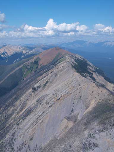
This is our objective. Finally got closer, but what you cannot see is the elevation loss…
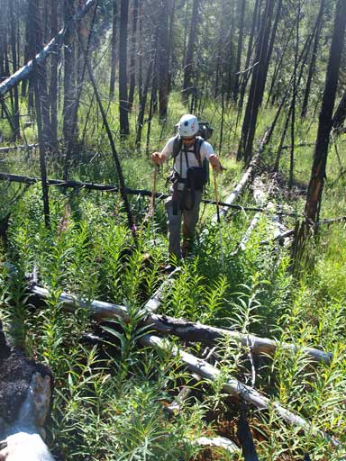
The trail indeed continued down that side and we didn’t have to bushwhack until dropping down to Cumnock/De Smet pass. The trail curved left around Redan so we bailed down to the creek that runs through the pass between Roche De Smet and Mount Cumnock. The water level was low in August and we didn’t even need to ford this creek. There was a couple logs providing natural bridges. The other side was burnt forest, so really, there wasn’t that much bushwhacking at all. Don’t get me wrong though as it’s still in the bush. But assuming you’ve done other Jasper styled bushwhacking ascents like Boule Roche, you’ll find this one being quite pleasant. The beginning part of this burnt forest was tedious due to the deadfalls but higher up it was a pleasant hike with pleasant views all around.
Ben on the trail. Definitely not the best trail in the parks, but good enough to follow.

Finally got close to the base of Cumnock

Bailed the trail to get down to De Smet/Cumnock pass
This bit was bushwhacky
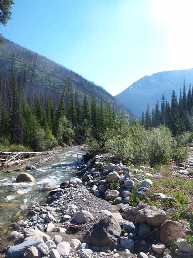
Down to the creek now. As you can see, it’s not hard to cross.
Up the other side. Ben is having fun with the deadfalls
Higher up it was a hike through burnt forest
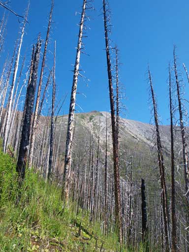
Cumnock seen from the burnt forest

Great view of Whitecap Mountain
It did take us a long time (especially considering the temperature) to reach the treeline before curving climber’s right towards the summit. To get to the summit it’s merely an off-trail hike. It was my first time in this area and I got views of many peaks that I’d never seen before. Well, at least from this direction. The view of Whitecap is so different than our familiar views from south. We could also see peaks like Haultain, Tory, and Rutherford, sitting deeply in Jasper’s backcountry. The other side is the wide Snake Indian River Valley, with the entire Bosche Range behind.
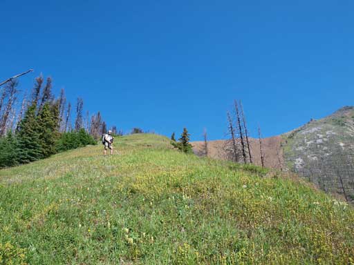
We merged to a grass field

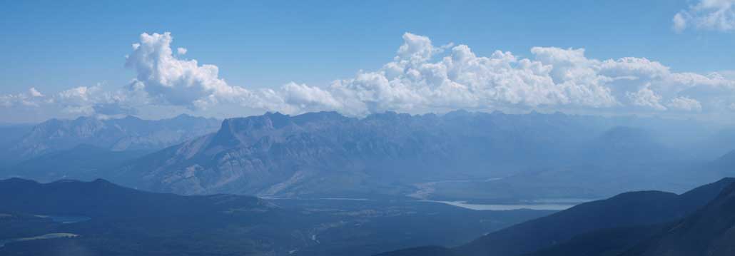
Looking towards Colin Range over Vine Pass

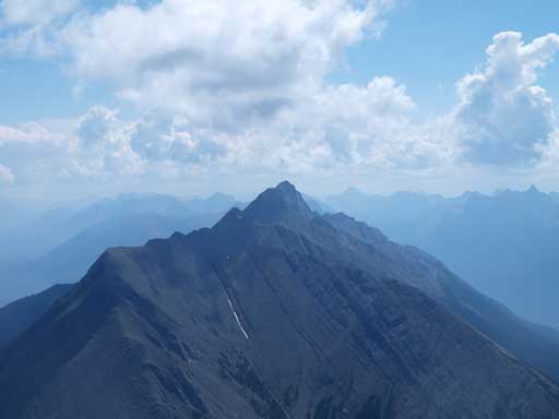
Redan Mountain. Don’t know if that’s a scramble or not..

Plenty of asters
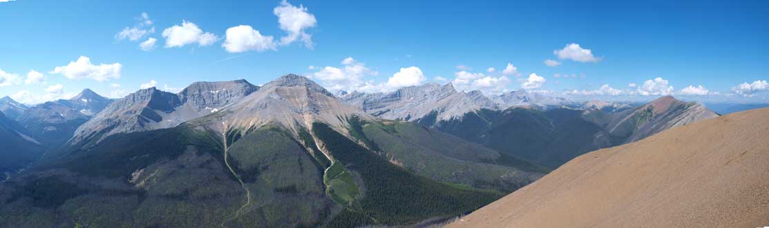
Great panorama view of these seldom-seen peaks already.
Ben with the summit behind
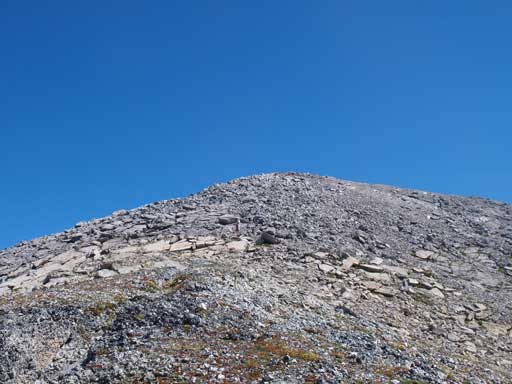
The last push

Summit Panorama. Click to view large size.
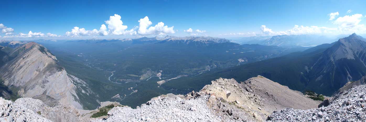
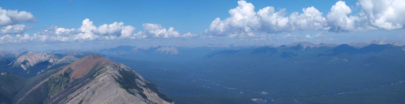
Panorama of Snake Indian River Valley
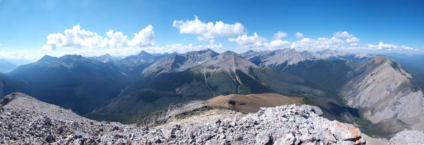
Panorama of the west side
Looking north up the Snake Indian Valley. In the distance at center is Persimmon Range and Daybreak Peak
Mount Aeolus is the highest in Bosche Range
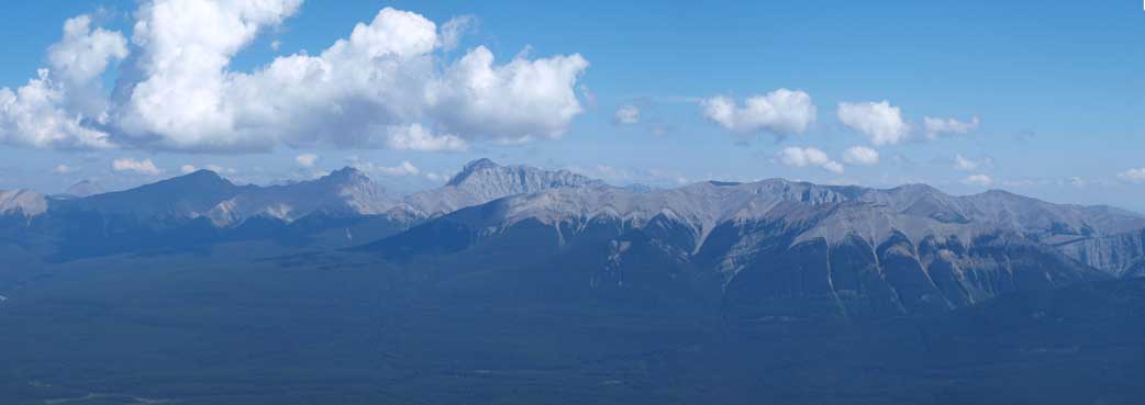
Panorama of Miette Range
Roche De Smet. It’s on my to-do list
Mount Bistre
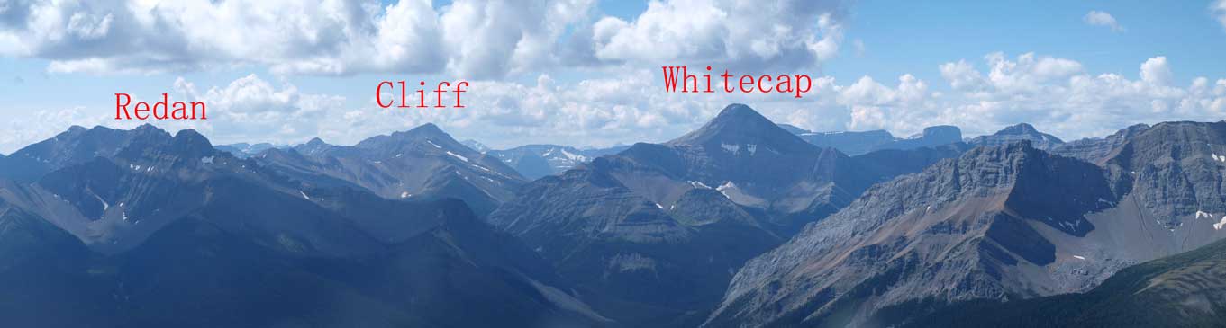
Cliff Mountain and Whitecap Mountain.
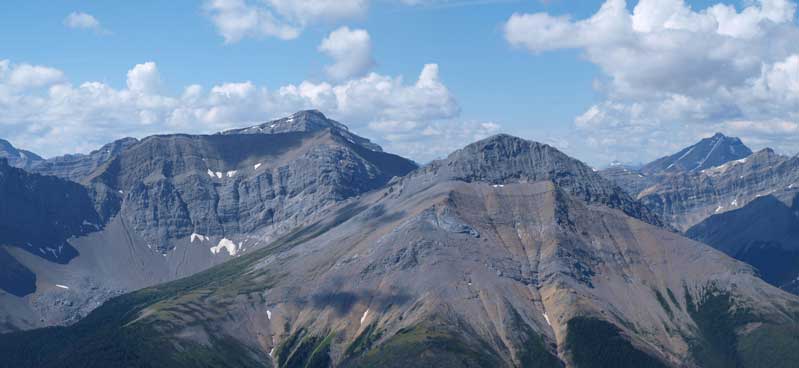
The big peak is unnamed. On the far right in the distance is Mount Rutherford
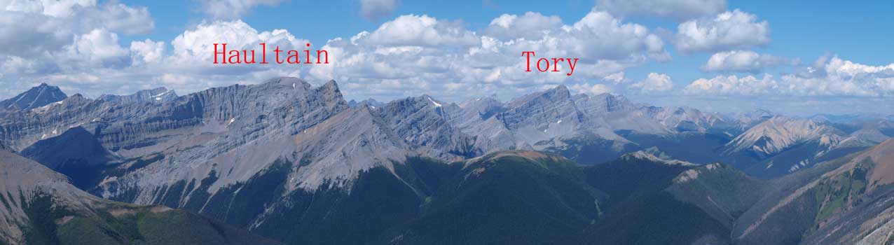
Haultain and Tory
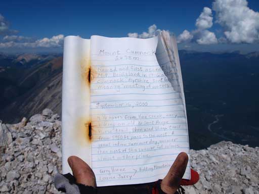
The summit register. We’re the 2nd party signing it.
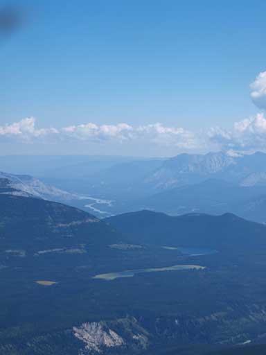
Can you spot Celestine Lake
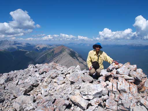
Me on the summit
It was gonna be a long way back. Oh well, we managed to find a line further skier’s right to avoid most of the deadfalls. After crossing the creek it was a slog to get back to the warden cabin, with a ton of elevation regain. We briefly considered going up Redan Mountain but the weather had other plans. Dark clouds were building up and we even heard a thunder. Rain never got to us though. The hike back to the parking lot was long, long, and long. It felt like eternity.
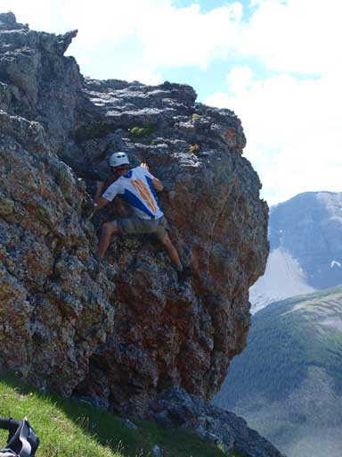
Ben playing around a boulder. It’s hard to find hands-on stuffs on this mountain.
Descending steep grass slope

Crossing the creek
Back to Vine Pass. Dark clouds were building up
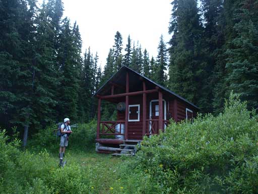
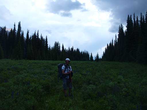
Back to the warden cabin, still 8km to go…
The mosquitoes were horrible at the parking lot. It’s probably the worst mosquito infested area I’d ever been to. Our round trip time was 10.5 hours on a fast pace, covering 30km distance and 1800m total elevation gain. Now I was exhausted but guess what? Only two days to rest and I was off for another Rockies’ giant.

Interestinng thoughts