West Twin
May 9, 2015
3360m
Columbia Icefield, AB
West Twin is the unofficial name of a minor bump just to the west of the much-bigger South Twin. A lot of climbers would argue that it’s merely just an extension of South Twin and not a separate peak at all, but since it’s included in Bill Corbett’s The 11,000ers book I’ll have to bag it. Despite its insignificance compared with the other Twins, it’s not an easy climb. The standard route up its steep East face involves a long section of 40-degree snow face, a bergschrund, traversing underneath some gigantic cornices and a narrow summit ridge. Among the 4 Twins, it’s also known as the one having the most significant avalanche hazard due to the south/east facing direction. Ben and I managed to squeeze it in during our grand 4-twins-in-a-day, on the 3rd day of our Columbia Icefield ski mountaineering expedition.
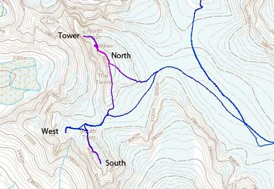
Ascent routes of the 4 Twins. GPX DL
After a successful ascent of South Twin I immediately focused on our next objective. I ski’d down to the broad bowl between South and West Twins without taking any unnecessary break, put skins back on and skin’d partway up that steep East face. Ben would join me shortly after while Vern and Kevin decided to wait patiently on the shoulder of South Twin. Ben and I would rush our way up West Twin for as fast as we could and Kevin would have a nice short break before the long grind up the S. Ridge of North Twin. The snow was loose and soft but I still decided to strap crampons on just in case (it’s easier to strap them on lower down than on a 40-degree face). Ben was about 5 minutes behind but ditched his backpack. I had a lot of knee-deep post-holing to work with so at just above the bergschrund Ben caught me up and took over the lead.
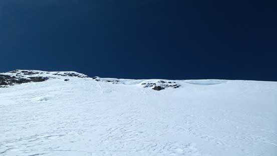
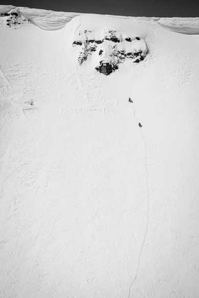
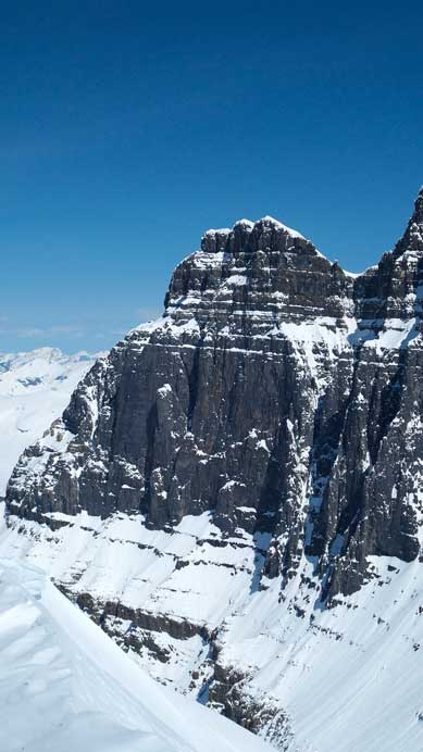
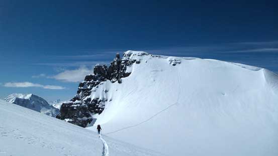
Looking up the snow face on West Twin. Note the cornices…
This pictures shows the slope angle better from a side-way point of view
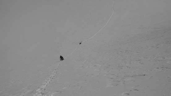
Looking back towards South Twin
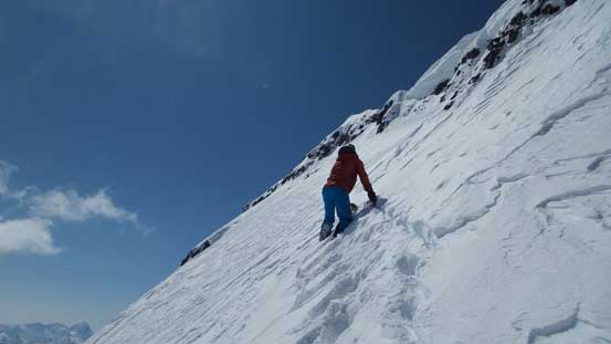
Ben starting this face. He’d catch me up in no time.
Me and Ben ascending the face. Photo by Vern
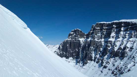
The next section was a rising traverse cutting underneath a gigantic cornice. I found this part being even more exposed than the cornice on Trapper Peak so it’s certainly not as easy as one would think. We aimed towards a nice exit point to the summit ridge but the snowpack there was very thin (and still loose) making some interesting mixed movements on rocks/scree. The final section along the summit ridge also showed some rocks and quite narrow, but at least short-lived.
Ben leading the next section – traversing towards the exit point

More on the face. Photo by Vern

Near the exit point the snowpack was very thin (crampons on loose rocks)…
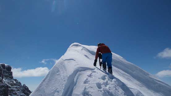
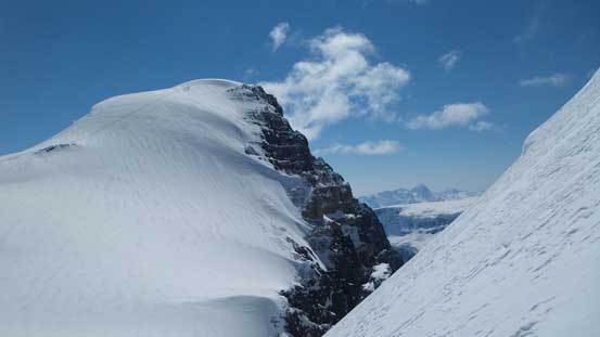
On the summit ridge now. Only a few meters away
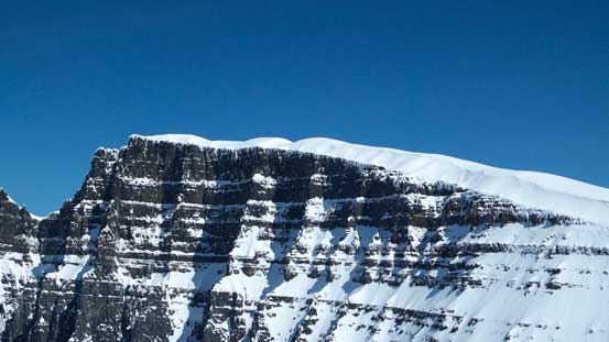
Great view of Mt. King Edward
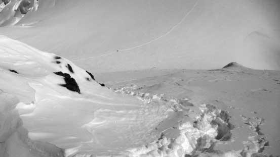
Looking down at our tracks
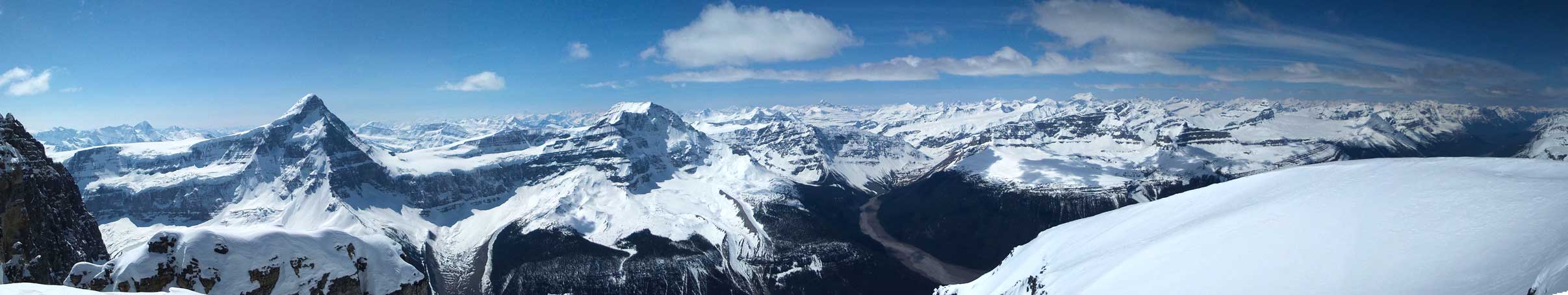
Partial Summit Panorama. Click to view large size.

Partial Summit Panorama. Click to view large size.
The long south ridge of North Twin, our next objective
Twins Tower’s shear face – our 4th objective in this day
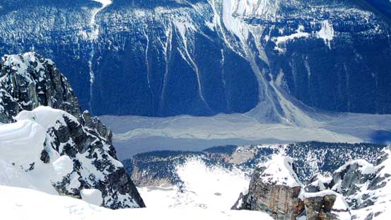
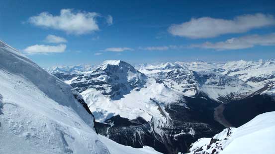
Looking deeply down towards Athabasca River valley

Tsar Mountain and Chaba Icefield

Mt. Columbia

Here’s the col between South and West Twins. To its right is a 2000-meter drop to Athabasca River

Me on the summit of West Twin, my 24th 11,000er
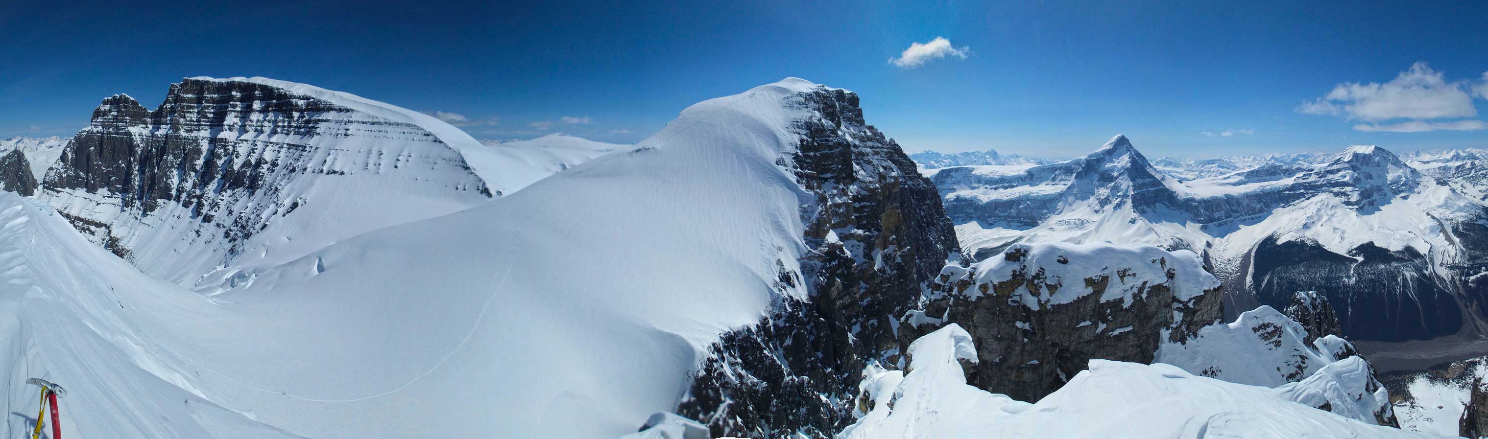
Another panorama from the summit. Click to view large size.
After snapping some obligatory summit pictures we immediately started the descent. Down-climbing that thin section was tricky but plunging down the rest of the face was fast and fun. Ben even managed a long glissade down the face. Soon we were skinning back up towards the shoulder of South Twin. We found Kevin and Vern had already started their trudge towards North Twin so we speeded up to catch them up.
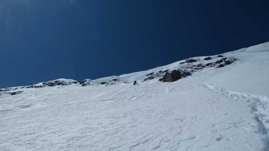
Ben descending the upper face. As you can see, it’s quite steep..
Regaining the shoulder of South Twin. Our tracks are visible
Our round trip time on West Twin was about 40 minutes with tough trail-breaking. If it’s good step-kicking then I’m sure we could have it bagged in less than half an hour. And since we did good on time we’d soon off towards our next objective, North Twin.
