Dog Mountain (Hope)
March 5, 2023
1312m
Hope, BC
Not to be confused with Dog Mountain in Mt. Seymour Provincial Park that sees zillions of tourists every year, this one rises abruptly above the municipality of Hope on the north side of Fraser River and sees no more than several internet ascents in the past decade. The steep, bushy and bluffy sides grant no easy passage to the summit. Several biking trails exist on the lower southern flanks but they only extend 1/3 of the way up and the “trail” on OpenStreetMap and Gaia is incorrectly labelled and not existing. Over the past several years a few small groups that basically shows who-is-who of the Fraser Valley’s peak-bagging in this modern era, namely Simon C. (solo), Carol (solo) and then Matt J./Chris G. had all gone straight up the south slopes over some classic SW BC’s character-building terrain. Their reports were convincing enough for me to follow, but yet not convincing enough for me to completely abandon my own thoughts. I, on the other hand, had been thinking about this objective even several years before Simon’s trip and my original plan was to take the NE Ridge system because that’s the side with the least aggressive terrain, at least according to the contour lines on the maps. The distance would double the now-standard south side route but I wouldn’t mind.
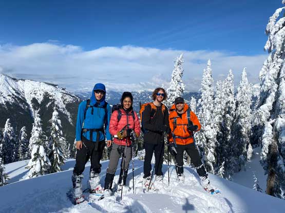
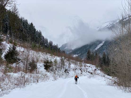
Raphael made a spontaneous suggestion on Wednesday to tackle Dog Mountain on Sunday and I agreed mostly due to the lack of more exciting objectives. Nikita and Francis were also on board and the plan was to take the south side route. However, several intense low-elevation snow storms had since passed and reportedly dumped 1 meter of snow in the Coquihalla region leading to the temporary shut-down of Coquihalla Highway. We had no clue how much snow this mountain had seen, but the “considerable” avalanche forecast even for the below-treeline zone made us to second guess the plan. We eventually agreed to keep the same objective but explore the NE Ridge system from American Creek FSR. I knew elsewhere (North Shore for example) had seen less snow but insisted to do Dog Mountain as I’d been planning this peak for many years. I was also confident that by taking the NE Ridge we should be able to avoid most, if not all avalanche terrain even though there was absolutely zero “beta” anywhere. The 4 of us then grouped in Abbotsford at 6 am and made to American Creek FSR an hour later. I was able to drive the Tacoma several kilometers up and parked in front of the BC Hydro’s gate. The road had been plowed to this point but hadn’t seen any traffic beyond. There’s already enough snow to don snowshoes right from the truck and this was at 300 m elevation.

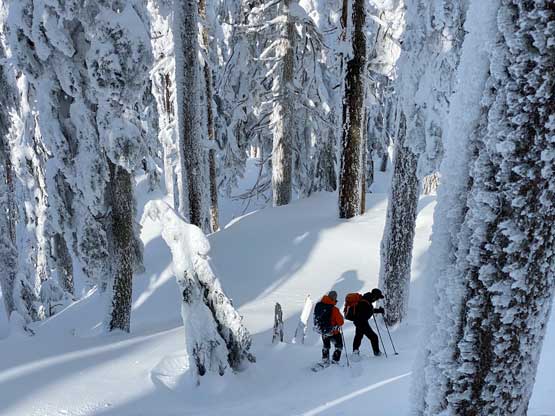
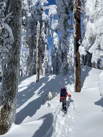
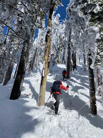
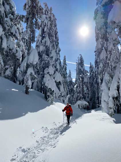
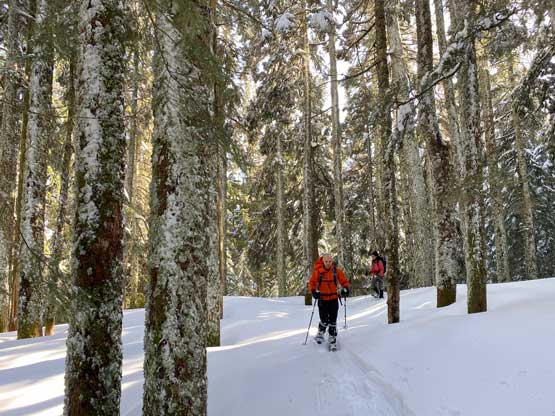
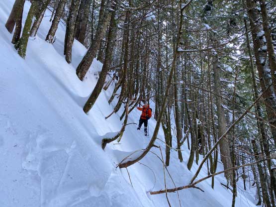
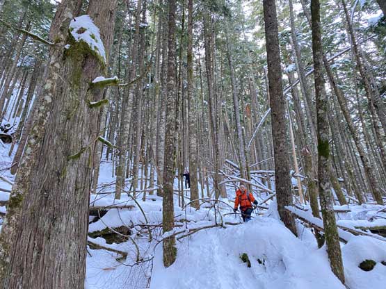
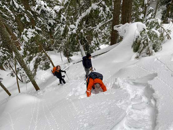
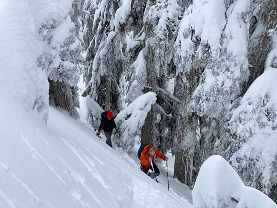
The planned starting point was within 1 km of walking from where we parked so we donned snowshoes, plodded to that theoretical point and dashed into the woods. Right off the bat we had to mantle up an awkward step. The forest was pretty much as expected, steep and bluffy with millions of pick-up-sticks but to my surprise we were able to weave around most of them so the bushwhacking was never annoying. What made things annoying was the trail-breaking. From around 600 m elevation upwards the trail-breaking had become insanely heavy and it definitely seemed like this area had seen a meter of the recent cold snow. Thankfully we had three strong dudes in this group and we were able to rotate and share the duty. At around 900 m I directed us towards the ridge crest and learnt the ridge was rather narrow and bluffy, contrary to what the contour lines suggested. We then had no choice but to traverse/ascend a long stretch of 45 degree forest with post-holing up to our thighs. This was the worst part of the day but we persisted through. A while later we were back onto the ridge and found more bluffs and micro-terrain, but were able to directly attack and overcome most of them. One particularly large bluff required us to detour climber’s left with more thigh-deep wallowing on 45-degree terrain, but we manned them all through without a single word of complaining.


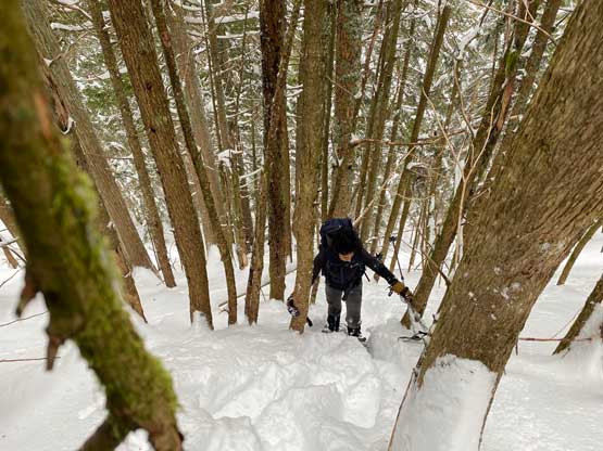

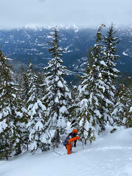

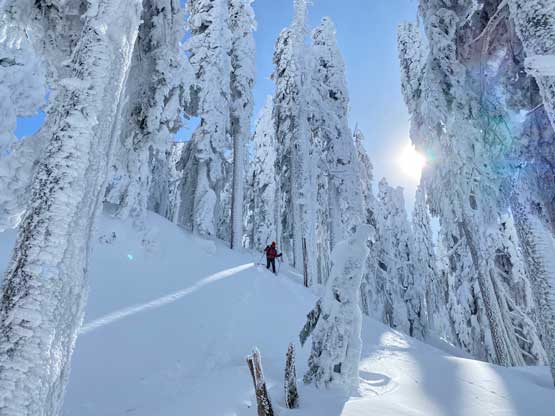
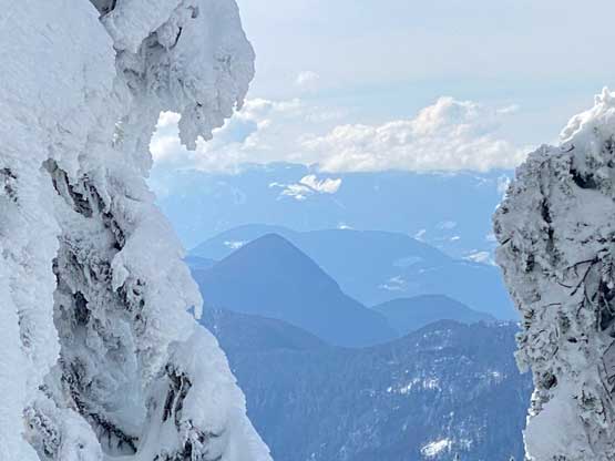
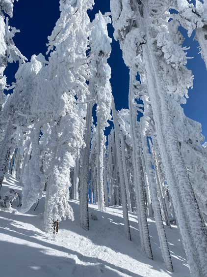
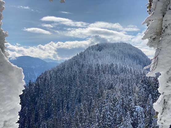
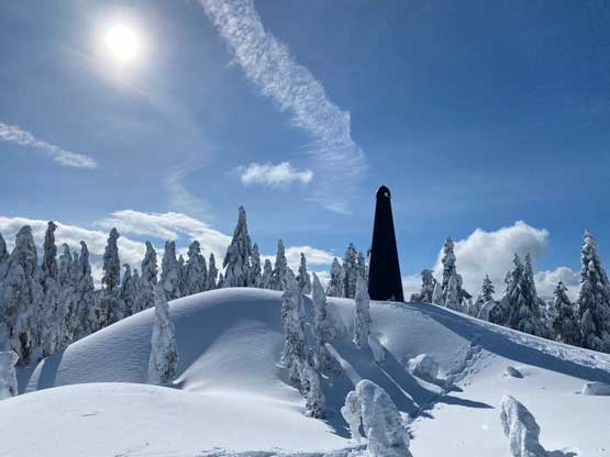
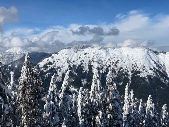
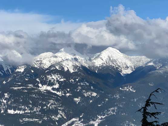
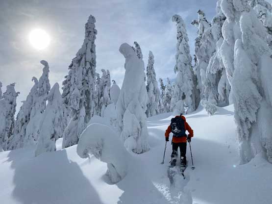
From 1050 m elevation onward the bluffs and micro-terrain finally gave way to a gentle and broad forested ridge so we finally picked up some progress. The trail-breaking was still heavy but at least the route-finding wasn’t that challenging anymore. A long while later we arrived at the major hump on this long NE Ridge system and surprisingly found out a gigantic green dildo perched right on top. We aptly named it the “Dog’s Dildo” and moved on. The descent off this subsidiary bump was confusing and disorienting. We ended up descending too far skier’s left and I had to correct this mistake by leading a lengthy side-hill traverse. The terrain kept directing us to descend the wrong way but I decided to just hold the phone and stare at the GPS screen while walking, and that prevented us from having to do any backtracking. After getting back onto the ridge we immediately faced a steep down-climb that made us to switch footwear from snowshoes to crampons. I insisted at the beginning of this trip that all of us had to have crampons and the decision paid off here. This micro stretch was entirely wind-scored down to the icy layer underneath. The final stretch of this ascent was 2 more kilometer of mind-numbing plod to the true summit over similar terrain. We were all getting tired, both mentally and physically but we persisted through without a problem. The true summit was completely forested as expected but we were able to get some glimpses of views slightly north of the high point.


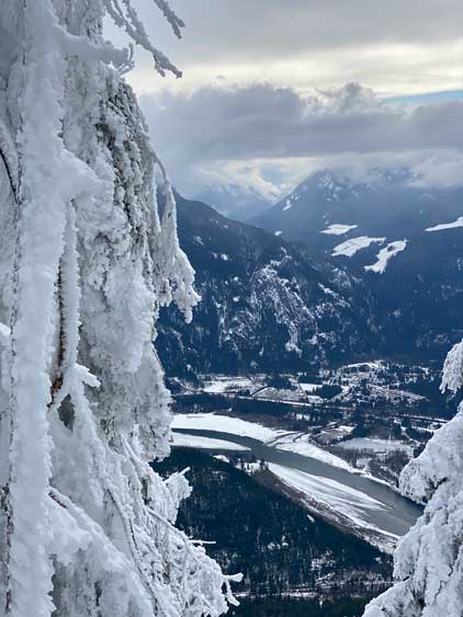

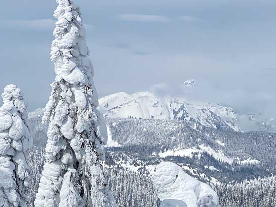

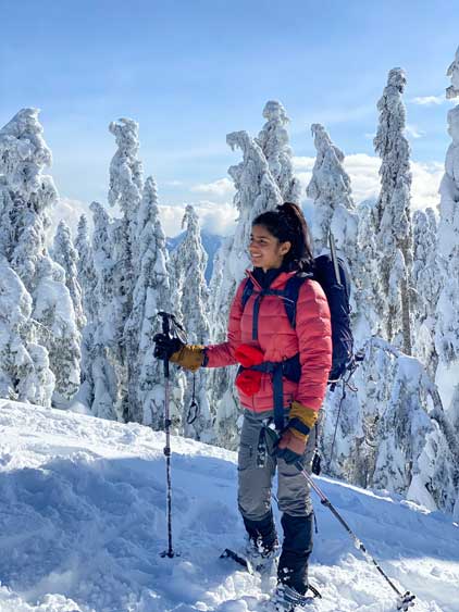
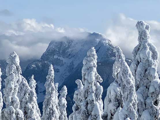
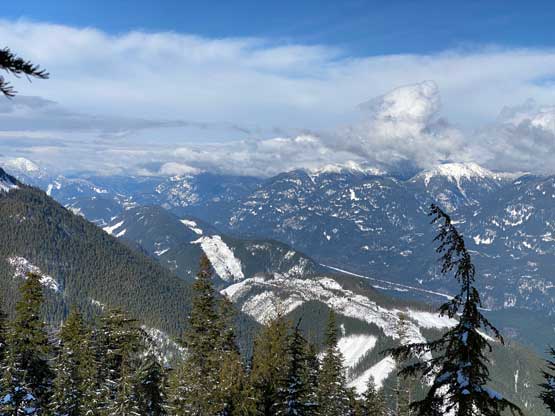
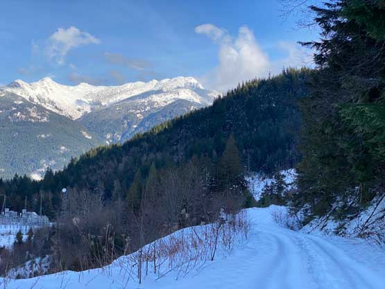
The weather was improving with a band of blue skies coming in from the south so our descent was mostly done in good weather. I made short detours here and there to check out some potential viewpoints and some were definitely worthy. Other than checking the views we simply followed our tracks back, up and over the “Dog’s Dildo” even though I knew some part of the route wasn’t the most efficient. The only spot with some avalanche concern was a steep but short slope on the north side of this subsidiary bump and we found a less exposed variation on the descent. We then found more views lower down and plunged back into the steep forest. The forested descent wasn’t as treacherous as we thought because the powder (cold) snow was good for downhill snowshoeing. We did have to pay attention to the buried pick-up sticks and several of us took several face plants. I also accidently went into a dead devil’s club and got a million of thorns on my backpack, shirt and back. I don’t think any of them went into my skin but the shirt had likely bitten the dust. I stripped the shirt off and plodded the final kilometer back to the truck shirtless. Thankfully this wasn’t an overly cold day. Our round trip time was 8.5 hours taking in account of everything so this wasn’t a long day overall. I eventually got back home at dinner time and didn’t even feel rushed.