Silver Peak (Hope, BC)
July 20, 2021
1949m
Hope, BC
Silver Peak and the taller neighbour, Isolillock Peak form a very visible massif that towers 2000 m above the Fraser Valley and the small town of Hope. These two peaks are often done together and the access is from the main Silver-Skagit Road. For Silver Peak the access is almost exclusively done by walking/driving up the Eureka Mine Road and a few recent reports in 2020 and 2021 indicated that this road’s in a decent driveable shape that with a reliable 4×4, high clearance vehicle one could drive to 1500 m elevation making these some of the more easily-accessible summits in the region. That being said the road is extremely steep, narrow and rough and can only be driven by a top quality vehicle such as a Tacoma, 4Runner or Jeep, and with good tires.
The decision to scramble Silver Peak and Isolillock Peak was a last-minute one. I did have these peaks on my “list” for years but these were never the priorities in the busy summer months. When Christine confirmed that she’s available for a day-trip on Tuesday I immediately thought about these peaks. Oddly enough we also both wanted to have a short day. Christine volunteered to drive her 4Runner and I greatly accepted the offer. I had some concern about her stock tires but figured it’s probably fine as the tires were basically brand new. We agreed to meet in Abbotsford at 6 am and made to Hope an hour later.
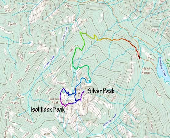
The Eureka Mine Road was as expected, steep and rough with numerous water bars to start with. None of the water bars were problematic. The lower roads were improved by logging company over the last couple years and some new logging spurs had been made. The navigation would be extremely confusing without the GPS device but these days with the modern technology of Gaia we managed to stay on the correct path the entire time. I had downloaded the Gaia map, the government’s topo map, the satellite images and even the Sentinel Hub’s latest satellite maps so the navigation wasn’t a problem. The road’s becoming extremely steep and rough starting at 1200 m elevation and also from this spot onward there’s very minimal place to turn-around. The 4Runner was switched to 4Low in no time and even so we were a bit worrying about the tires being punctured by the sharp rocks. We were basically crawling on rocks on those few tight switchbacks. Eventually the road crested the broad north ridge of Silver Peak and made a gradual descent into the valley between Silver Peak and Isolillock Peak. There’s one massive spot to park and turn-around and I thought about to just start the hike there, but we decided to push further. And sure enough we encountered snow on the road and were forced to do a 10-point-turn. This was a tad bit sketchier than we liked but we did get the job done.

We stayed on the climber’s left side of the valley to make a long and gradual rising traverse towards the grass/scree gully on Silver Peak’s west face. This stretch of traversing had some annoying side-hilling on scree. There were a few patches of snow to ease the pain but the snow was too short-lived. The grass/scree gully was a pure slog to ascend. About 200 m of elevation gain later we made to the col between the north and south summits of Silver Peak.


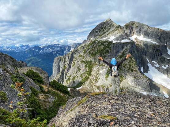
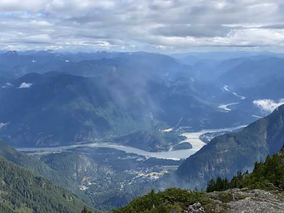
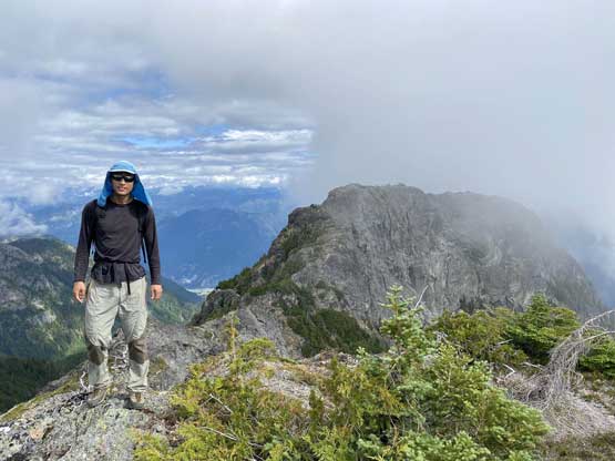
The north summit’s supposed to be the true summit so we went there first. There’s one narrow spot to negotiate on the ridge with moderate exposure but other than that, the going was easy. We continued passed the summit to explore a “northern viewpoint”. The GPS track sent by Duffy et al. went further than the summit. We weren’t sure why would they do that so opted to follow just in case. It turned out that we managed to get some nice views looking down into Hope and Fraser Valley but the end of their GPS track was definitely not the highest point on this peak.
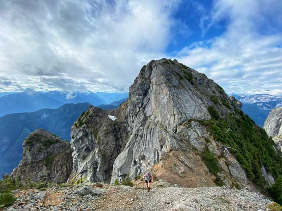
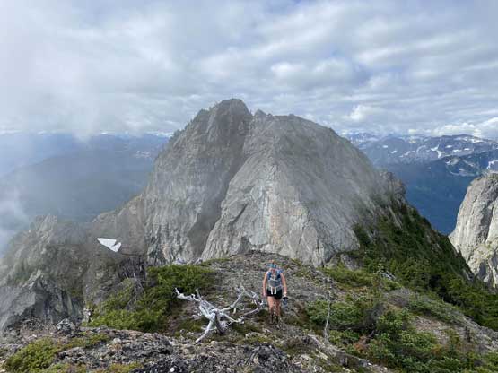
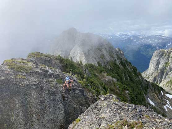


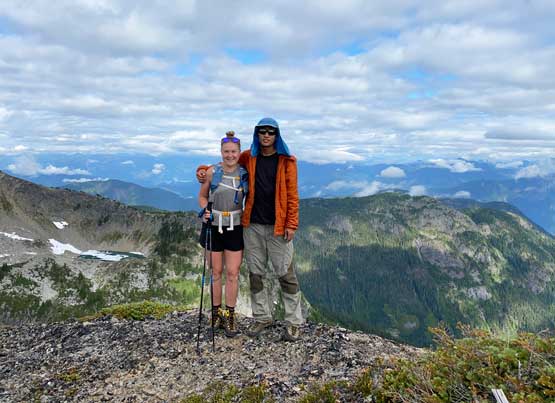
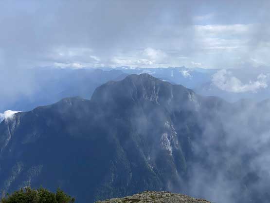


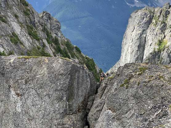
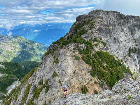
After descending back into the col between the north and south peaks we made the decision to explore a route up the south summit. None of us had done any research and this summit surely looked harder than a “walk-up”. However, by visual it’s hard to tell whether the south summit’s higher or lower than the one we just did, and the contour lines on Gaia map did not boast confidence neither as they share the same contours. To make sure we could definitely claim Silver Peak I said we had to do both. The hardest part of the south summit was right above the col where we must traverse and zig-zag on some narrow and down-sloping ledges with questionable rocks. Above the initial “rock fin” the going became easier albeit still with some exposure. The final summit tower required a stretch of 3rd class scrambling on very loose rocks and as expected, it’s hard to tell whether we were higher than the north summit or not. There’s even a register on this south summit, but we couldn’t read.


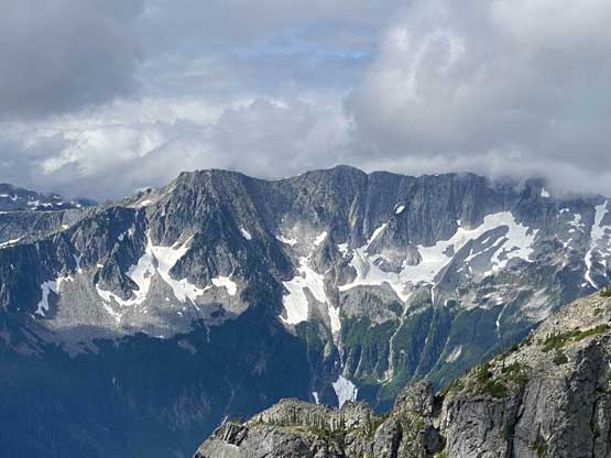
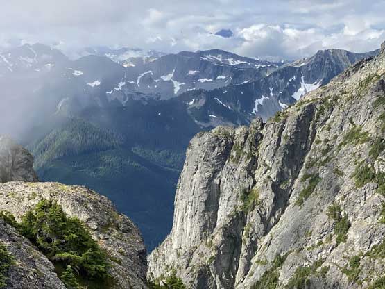
We then carefully descended back down into the col paying extra attention to the loose rocks. I felt the rock quality on this mountain was very similar to what I’ve seen on Vancouver Island and some parts of Washington Cascades. The descent of the main gully was straightforward and once making sense, I led us traversing towards Silver/Isolillock col before making an ascent of Isolillock Peak.


