Copperstain Mountain
July 14-15, 2014
2606m
Golden / Spllimacheen River, BC
Copperstain Mountain is one of the not-so-significant summits in the Dogtooth Range in the northern Purcells. While it’s not very popular to the scrambling community, after finishing the ascent I’d say it deserves more attention. I think the 60 km one-way drive on a logging road together with the long approach has distracted most people, but on a clear day you’ll get a full panorama view of the giant peaks in the Selkirks including Rogers, Sir Donald, Dawson and Wheeler. There’s also a well defined trail leading all the way to Grizzly Col (a high col in the alpine just to the southwest of this summit). The approach and the ascent route is well documented in Hikes Around Invermere and Columbia Valley book.
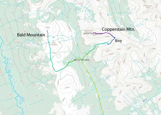
Bald Mountain and Copperstain Mountain ascent route. GPX DL
Copperstain Mountain was the primary objective of our trip in this past Monday and Tuesday. On the first day, Eric and I also bagged the nearby Bald Mountain, and on the way down from it we got caught by a thunderstorm. After descending back to the campground we hid in our bivy sack/tent until the storm passed by, and once it did pass by we re-packed the gears and started the trudge towards Grizzly Col. Our plan was to bivy at Grizzly Col, wake up at 4:30 am the following morning and watch alpenglow on the summit.
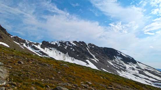
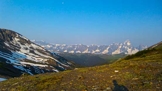
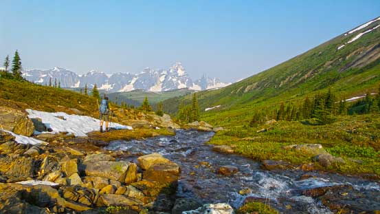
The trail to Grizzly Col wasn’t that obvious if not paying attention, but since we had the detailed instruction from the guidebook, we located it with no problem. It’s about 25 m after crossing two streams on two bridges, while going back (towards parking lot) from the campground along the main trail. Once we located the trail, it’s very easy to follow. There was minimal dead fall nor other obstacles, however, the mosquitoes were just beyond insane. I had to spray myself with a lot of DEET… The warm and humid air was also nearly intolerable and it was quite a grind to drag ourselves (with the overnight gears) up this steep trail. On the upside, the upper part of this valley was quite scenic with lots of running streams and meadows.
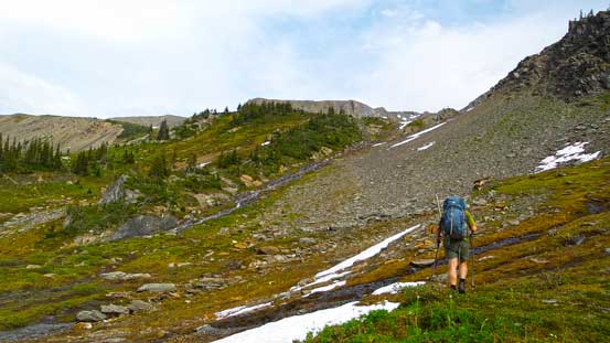
Eric hiking up the valley leading to Grizzly Col
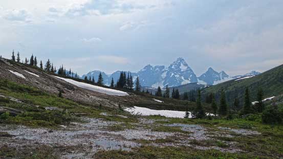
We had Mt. Sir Donald in the view for all time
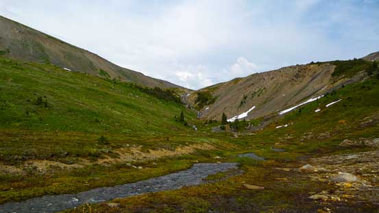
The upper valley. At one point we lost the trail so went up climber’s right

Going up climber’s right

Almost at Grizzly Col
One of the nearby unnamed summits
As planned, we pushed to Grizzly Col to set up our camp. There was quite a few prime camping spots at this col, with running water reachable within 2 min of walking. The view was already great from the col, with Sir Donald Range towards west and Moonrakar Peak and other peaks in Dogtooth Range towards the other side. It was an awesome spot to hang around in this evening and the mosquitoes weren’t quite chasing us up this high and that was a bonus. However, just after having a well deserved dinner, we noticed some dark clouds approaching at a rapid pace from southeast… Oh well, another thunderstorm was coming. There weren’t that many BOOMs nor a lot of rain, but the wind was crazy. My Fly Creek UL 1 was certainly not designed for this harsh weather. If not because of the big rocks it would certainly get blown away, but good thing it wasn’t.
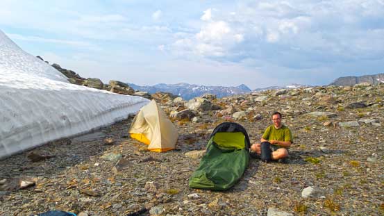
Our campsite at the col
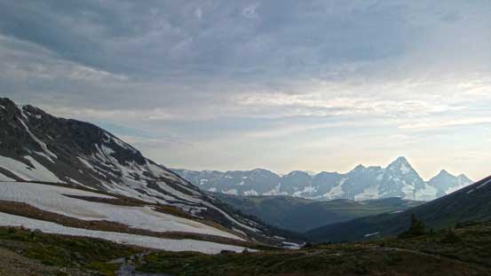
Looking towards the distant Sir Donald Range

Across the valley towards east, we could see Moonraker Peak (left)
Sun setting behind the ascending ridge to Copperstain
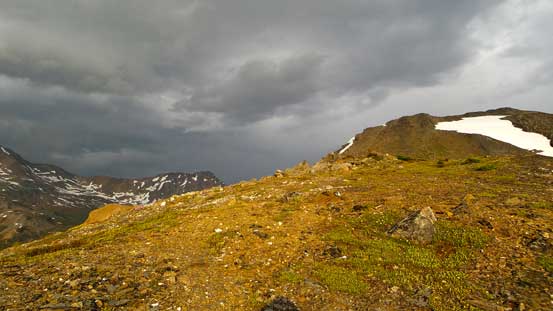
Another thunderstorm was approaching from southeast
The approaching storm and Dogtooth Range

Eric taking in some views
The sky was darkening up very quickly

The last photo before the thunderstorm. Wind was howling like crazy
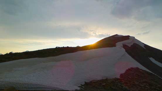
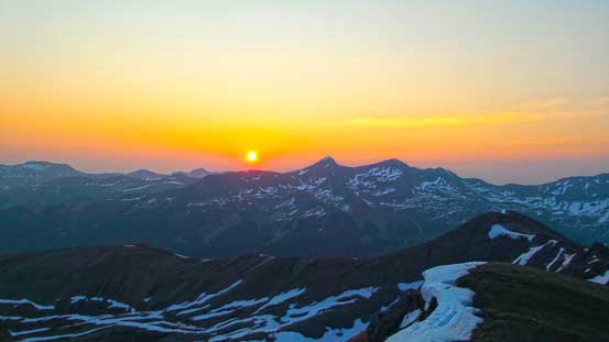
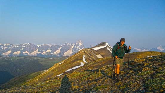
After the storm everything went back to peaceful and we woke up at 4:30 am in the morning. There weren’t even one piece of cloud so we were all in great mood to get going. So after a quick breakfast (2 apple pies for me), we started the ascent – via the obvious ridge crest. The ridge was straightforward and we stuck more-or-less close to the ridge crest. There were a couple steps could be bypassed on the left side, including one snow slope and two rock bands. We got to the summit right at sunrise time. The smoke prevented the alpenglow but gave us a very reddish and then orange sunrise… We stayed there for maybe 1 hour to soak in the views.

Eric scrambling up an optional rock band on the connecting ridge
A view from the ascent. Normally this would be alpenglow time, but thank to the smoke…..
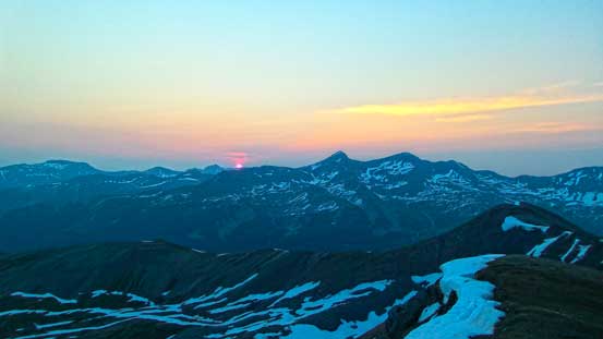
Sunrise time!
A typical smoky sunrise

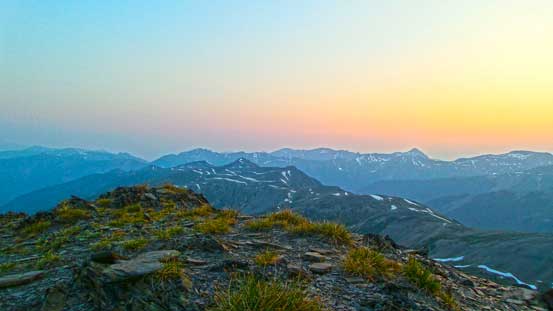
More of the dawn view. This is looking north.
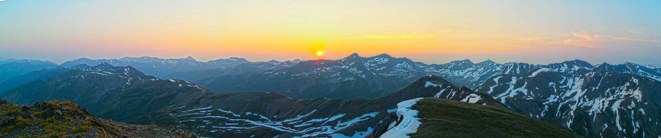
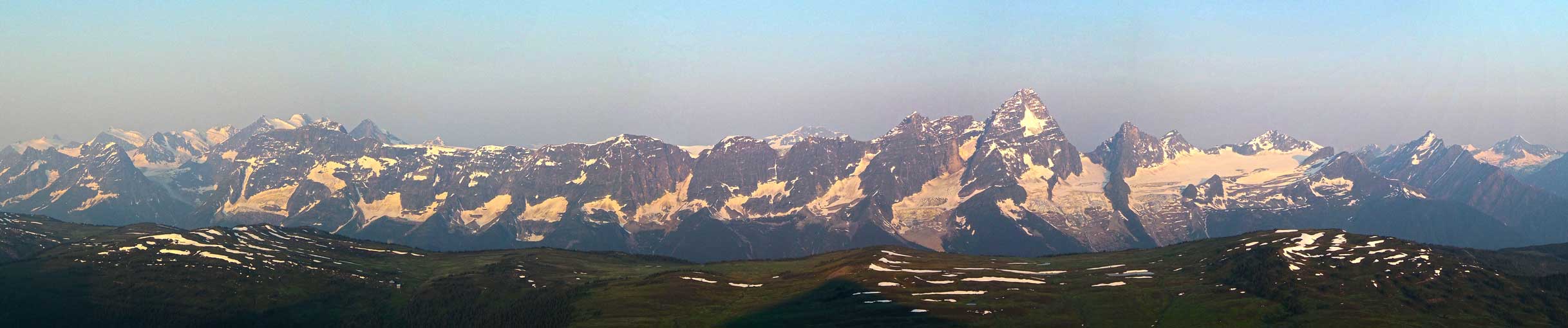
Partial summit panorama. Click to view large size.
Partial summit panorama. Click to view large size.
Morning colour above the typical BC mountain ranges
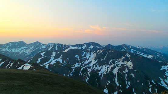
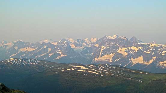
More of the Dogtooth Range.
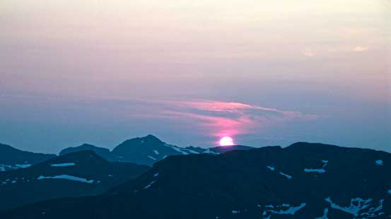
Now the orange/reddish sunrise
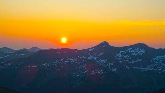
A closer look at the sun

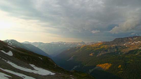
Looking south into the long Beaver River Valley. Thank to the smoke again we couldn’t see very far
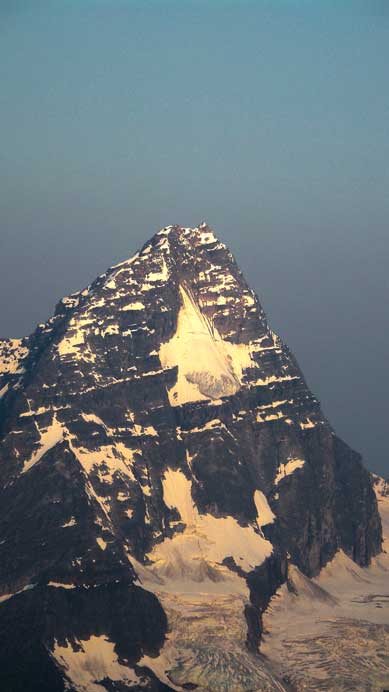
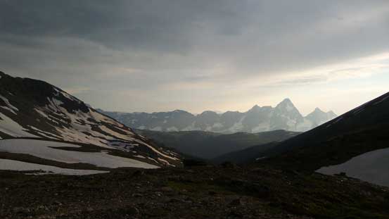
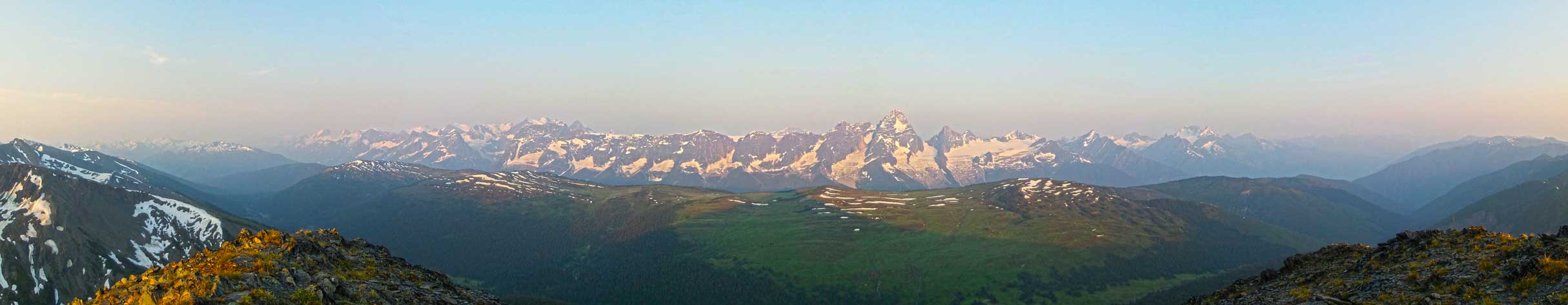
The majestic Mt. Sir Donald. I’ll have to climb it someday.
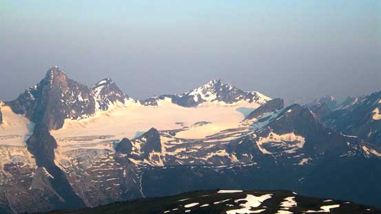
Uto Peak, Eagle Peak, Avalanche Mountain

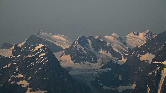
Mount Dawson rises behind Mount Macoun
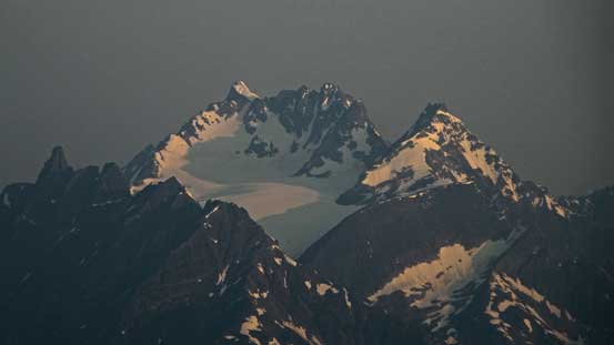
Giants further south – Mt. Wheeler and Augustine Peak
I climbed Mt. Rogers a couple weeks ago

Mt. Sifton
The southern Selkirk giants – Mt. Wheeler et al.

Mt. Sir Donald et al.

Mt. Rogers et al.
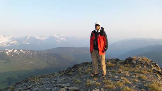
Me on the summit of Copperstain Mountain
Panorama of the long rockwall that forms the eastern aspect of Illecillewaet Neve. Click to view large size.
Then we leisurely descended back to camp, broke camp, and started the long slog back to the parking lot. The descent from Grizzly Col to the low campground went by fast, but after that the rest of the return was flat and boring. The thunderstorm from previous night dumped a ton of water on the brushes and our boots were soaked wet quickly. I was glad to have brought my iPod up. Music did help on this boring hike-out. The river crossing did add a bit to the overall variety but not by much, and after that we had to deal with an up-hill section which was brutal given the heat…

Leaving the summit behind

Eric descending a snow slope

Looking back along the undulating ridge
Eric on the ridge
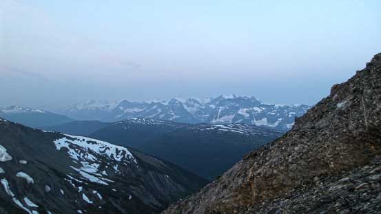
A view of Sir Donald from near Grizzly Col
Hiking back down this lovely valley
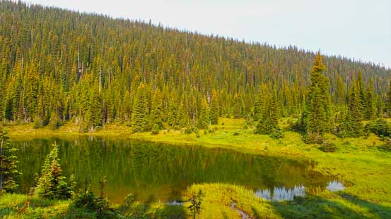
A tarn on the return
The boring and long hike-out

Crossing back Baird Brook
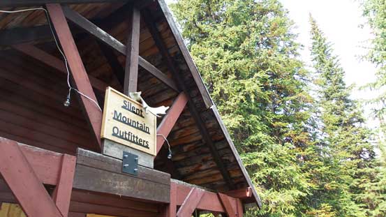
An outfitter cabin
All in all, it’s been a while since my last “easy” trip and I really enjoyed it (apart from the mosquitoes, the heat and the thunderstorms). We thoroughly took our time to enjoy this wilderness area and spent a night at a beautiful col. The Dogtooth Range in the northern end of Purcell Mountains is a great place to explore with some great views.
