Mount Oberlin
August 20, 2015
2493m
Glacier National Park, MT
Mt. Oberlin is an interesting peak in Glacier National Park, MT. While it’s a rather striking summit viewing from north and west along Going-to-the-Sun Highway, it’s certainly one of the easiest out there to ascend, thank to the high starting point (over 2000 m elevation at Logan Pass). Scramblers usually use it as an introductory to this area but I found it serves best as a “Plan B” objective when your’re low on motivation, time or energy, or when the weather doesn’t cooperate. That was exactly the case on the 3rd day of this trip. After bagging Chief, Gould, Haystack and Reynolds in the previous 2 days Mike and I were tired. The extremely-dense smoke didn’t help our motivation neither so as we drove up the Going-to-the-Sun Highway we decided against the long ascent of Mt. Jackson and opted for this much-shorter objective to salvage the day…
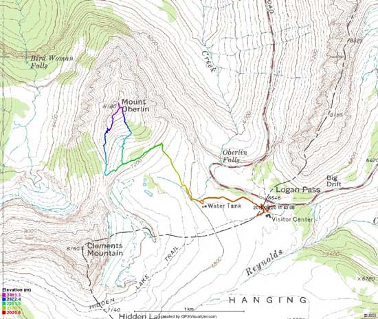
Mt. Oberlin scramble route. GPX DL
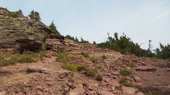
Okay so that’s gonna be a LOT shorter than anticipated so no need to start that early.. We were both tired so figured might as well just take a nap first at the parking lot. About an hour or so later we woke up and leisurely started our day. The crux for Mt. Oberlin for folks like us was to correctly locate the climber’s trail. We took advantage of the book store in the Information Center and did a short study of the route (as we didn’t do any preparation of this ascent before the trip), but even so that climber’s trail was still easy to miss. We ended up backtracking a bit but once on the trail it’s become very obvious. Oh well… This trail led us to the base of our objective then took a sharp turn towards climber’s left aiming towards Clements/Oberlin pass.

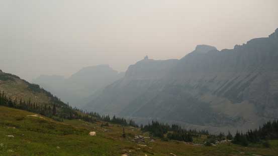
Seeing a sun like this you know your day is screwed if you like views…
The Garden Wall just across the Highway
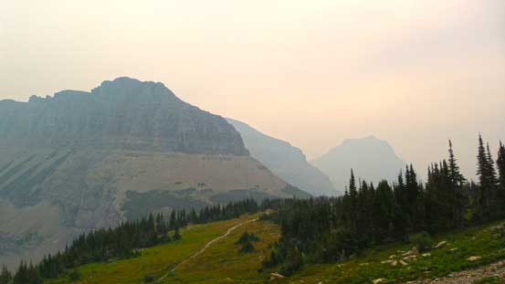
It was very, very smoky… No clouds just the smoke…

On the day like this you might as well just picture the flowers

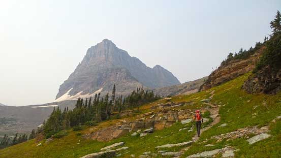
Hiking towards our objective

A marmot

A set of waterfalls
Mike hiking towards Clements/Oberlin col
There are two routes on Mt. Oberlin and on the ascent we followed the recommended one. From Clements/Oberlin pass we pretty much stayed on the ridge line with occasional detours to the sides following obvious cairns and paths. Higher up we caught up with a couple from Wisconsin and Minnesota and teamed up for the rest of the ascent. There were a few trickier spots with some brief route-finding (Class 2 or 3 depends on route), but nothing major, and soon enough we stood on this lowly summit, with nothing but smoke around…

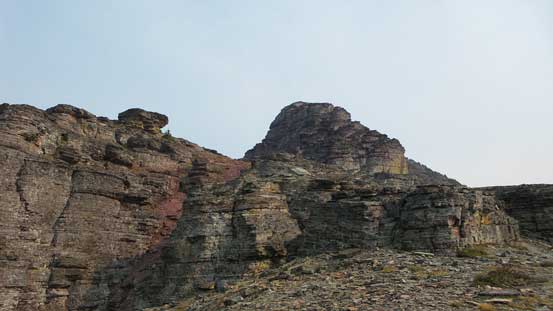
Some broken terrain along the ascending ridge
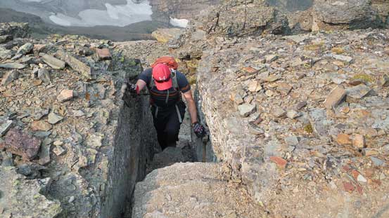
Mike scrambling through a chimney
The ridge continues on
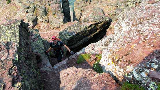
Another scrambling step

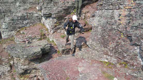
The Wisconsin girl scrambling down a short section
Then jumping across a gap. We were probably off route here…
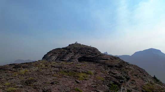
The summit ahead
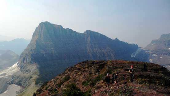
Our group on the summit ridge, with Clements Mountain behind
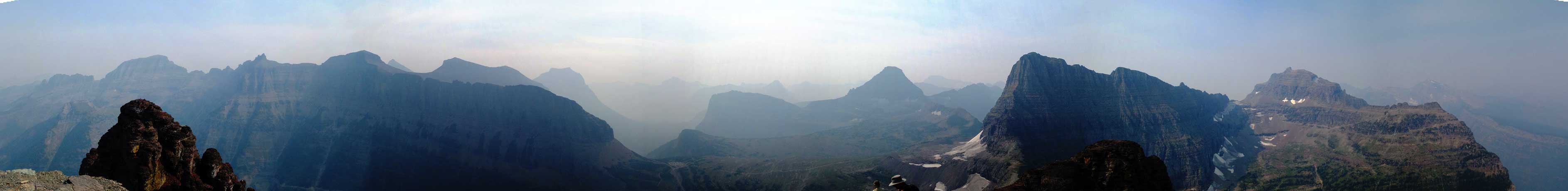
The super smoky summit panorama. Click to view large size.

The lower North summit

Bishops Cap

Mt. Cannon
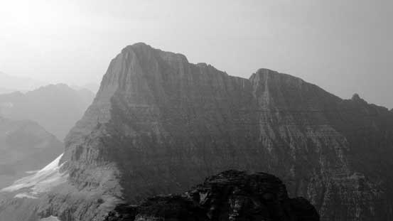
Clements Mountain
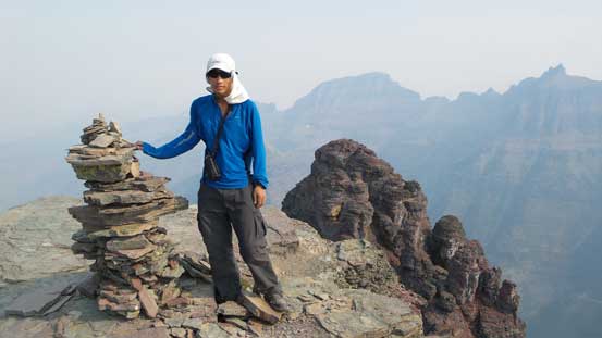
Me on the summit of Mt. Oberlin
On the descent we took the alternative descent route that went down the obvious slopes on a trail/path. This route was nothing fancier than “easy scrambling” and brought down down the mountain fairly quickly. It rejoined the ascent route at just below Clements/Oberlin pass and then it’s a leisure walk back to the car at Logan Pass.
Descending the alternate route
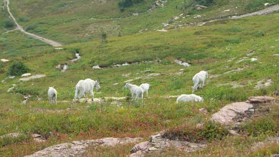
A group of sheep near the climber’s trail
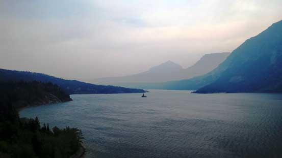
St. Mary Lake on the drive back
Having the entire day ahead of schedule we had plenty of time to drive back to Edmonton. It was a great trip to ascend 5 peaks in Glacier National Park, Montana, but too bad about the smoke… It’s indeed an awesome area as advertised by others and I’d love to come back in the future (if I ever have the chance as it’s gonna be a lengthy road-trip now). The weather was supposed to turn horrible for the next day but then clear up quickly, and surely enough I found myself planning an ambitious adventure with a hardcore climber.
