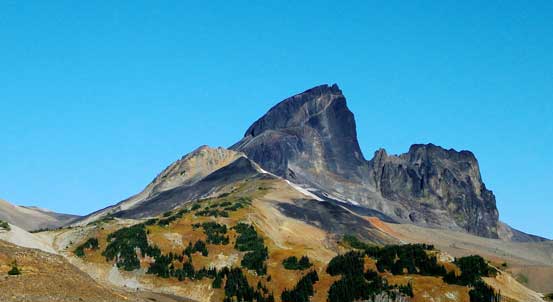
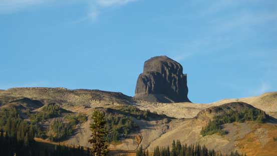
Castle Towers Mountain
September 12, 2015
2676m
Garibaldi Provincial Park, BC
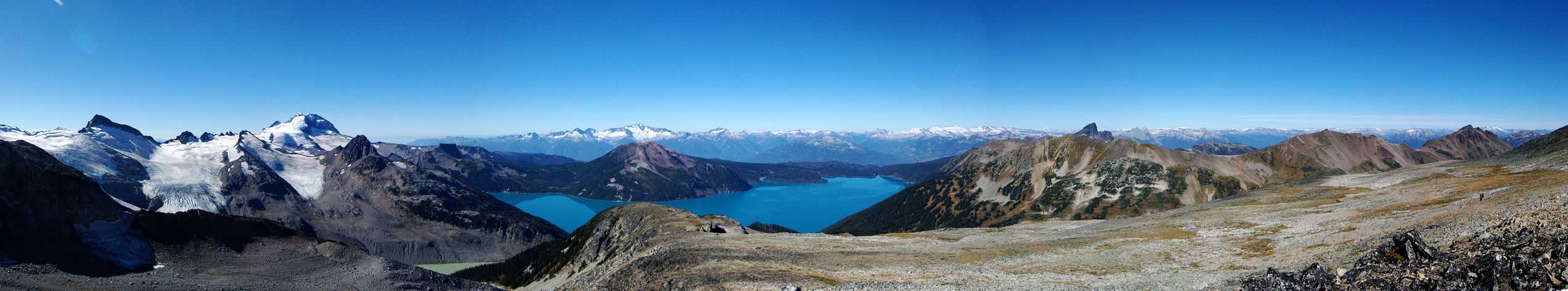
Castle Towers Mountain, or commonly known as just “Castle Towers”, is one of the bigger peaks dominating the backdrop of Garibaldi Lake – the heart of Garibaldi Provincial Park that sees perhaps more than 100 visitors every day in its prime season. Having already done the Garibaldi Lake hike 6 years ago and seen a couple trip reports on ClubTread with outstanding views from this gigantic mass of snow, ice and rock I was determined to give it a try at some point. It has three summits with the lowest west summit a mere Class 2, albeit very long plod, and well documented in Matt Gunn’s Scrambles in Southwest British Columbia guidebook. Getting to the true (central) summit is trickier, but described to be nothing harder than a “difficult scramble” (Class 3/4). There’re two commonly used approaches – the shorter way from Cheakamus Lake while the more scenic option from Rubble Creek.
My original plan was to approach from Cheakamus Lake and ascend Castle Towers plus a couple bonus summits over the course of 2.5 days, but thank to some unforeseen commitments I had to be in town on both Friday and Sunday, screwing up all of my plans. But the weather was too good to not go for it, so the decision was fairly easy – a day trip and that’s it… And not liking to scrap the bottom of my small car on the unpaved Cheakamus Lake road I opted for the longer route (more than 40 km distance and 3000 m elevation gain). I set my alarms at the ridiculous 2:30 am in the morning, had some breakfast at home and by 4:45 am I’d already started the long plod in the pitch dark.

Castle Towers Mountain via Garibaldi Lake Trail. GPX DL
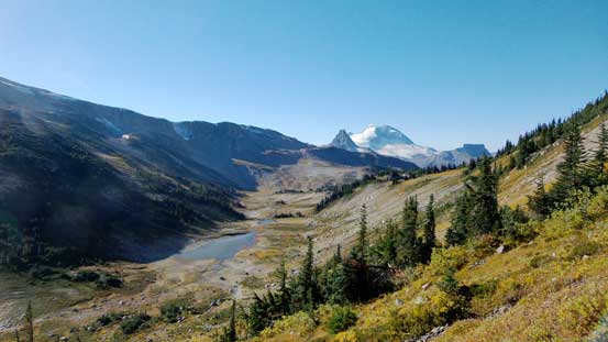
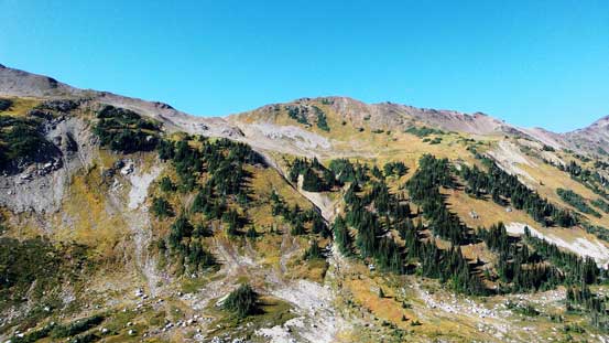
The 7.5 km plod to Taylor Meadows campground in the dark wasn’t inspiring and it’s the matter about how to kill time. My iPod came very handy for scenarios like this so music on, and up I went… Another thing I did was to hike shirtless to save me from sweating too much as it’s warm, humid and windless. I put more clothes on once hitting the meadows as it got considerably colder up there. Plodding through the meadows I came to the junction to Black Tusk, then I took the right turn towards Panorama Ridge. Looking back I started to see some gorgeous alpenglow view on the famous Tantalus Range. And once cresting Helm Pass I continued along the main trail dropping to Helm Lake – a very beautiful place in the morning hours with all the reflections. I took a short break, changed my footwear to mountaineering boots and then it’s the start of the off-trail plod. By now I’d already knocked 14 km off.

Alpenglow on peaks across the Highway
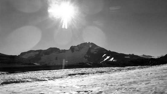
Finally hiking into sunshine
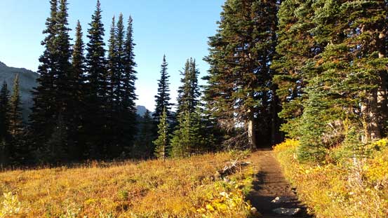
The very good trail
Looking back towards Tantalus Range
At Helm Pass, looking across to the far side
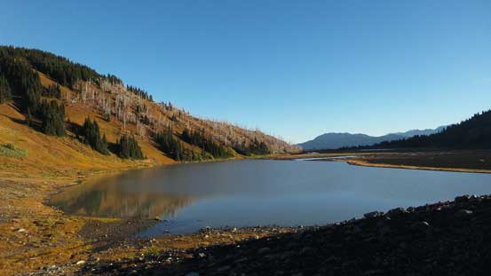
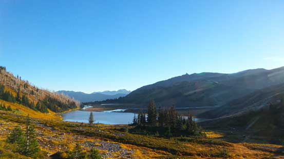
Helm Lake is gorgeous in the morning

Reflections in Helm Lake. Click to view large size.
The usual approach to Castle Towers involves either ascending the entire length of Helm Glacier, or bypassing it entirely by traversing high on either sides. I somehow did a combination of the two loosely following Simon’s trip report on ClubTread. The reason was simple – bypassing the entire glacier would involve a hack lot of elevation loss/regain while ascending the entire length would be cramponing all the way up on hard ice (painful on my knees and feet). There’s a somewhat confined valley between Cinder Cone and Panorama Ridge that I hiked up staying climber’s right of the creek. It led me to an unnamed mud lake. I circumvented the lake on the right hand side, and then picked a line with the least amount of resistance up towards the broad ridge/plateau between Panorama Ridge and Gentian Peak. It’s a foreshortened plod but thankfully the ground wasn’t too loose and views kept improving.

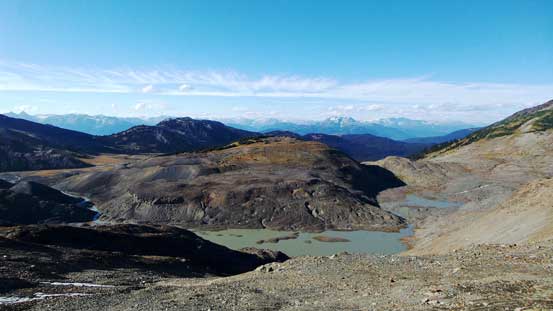
Hiking along the valley leading to that unnamed lake, looking back
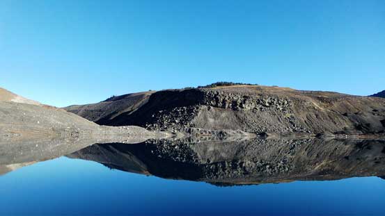
Cinder Cone and its reflections in the mud lake

The tip of Black Tusk started to show up again

Panorama of the mud lake. Click to view large size.
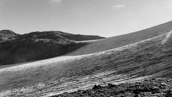
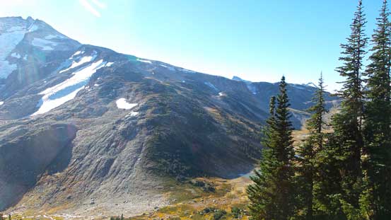
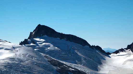
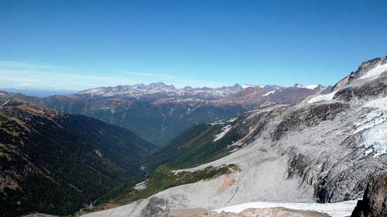
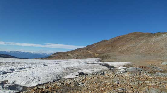
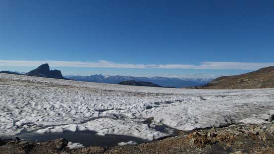
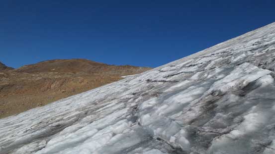
There’s a bit of up-and-downs on the broad ridge but not significant. Up and over the first bump I got to see a hidden tarn right on the ridge crest that’d potentially be a 5-star bivy site, but I had to press on. I started contour a bit on the left side resisting gaining too much height, and around another corner I started to see the upper Helm Glacier. It was as expected, bone dry top to bottom and the headwall looked fairly steep to be honest. But once I made to the edge of that glacier the angle seemed to ease quite a bit. I strapped crampons on and ascended the headwall following a rising traverse line from bottom right to upper left. During which I met a solo climber on his way down (he must have camped at the pass the night before), as well as another guy on his way up but he was way ahead of me at that point. Then I arrived at Gentian Peak’s high shoulder and ahead was the uninspiring 300 m height loss to Gential Pass…
The Black Tusk
I was surprised to see a gorgeous lake on top of this broad ridge
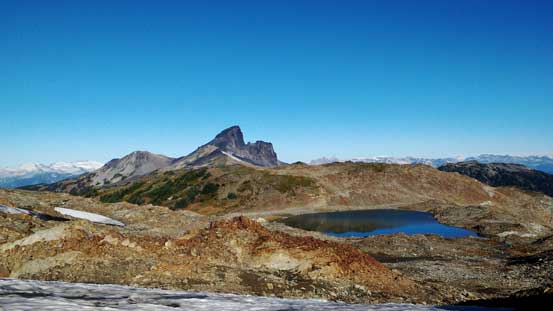
Black Tusk and that lake
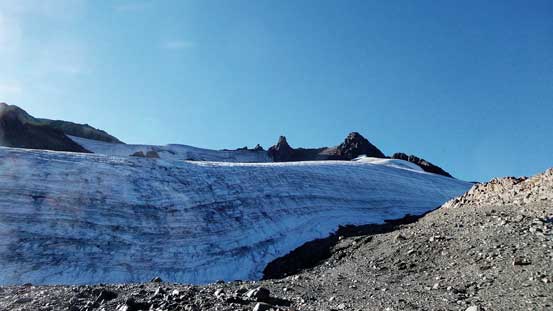
Ready to cross Helm Glacier
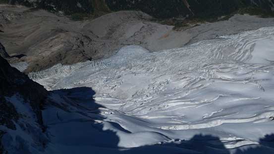
Part of Helm Glacier, looking towards Gentian Peak
Looking down the tongue of Helm Glacier

There are a few cracks on this glacier.

Another crevasse or melt hole…

Almost on the broad pass now, looking towards Gentian Peak
Looking ahead towards my objective. What you can’t see now is the massive drop ahead…
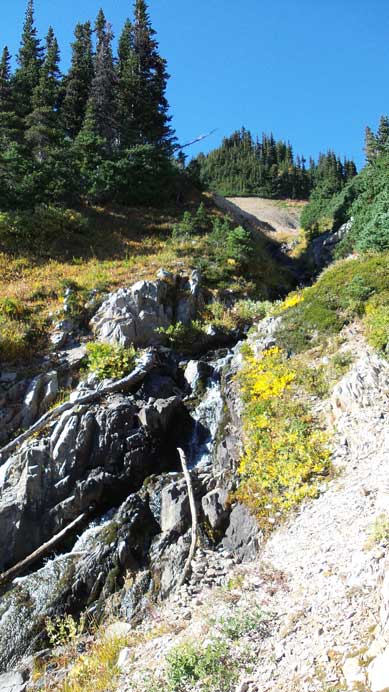
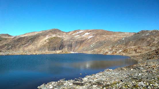
Descending to the pass I had no clue where to pick the best line so basically went straight down. Soon I started encountering some very steep grass. The moisture made it very slippery and I had to side-step a long ways, one step after another. It felt tedious and just about I started to plunge facing outwards I took a slip and got my pants wet… Oh well.. After some cursing I resumed the descent and had no further issue. Once down to the pass I took a short detour to check out the tarn (and to fill up my water bottles as it’s the last water source on this route).
Partway down, great views of Sphinx, Guard and Garibaldi
Steep grass… Not very pleasant…
Polemonium Ridge ahead
Looking down at Gentian Pass

This lake at Gentian Pass would be another gorgeous bivy spot…
The next section was plodding up Polemonium Ridge. It’s basically just a hike and the ridge was wide and open but oh man this section was long… I kept looking back as I knew I had to get at least higher than Gentian Pass, but it just seemed to drag on forever. Once the right hand side ridge (that comes from Sphinx Bay) appeared closer and closer I started to move towards climber’s right searching for that “scree gully descent”. There’s no need to summit Polemonium Ridge in order to ascend Castle Towers. The scree gully was about 50 vertical meters below the top of this ridge and I correctly located it on the first try, saving me some extra height gain/loss. I went down the gully, then side-hill bashed my way across the loose talus slope to Polemonium/Castle Towers col.
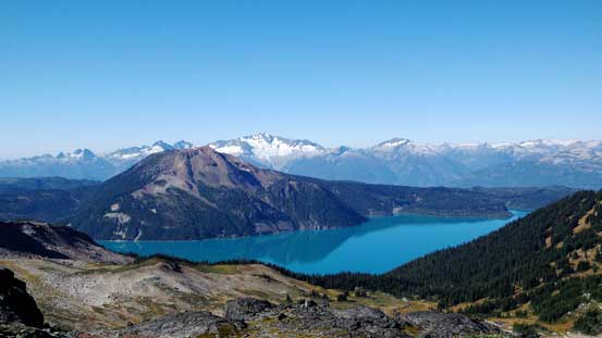
Garibaldi Lake and reflection of Mt. Price

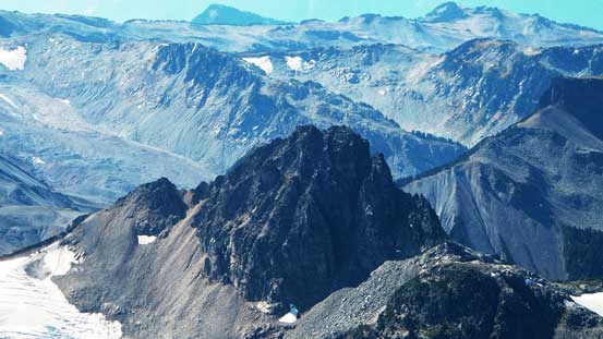
Looking towards Corrie Peak. The high shoulder on far left
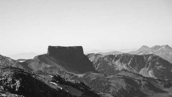
The unique shaped The Table is said to be almost “unclimbable”.

Long plod up Polemonium Ridge

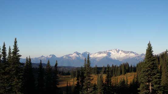
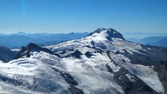
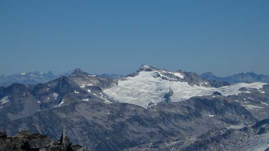
The mighty Mt. Garibaldi
The west summit ahead, still a looong way to go…
Panorama from the highpoint on Polemonium Ridge. Click to view large size.
The Sphinx

Now, time to descend this scree gully
Then, side-hill bashing…

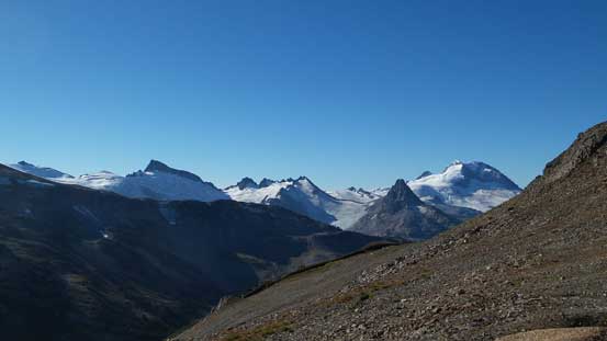
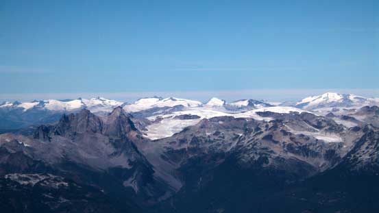
Lots of glaciers nearby

Traversing towards Polemonium/Castle Towers col
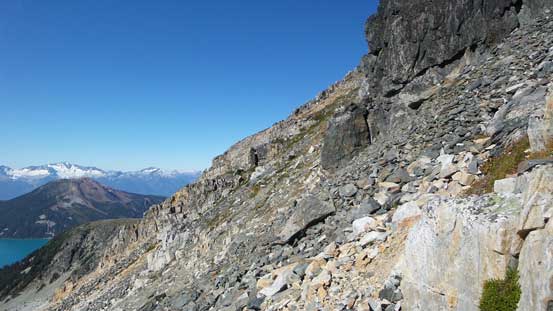
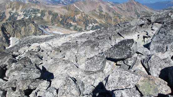
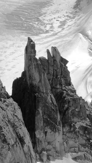
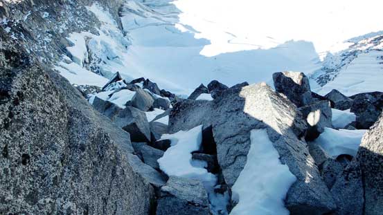
The section ahead was a bit confusing as I didn’t bring route description with me. I circumvented the imposing pinnacle directly ahead on the right side but then went up too early. I ended up on top of that pinnacle looking down at a 10-meter drop. Instead of retracing my steps down I took a further look over the edge and decided to just down-climb into the notch – only one trickier move involved towards the end. After that bit of detour I started to see more cairns and had no further issue getting onto the broad W. Ridge. Ahead would be the last plodding section, the most “exciting” one… It’s hundreds of vertical meters of gigantic granite boulders… It’s brutally tedious but at least most of the boulders were solid but there’s always a few exceptions that could give you a good surprise…
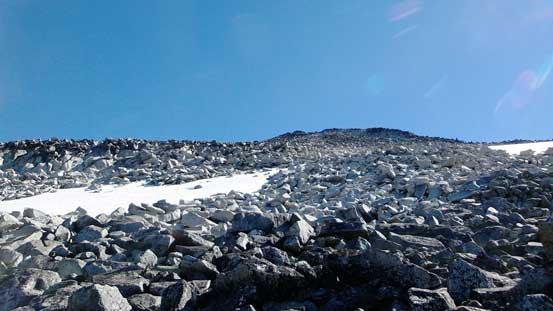
The typical terrain on Castle Towers…
Oh the hundreds of meters of boulder fest…

Enough..
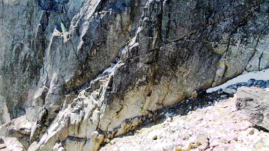
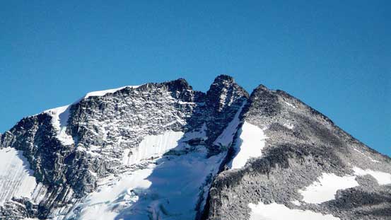
As I slowly ascended to the lower west summit I kept imaging the look across the gap towards the true one as from earlier observation I could see fair a bit of snow on the N. Face ledges. Thankfully it didn’t look too bad once examining up-close. Descending from west summit to the connecting col I followed the ramp/gully option that went downclimber’s right. There’s one tight and very strenuous move involved (but only moderately exposed), but other than that I agreed with the Class 3 rating.
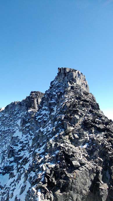
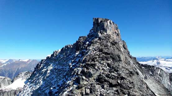
The true summit showed up ahead
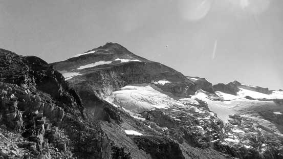
The glacier on the N. Face

Starting down this ramp/gully
Halfway down, it’s getting tighter and harder

Looking back up this ramp/gully

It’s steep…
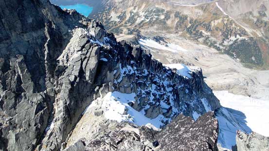
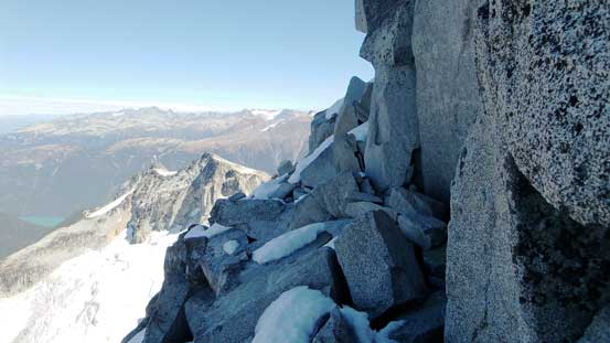
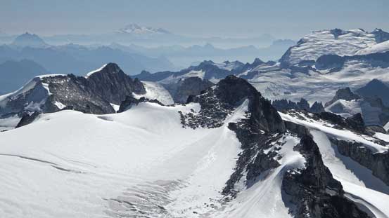
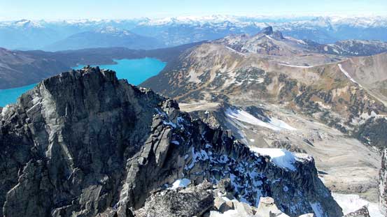
Up towards the true summit I started to encounter snow. I did haul my crampons all the way up here but the snow was great for kicking in if I had to, so didn’t bother to use them. At the base of the final obstacle I traversed climber’s left onto the N. Face. The snow did add a bit spice to the exposure but the ledge was fairly wide to allow some good foot placements. Soon I went around the far corner and seconds later I was standing on the summit, 8 hours after leaving the parking lot in the morning. The views were kicking-ass towards all directions.

The ramp down from west summit is shown.
Partway up the true summit, looking back to the col
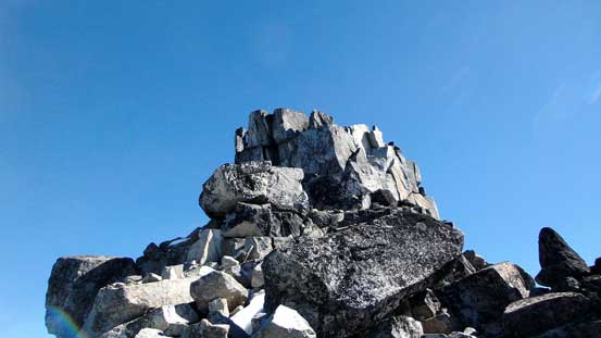
The summit block
Traverse on a ledge, climber’s left onto the N. Face

Summit Panorama. Click to view large size.
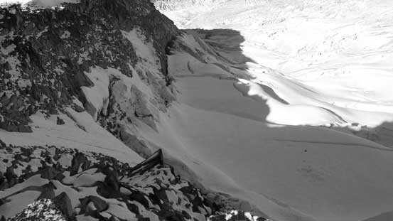
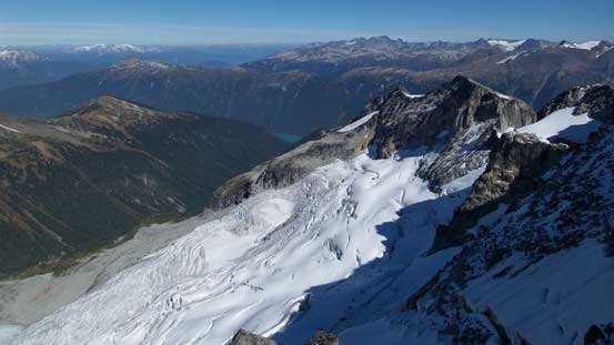
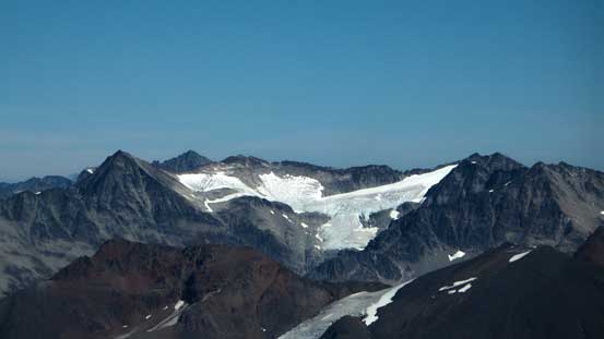
The steep N. Face and the gigantic bergschrund
The heavily crevassed glacier on the N. Face

Looking over Cheakamus Glacier
Looking over Sphinx Glacier towards Mt. Garibaldi

Garibaldi Lake
Mt. Tantalus

Some low peaks by Sunshine Coast

Another shot of Mt. Garibaldi

And, The Sphinx

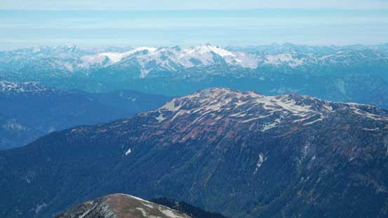
Sky Pilot Mountain behind – my previous objective
Mamquam Mountain
Mt. Carr in the foreground
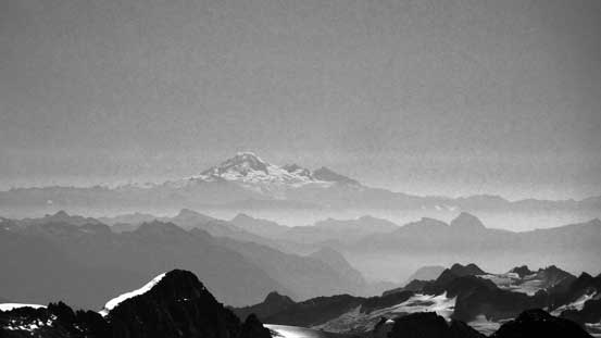
Mt. Baker way in the distance
Behind Mt. Robie Reid (fg, R) is Mt. Shuksan (bg, center)
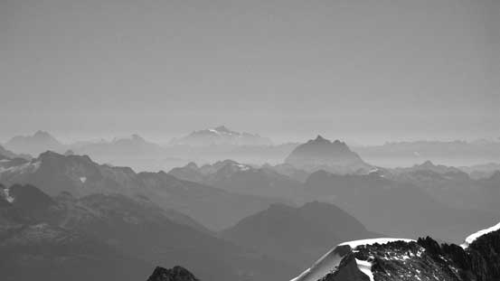
Some remote peaks on McBride Range

Peaks by Snowcap Icefield, another very remote area

The very fractured Sphinx Glacier

Icefalls!
Guard Mountain looks fairly different from here than the usual angle
Some icefields in the distance. Tricouni/Cypress in foreground, bottom left

The Black Tusk

Mt. Weart and Wedge Mountain – the two highest peaks in Garibaldi Park
Overlord Mountain area
Whistler Mountain in the foreground
Phyllis’ Engine
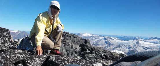
Me on the summit of Castle Towers

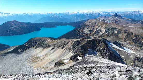
Panorama looking North. Click to view large size.
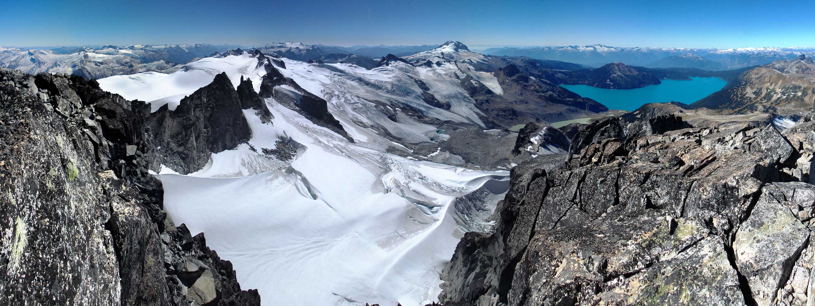
Panorama looking South. Click to view large size.
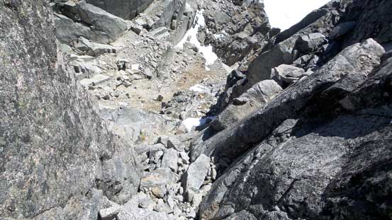
I took a fairly long break as I didn’t want to leave this beautiful place knowing I probably wouldn’t be back here ever again, but I knew I had to get going soon as I still had a LONG way back home to go… I “crab-walked” down to the snow covered ledge, then carefully traversed back across, then “crab-walked” again down to the true/west col with no problem. Back up the ramp there’s that strenuous move. I wasn’t sure if I had picked the best line but the foot placement was very poor on that move so it’s mostly pulling myself up with some pure arming strength… Once I made it through the rest of the way back to the west summit was fairly straightforward. I took another well-deserved break on the west summit before continuing the descent.
Carefully making my way down the initial few meters to the ledge

The ledge traverse
Expansive vistas!!
There’s a narrow ledge traverse to get into that ramp/gully

The bottom section of the ramp/gully
Back to the west summit, looking back
Now came that boulder field. It was surprisingly easier to descend than on the way up and “crab-walking” was again, the key to avoid suddenly putting my entire body weight on one single boulder, thus reduced the consequences of potential rolling. Side-hill bashing beneath Polemonium Ridge was not very pleasant and by this time of the day it’s starting to get very hot. I didn’t feel like claiming Polemonium Ridge so went straight down the slope after ascending back up that scree gully. The next section was uneventful and I took a long break at Gentian Pass.
Descending towards Polemonium Ridge (foreground)

Oh the boulder fest…

Traversing underneath Polemonium now, looking back

Reascending back up Polemonium Ridge
Looking over Castle Towers Creek towards Wedge area
Ahead is the slog back up the high shoulder from Gentian Pass…
Ahead came the section that I was the least looking forward to – the 300 vertical meters of grind back up to the high shoulder under the hot afternoon Sun… But I had to do it no matter what. This time with the sight in view I managed to pick a better line staying close, or just to climber’s right of the main creek. There’s a lot less steep grass to negotiate and there’s always a running stream for water source. Despite the uninspiring grind I was still physically strong at this point so it actually didn’t take me too long to crest the high shoulder.
Following the main creek up

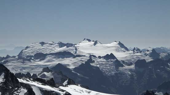
Looking back towards my objective
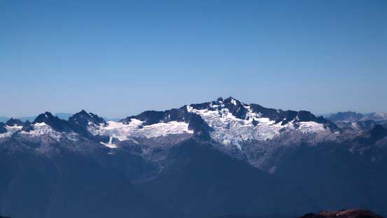
A zoomed-in shot of Castle Towers
Ready for Helm Glacier. Gentian Ridge on the right
The tip of Black Tusk pokes behind Helm Glacier
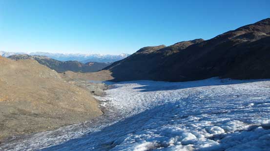
Crampons on and down I went. The ice had become considerably softer and there’s a LOT of surface melt on this glacier. I retraced my line back across, then up and over the minor bump just before Panorama Ridge, and then picked my line down to that mud lake. And then it’s the trail plod…

Crevasses…
Cramponing down the ice

Done the Helm Glacier crossing
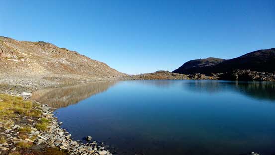
That beautiful unnamed tarn would be perfect to spend a night…

Cool waterfalls coming down from Gentian Ridge

Panorama of that unnamed tarn. Click to view large size.

Another look at the tarn
Now, time to descend to that mud lake

One last look at Gentian Peak
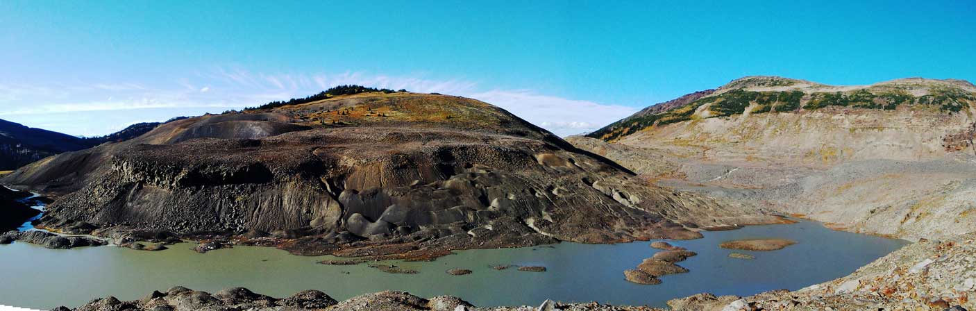
Panorama of the mud lake with Cinder Cone behind. Click to view large size.
Another panorama, from the lakeshore. Click to view large size.
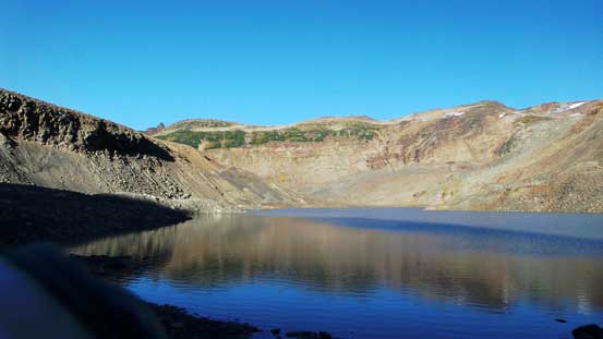
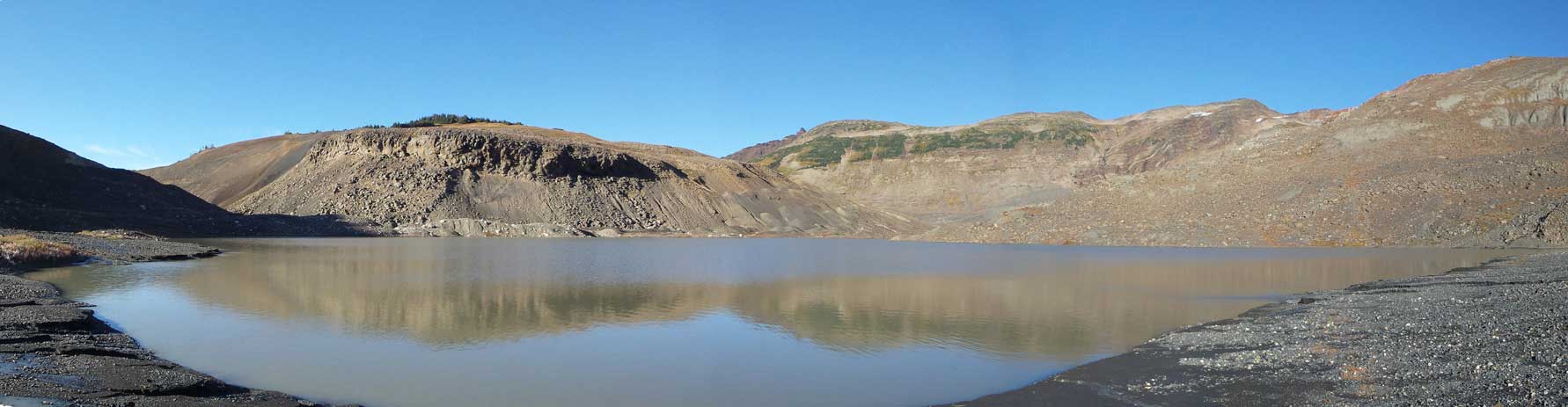
One last look at this mud lake

The stream flowing out of the mud lake
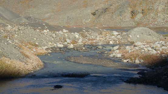
The same stream

Again, the same stream flowing out of that lake
Back to Helm Lake now
Panorama Ridge with Mimulus Lake in front
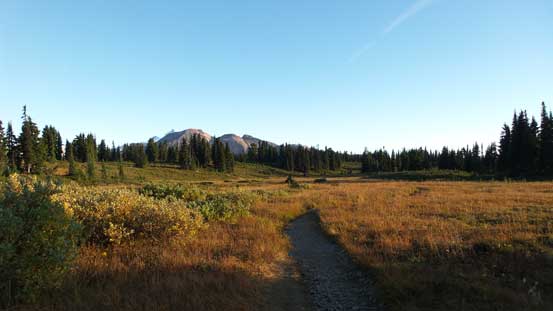
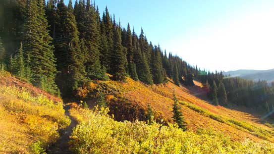
Hiking back across Black Tusk Meadows

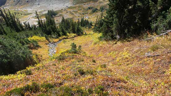
Gorgeous fall colours!!

Lovely meadows!
The Black Tusk
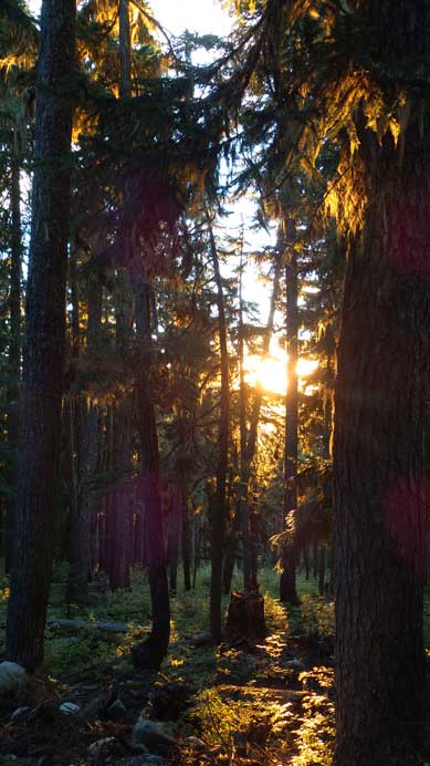
Sunset through the woods
Eventually the darkness fell just when I got back to the 6-km junction, and another hour later I was back to the parking lot. My round trip time was exactly 16 hours. Comparing to the V. C. Traverse, Ghita Mountain or even the Fitzwilliam traverse this one wasn’t nearly the longest day-trip I’ve done, but it’s certainly a long one. I’d say breaking it over 2 or even 3 days is a more enjoyable way and you’ll also have time to ascend some other peaks nearby, but in any case I’m just glad I have the fitness and mental toughness to overcome something this long when “needed”. The Garibaldi Lake area is awesome with some massive glaciers and I’m hoping to go back for the other peaks sooner than later.
