Zofka Ridge
March 4, 2021
1559m
Hope, BC
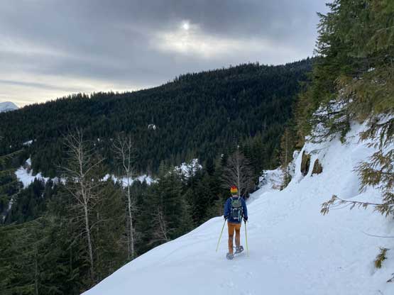
The officially-named Zofka Ridge occupies a large area on the west side of Fraser Canyon between American and Emory Creeks and immediately to the north of Hope. The highest point on this ridge is on the NE side and boasts slightly over 600 m prominence. The ascent of Zofka Ridge is very obscured and mostly unheard in the SW BC community. Through satellite images and topographical maps this peak indeed does not look inspiring and the ascent seems doomed to involve overgrown logging roads and fair amount of bushwhacking. The highest spur roads do reach to within 500 vertical meters from the summit on the NE slopes, but the satellite images suggested that they had been re-sloped into messes. More importantly, there had been zero information about the status of these roads. I figured the only feasible time to bag Zofka Ridge is winter and spring when a thick snowpack covers most, if not all of the annoying bushes but on the other hand, I wanted the snowline to be at or below 450 m as the road to Nicklemine site is driveable and in a good shape. I wanted to take advantage of the road to shave off at least an hour’s walk each way.
A few days ago the “Unnecessary Crew” led by Duffy had made a half-hearted attempt to about 1000 m elevation on the east slopes. Matt and I wanted to take advantage of their tracks but after some in-depth researching we opted to explore our own way. There are quite a few ways in my opinion. My proposed route was to the south of Duffy’s tracks but Matt had a different vision to use the (snow covered) re-sloped roads on the NE side. I generally avoid re-sloped roads for all costs but Matt found a recent satellite image showing those roads were fully snow covered, so I was sold on that idea. The forecast for Thursday was calling for cloudy skies but ridiculously high freezing level and both Matt and I had work commitment later in the day, so to make the most use of our window we decided to meet at Abbotsford at 3:30 am to give more than enough time contingency. Matt again did a fantastic job driving us to 450 m elevation. The last few turns of the road before Nickelmine were too slippery even for Matt’s truck so we parked a little bit short of the highest driveable spot. This was already 1 km farther than Duffy’s starting spot so we were happy about it.
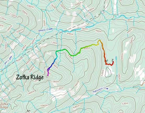
Zofka Ridge from Nickelmine. GPX DL
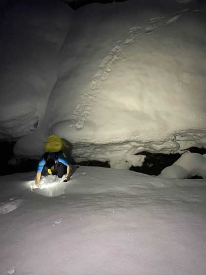
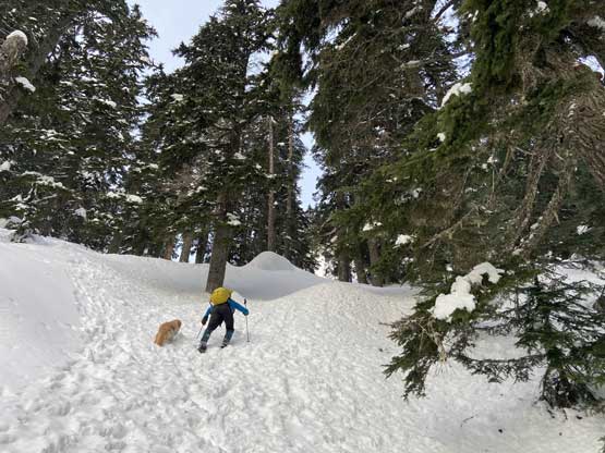
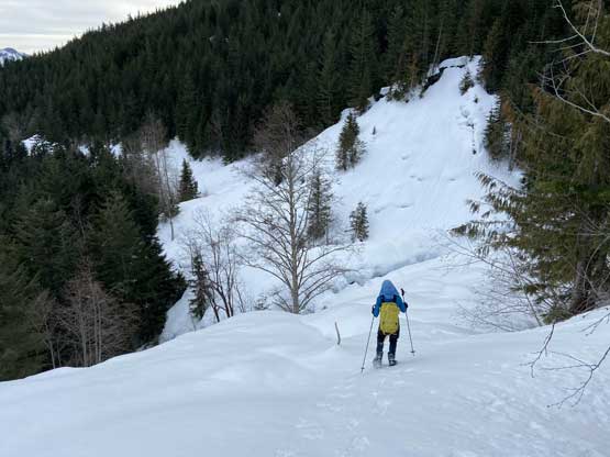
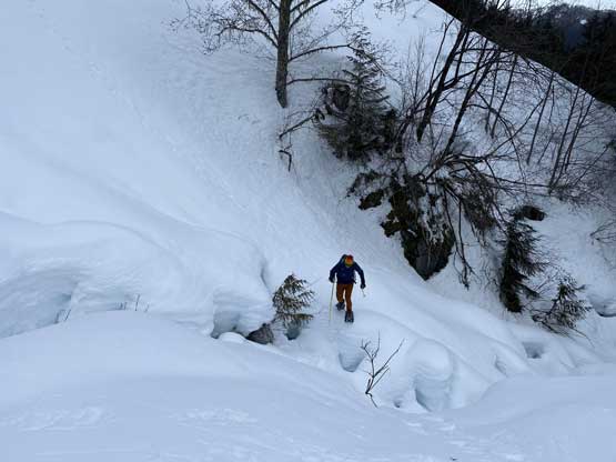
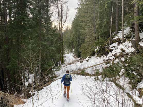
We easily followed the previous group’s snowshoe tracks across some open terrain to the start of the first leg of this aforementioned logging roads with unknown status. The snowshoes were strapped on as soon as reaching the logging road as the overnight freeze was poor and the snow was a bit slushy (even at 5 am in the morning). Their snowshoe tracks unfortunately came to a stop in less than a km into the plod as they for some reasons opted to ascend the steep forest on the left side. The road beyond their bailing spot looked bushy with some dead-falls but not unreasonable so Matt and I carried on. We did have to overcome a few annoying stretches but did not encounter anything worth noting for SW BC status. At about 600 m the road made a 90-degree turn due SW/W into what seemed like a large cut-block. The branches in this cut-block were confusing in the dark but we had come prepared with all sorts of GPS maps, so the navigation was not a problem. We picked up the second leg of this road system which clearly felt like a “re-sloped mess”. The deep snow coverage did ease the ground unevenness and the going was honestly much easier than I thought. The worst was a few creek crossings around 900 m elevation with at least one requiring a jump.
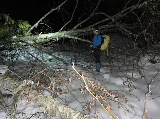
After the previous group’s tracks stopped we immediately faced some dead-falls

Matt hopping over one of those annoying dead-falls
After a while this was me jumping one of the ditches

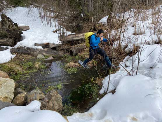
Matt leading across yet another tricky creek/ditch crossing
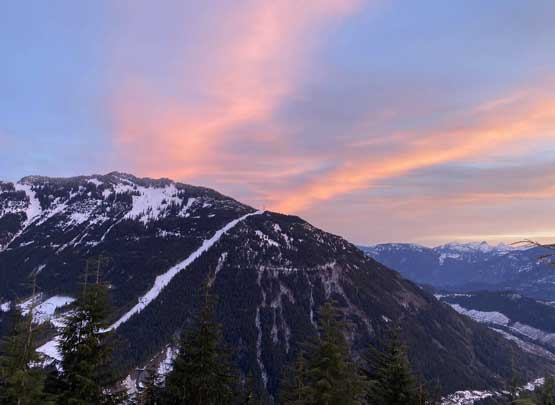
Towards the end of this re-sloped “road” we took the first energy break and then we were treated with a gorgeous sunrise behind us. We also made another important decision here to bail the switchbacks and aim for the lower north ridge. We were both tired of the side-hilling at this point and wanted to ascend straight up. Matt led us through a stretch of steep old growth forest into what seemed like a gigantic car-sized boulder field. The snowpack was deep enough to cover the boulders so we were able to cruise. I then took over the lead linking up a few patches of steep and open slopes to gain elevation quickly. In general we stayed on the east side of the north ridge and never went too far away from the actual north ridge. The going was quite easy although the trail-breaking was a little bit heavy at times.

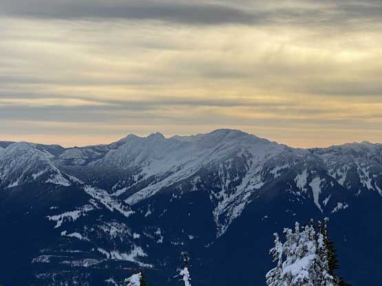
A gorgeous dawn skyline behind Squeah Mountain and its sub-peaks

Morning horizon behind the Anderson River Group of spires

This was the spot where we eventually left the roads
Looking back at a marvelous powerline

Twig led us into this long and steep stretch of boulder fields

Matt grunting up this boulder field with the powerline behind

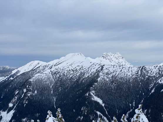
A wider-angled shot of Squeah Mtn. and Jorgenson Peak and their sub-peaks
Me picking a steep line through old growth forest to link up more boulder fields

Matt grunting up the same stretch
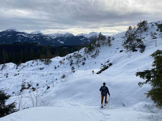
The snow had transitioned to the dry powder at this point. After what seemed like a long while of grunting we were finally staring at the summit block. The obvious attack was on the climber’s right side so we finally ascended onto the north ridge proper. The last 50 m to gain the summit was pretty steep but the views were also fully opening up. The view from this summit was much better than anticipated that we lingered for at least 20 minutes before descending.

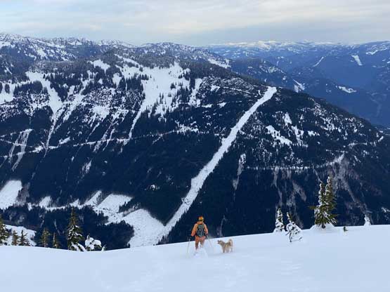
Matt and Twig breaking trail up the next open slopes

The Anderson River Group – Steinbok, Ibex etc. behind Mt. Oppenheimer

The morning sun behind Jorgenson Peak

Me picking a line to gain the north ridge immediately under the summit

Me snowshoeing up the last steep roll before summitting
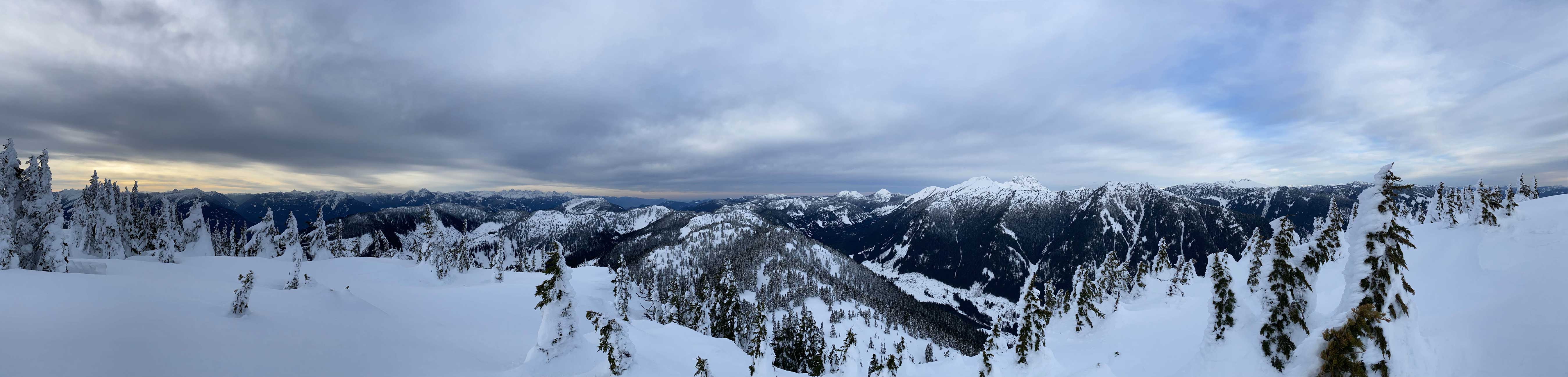
Summit Panorama from Zofka Ridge. Click to view large size.
Mt. Baird and The Old Settler

Mt. Parker and Mt. McNair in Bear Creek drainage

Mt. Fagervik is a remote summit halfway between East Harrison and Fraser Canyon

A very zoomed-in view of The Old Settler the eye-catching giant in this area
Jorgenson Peak is an obscured summit between Fraser Canyon and Coquihalla Corridor

Mt. Hatfield and Mt. Outram with Ogilvie Peak blending in front

A very unusual view of Sunshine Valley with Marmot Mtn. poking behind right of center

“American Mountain” and other parts of Zofka Ridge in foreground

Silver Peak and Isolillock Peak dominate the southern skyline

Hope Mountain in foreground with Mt. Grant, Mt. Payne and Mt. Rideout behind

A zoomed-in view of Lady Peak and Cheam Peak in Cheam Range

Me on the summit of Zofka Ridge
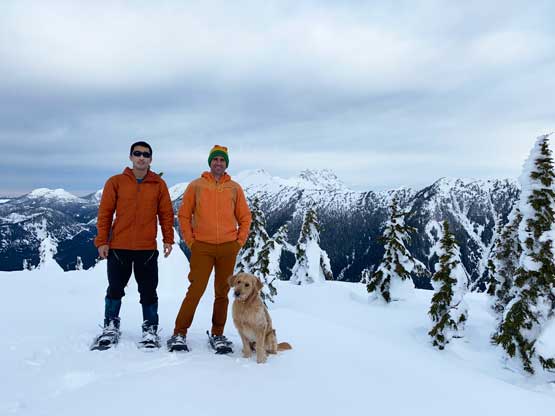
Our group shot on the summit of Zofka Ridge
On the descent I followed Matt glissading three big runs with snowshoes on. The snow was very powdery that I felt safe to let the speed pick up. We then had a fast plunge and run down the open boulder fields and old growth forest, losing 600 m elevation from the summit down to the re-sloped logging roads. The plod back along the roads was also easier than expected. The few creek crossings were annoying but not troublesome. We were able to find some alternative solutions than boldly jumping those ditches. The rest of the return was fluent and uneventful.
Time to head down…
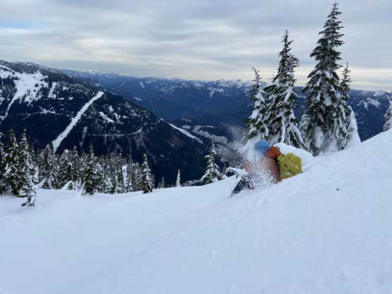
Me trying to gain some confidence glissading with snowshoes still on
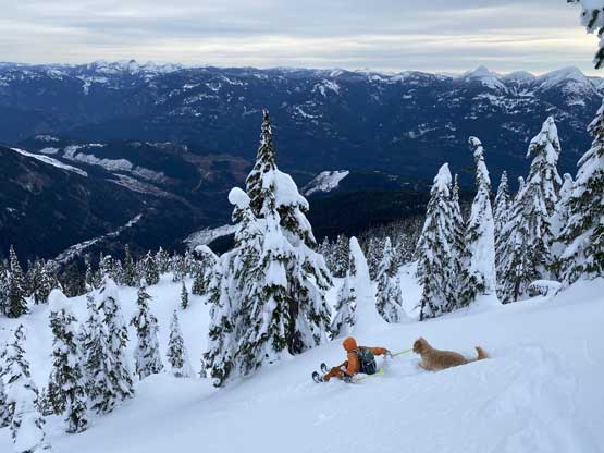
Matt and Twig led down another (steeper) glissade

Matt demonstrating his technical snowshoeing
Down to the logging roads now
Me snowshoeing down one of the flatter stretches
Matt negotiating one of the creek crossings

Matt and Twig on the worst creek crossing

I picked a different line across this creek.

Twig enjoying a well-deserved break
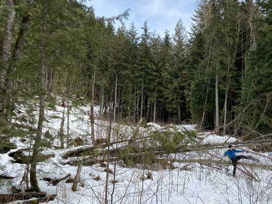
Matt snowshoeing back down into this large area of cut-block

Mt. Oppenheimer is that dumpster summit in foreground; “Saddle Peak” behind
Back down to the bushy lower roads
Me hoping over one of the sticks
Me negotiating some typical stuffs on a BC deactivated road

The north face of Hope Mountain looming to the south
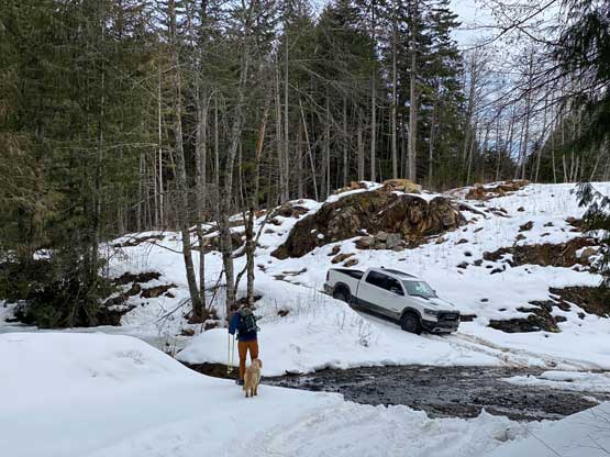
Almost done. It’s truck time…
Our round trip time was just under 5.5 hours so this was quite a short trip. The terrain was also much more friendly than we had anticipated with very minimal bushwhacking. Both Matt and I were pretty fast at this trail-head transition thing so we were on the road in no time. I eventually got back home at 12:30 pm right in time for lunch, earning myself quite a few hours of break before the afternoon/evening work routine.
