Mount Thynne
October 4, 2021
2020m
Coquihalla Pass, BC
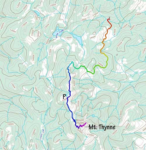
Mt. Thynne is a broad and prominent summit slightly to the north-east of the familiar Coquihalla group of peaks. The access road is even further to the north starting at the Coldwater Road exit. This peak can be driven to the summit for those with a capable 4×4 vehicle and all-terrain tires but I opted to park 3 km from the summit as I still wanted this to be a hiking trip. The logging road system is complicated and confusing so careful planning on the various maps before the trip is essential. I had recent beta from Alan and Katie that the road was driveable to the summit so I pulled the spontaneous last-minute trigger a mere two days after their ascent. This was a Monday so that I needed to be home by 3 pm for work, so the only way to make this happen was to drive out on Sunday night and sleep in my truck.
Sunday had been a busy work day such that I did not manage to leave White Rock until 10 pm. Somewhere between Chilliwack and Hope a chicken flew onto my windshield and completely destroyed it. Thankfully the chicken did not break through my windshield so I was unhurt, albeit a bit shaken. I had already driven out too far to consider a turn-around so I carried on, up and over Coquihalla Pass to Coldwater Road. The first 15 km or so was actually paved (to my surprise) and led me into a small community called Brookmere. There was still cell reception at this point which was also to my surprise. I then turned onto the gravel road labelled “Thynne Mountain FSR” and followed the mainline for about 10-15 km. The road condition had been mostly excellent up to this point. Upon reaching a Y-junction I decided to take the left branch labelled “Upper McPhail” as this road looked a bit more open on my satellite images. Later on the return I drove the other branch down and regretted that decision, so I did make a good choice on the way in. This “Upper McPhail FSR” was mostly smooth and wide, but had two small wash-outs likely due to the recent rainy weather. These two wash-outs required high-clearance to crawl across. Once rejoining the other branch I soon drove passed a snowmobilers’ cabin and after that the road brought me onto Mt. Thynne’s undulating north ridge. The condition of the road had become increasingly rough with rocks and steeper grades so eventually at a convenient spot, about 3 km from the summit I turned around and parked. It was almost 2 am so I quickly crawled into my -18 degree bag and slept.
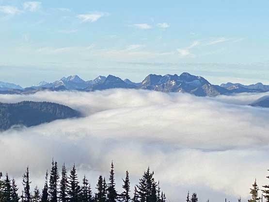
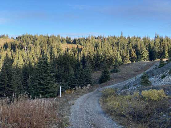
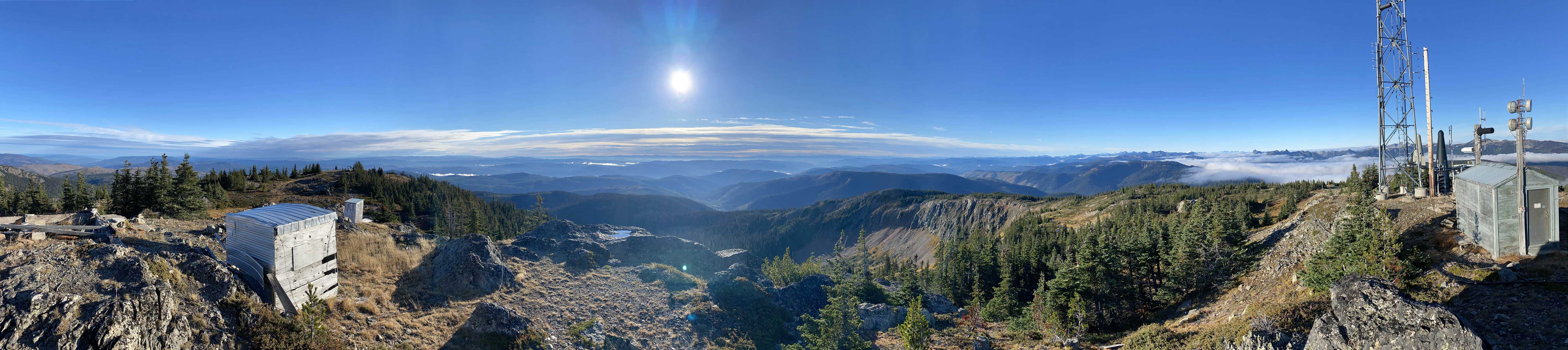
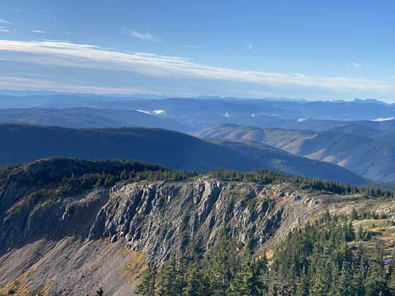
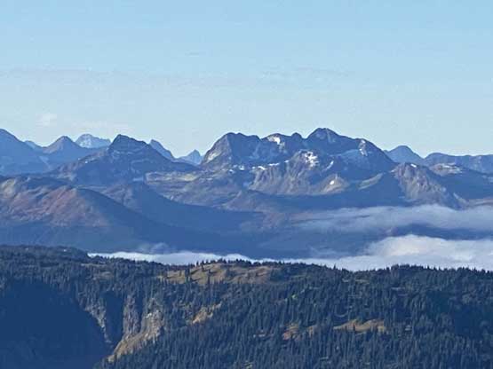
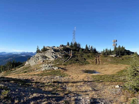
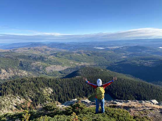
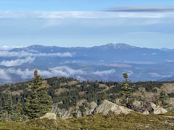
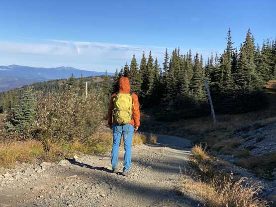
The next morning I slept in till 7:20 am. I did not even bother to have breakfast as the temperature was chilly and the hike was supposed to be very short. I heard some wolves’ howling so considered to turn around and just drive to the summit but then I determined the risk of being attacked by wolves should be very low, so carried on. There were some undulating stretches along the north ridge and the views were already great through thinning trees. There’s a layer of cloud inversion above the valleys. The bulk part of the elevation gain was near the end but basically the entire ascent was done by walking on a road. I opted to explore the summit “plateau” to check out every possible corner for additional views. This was a great call as the best views were indeed not from the very summit which was occupied by communication structures and the “green dildos”.


While trying to update my social media status from the summit I learnt there’s some global outages on Facebook, Instagram and WhatsApp. I think I caught the first few minutes when it’s down as I was browsing Instagram and all the sudden I could not refresh anymore. I searched it up on Google and sure enough people all over the world were having trouble. With no access to social media I decided to just leisurely walk back to the truck and I heard wolves again near where I parked. On the drive-out I decided to avoid those two wash-outs by taking a spur road to the west of “Upper McPhail FSR”. I believe the road I took on the descent was the proper Thynne Mountain FSR but this road was rougher and narrower. There was no wash-out but I had to drive at a consistently slower speed than the one I took on the way in, so not recommended. The rest of the drive-out was very long but scenic.


Another couple hours later I was back to Abbotsford for some Donairs and the social media outage was still not fixed. The apps had been down for over 4 hours such that this had become the biggest down in Facebook’s history. The apps eventually came back another couple hours later and thankfully nobody seemed to have lost anything in them. Asides the Facebook down I also had to book an appointment to replace the windshield on the following day and that was 300$ even with ICBC coverage. Oddly enough these turned out to be more memorable than the ascent itself…
