Wedge Mountain (NE Arete)
February 23, 2016
2892m
Garibaldi Provincial Park / Whistler, BC
With elevation just under 2900 m Wedge Mountain is the highest in Garibaldi Provincial Park, and also the 4th highest in the region of “SW BC”. The deep valleys surrounding this mighty giant also create a greater-than-2000-m prominence making it rank #15 on the prominence list of the entire British Columbia. Needless to say, given its geological significance this peak is a major lure for climbers and peak-baggers like myself. There’re two commonly used routes (west ridge and north-east arete) along with a few different approach options.
Update from 2024: I climbed the NE Arete for a second time on the way back from Lesser Wedge Mountain, so check out that trip report as well.
The debate between the two routes has been going on for years but the bottom line is, this peak can be done as a mere “moderate scramble” by the west ridge, and all the glaciers can be avoided by an arduous and contrived approach, as documented in Matt Gunn’s Scrambles in the Southwest British Columbia. However, folks with experience in “Alpine II” mountaineering are recommended to avoid the temptation in going that route for all cost, for many obvious reasons that I’m not listing all. The classic NE Arete is one of the aesthetic lines that offers a mere 45-degree, albeit exposed snow climb. The standard approach via Wedgemount Glacier is almost entirely on a trail and/or snow which needless to say, is much more pleasant than the boulder-fest over Parkhurst/Rethel col…
The nature of this route being entirely a snow-climb naturally triggers the question – can I do it in winter or early spring, instead of the what seems like the prime season (June/July time frame). The answer is indeed, ski link-ups (up NE Arete down S. Face) has been done fairly often in winter conditions. The nearby Parkhurst Mountain also caught my interest as it’s basically “right there” and appears tame in nature. After some more digging I started to realize there might have a faster winter approach option via the ridge south of Rethel Creek so with some exploration head I decided to try it out. And then it came this past Tuesday when “moderate” avalanche condition finally lined up nicely with a “dominator” high pressure system. The decision was easily made on a solo snowshoe attempt.
Wedge Mountain (NE Arete) and Parkhurst Mtn. on snowshoes. GPX DL
I set my alarm at 1 am but unfortunately, didn’t manage to catch any sleep. By 12:30 I felt I had enough of the “pseudo-sleeping” mode so off I went. The drive to the trail-head was slower than anticipated thank to a layer of frost on the highway. In winter one cannot drive any further up the Wedgemount Lake access road beyond the bridge crossing Green River so that added about 2 km one-way to the trip. For my approach this wouldn’t matter much as I’d branch off to the right (south) along a deactivated logging road. A biker’s foot bridge led me crossing Rethel Creek to its south side fairly easily but then the adventure began. The spur roads and cut-blocks that I had previously spotted on the satellite images were heavily overgrown and chocked with alders. For the next two hours or so I had to deal with dense bushwhacking up secondary growth forest, deep post-holing and route-finding in forested bluffy terrain (and yes, in dark). It was super miserable but with a good attitude I managed to power it through. Eventually the snow became deep enough (to strap snowshoes on) as I gradually entered the old growth.
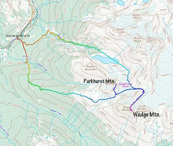
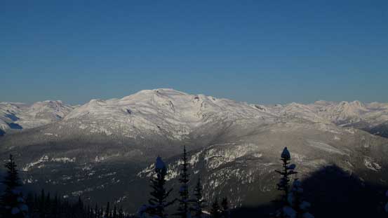
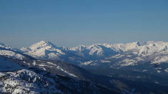
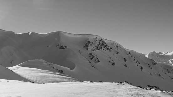
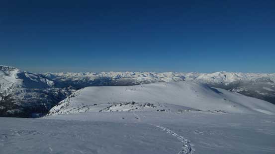
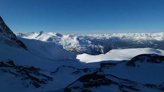
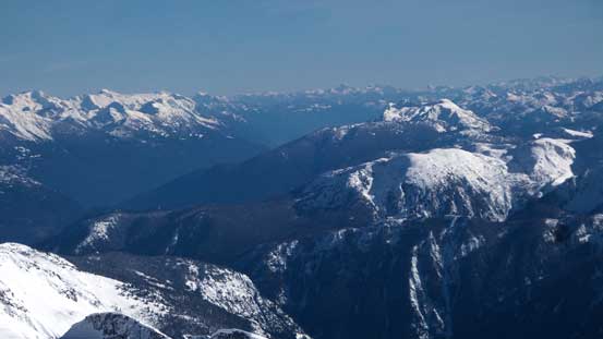
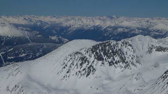
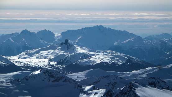
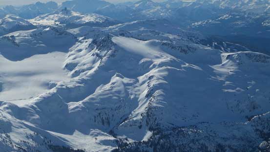
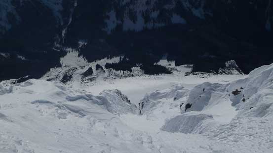
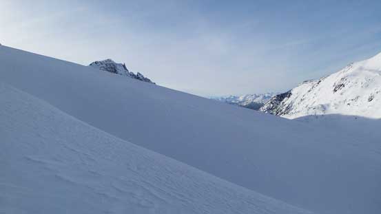
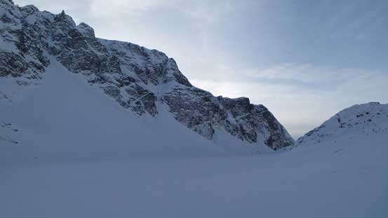
By now I was close to the crest of the broad “Rethel Ridge” and I knew right away that I wouldn’t want to return via the same way dealing with the “type III” fun… At least I could leave those bushwhacking behind now, but the ridge was far worse than what I was expecting. Along with some fairly involved post-holing, the terrain was undulating with some micro-terrain that’s not visible on Google Earth. In particular, there’s one major cliff band requiring a long side-hilling traverse to the right side. It was not fun and I did not enjoy it. By the time I finally reached treeline it had taken me 6 hours and I knew I had wasted valuable time and energy by “exploring” a less travelled route. Part of me was mad at myself not taking the standard Wedgemount Glacier approach but at least this route did give me some rarely-seen views. The morning was gorgeous as I slowly approaching the highpoint along this ridge.
Morning view of Rainbow Mountain across the Sea-to-Sky valley
At treeline now, looking back at the broad ridge
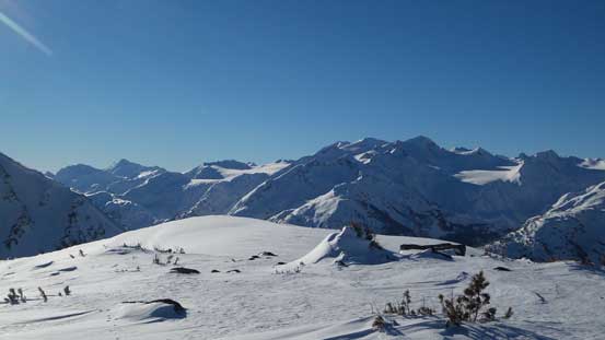
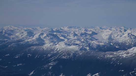
Great view of Phalanx Mountain on Spearhead Range
The best view towards Pelion/Ossa in this trip
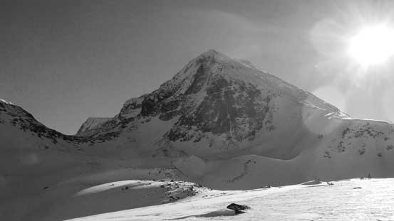
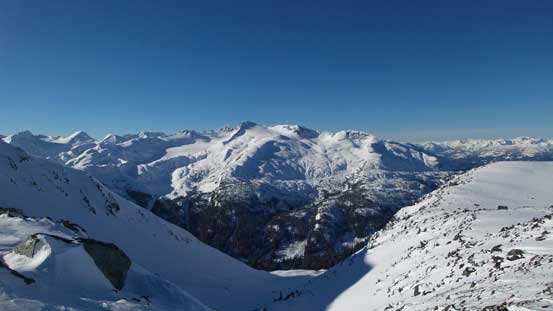
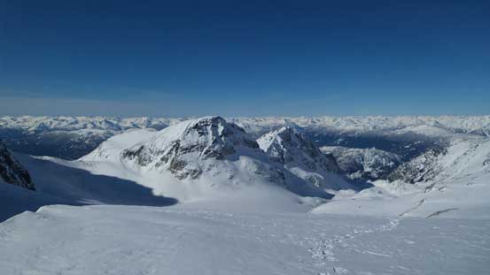
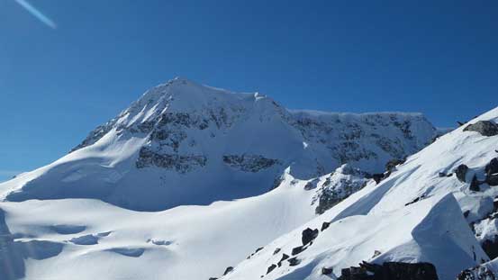
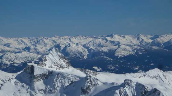
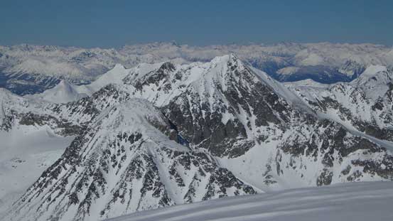
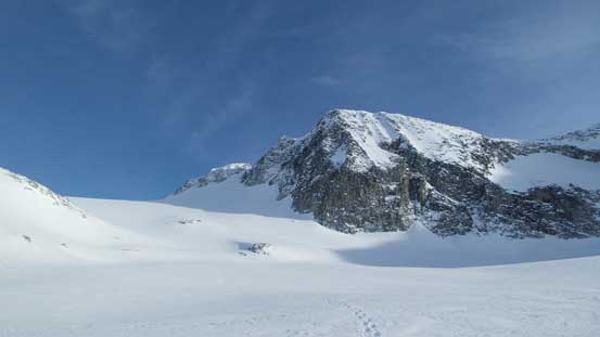
And here’s my objective, the bulky Wedge Mountain.
From the highpoint on this ridge, looking towards the familiar peaks on Spearhead Range
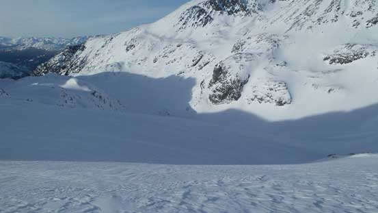
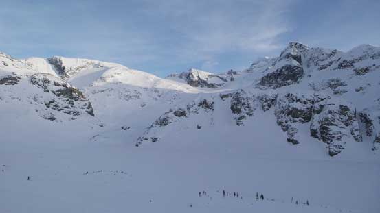
Another bonus for taking this approach was to get a head-on view of the giant west ridge slog. There was not enough snow to cover those loose boulders and even just the appear of it made me tired. I knew right away that I wouldn’t want to ascend the west ridge, let along there wan’t even an easy line to get there. I had to either descend about 200 m or to ascend a steep, loaded north-west slope (with big cornices on top). No thank… I turned my attention immediately to the nearby Wedge/Parkhurst col, but to get there also involved fair amount of undulating terrain. There’s nothing difficult in reaching the col and then Parkhurst Mountain was “right there”.
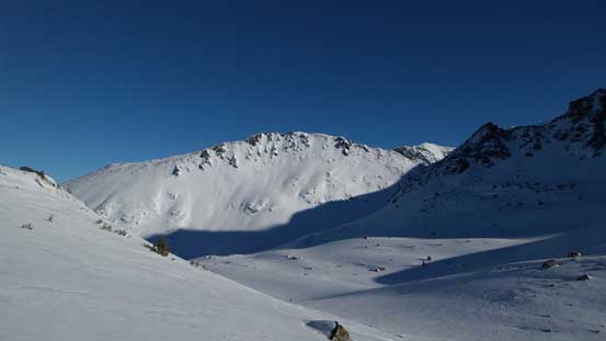
Looking towards the south side of Rethel Mountain from just after the highpoint
Another view towards Phalanx Mountain

As you can see, there’s no easy way to access Wedge Mountain’s west ridge in winter..
To get there I’d have to climb this loaded slope and break a cornice. No thanks…
I kept traversing along this undulating terrain, looking back

Instead of the west ridge, I turned my attention to the nearby Parkhurst/Wedge col
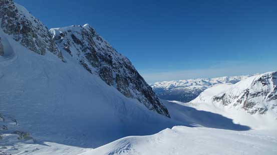
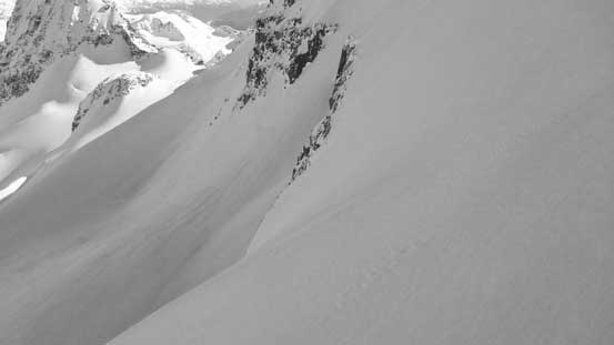
This obvious snow line is Wedge’s NW Couloir – a steep ski descent at 45-50 degrees
Eventually I made to Parkhurst/Wedge col, looking back
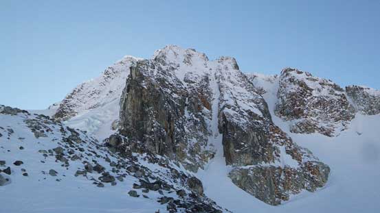
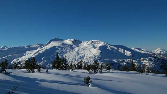
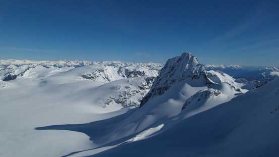
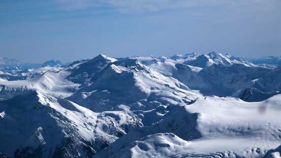
Wedge Mountain is such a gigantic mass of rock, ice and snow.
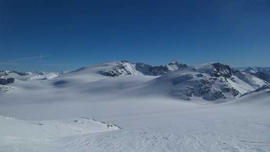
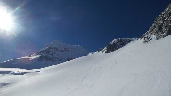
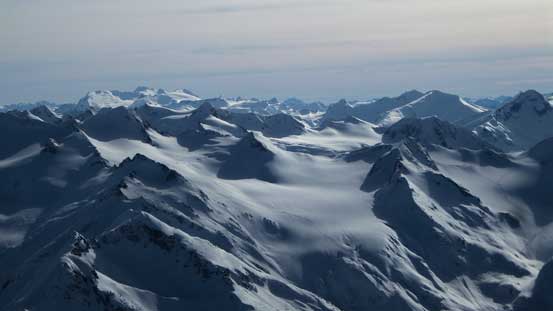
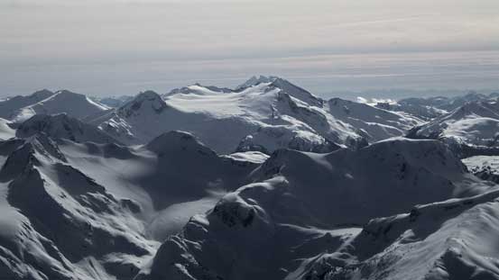
The GPS technology revealed a mere 160 m elevation gain to the summit of Parkhurst Mountain. There’s no way I would give it a miss and the ascent of that peak was written in a separate trip report since it’s a different peak. Another reason to go up there was to look down at the (supposed) heavily crevassed Wedgemount Glacier to get an idea of what I had to deal with hours later. Thankfully the winter snowpack had already bridged most of the crevasses and I really liked the appear of it. Back to Wedge/Parkhurst col I had to immediately focus on getting to the base of Wedge’s NE Arete, that was, the broad Wedge/Weart col. There’s another 100 m elevation loss involved down on Wedgemount Glacier, and the plod to Wedge/Weart col was very foreshortened and seemed to drag on forever. The col was actually higher in elevation than the summit of Parkhurst Mountain to make a good comparison.
The N/NW side of Wedge Mountain

Looking ahead to the plod across Wedgemount Glacier. Weart/Wedge col on upper right

Neat glacier scenery.
Into the sunshine again, looking towards the bulky Mt. Weart

Icefalls on the upper Wedge Mountain

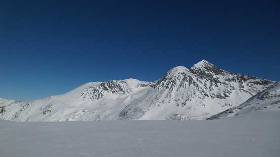
Gaining height again, looking back towards Parkhurst Mountain
As you can see, the col was actually higher than Parkhurst Mountain
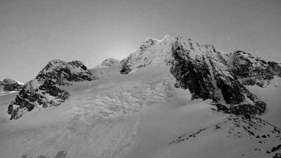
A view looking across the north side of Wedge Mountain from Weart/Wedge col
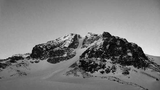
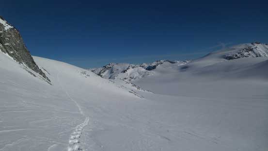
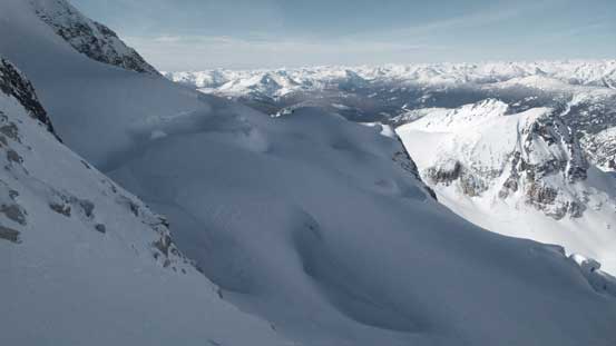
There’s a lot of things going on my mind at this stage – how did the NE side look? Pretty much all of the NW aspects were heavily loaded and there was one size 3 avalanche on Wedge’s NW Face stepping down to glacial ice (appeared to happen in the last storm cycle within 48 hours). Had the NE side being just as loaded I should just go home instead. Thankfully, it wasn’t as I could see the south-easterlies stripping snow off the ridge. I kept my snowshoes on and ascended the start of Wedge’s NE Arete, only to find out a broken notch that’d require exposed mixed climbing. I did not remember this part from any other’s trip report. Looking down the east side I did manage to spot a bypass on continuous snow but that’d involve another 100 m of elevation loss, but what else I could do now… Backtracked (very frustrating) and down into the east bowl it was such a furnace under the full-on sunshine.

Here’s the start of Wedge’s NE Arete
Looking across the flat Weart Glacier on the east side of Wedge/Weart col
The remote Mt. James Turner strikes out
Here’s the unexpected broken section of the arete.
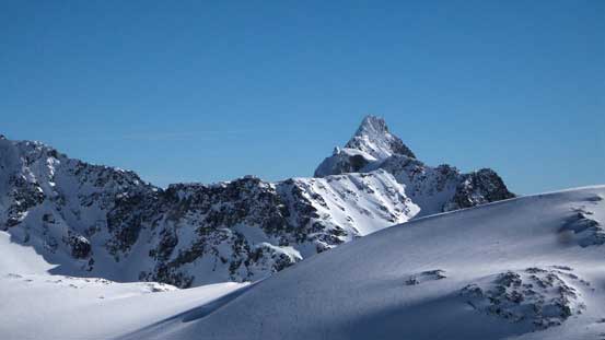
My objective from the lower NE Arete
To bypass that broken notch I dropped down into the east bowl
In order to minimize elevation loss I made a long side-hill cut on the slopes above the bowl rather than the bottom of it. The stability on the east aspects was good but even so a few moments were a bit nerve-wrecking looking up to see the size of the slopes above. I made it as fast as I could physically do (snowshoes suck at side-hilling), and then took a more-or-less straight line up the “headwall feature”. The headwall was again, very foreshortening and felt steeper than appeared from afar. But eventually I cleared it and intersected the NE Arete on a flatter bench.
Looking back at the traverse/descent that I did into the east bowl
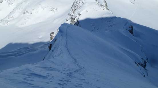
Cresting the NE Arete again, looking over the other side

Exciting time ahead!!
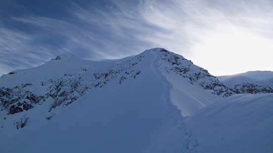
Now with only less than 300 m elevation gain to the summit it’s time to ditch snowshoes and don crampons. The arete looked steep, but also exciting as I slowly gained height step by step. The cornices were gigantic and I had to traverse alternatively on the different sides. In short time the exposure increased with huge cliff bands on each side’s run-out and then the post-holing soon took over once the grade also steepened. There’s nothing breaking off but the snow was deep and loose. The terrain and the condition reminded me greatly the final plod up Twins Tower last year and I literally had to “knee it down” to make my lifting easier. But I always seemed to have endless energy when it came to post-holing. There were a few rocks poking from underneath and I traversed towards climber’s left onto some hugely exposed, but technically easier terrain, and shortly after that, the angle eased.

My favourate view was actually looking at Lesser Wedge Mountain.

Starting the arete
Another look at Lesser Wedge Mountain – apparently a tough peak to climb…

Ahead is the crux section. It’s longer than appeared in this photo
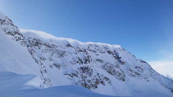
Gigantic cornices hanging on Wedge’s north face
The exposure is real!!
Just about to tackle the steepest part, looking back
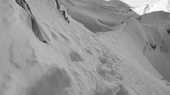
Here at the crux pitch I traversed climber’s left to avoid some rocks

The angle eased as I gained the summit ridge
A few more steps I was on the final summit ridge. There’s still fair amount of plodding but didn’t seem to take that long. By now it had taken me close to 11 hours and I was definitely late for dinner, so after snapping the obligatory summit pictures and eating some food I had to immediately focus on getting off this mountain.
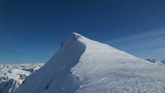
The summit is finally within touching distance!

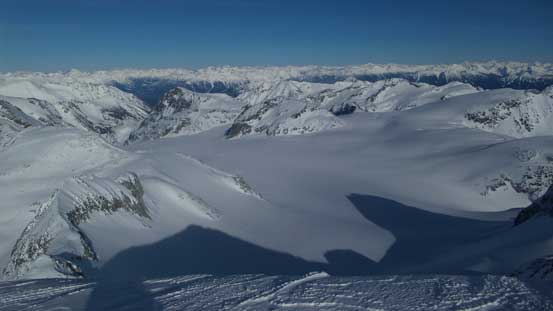
Looking down at the icefield from where I topped out on the summit ridge

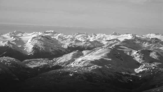
Summit Panorama from Wedge Mountain. Click to view large size.
Petlushkwohap Mountain and Skihist Mountain on the horizon

A sea of peaks along Stein Divide behind Lizzie Lake area.
Looking over Mt. James Turner (fg, L) towards remote peaks south of Stein Divide
Looking down into the Lillooet Lake valley. Mt. Breakenridge on left skyline

Nivalis Mountain is a remote peak on McBride Range
Mt. Sir Richard and more remote peaks on McBride Range, and behind towards Misty Icefield area
The volcano Mt. Baker looms over the southern skyline
Looking at Mt. Weart in foreground – the second highest in Garibaldi Park
Looking over Mt. Cook in the foreground

Looking over Ipsoot Mountain towards distant peaks by Lillooet Icefield
And, looking towards an ocean of peaks by Pemberton Icefield
Looking over Rainbow Mountain towards Alfred, Albert and Tinniswood on the skyline
The striking Black Tusk in front of the rugged Mt. Tantalus
Phalanx Mountain in the foreground
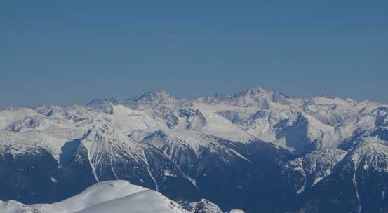
A whole bunch of peaks along Spearhead Traverse. Mamquam Mountain on left skyline
Mt. Garibaldi and Castle Towers almost blend together.
The steep south face drops one vertical mile into Wedge Pass
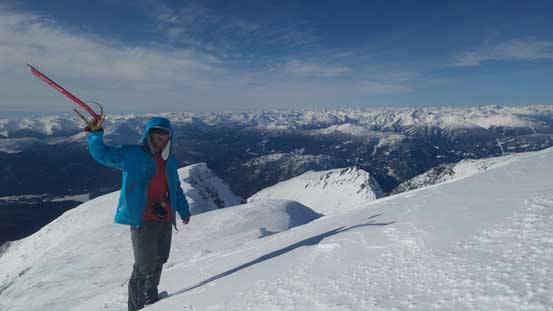
Me on the summit of Wedge Mountain
Plunging down the summit ridge was fast and easy and in short time I turned my face in for the crux 45-degree section on NE Arete. As usual, I had high confidence in down-climbing deep and loose snow and this section literally took me no time. Back to the corniced section I turned my face outwards again and followed my exact tracks, and soon enough I was back to the snowshoes. Another minute or two was spent switching gears and I took a fast plunge down into the east side bowl. Retracing my steps across the east facing slope was much faster than what I thought it’d be, but too bad near the end of the uphill plod I was completely done on energy. I had no choice but took a short 2-minute sucking in another muffin, then I was back on (nearly full) energy. Up and over Wedge/Weart col I got to enjoy another long run plunging down onto Wedgemount Glacier.
One last look at Weart Glacier before dropping down the NE Arete

A panorama of the icefield Click to view large size.

Looking down the NE Arete just before the crux
My tracks on the crux section

Looking over Peggy Peak towards the pointy Mt. James Turner

Looking back at my tracks traversing the east bowl slopes

Back to Wedge/Weart col
Down to Wedgemount Glacier, looking back
Onto the glacier’s flats I branched off from my uptracks and aimed for the “tiger country”. There’s one convex roll and after that the glacier steepened down towards the toe, and from my summer memories I knew there were lots and lots of monsters around. Indeed, I could see some big saggings but those were all fairly easily avoided and I had my fate on the “west coast cement” to do its job glueing the gaps. No surprise happened as I exited the glacier on skier’s right side and then I cut over to aim for the toe. I also went to check a massive “ice cave” which was pretty cool, but too bad the sun was already behind the mountains so I didn’t get the best photos. I had hope to find some ski or snowshoe tracks on Wedgemount Lake but unfortunately nobody went here after the storm, so I was on my own breaking trail across the lake, and then ascend (for 60 m) to the hut.
Here the glacier drops steeply.
Lots of crevasses (saggings) around

Looking back at my tracks down the Wedgemount Glacier

Almost done the glacier
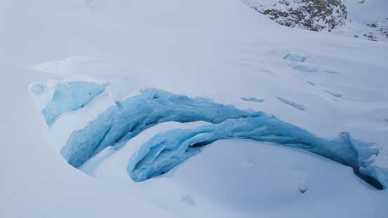
Checking out a huge ice cave

The toe of Wedgemount Glacier
Onto Wedgemount Lake now. The N. Face of Rethel Mountain is that wall
From near the hut, looking back

A closer look at Wedge and Parkhurst – two peaks that I ascended on this day
By now I only had at maximum 1.5 hours daylight time and I really started to worry what if there’s no track at all down from the cabin?! I had previously never been on this approach in winter and I did not come prepared with a GPS track… I did know (roughly) where the summer track was, but without a track I’d for sure go off route and into more bushwhacking… Thankfully my worry didn’t come true as I managed to pick up a set of snowshoe tracks down the headwall below the hut. The headwall was easily plunged down thank to the soft powder. Lots and lots of orange markers on the trees so even without the tracks it’d be hard to get lost, but the tracks simply eliminated any route-finding for me which was a bonus after not sleeping for more than 30 hours…
Just about to drop down the headwall below the hut/lake

Into the woods following the tracks
But then another problem came as I descended into the rough elevation zone of 1300 m… The trail became downright icy and my snowshoes started to lose their grip and the straps simply started to give my ankles too much stress and twisting. Time to take the ‘shoes off but right away I start to slip. The solution? I had to don crampons for the second time in this trip and I was NOT looking forward to descend the last 700 vertical meters with crampons on. With a tired mind and body it’d be very easy to twist something, but it wasn’t actually that bad. I manage to maintain a fast pace throughout, picked up the “new trail” lower down and once onto the final road slog I finally removed the crampons, and raced the last 2 km back to the car.
The descent was faster than what I thought overall and my round trip time was exactly 15.5 hours. No surprise at the parking lot (I was thinking about the possibility of a break-in after leaving my car there for some night hours), and now came the 2.5 hours drive back home. It was tiring but with a successful ascent of Wedge Mountain I managed to keep myself in the “excited mode” so didn’t find the driving to be that tiring…
Overall this was for sure one of the more involved winter ascents I’ve done to date and the satisfaction I got was higher than most of the Wapta Icefield’s trips by a comparison. It’s also good to see what I’m physically capable right now as it’s been a while since my last “all-nighter” and my last time post-holing for 15+ hours was also a long while ago. I was still relatively high on energy even when finishing the trip so I knew I could handle something even longer in one day (which was good to know given my current work schedule)… Regarding the approach I took, the “Rethel Ridge” is ugly and everybody should go in via the standard Wedgemount Lake.
