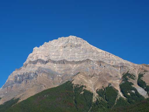
Mount Carnarvon
August 25, 2012
3040m
Yoho National Park, BC
It’s late August, and time for some big mountains. When Andrea asked me about this weekend’s plan, I threw out my idea, doing 2 of these back to back: Coleman, Chephren, Sarbach, Stephen, Carnarvon and Daly. I let her choose and she picked Mt. Coleman and Mt. Carnarvon. These two are the easier options among the 6, but doing them in one weekend isn’t for the faint of heart as both mountains are rated as difficult with elevation gain of more than 1700m… There’s some light dusting of new snow from the previous storm but we figured the daytime heat should (hopefully) melt them quickly. Speaking our first objective, Mt. Carnarvon is a big mountain in the heart of Yoho National Park with its south ridge offering a non-technical route up.
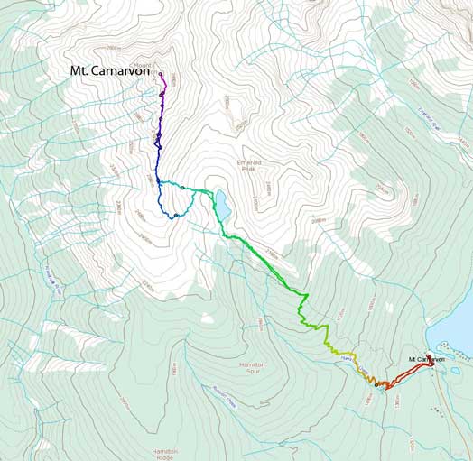
Mt. Carnarvon scramble route
Emerald Lake is a fairly long drive from Calgary, given the good forecast in afternoon, we decided to do a not-so-early start. We met at Lake Louise at 8AM and started shortly after 9AM. This is the second time this summer I had a really hard time at the start of the trip (last time was Mount Edith). I rested for 6 days since last trip (Mount Northover) but I didn’t do any warm-up before going up the steep Hamilton Lake Trail, and obviously, I suffered from that. My muscle almost got cramped… Okay, the trail itself is fairly steep and goes on forever. There’s very little view along the way, with almost 900m elevation gain. On the positive side, you gotta gain half of the elevation on a well-defined trail. Despite my not-so-good physical condition, we still managed to get to Hamilton Lake in just under 1.5 hours.
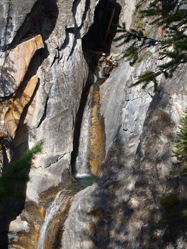
Hamilton Falls
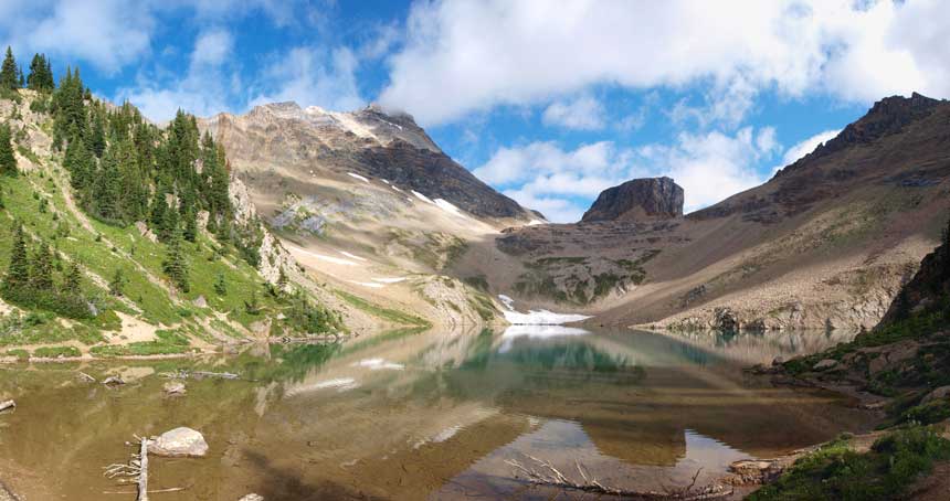
Hamilton Lake
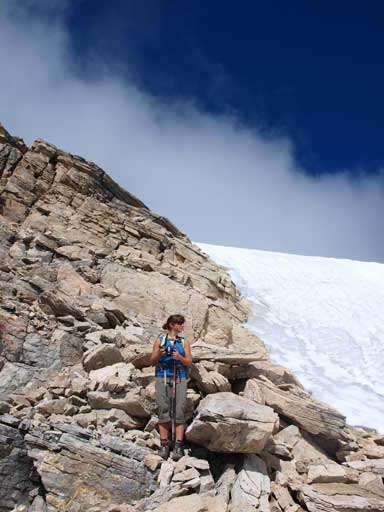
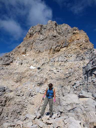
After some quick photos we started circumventing the west side of Hamilton Lake. There’s a trail but at one point it gets dangerously close to the lake. It reminded me the trail around Aster Lake… We soon started the slog up the lower talus / grass slope. We basically followed the verge of grass, but were using talus actually. The ground wasn’t loose so it didn’t matter which line we picked. Further up, we encountered a cliff band. We tackled it head-on and got some moderate scrambling for warm-up. After this, I went up towards climber’s left aiming for less steep terrain, while Andrea aimed further climber’s right directly towards the ridge crest. Both routes worked out and we made up the ridge at almost the same time.
Looking back as we circumventing the lake
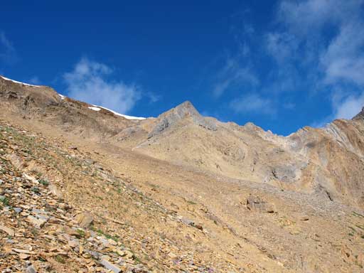
Going up the scree slope to gain the S. Ridge
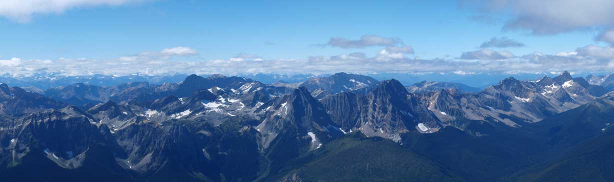
Once topping out on the south ridge, the view suddenly opened up, towards the Rockies’ west ranges and Columbia Mountains. I won’t show photos now as the weather wasn’t good at this point. The upper ridge looks inviting and we soon started up.
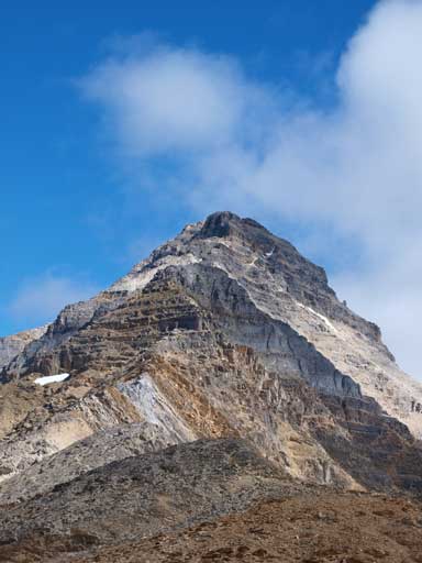
Awesome looking terrain ahead.
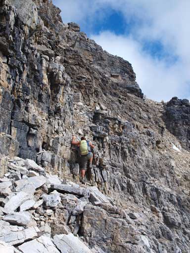
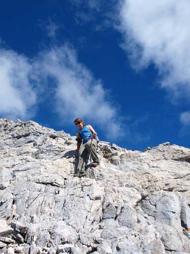
Given the elevation gain and difficulty, we didn’t expect this mountain to be that popular. There were tens of cairns guiding the way. After some moderate terrain, we encountered a cliff band that I could remember from Marko’s trip report. We followed a faint path towards a cairn on climber’s left and circumvented this band. We re-gained ridge crest by going up a gully afterwards. With good route-finding skill, this mountain is merely a consistent moderate scrambling for 500 vertical meters. Even so you still have to treat it as a difficult scramble, just like considering Mount Fox as a climber’s scramble because it has consistent difficult terrain for 600 vertical meters. At one point, we detoured slightly towards climber’s right, cut back to ridge crest, then traverse horizontally climber’s left aiming for another cairn. We followed cairns further towards left and re-gained the ridge by a long loose gully. This part sucks and reminds me about the scree-bashing on Storm Mountain Banff… Now we were treated with a snow field / glacier on the east side of the ridge, and the summit wasn’t far by this point.

Andrea scrambling up the south ridge of Carnarvon
There’re only a few spots where we detoured to climber’s right side of the ridge.
We traversed climber’s left at here before going up a loose gully
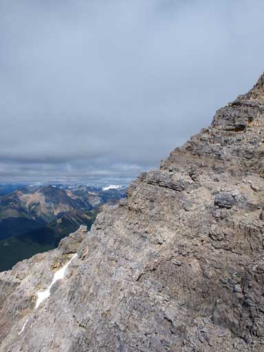
Near the summit
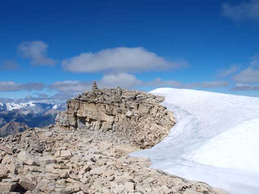
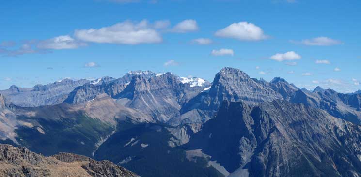
Once on the summit, the view towards Wapta Icefield suddenly showed up. Awesome view but I didn’t get a “Wow” moment because I’ve done too many mountains in Yoho this August. Kiwetinok Peak to McArthur to Kerr already gave me the similar view of Wapta Icefield and the West Range / Selkirks & Purcells. Wapta Mountain gave me the view of Lake Louise – O’Hara group and Mount Stephen and Vaux, as well. But if Carnarvon is my first peak in Yoho, I would get a big “WOW” moment for sure. The weather was bad due to low ceiling clouds. We had a summit nap and were treated with better views soon.
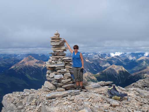
Andrea on the summit

Me on the summit
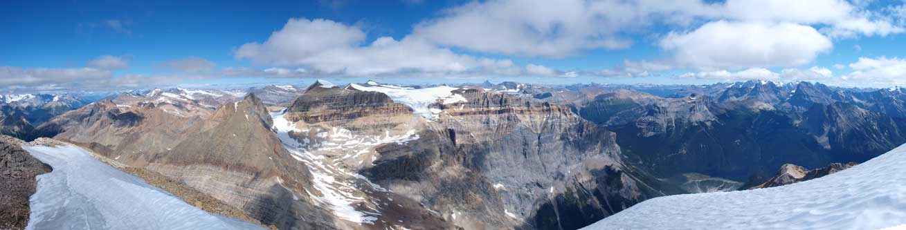
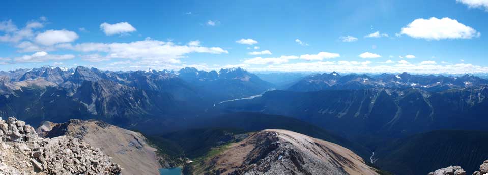
Panorama looking west
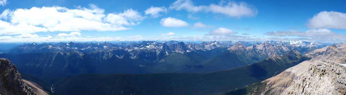
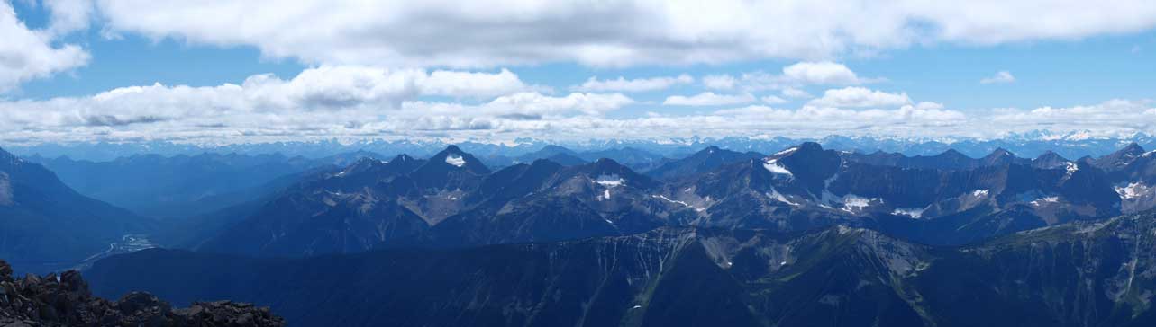
Panorama looking East
Panorama looking South. Clouds had already lifted up by this time.

Emerald Glacier
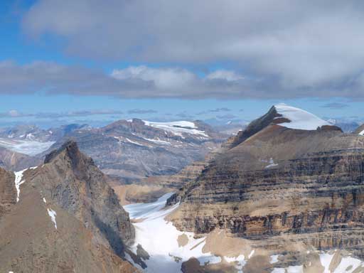
Mount Gordon in the distance
Looking south to Mt. Owen, Goodsir, and Vaux
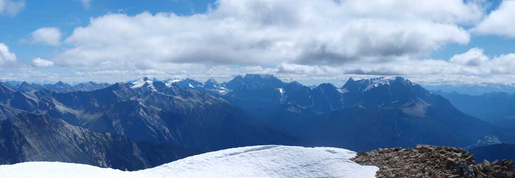
Peaks on Outram Traverse: Kerr, Kiwetinok, Pollinger, McArthur, Isolated

Freshfield Icefields
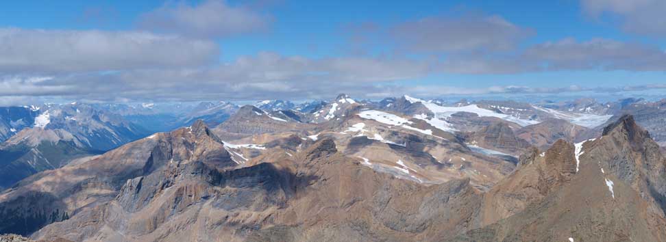
West Range and the distant Selkirks
West Range and the distant Purcells
After the lengthy summit stay, we started moving back. We mostly retrace out steps down except for a few sections where we descended straight down the ridge crest for more fun stuffs. We met a large group of Korean or Japanese scramblers going up. The views were getting better and better as clouds were really lifting up by this time.
Looking back at the summit
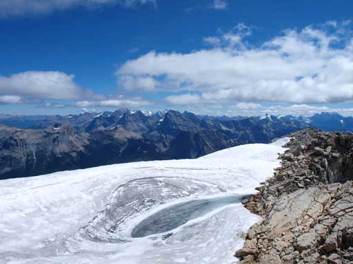
A bit of permanent snow/ice
Andrea with Carnarvon’s S. Ridge behind
More about descending

Looking back

Andrea enjoys an optional fun step
Cathedral Mountain and Mount Stephen looks better in afternoon
We used Andrea’s ascent gully to descent towards Hamilton Lake. It’s pretty steep and loose so I suggest you going further down the ridge and aiming for less-steep terrain. With afternoon sun, Hamilton Lake itself is a good distraction. We took another long break at the Lake.

Descending the scree slope.
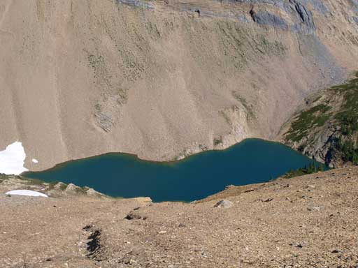
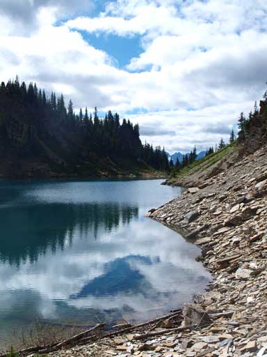
Hamilton Lake

Top Hat Peak

Back to Hamilton Lake. Emerald Peak behind.
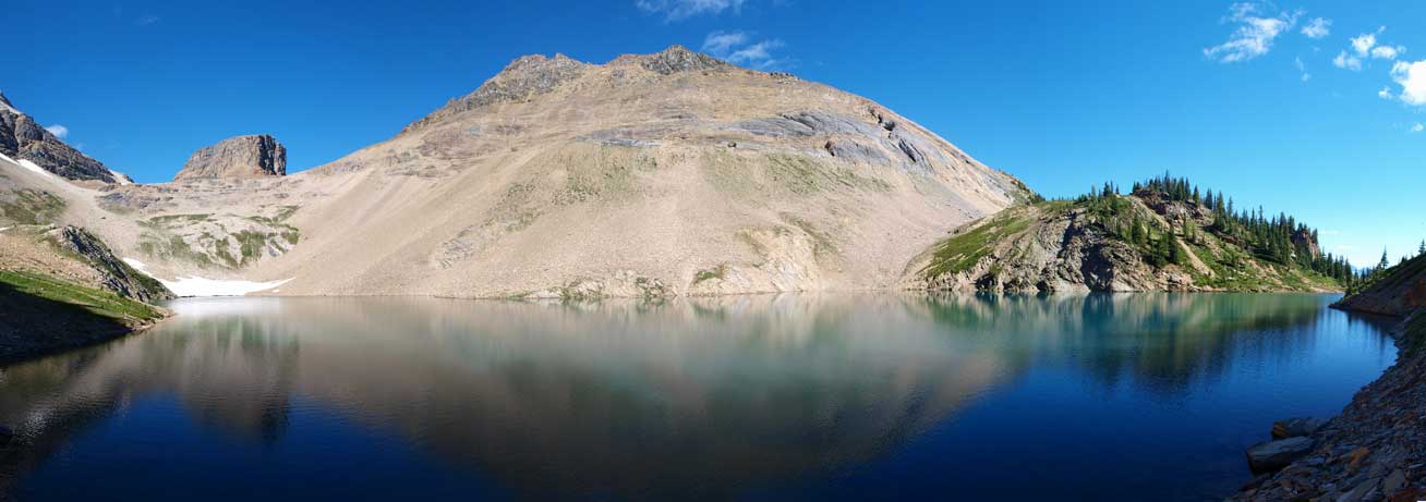
Panorama of Hamilton Lake
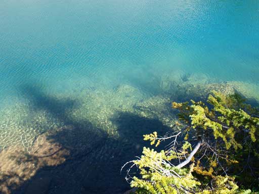
It’s very clean

Hamilton Lake in afternoon

Me at Hamilton Lake
Andrea set up a fast pace descending the Hamilton Lake Trail. The grond is mostly dirt and soft soil which is easier on the knees. The trail really goes on forever and after eternity we broke through the trees and back to parking lot. We went to the nearby Emerald Lake for photos.
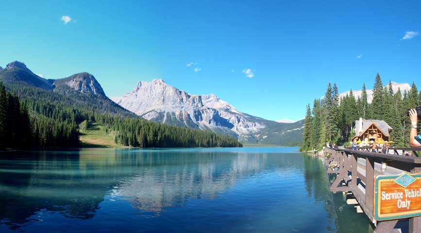
Back to Emerald Lake. This is the classic shot from this tourist viewpoint.
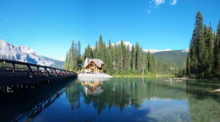
Another shot of Emerald Lake
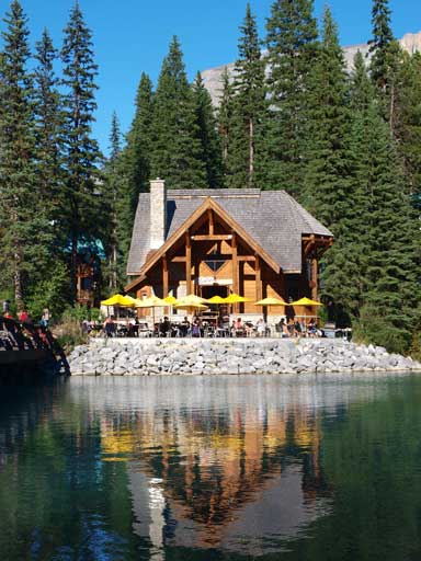
The busy Emerald Lake Lodge
Mount Stephen from Field Information Center.
We felt good on energy so we went to Field information center hoping to bag a permit for Mount Stephen the next day… Too bad they didn’t give us as we had to be there 24 hours ahead… Oh okay, we drove all the way up Icefield Parkway towards Rampart Creek Campground then. Mount Coleman next day.

Holy.
Thank you