Mount Athabasca
July 16, 2013
3491m
Icefield Parkway (North), AB
Mount Athabasca is one of the well-known mountains in the Canadian Rockies that probably doesn’t need much introduction. It’s been on my list pretty much since I started mountaineering, and in the past few months I’d been planning it for quite a few times, but due to various reasons the trip didn’t get realized until mid July. The forecast for this past Tuesday was superb with sunny skies and a low overnight temperature. I thought it was finally the time to bag it, and I was very glad to have three volunteers (on a weekday). I would leave Edmonton on Monday evening together with Ben and Ken, and meet Grant at climber’s parking lot at midnight. Our plan was to start at 1:30 am, and up the most reliable route, AA col glacier route. It took us longer to get ready and we managed to leave our cars at 1:50. Needless to say, none of us got any sleep. With millions of stars lighting up the sky, we could clearly see the outlines of the nearby mountains as we started our initial hike up the Snowcoach Road.
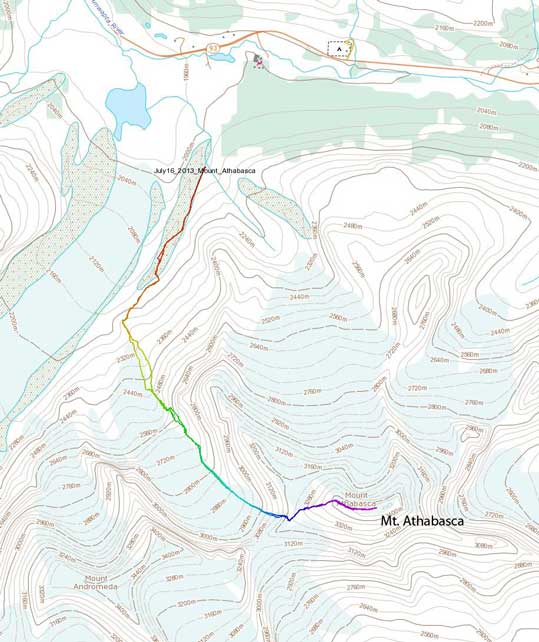
Mt. Athabasca climbing route via AA Col. GPX DL
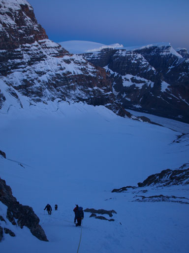
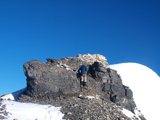
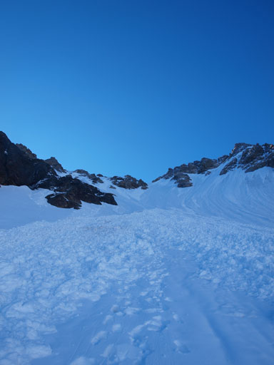
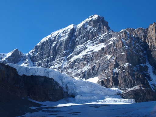
There are many detailed online sources about the AA col route, and our reference was this one. We paid close attention to our left side, and it was hard to miss the trail that branches off from the road. There were cairns and the initial bit of this trail was quite obvious to follow. Overall the trail was in better shape than I expected. It was mostly easy to follow, but it did get faint at a couple sections. It’s overall an unofficial trail built on moraines and since we could follow it in dark, I wouldn’t complain anything about it. My suggestion is, if you do lose the trail, then don’t easily give up finding it. Keep going forward and looking around you are very likely to regain the trail. Eventually after going enough “forward”, it trended climber’s left towards the AA glacier. Now we could see the faint outline of the headwall ahead. The route goes up climber’s left of this headwall and the scrambling is easy to moderate at most. It was a little tricky in dark and we lost the trail once exiting the headwall, but at that time we were already very close to the AA glacier anyway. I would consider this entire section as being the approach, and the approach took us longer than expected. I didn’t realize we would gain more than 500 meters elevation before merging to snow.
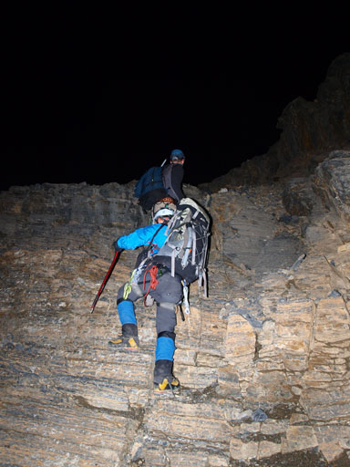
Ben scrambling up the head-wall in dark

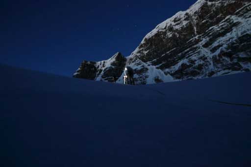
Ken getting ready for the glacier travel
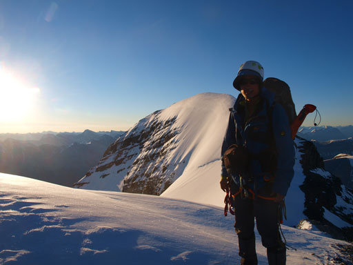
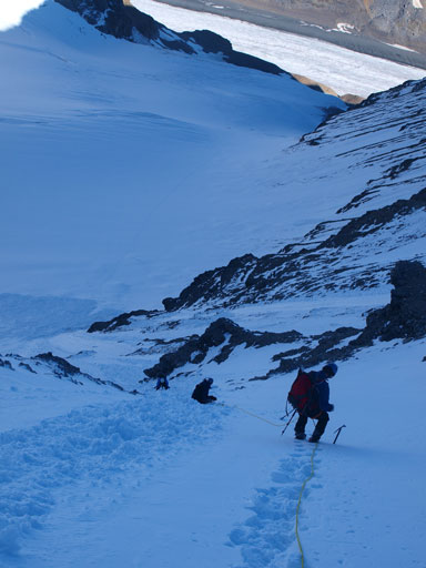
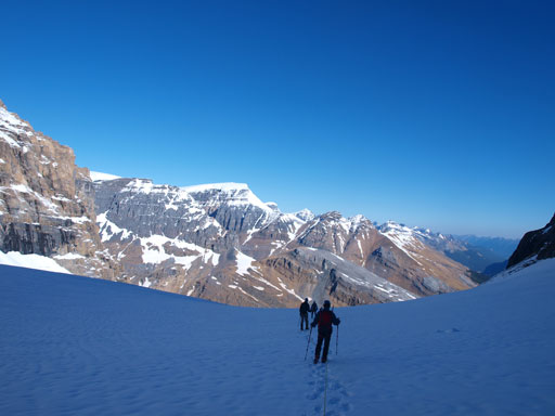
We geared up in dark, and quickly set our foot on the glacier. The snow was rock hard and our crampons bit the surface very well. I led the way staying left on the glacier, but away from the edge. Travelling was easy as we quickly moved our way towards the big slope. By now there was already some brightness showing up on the skyline behind us. That slope looked to be fairly steep, and it was. It was a bit more demanding than expected for a couple reasons. We had no tracks to follow, and the snow was icy hard. This slope would also be a prime avalanche terrain on a warm day, but thankfully for us, it had already slid. The debris also filled the (supposed) bergschrund nicely. The schrund was huge on the Andromeda side, but we didn’t see any sign of a bergschrund beneath us as we slogging up the debris. The debris gave way to ice higher up and we soon found ourselves front-pointing on the surface. After ascending this icy slope for quite a while, I merged to snow and trended slightly towards climber’s left. From here on it was step-kicking all the way up to the AA col. This slope was very foreshortened and it took us longer than it appeared.
Apparently Ben has better camera. Photo by Ben N
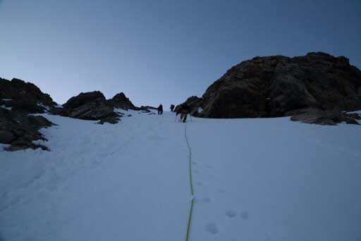
Going up the steep slope towards AA col. Photo by Ben N
Ascending the “big slope”, looking back
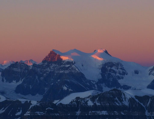
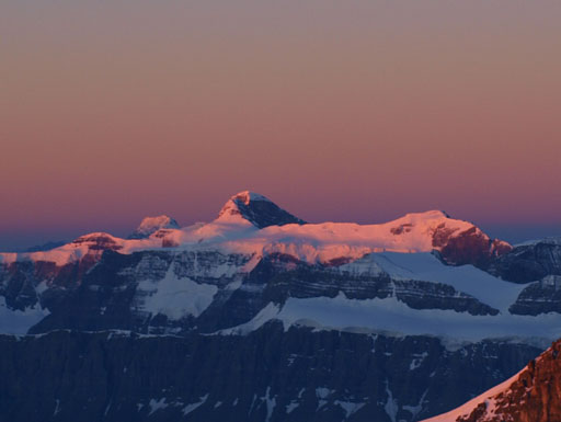
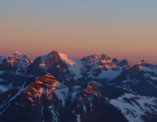
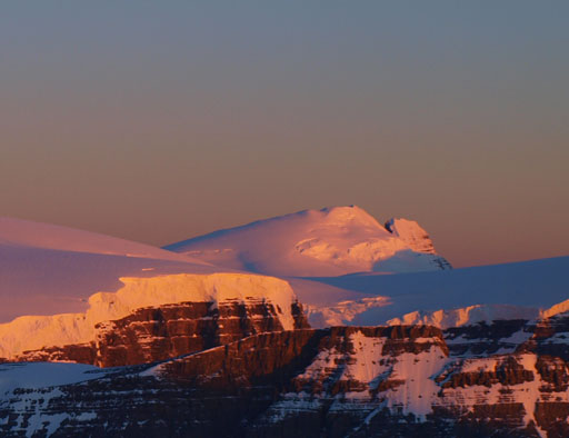
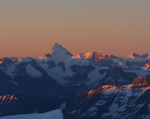
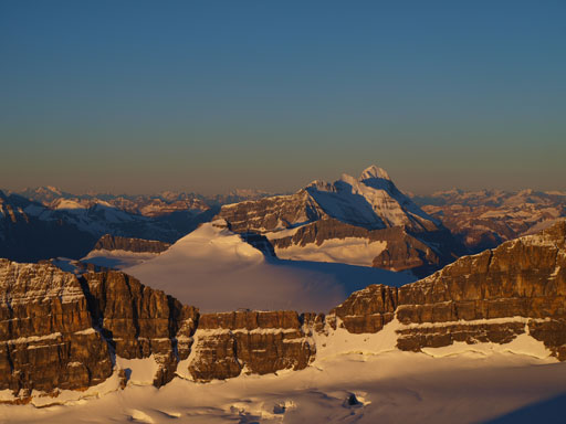
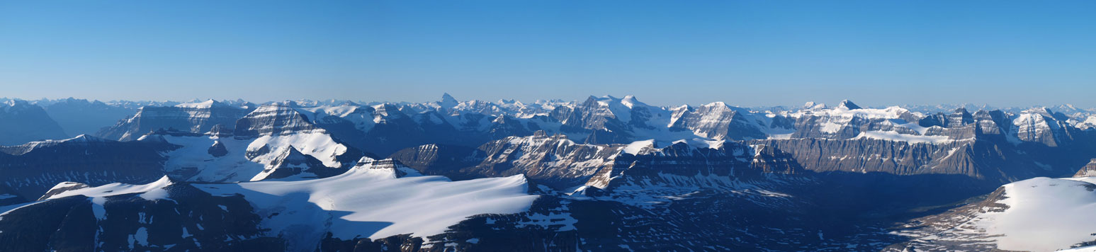
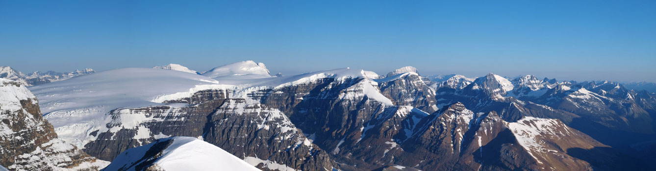
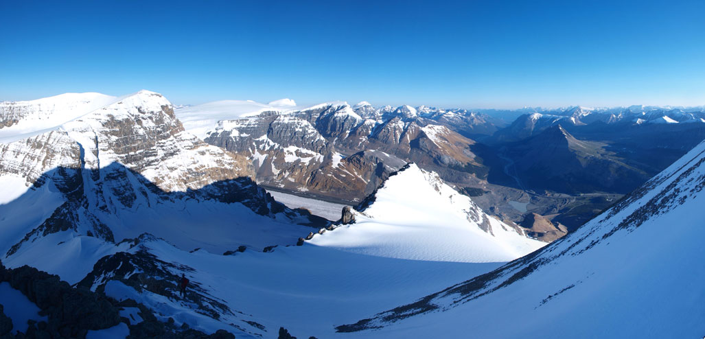
As we quickly gaining elevation on this slope, the sky was gradually being lightened up, and we would have a perfect timing for the alpenglow photos once we topped out on the col. The next 15 minutes or so was probably the most beautiful moment I’ve seen in this year. I must have taken hundreds of photos during this short period. Now I feel very sorry for those who lost the views from this lofty summit. I have to admit I was on a bit of rush when planning this ascent, and now I’m very glad I patiently waited for a clear day. Watching alpenglow at near 11,000 feet, looking towards all of the distant giants from Amery and Saskatchewan towards south, to Forbes and Lyells, and then Bryce, Snow Dome, North Twin, Wooley & Diadem, all the way to the Brazeau group and Sunwapta Peak towards north is surely a memorable moment in my climbing career.
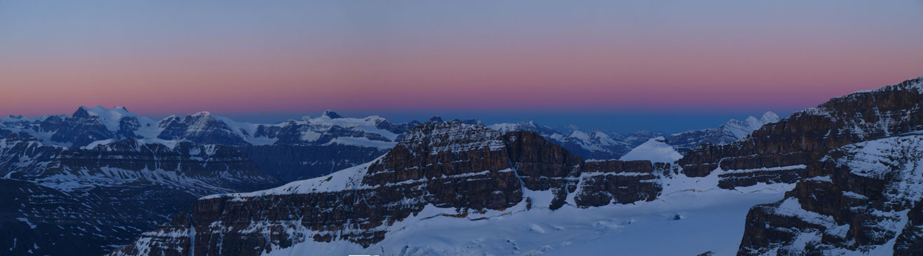
Panorama of endless peaks from just above AA col
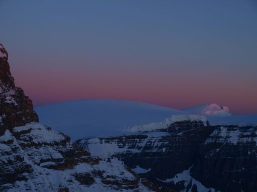
Snow Dome and North Twin are ready for the glow!

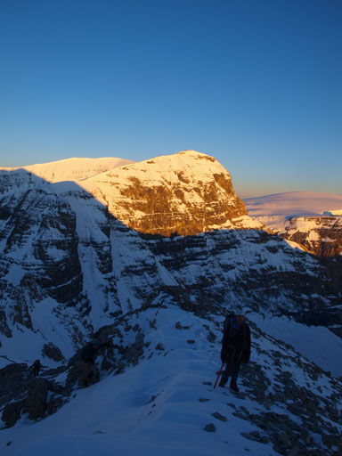
Grant

Mt. Andromeda on alpenglow
Looking south. Too many peaks to describe. At center is the mighty Mount Forbes

And, more peaks

Glow on Sir Winston Churchill Range. You can see the familiar Icefield peaks
Lyell I, II, III
Mount Alexandra

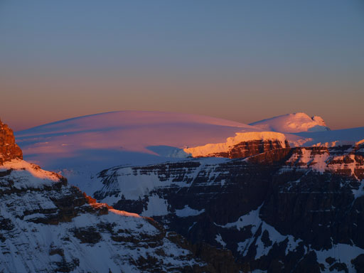
Looking over Athabasca’s north glacier, towards the distant Sunwapta Peak
Wooley & Diadem
Snow Dome
North Twin and Twins Tower

Mt. Amery and Mt. Saskatchewan
The tooth that sticks out – Mt. Forbes

The mighty Mt. Bryce
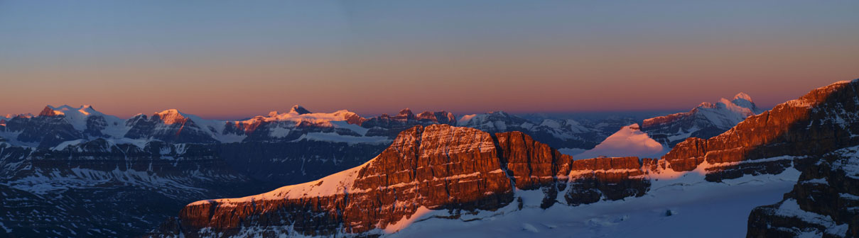
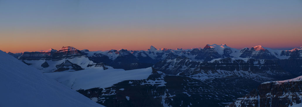
Another panorama.
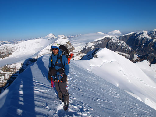
The climbing towards Silverhorn looked to be rocky. We ditched rope gears on a nice spot, and I also took off my crampons for easier travel. I would stick mostly on rock for the next bit slogging up to Silverhorn. By the time we reached the top of Silverhorn we were already pretty close to the true summit. A short dip, and we soon found ourselves on the final summit ridge leading to the highest point. I led the way up this corniced ridge, and this was the only post-holing section of our entire ascent. In short time we made to the top. I felt very happy to finally have this 11,000er bagged, and also have a full panorama view with no single piece of cloud in it.
Ben coming up the rocky ridge towards the top of Silverhorn
Mt. Bryce

Snow Dome and North Twin

Grant scrambling up to Silverhorn

The true summit seen from Silverhorn
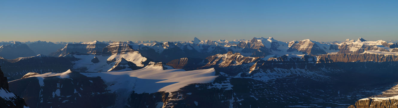
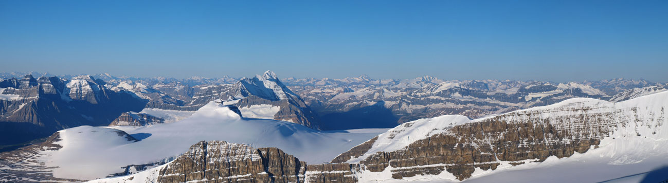
Panorama view from Silverhorn

One of my favourite panoramas from this trip!
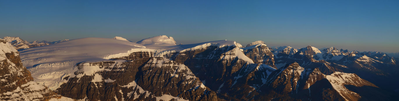
The Columbia Icefield!
Icefall coming off from Andromeda
Me on Silverhorn, with the true summit of Athabasca behind

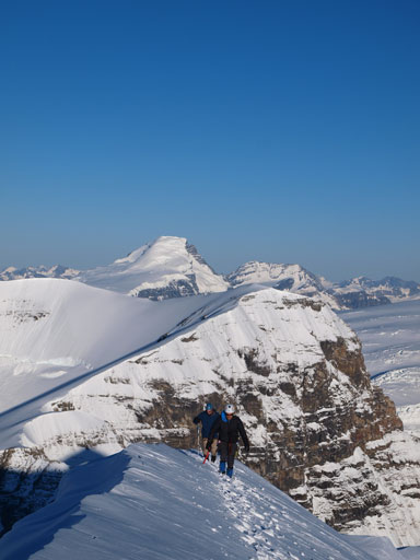
Grant going up the summit ridge. Silverhorn behind

The last bit

Summit Panorama. Click to view large size.
Panorama looking south from the summit.
Looking west over the summit of Bryce. A sea of peaks in BC side.
Ben and Ken coming up the last few steps, with Mount Columbia behind.
Panorama of Sir Winston Churchill Range from the summit.
Zooming-in towards Brazeau group in the distant.

A sea of peaks towards east. Nigel Peak looks tiny from here, in the foreground.

And a sea of peaks in David Thompson Country.

Part of the long long approach via Saskatchewan Glacier can be seen from here.

Another shot of Andromeda’s icefalls

One of the many shots of Bryce
Me on the summit.
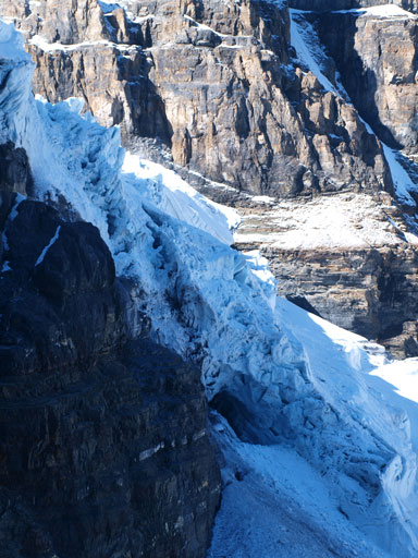
It was frosty up there so we didn’t stay long. The descent went scenic and easy until the big slope. The snow was still rock hard and we had to be extra careful not making a slip. It’s still quite straightforward though and I pretty much just walked it down while facing outwards. Just as we started this slope, another group of two showed up above us, but disappeared very soon. I kinda want to know what was their objective as they didn’t go towards the summit, nor coming down from the AA col. The only reasonable explanation would be using Athabasca’s ascent routes to access Andromeda? I didn’t have a chance to ask so I’m just guessing. Apart from these two guys, we had the entire mountain to ourselves (under perfect climbing condition and weather). Can’t ask for better! Back to the glacier, travelling was still easy on the hard snow. The sun never got on us on the AA col approach/descent route until we were down the head-wall already. Descending the headwall gave us some surprisingly good serac photos, and after this only bit scrambling we were pretty much home free. Lower down we got excellent view of Athabasca Glacier, and of course, how busy it was given all of the Snowcoach buses.
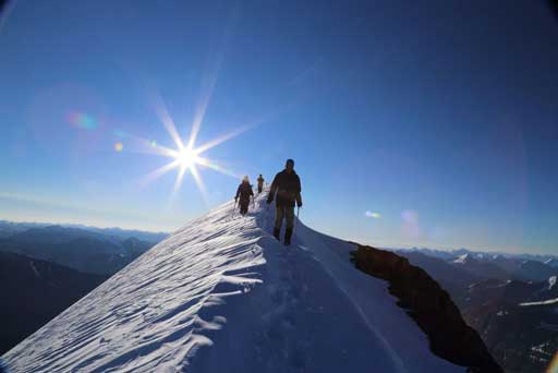
Descending the summit ridge. Photo by Ben N

Some big schrunds below the Silverhorn
Ken scrambling up a rock step to get back to Silverhorn
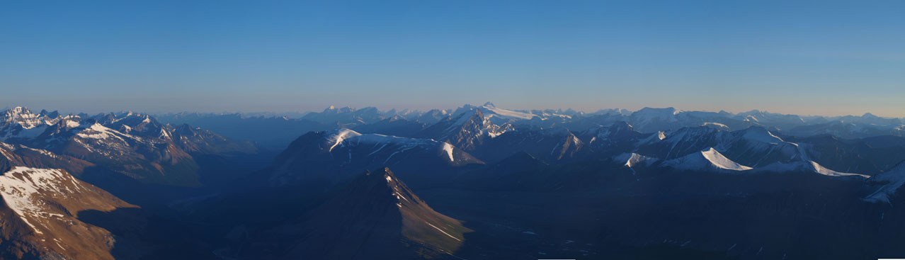
Panorama from the descent. The colours are constantly changing so that’s why I took so many panoramas.
Descending the big slope
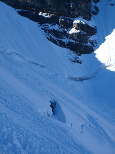
Giant schrund on Andromeda’s side
Looking back at the base of this slope
Back onto the glacier

Looking back at our route. I was hoping to climb straight up, but opted for a less steep line.

Neat view from the descent. The big peak in the background is Mount Unwin.

Looking back towards AA col

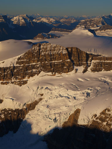
Icefalls on AA Glacier

Descending the head-wall
Icefalls again
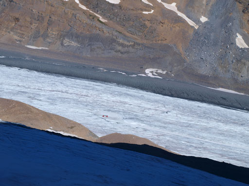
Snowcoach buses on Athabasca Glacier

Andromeda and AA Glacier’s icefalls
Same as above

A full view of AA Glacier
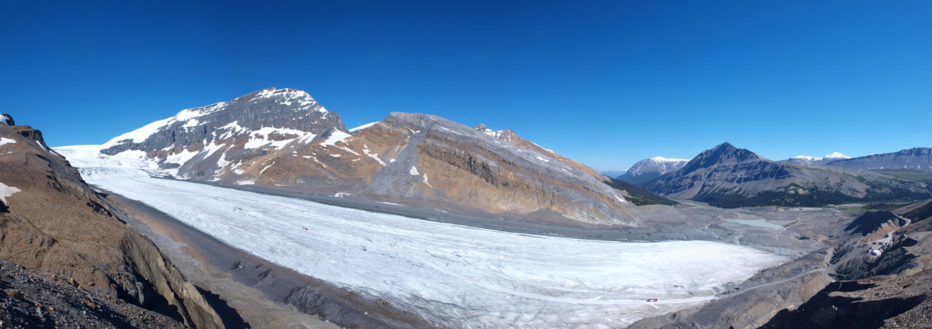
Panorama of Athabasca Glacier

Zooming-in towards the upper icefalls on Athabasca Glacier

The Skyladder route up Andromeda

Wilcox looks big again.
It was only 11am by the time we got back to car. Round round trip time was 9 hours in a no-rushing pace. We could easily get it bagged within 8 hours but why in a hurry on such a beautiful day. Ken and Ben had to work the day after so they needed to catch up some sleep, so we drove back to Edmonton and arrived at the ridiculously early rushing hour. Grant on the other hand, decided to hike up Parker Ridge as his second objective. That’s gonna be quite an interesting two-peak day with two completely different ascents.

Hey there, Steven. Regarding those two gentlemen that we saw heading up on the east side of the Athabasca glacier, I think they were taking the scramble route up Athabasca, or at least trying. Not that I know of a scramble route up Athabasca but I had heard something along those lines. It looks like they were in the right vicinity… Remember? They were in the rock when we were on the snow and ice. Thanks for posting. It’s really nice to be able to look back and reflect a year or two after a significant summit like this.