Mount Gould
August 19, 2015
2912m
Glacier National Park, MT
Mt. Gould is not nearly the highest in Glacier National Park, Montana, but it’s one of the higher peaks surrounding Logan Pass – the core tourism area in this Park. It’s one of the major objectives in this 3-day visit to the far south by Mike and I so we saved it for the day with the most guaranteed weather (Wednesday). However, the weather played a joke with us as a thick layer of smoke blew in from west obscuring most of our views. But nonetheless it’s a great introductory to Logan Pass. The Going-to-the-Sun Highway brought us more than 1000 vertical meters from West Glacier to the pass and by the time we started our day we were already near treeline.
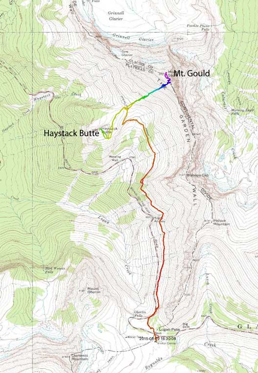
Ascent routes for Mt. Gould and Haystack Butte. GPX DL
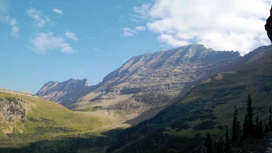
We had an ambitious plan to bag Gould and Reynolds in 1 day so cruised down the Highline Trail on a fast pace, passing a hundred tourists along the way.. This 6-km trail was indeed very scenic and brought us from Logan Pass to the broad saddle between Mt. Gould and Haystack Butte in just over an hour, while (sort of) maintaining elevation. There were quite a few up-and-downs but not too bad and near the saddle we followed a wide switch-back up.

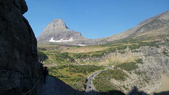
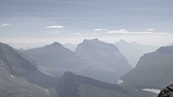
A view of Reynolds Mountain from Logan Pass – my final objective in this day
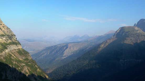
Smoky view looking west. It would only get worse…

Mike hiking along the Highline Trail
As you can see, the trail parallels the road for quite a ways

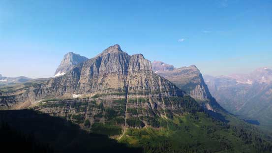
This striking peak is Clements Mountain
Mt. Oberlin in the foreground – the easiest summit around here
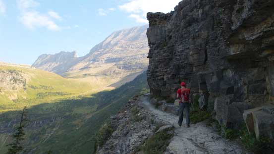
Another “exposed” section of this Highline Trail
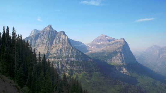
Now our objective is in view.
Mt. Oberlin and Canon Mountain
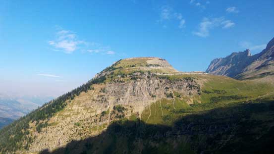
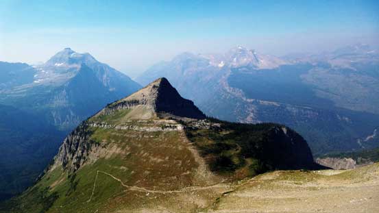
Ahead is the lowly Haystack Butte
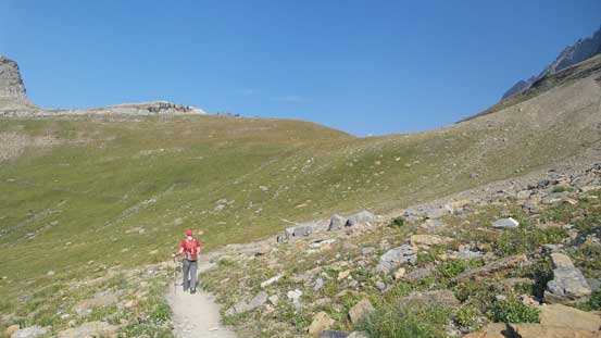
Hiking towards the broad saddle between Haystack and Gould

The W. Face of Mt. Gould ahead
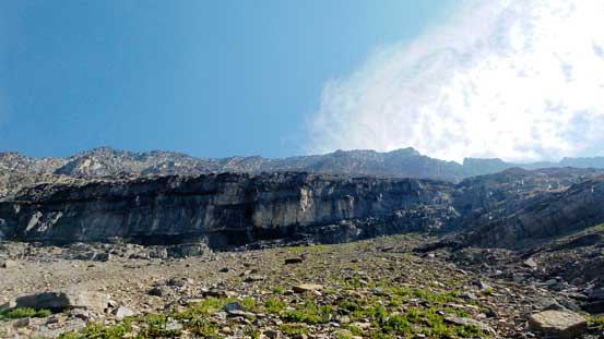
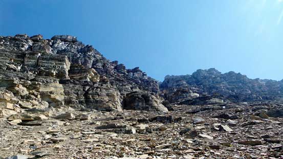
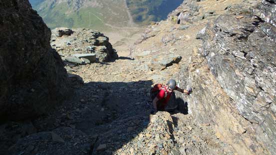
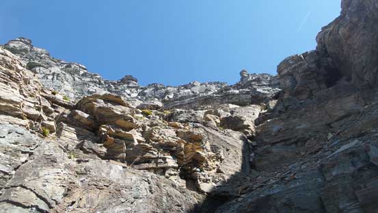
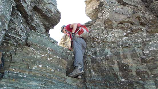
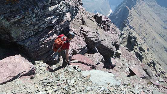
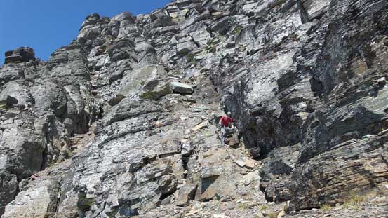
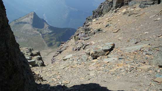
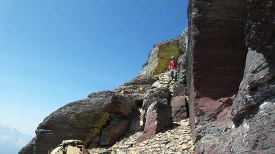
At the saddle I switched my footwear to the mountaineering boots and then upwards and onwards ascending the W. Face loosely following Sonny Bou’s trip report. We knew this route went roughly at Class 4 scramble via an obvious diagonal gully system then transitioning to the upper SW Face. The gully was very easy to spot and not far up we found ourselves working our way through a series of rock steps and then the lower cliff band. They all required route-finding here-and-there but nothing overly tricky. Once above the lower cliff bands the terrain angle eased a bit and it’s mostly a scree slog on horribly loose ground for the next short while.
Looking up from the start of this ascent
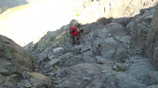
Mike scrambling up the lower cliff bands
More scrambling on the lower cliffs
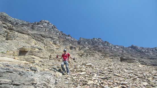
Looking back, already higher than Haystack Butte
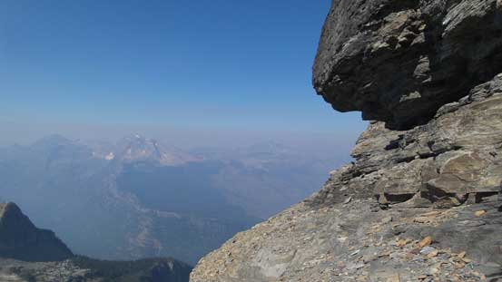
We took a short break underneath this overhang. Note the smoke….
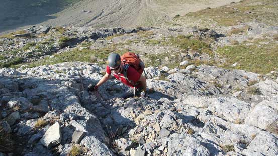
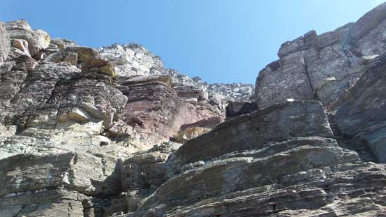
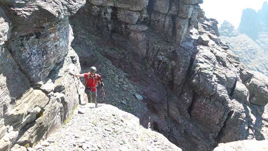
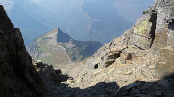
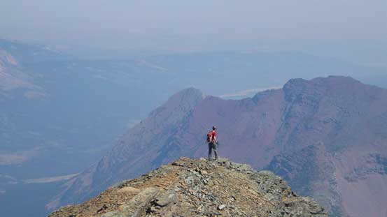
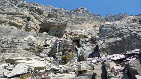
Not farther up the gully started to get more involved again with some route-finding on Class 3 loose terrain. We weren’t sure exactly where to exit the gully higher up so decided to go all the way to the end to check out Sonny’s notch anyway. That required a bit of extra work but the view looking straight down the E. Face was all worth the shot. We backtracked a bit then followed paths and cairns here and there on the upper SW Face. We kept traversing back-and-forth many times to keep the terrain at scrambling only (Class 3 or 4) and soon enough we were on the final summit ridge. A short walk brought us to the highest point, disappointed thank to the smoke…
The upper gully and cliffs

Mike on the loose slopes
Lots of hands-on scrambling in this gully

Scrambling
We had to traverse back-and-forth many times to find breaks through cliffs
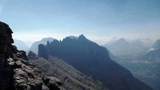
Great view of Bishops Cap
More scrambling…
The terrain would never end…
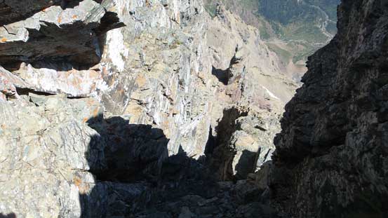
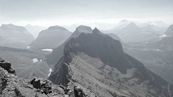
At the notch now, looking down the E. side.

This is a giant cliff face!!
Mike checking out the intimidating views down the E. Face
Way up high in the gully now, looking back towards Haystack Butte
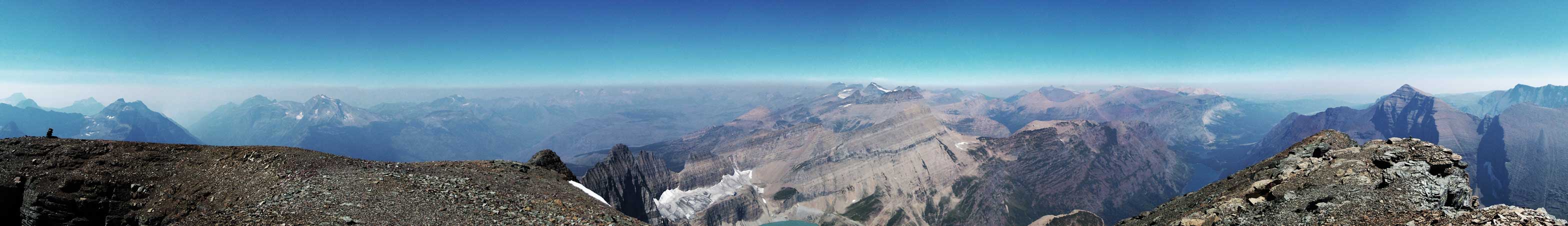
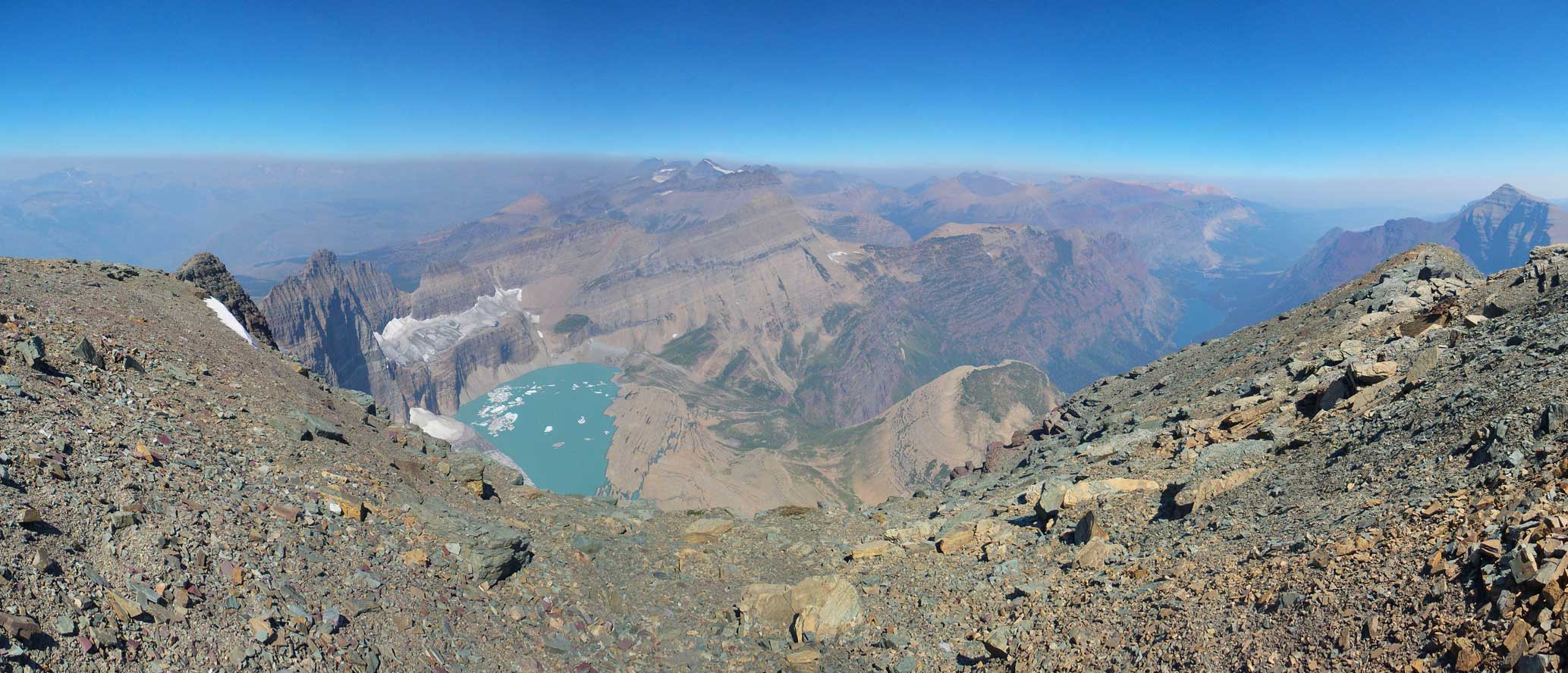
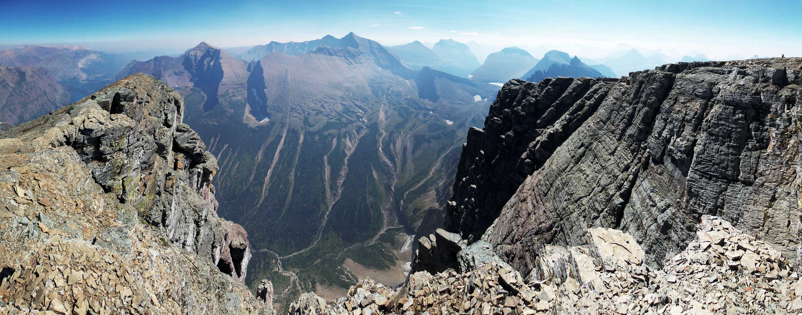
Partial summit panorama. Click to view large size.
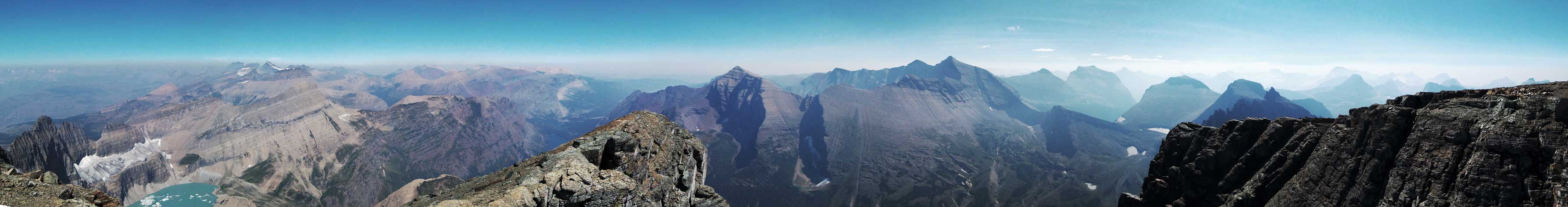
Partial summit panorama. Click to view large size.
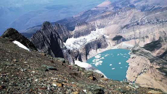
Upper Grinnell Lake and the Grinnell Glacier
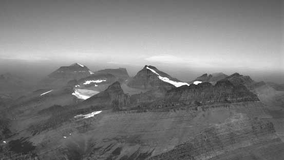
Looking north towards the 10,000ers Mt. Cleveland and Mt. Merritt.

Lake Josephine and Swiftcurrent Lake
Peaks by Many Glacier area. Mt. Henkel et al.

Allen Mountain to the east

Mt. Siyeh is another 10,000er
The prominent peak is Going-to-the-Sun Mountain.

Cataract Mountain and Piegan Mountain

Way in the distance is Mt. Jackson – one more 10,000er!!
Mike wondering around to check out more views

The Clements/Canon/Oberlin group

Upper Grinnell Lake again
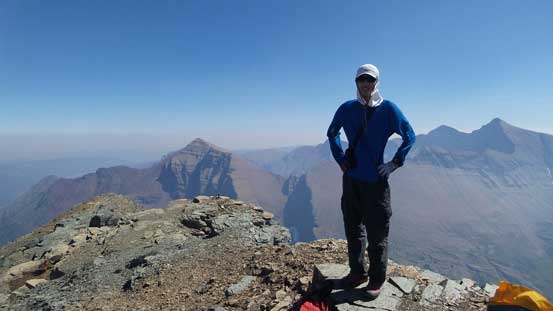
Me on the summit of Mt. Gould
Another panorama view from the summit. Click to view large size.
One more panorama. Click to view large size.
There weren’t too many stuffs to see from the top so after a quick lunch break we started the descent. I initially disoriented myself thank to the abundance of cairns leading down the wrong direction. Thankfully Mike spotted my mistake and we quickly corrected ourselves without too much of a detour. We then loosely followed our ascent route down the upper face into the gully. Descending the gully was tedious thank to the millions of short rock steps but by breaking them one-by-one it’s very manageable.
Starting the descent
Bishop’s Cap in the foreground
Some interesting terrain.
Into the gully
Lots of minor cliff bands
And lots of scree
The lower cliff band
Once down to the saddle between Gould and Haystack Butte we had to make a decision. At this point Mike weren’t 100% sure about his motivation to ascend Reynolds Mountain in the evening so to salvage this day without another peak we decided to hike up the lowly Haystack Butte. We didn’t have too many hours of daylight time for ascents of both Haystack and Reynolds but I figured by pushing a bit I could still possibly get both.
