Silvertip Mountain
September 15, 2017
2596m
Hope / Skagit Valley, BC
Silvertip Mountain, the only “ultra” in the BC Cascades, rises more than one vertical mile above three adjacent valleys (Sumallo River, Skagit River and Silverhope Creek). It ranks #34 on the “prominence list of British Columbia” and considering the elevation of the remote north coast ranges this is a pretty significant feat. Also for this matter Silvertip Mountain attracts the American peak-baggers such that in the summit register I actually saw more Washingtonians’ names than our locals. This is pretty amazing. For me myself I’ve seen this peak from all sides in the past two years and every time, especially in winter this gigantic massif never fails to catch my attention.
There are quite a few aesthetic mountaineering routs on the north and east aspects but the standard route is a fairly straightforward scramble via south slopes. The tremendous amount of elevation gain does make it somewhat daunting but most of the elevation is gained via a “straight-upwards” process and the scrambling difficulty does not exceed class 2, albeit with terrible rock quality at places. To make a full use of that day Al, Vlad and I decided to combine Silvertip Mtn. with Mt. Rideout to make a double-header. The plan’s been working out excellently. All three of us summitted Mt. Rideout in a timely manner and now we were on our way up Silvertip Mountain.
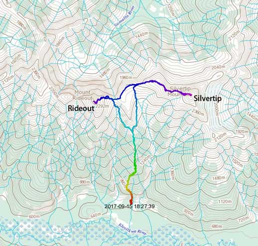
Mt. Rideout and Silvertip Mountain ascent routes. GPX DL
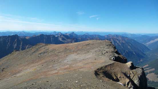
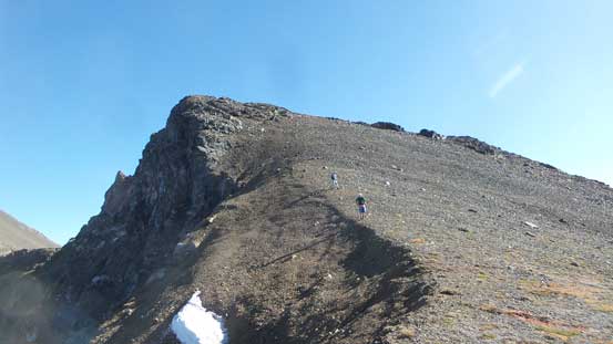
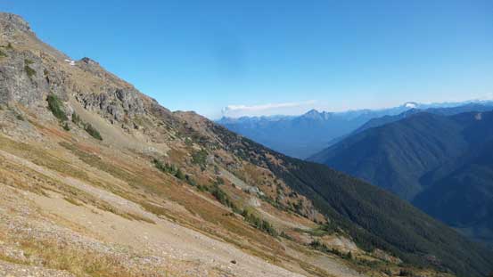
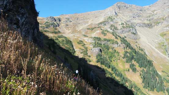
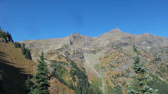
The ascent via west ridge is a long and gentle process. There wasn’t much of elevation gain to do until the final summit push but much of this lower reach did make a scenic ridge walk. I stayed close to the ridge crest for pretty much the entire way and even though there’s some up-and-downs I did not regret as the views were much better from the crest. And then there came the false summit. Most trip reports indicated a sketchy traverse below the false peak to bypass “a tricky down-climb” but I decided to ignore that. Part of the reason was to get a head-on view of the true summit from the top of this false peak so I trudged up the tedious scree. And then to my surprise there wasn’t any “troublesome down-climb” at all to drop down to false/true col and the hardest scrambling was 3rd class at the maximum. Meanwhile Al and Vlad had to deal with some pretty bad side-hilling but worked out nonetheless.

Trudging up the lower west ridge of Silvertip Mtn.

As typical as the ridge goes
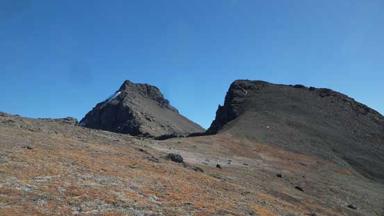
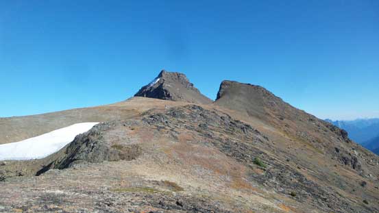
Very scenic broad ridge walk. False summit on right; true summit behind
Could see the north side now
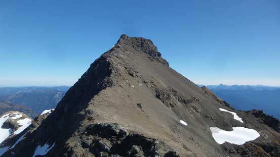
True summit from the false summit

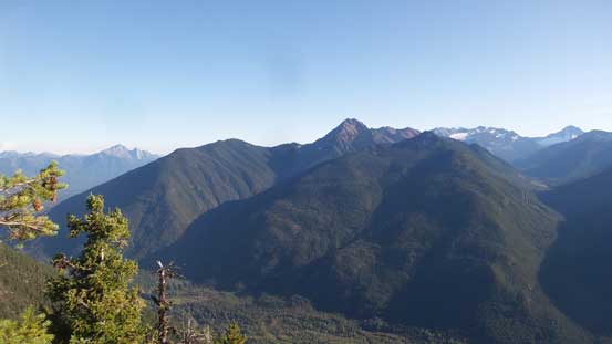
Looking back towards Mt. Rideout and Mt. Payne
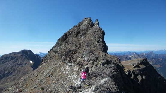
After the false summit traverse
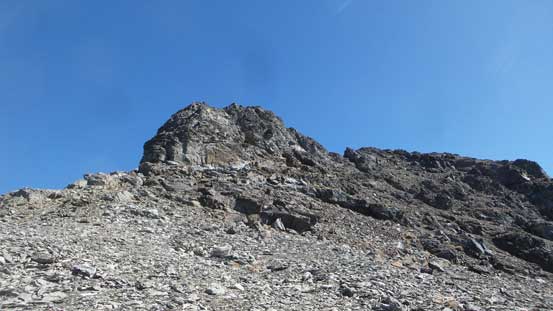
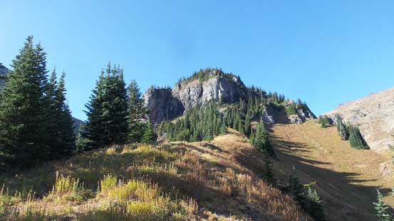
The true summit pyramid looked like a pile of choss and it sure is.. Vlad and I opted to scramble the ridge line to cut off as much choss-fucking as possible but unfortunately that didn’t work out very well. A near-vertical down-climb blocked the way and after trying a few different methods I gave up and back-tracked. This was super frustrating and to make it worse we then had to trudge up the treadmill scree. For about 100 vertical meters the terrain was pretty terrible even for Rockies standard with any meter of upwards progress felt hard won. But with a good perseverance we all powered it through and got back onto the ridge higher up. Near the top I gave up that “ridge line” idea and led a more traversing, side-hilling and scree-bashing line on climber’s right. And shortly after that we were on the summit.
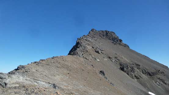
At the base of the true summit now.
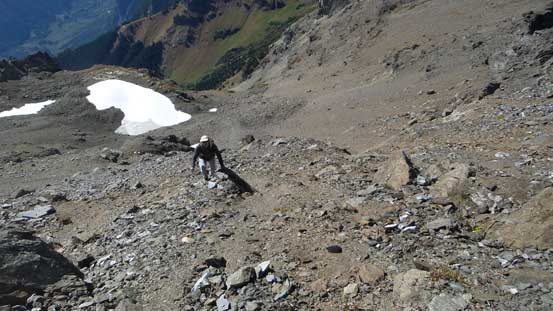
Vlad trudging up the treadmill scree
Partway up we rejoined the ridge briefly
The final push… We then detoured to the right again
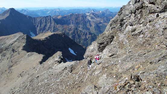
Al and Vlad traversing loose terrain
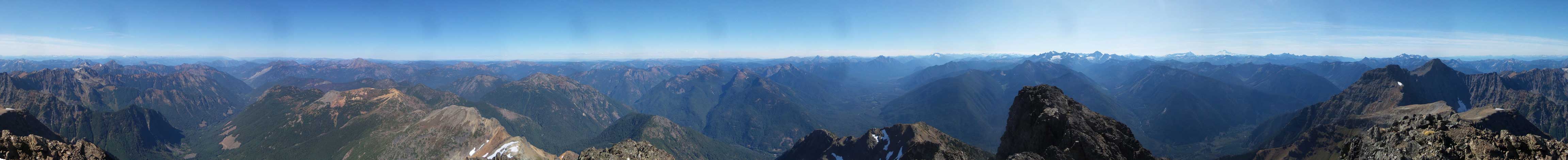
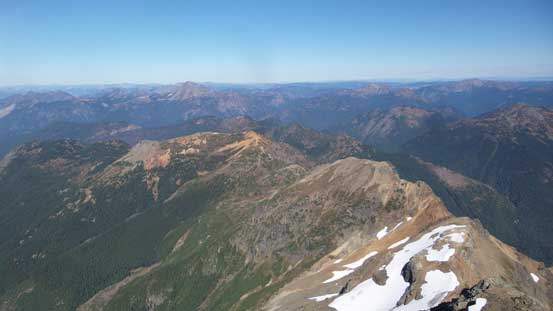
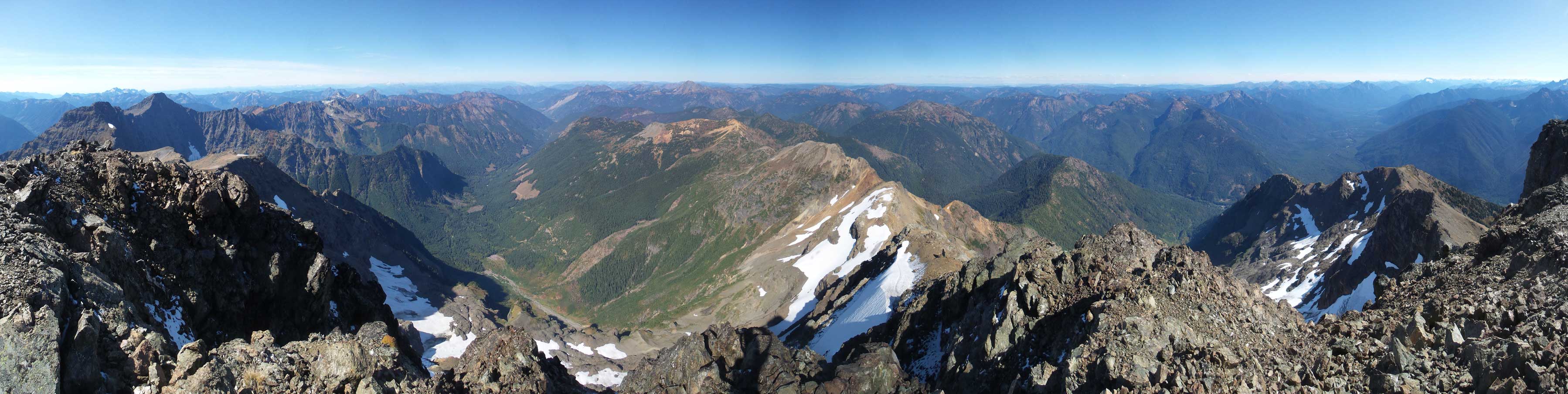
Summit Panorama from Silvertip Mountain. Click to view large size.
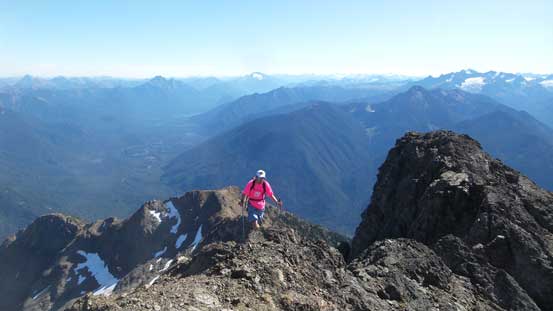
Al approaching the summit with Skagit Valley behind
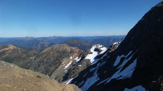
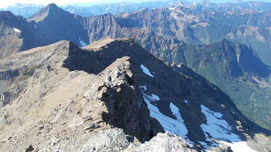
Looking down at the broad north ridge extension inc. Merge Peak et al.
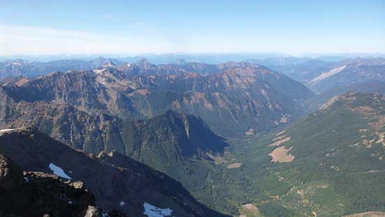
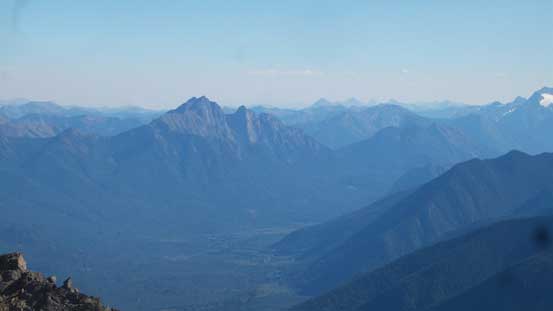
Sumallo River valley and a sea of peaks in BC Cascades
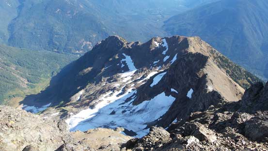
This is looking down the east face glacier

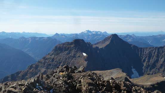
Mt. Fordred et al.
Mt. Rideout and Mt. Payne
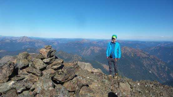
Me on the summit of Silvertip Mountain
Another panorama from the summit of Silvertip Mountain. Click to view large size.
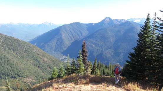
After about half an hour we decided to head down. We were doing pretty good but still, there’s not that much extra time to kill if we wanted to complete the mission of getting back down before head-lamp time. This time with gravity on our side the scree-skiing down summit pyramid was such a blast. And then we all opted to scramble up and over the false summit to shave off more side-hilling, followed by a long, but scenic descent down the west ridge. The worst section came at an inevitable side-hill traverse on a steep grassy bench with a slight downwards incline. This part was painfully long and required lots of concentration as a slip would not end up well at places…

Going home..

The false summit ahead
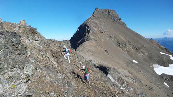
Vlad and Al on false summit with the true peak behind
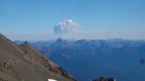
Apparently there’s a new fire in Pasayten Wilderness
Hozomeen Mountain looks a bit differently from this angle.
The very broad ridge walk..

Descending from the false summit
More about the descent from false summit

Very impressive view of the true summit and the north face
The endless ridge walk terrain

Dropping down now
This is the vast south slopes above treeline. Endless exploring oppourtunities
This is that tedious grassy traverse
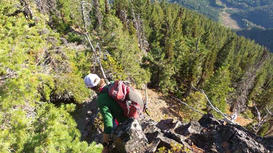
Back at the treeline what’s left was a “mere” 1000+ meters of steep descent down the forest. Much of this last stage would be a straight-down process and that further meant our knees would not be very happy.. But let’s face it. There’s very little worth noting other than I pulled out the GPS for every 5 minutes in order to stay on route. There’s quite some confusing micro-terrain. We only took one break and that’s about 100 m above the entrance to the lower gully. Oh by the way, both Vlad and Al got stung multiple times by wasps but I narrowly escaped. I don’t know why every time I was the lucky guy as to this date I have never yet been stung by wasps, bees or hornets.
Rejoined the south spur approach now
The south spur approach
Another look at Silvertip Mtn.
Descending…
Mt. Whitworth
Descending… Never ending…
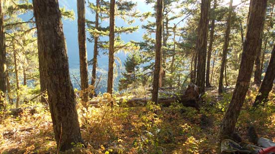
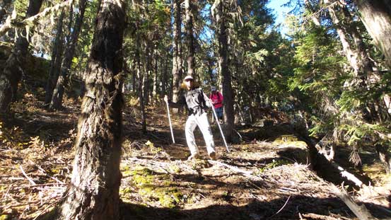
The typical forest

This step is very steep and has a fixed rope
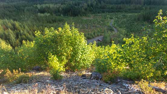
Almost done.
Our round trip time was just over 10.5 hours and that’s much faster than others have made it sound, although we were rushing for pretty much the whole day thank to the late start. Overall this was a great day-trip to finally put Silvertip Mountain in the bag, but speaking the scrambling quality Mt. Rideout is definitely the highlight. But in any case these two peaks fall into that “peak-baggers’ summits” category. Lots of tedious work for some mediocre scrambling.
