Roche De Smet
July 22, 2014
2539m
Jasper, AB
Roche De Smet is the highest point on De Smet Range which forms a prominent ridgeline extending northwest from Athabasca River Valley in Jasper National Park. Over the past few years lots of scramblers were questioning if it’s possible to scramble the connecting ridge from its lower south end, namely Mt. Greenock. While nobody actually went this way to try it out, through the publishing of Ben’s and Mike’s trip reports, it’s confirmed to be a class 2 scramble from the north side, approaching from Vine Creek Trail. After a rainy weekend this past Tuesday saw a brief high pressure ridge forming up in the mountains. Considering my last time visiting Jasper area was back in March I was keen to head this way, and Roche De Smet seemed like a reasonable solo objective.
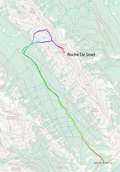
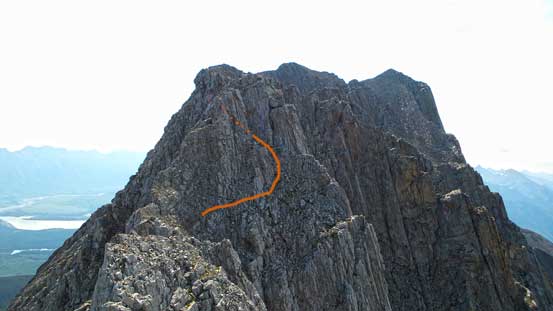
Roche De Smet scramble route. GPX DL
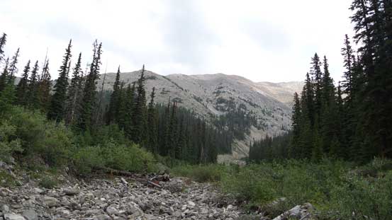
Celestine Lake Road had improved since my last year’s visit to Mt. Cumnock. Someone had built a wooden platform across Coral Creek and I managed to drive to the Vine Creek trail-head with my small car. I arrived there a few minutes before 6:30 am and started the hike shortly after. Despite the Vine Creek area controlled burn in last September, the trail was unaffected and except for a few wash-outs and two creek crossings it’s pretty much trouble free. The wash-outs were already there as of August last year so the overall hiking quality was better than my expectation, and in about 2 hours I made to the flats/meadow just before the campground at Vine Pass, about 9 km into the trip. The vegetation was pretty wet thank to the morning dew so I headed climber’s right into the bush.
From here I pretty much followed Mike’s GPS track and it led me through a lot of dead-falls. I remember Mike talking about following a creek up so I checked out a bit to my right side, and sure enough, there’s a dry creek bed to walk on. By following it I gained elevation quickly until the terrain ahead becoming a canyon structure. Here I left the creek up climber’s left side and hiked up some easy grassy but steep terrain to a rib. Thank to the foreshortening view it took me a long time to eventually top out on the summit ridge. Since I’d done the nearby Mt. Cumnock the views weren’t “new” to me, so I immediately focused on the traverse towards the summit.
Looking up the ascending drainage. I went up the left side of it and came down the right side

Looking back towards Redan Mountain
And, Gargoyle Mountain
A view from the ascending rib
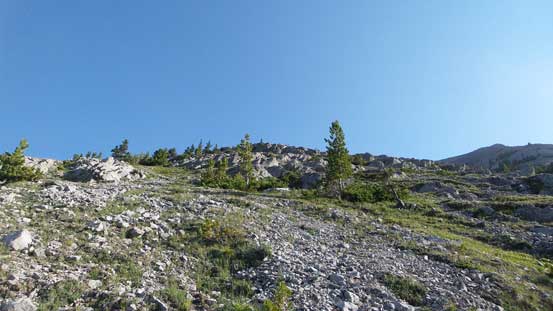
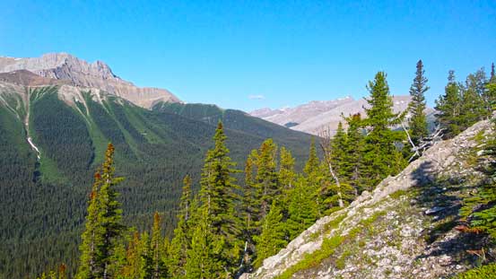
Looking up this broad rib. Typical terrain
Looking north I could see some interesting colours
I ascended Mt. Cumnock last year. That was a long hike in..

Mt. Tory right of center, very obscured and remote
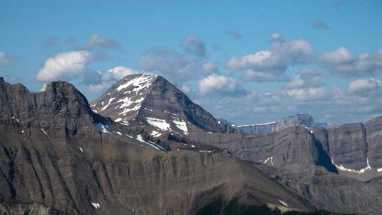
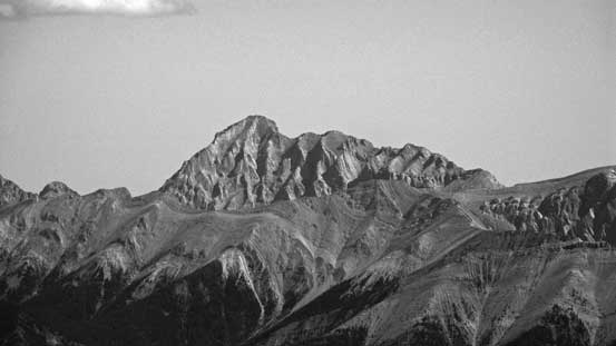
A view of Whitecap Mountain
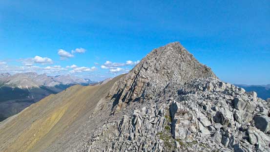
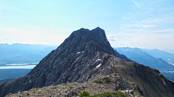
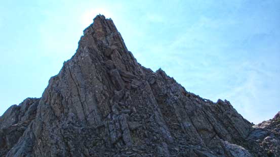
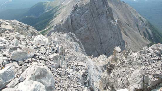
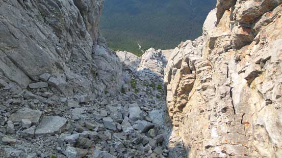
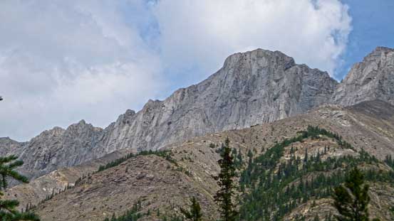
Apparently there’s a few up-and-downs on this ridge and after climbing up the first high point I had to lose some elevation. That’s okay as it’s a pleasant ridge walk. There was another high point to go up and over, and the real scrambling didn’t start until the base of the summit push. I easily circumvented the first obstacle on climber’s left side and then avoided the second obstacle by contouring a bit on the climber’s right side and then scrambling up a (somehow) wide gully. The crux move was just after gaining back to the ridge crest after exiting this gully, but only for a few moves. After this bit the rest to summit was largely trouble-free. The views were supposed to be great but thank to the forest fire smoke I could barely see the outlines of Edith Cavell and Fryatt… And apparently this peak is seldom ascended. Mike was the only guy signing the register after Ben brought it up two years ago.

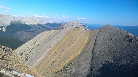
The connecting ridge to true summit
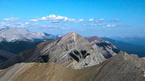
Looking back at the first high point I had to go up and over
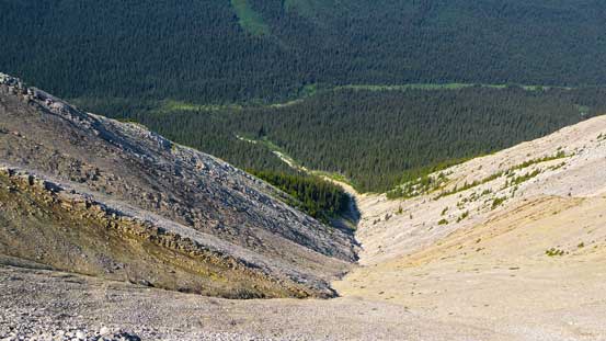
Looking down the big drainage. I went up the right side and down the left side of it.
More of the connecting ridge. This was viewing from 2nd highpoint
Typical scrambling
Route to bypass the second obstacle
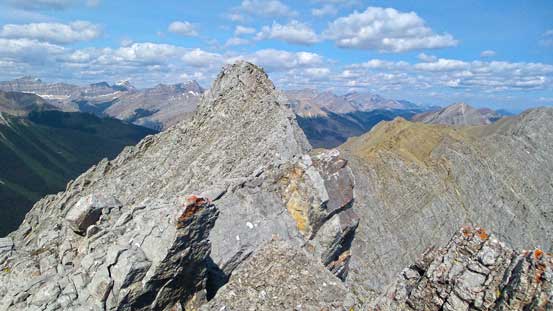
Looking back along the ridge. There were a few exposed sections

The rest to the summit was easy
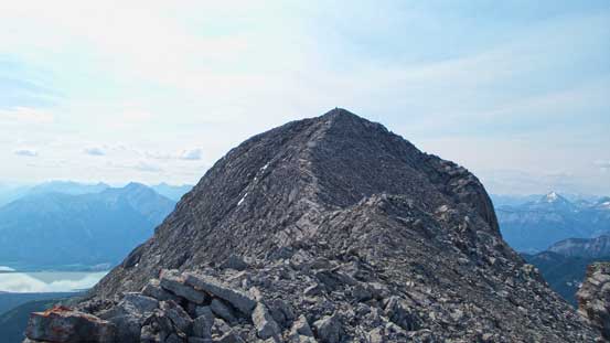
The last bit
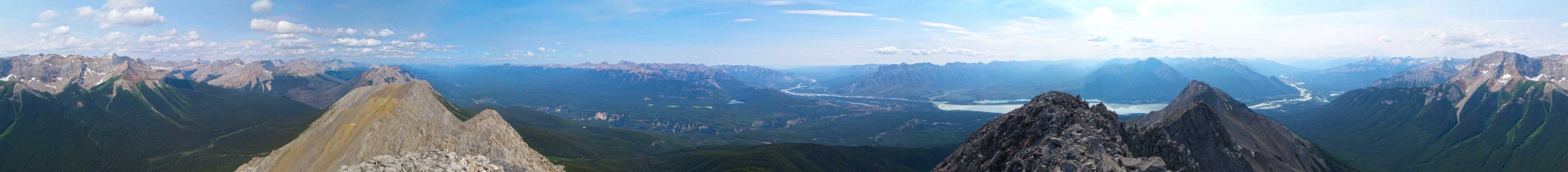
Summit Panorama. Click to view large size.
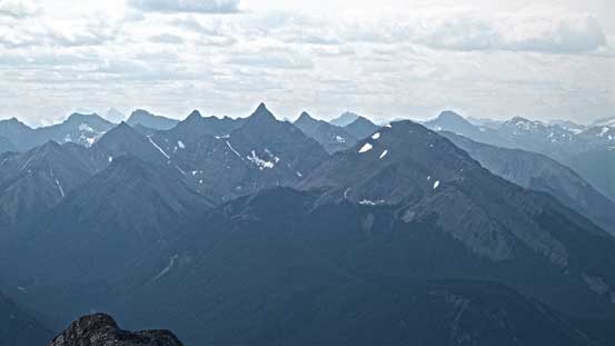
Bosche Range across Snake Indian River Valley
A zoomed-in view of Mt. Aeolus on Bosche Range
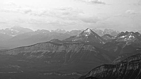
Smoky view towards Pyramid Mountain

Gargoyle Mountain is a difficult scramble
Obscured peaks north of Whitecap, including Mt. Thronton
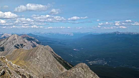
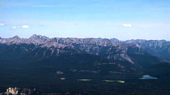
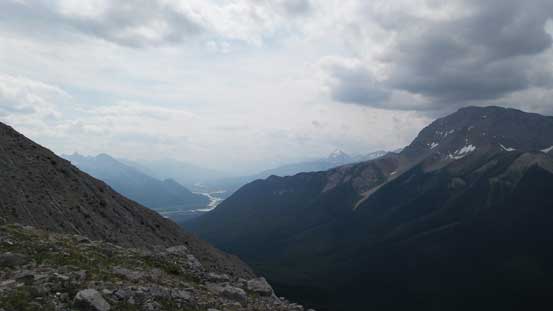
The broad Snake Indian River Valley

Jasper Lake
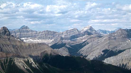
Mt. Colin and Hawk Mountain

Roche Miette and part of Miette Range
This is the terrain on the south side. Not sure if it’s a scramble but it does look pretty jagged…
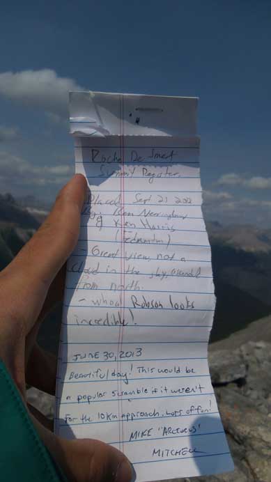
The register. I only saw Ben, Ken and Mike’s names
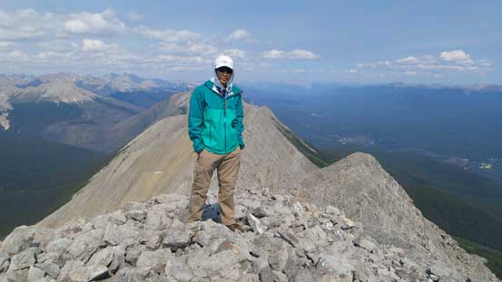
Me on the summit of Roche De Smet
On the descent I took a couple food breaks trying to enjoy more of this day by not rushing it. I also took a different rib down (one rib closer towards the summit). This helped me avoid elevation regain and the rib was just as easy to descend as the one I used on the way up. Into the woods I bushwhacked easily down the slope for a while and then cut skier’s right into the creek/gully. The gully became overgrown and faint near the bottom (that’s why I missed it on my way in), but after a short section of bushwhacking I rejoined the trail. The hike out was boring and long, but at least it’s on a trail…

This area is the crux – exposed moderate scramble
This is the gully I used to bypass the second obstacle
Looking back at the rib I used on descent
Some dark clouds started to move in

Aster
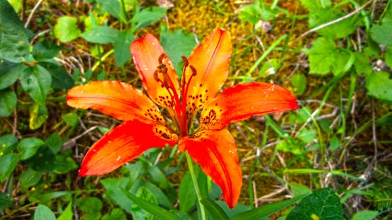
Wood lily
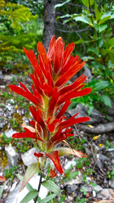
Paint brush
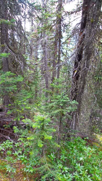
Bushwhacking for a while
Then I followed this drainage
Looking back…
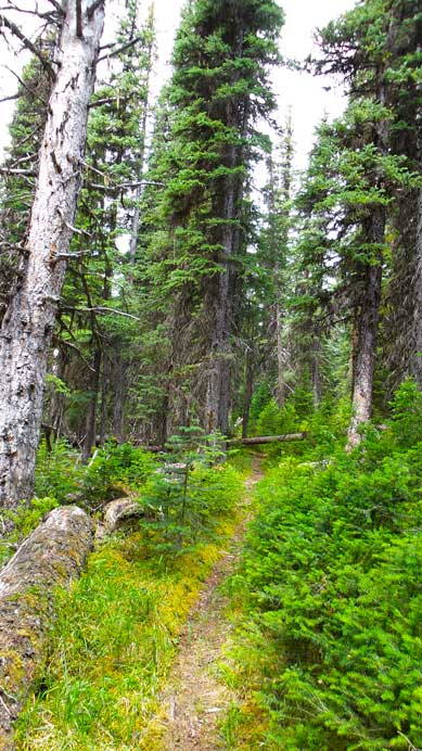
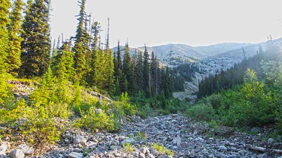
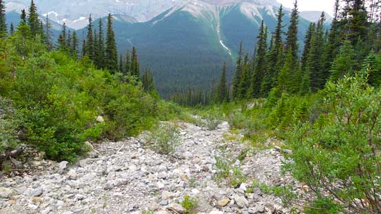
Typical view from the trail (9 km of this)
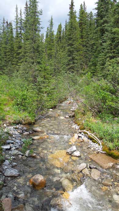
Vine Creek
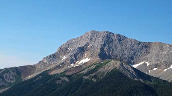
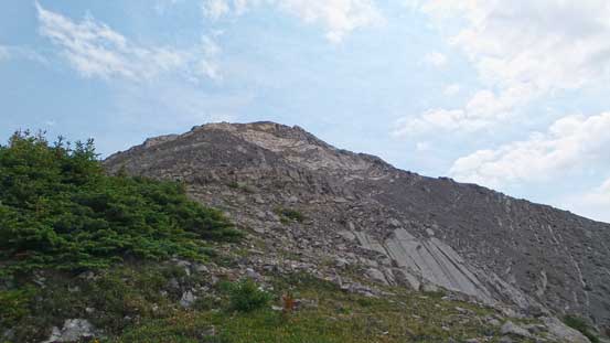
A look at the summit – pretty rocky.

Roche De Smet viewing from Highway 16
Roche De Smet proved to be a worthwhile scramble with a moderately long day and my round trip time was 9 hours. With more and more Jasper peaks proved to be scramble-able I hope more people are coming out this way to enjoy them.
