“Chehalis Peak”
February 27, 2024
729m
Chehalis Area / Harrison West, BC
“Chehalis Peak” locates on the west side of the south end of Harrison Lake. This is a forested hill with nothing notable except for the 400+ m of prominence. The name is unofficial, the summit is completely covered in trees, and the ascent falls perfectly into that category of “trash bagging”. Bushwhacking, though not very intense, cannot be avoided. There’s even some trespassing required as I encountered at least 3 “private property” and “no trespassing” signs on the drive-in, though I do not think they are very serious about the enforcement. I had considered this peak for a few years actually, and Duffy’s recent trip report made me to finally pull the trigger. Tuesday offered the only window in this week so I was aiming to get out in the morning. I needed to be back home no later than 3 pm for work, and I wasn’t super keen on doing another all-nighter mission especially given the cold and the fresh snow. “Chehalis Peak” was a bit of a lame solution but sometimes I just needed an easy day like this. I did not finish work until 11 pm in the previous evening and I seriously needed a few hours of sleep.
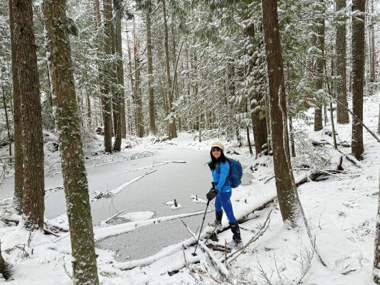
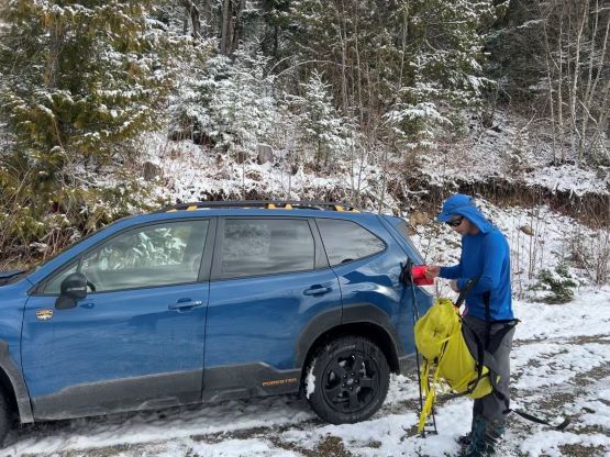
I crashed a few hours in Kate’s house and we left White Rock at around 7 am as planned. Kate got up earlier to make breakfast so we no longer needed to stop in Mission for food. We got to the start of Morris Valley Road in about 1 hour 45 minutes. The weather was mostly as expected, cloudy with flurries. I was surprised that the flurries had gone down to the valley floor, but the accumulation hadn’t started yet. A major system was supposed to arrive later in the day so the condition would temporarily shift back to “winter” for the next while. I was surprised to see the “no trespassing” signs as nobody had talked about them in their trip reports. I nevertheless drove past those signs (as always) but soon turned left onto the steep FSR. I actually did not think the “no trespassing” signs were for the FSRs but rather the continuation of this Morris Valley Road down towards McDonalds Bay, so whatever. This forestry road wasn’t as bad as I thought, but I did have to get out to move around some alders at just after the 1.5 km sign. I drove us to the 2 km marker where there were plenty of space to turn around and park. It’s possible to push a bit farther but I think wherever we parked was the most logical spot to start walking.

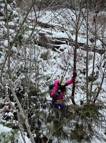
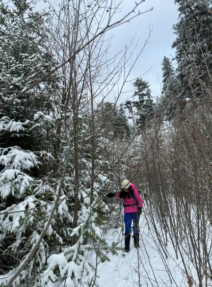
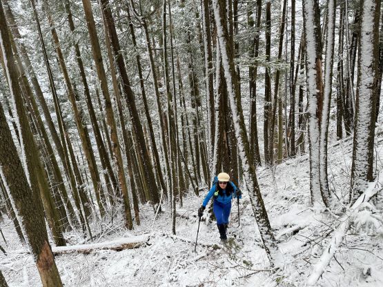
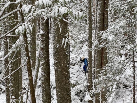
This objective was longer and farther away than I thought, and Duffy’s 3-hour round trip was more or less accurate. It ended up taking us 3 hours 15 minutes, and we were not moving particularly slow. The initial few kilometers were boring as we would simply put on foot in front of another along the deactivated and overgrown roads, and there’s some substantial amount of up-and-downs involved. The overgrown status was rather “tame” by this area’s standard, so we were able to make good time without having to do too much bushwhacking. The fresh snow had started to accumulate at this elevation (400 m). Higher up I decided in situ to follow the roads for at least another kilometer further rather than following Duffy’s route, as I did not find the alders to be annoying at all. Walking on a road (albeit with some alders) should be faster than dealing with the pick-up sticks, after all. The downside was more up-and-downs.


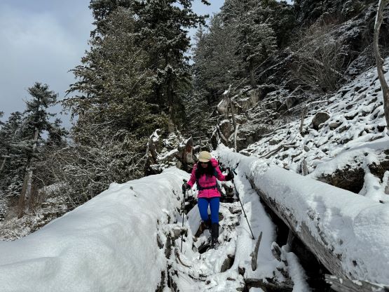
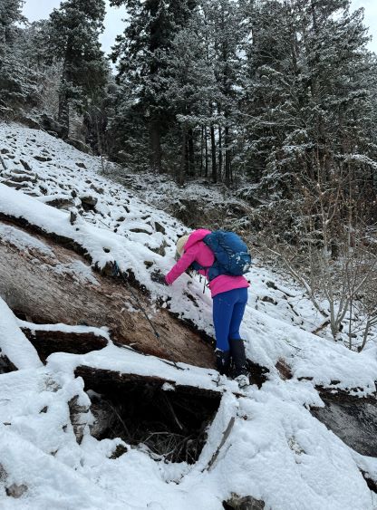
At around 550 m elevation we made to a switchback more or less directly underneath Chehalis Peak’s south side bluffs and the road suddenly became severely overgrown. I thought it’d make no sense to thrash further, as I spotted a line linking up boulder fields in open terrain. The boulders were covered in a layer of snow, and I was only wearing trail-runners, but I liked extra challenges. The worst was to get to the bottom of the first boulder field as we had to crawl over several gigantic and slippery dead-falls. A few moves felt like 3rd class and the need to use our hands regularly made me stop to take the gloves out. The boulders weren’t slick at all and that was a pleasant surprise. There’s a short section of steep and slippery forest to thrash through to reach the second boulder field, and this one was more or less the same, that the appearance was scarier than the reality. After this second boulder field we merged into the forest and traversed easily to the summit area. The true summit was most likely the northernmost (farthest) bump but we tagged all the bumps (4 or 5 of them) along the line to be sure.


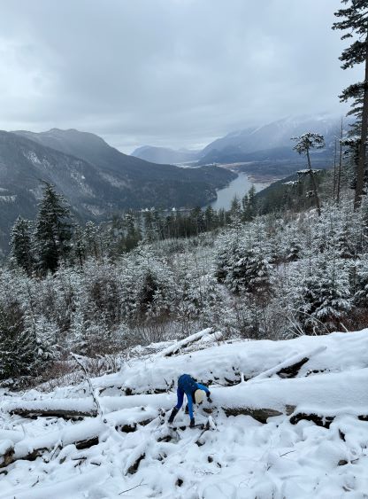


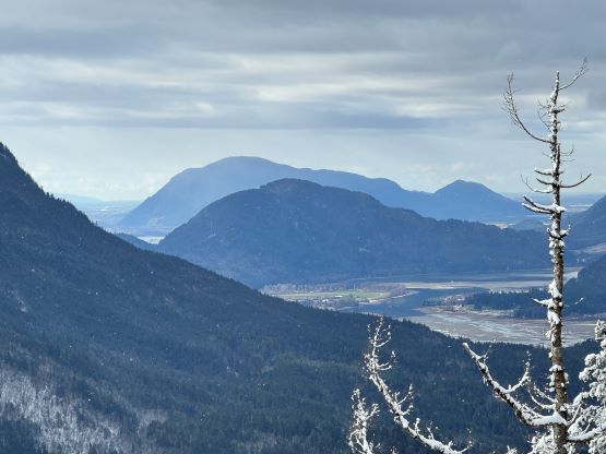
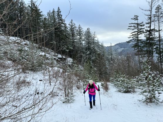
Due to the lack of views we immediately descended and by the time we got back to the few “viewpoints” above those boulder fields the flurries had magically stopped and the sun actually came out. I was originally considering to make a single dash all the way back to the vehicle but with the views we decided to take a break there. We then took our time descending those boulder fields where we got more views. This objective suddenly felt less trashy. I could imagine the views to be even better on a bluebird day. I’m not sure what route Simon C. and Katie V. had taken but Duffy’s route missed all of these open areas so it was surely more trashy for him. The final few kilometers did feel like a slog, but the fresh coating of snow had enhanced the scenery as well as our experience. Without doing much lingering at the “trail-head” I drove us out of the FSRs and then made Kate to drive us back to White Rock. I did manage to get some rest but the afternoon/evening work from 3 pm to 9:30 pm was still an exhausting show. I nevertheless was expecting that before even signing up for this trip, so I wouldn’t complain.