Doss Peak
June 18, 2021
2611m
Lytton / Kwoiek Creek, BC
Doss Peak locates in the middle of a very remote area but is somewhat overshadowed by the more fabled neighbours – Skihist Mountain and Mt. Neilsen. The former is the highest peak in SW BC while the latter boasts an iconic profile and an impressive north face. Doss Peak itself is even more remote and difficult to access than Skihist Mountain but again, it doesn’t draw much attention from the peak-bagging community due to its (relatively) insignificant status. This is also a walk-up summit on choss and hence the least interesting in the immediate vicinity.
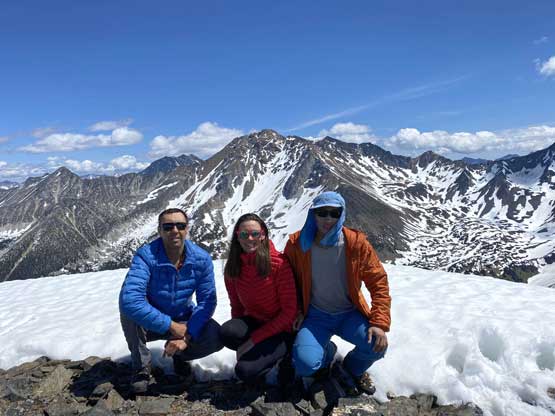
Vlad, Holly and I did it as part of a loop traverse from Skihist Mountain group towards Mt. Neilsen over 4 days. This was the morning of Day 3 and earlier in this trip we had bagged Skihist Mountain along with its satellite peaks – Antimony and Claimpost. The plan to traverse over Doss Peak to access Mt. Neilsen was a spontaneous one during the trip so I didn’t do a ton of homework to plan the routes. However, I did download the topo map and satellite images and it wasn’t difficult to draw a line. I knew a possible exit route off Mt. Neilsen as I vaguely remembered reading a trip report written by Greg Jones on bivouac.com (though I did not remember the details).

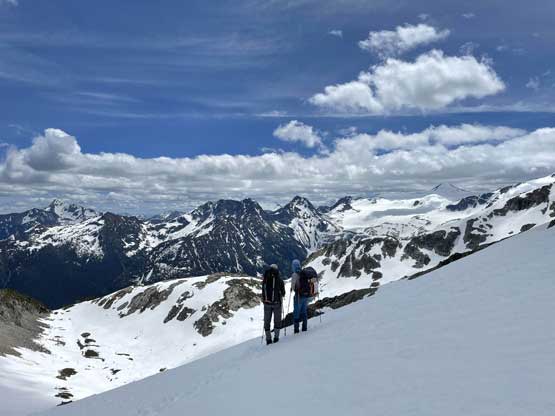
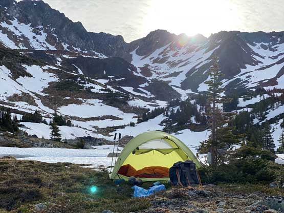
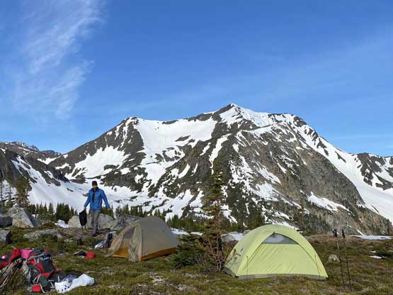
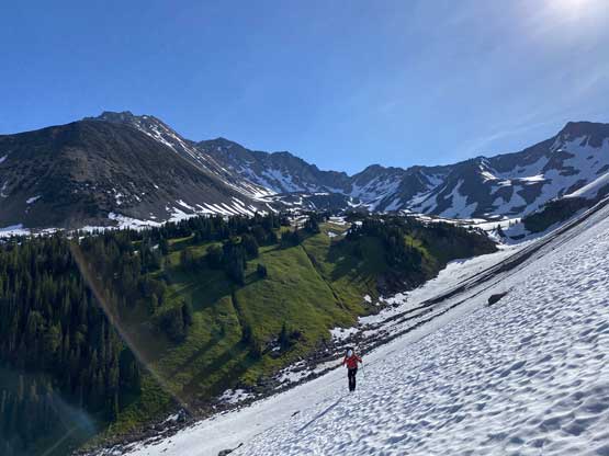
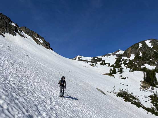
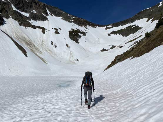
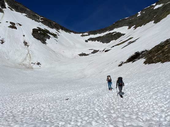
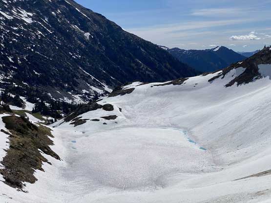
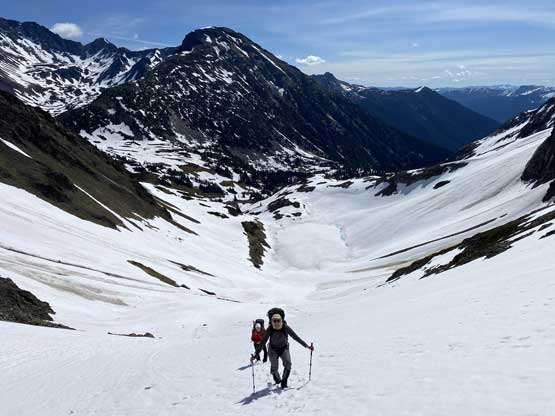
None of us was in the mood to wake up pre-dawn and in fact, none of us set an alarm but we all woke up at 6:30 am anyway as it’s already too bright to sleep. It took us over an hour to do the morning routine including breaking camp but by 8 am we did manage to get going. The first business was to continue descending Nesbitt Creek valley and re-ascend to a broad pass under Doss Peak’s east face. This section involved fair amount of elevation loss and regain as well as side-hilling on snow and boulders. While ascending towards the pass we were able to follow a fresh set of tracks laid by a huge bear. However, the bear’s strides were a bit too big for us to fully take advantage. From the pass I had several ideas but upon evaluating we opted for the longest but also the one that would definitely work. We descended 100 vertical meters down the south side of this pass then re-ascended 300+ meters on increasingly steep snow and then choss to a col on the south ridge of Doss Peak. This section of the grunt felt like a major drag that seemed to last forever especially considering the heat and the overnight packs.


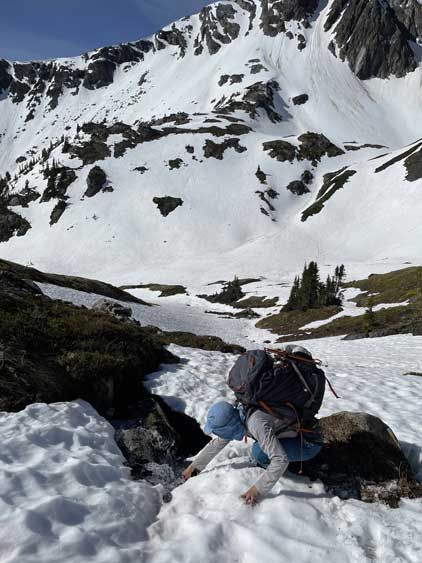

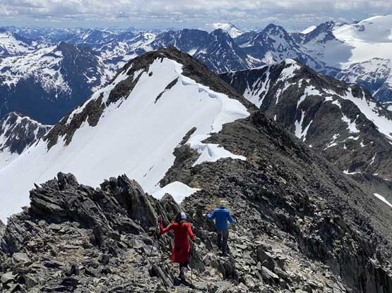
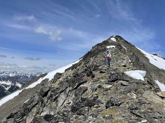
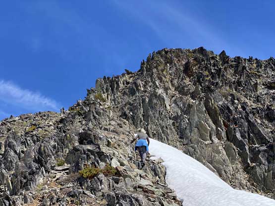
We estimated the ascent would not take more than two hours with only 300 m elevation gain so we opted to carry nothing but 1 L of water in the group. I have waist belt and a biner to clip a Nalgene in so I volunteered for the job. To gain the first (south) summit of Doss Peak required some scrambling on choss. Near the top I led Holly traversing under the SW Face to bypass some unnecessary elevation to directly reach the col between the south and main summits. Vlad on the other hand, always opted for more scrambling experience so stuck to the ridge crest. From the col to the main summit was just a walk-up but took us longer than expected.


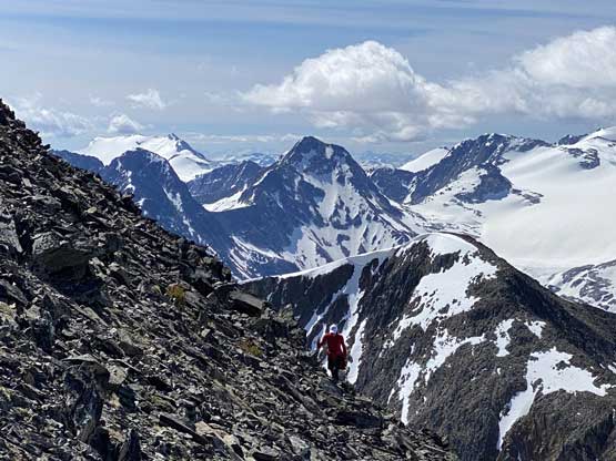

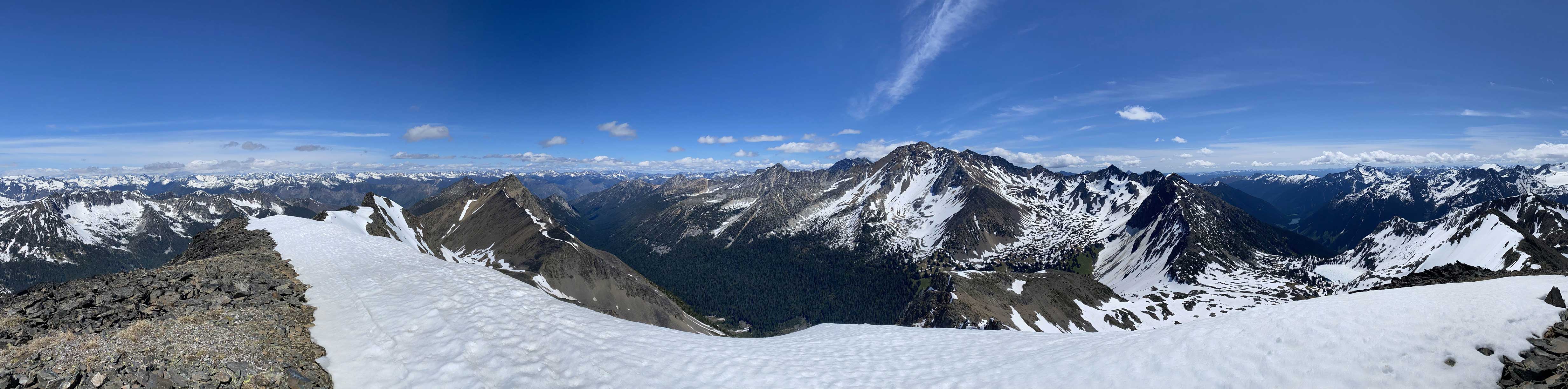

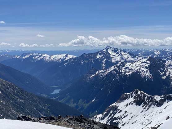
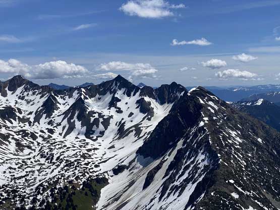


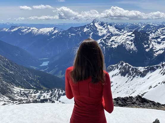


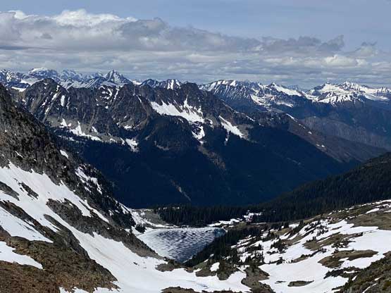
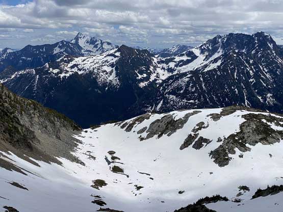
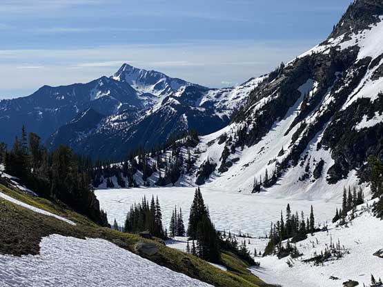
The views were pretty good but not much different than what we had just seen from the nearby peaks so we didn’t linger too long. On the return I again, insisted to bypass the south summit to save time/energy but we descended a bit too low on the SW Face and had to deal with some tricky scrambling on choss. Once back to the col we shouldered the heavy packs, descended a choss chute on the west side and traversed a horizontal bench of snow and boulder fields while maintaining elevation. Upon plodding over the next pass we sadly realized that to gain the long east ridge of Mt. Neilsen we must lose at least 100 m on the south side of this pass. We reluctantly descended into the basin and dropped our packs on a dry patch of boulder fields to prepare for the last ascent of this trip.