Gotcha Peak
November 10, 2019
2459m
Blowdown Creek / Duffey Lake Road, BC
“Gotcha Peak” is the unofficial name of the summit immediately south of Blowdown Pass on the boundary of Stein Valley Provincial Park. The name of this peak originates from Fairley’s guide and likely because of the proximity to Gott Peak. The ascent of “Gotcha Peak” is a fairly short but very scenic scramble from Blowdown Pass, which is accessed by driving up Blowdown Creek FSR from Duffey Lake Road. Those with ATVs or modified 4×4 vehicles can probably drive all the way to Blowdown Pass, while with regular 4×4 vehicles one can generally get to between km 10 and 11 on the main FSR, leaving roughly 6 km of road walking.
The primary objective on this day was Cottonwood Peak much farther away on the east side of the pass but the ascent had taken us shorter than anticipated. I figured there’s enough time to squeeze another summit into the day and I picked Gotcha Peak instead of Gott Peak because I felt Gott Peak should be combined with at least Moomin Peak to make a day, while Gotcha Peak is more of a stand-alone objective. Alex had done Gotcha Peak a few years ago on skis so opted to wait for me at Blowdown Pass.
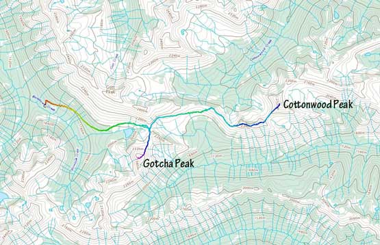
Cottonwood Peak and Gotcha Peak via Blowdown Pass. GPX DL
Based on the earlier observations I decided to keep snowshoes on for as long as I could, by utilizing a strip of snow on the broad north flanks. This worked out well and I gained elevation in no time. Once the snow ran out I ditched snowshoes to start boot-packing and scrambling. In retrospect I should have carried snowshoes to higher up, but being right there it was difficult to make that decision. All I could see was rocky and bare ground and who knows it eventually turned into a post-holing fest on snow-covered boulder fields. There’s one short stretch of scrambling that I had to be careful about, and after that I was on the flatter ground near the summit. There was fair amount of post-holing to slow me down and for every five to ten steps I would discover a deep hole, and sometimes to waist deep… Nonetheless I kept pushing and made to the summit in the early evening hour, enjoying a well-earned 360-degree panorama.
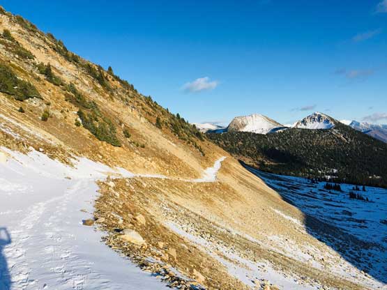
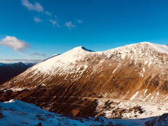
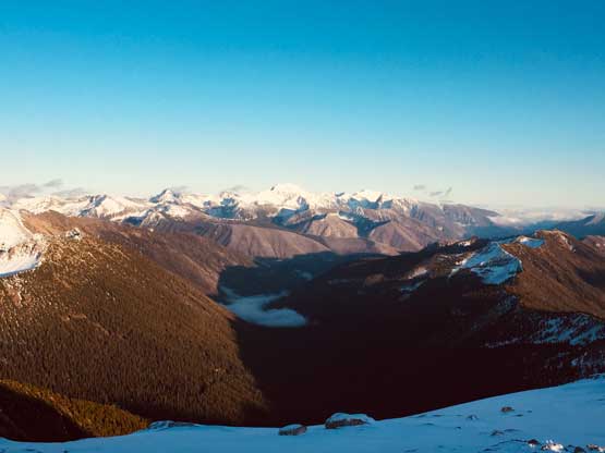
The is looking back towards Cottonwood Peak from Blowdown Pass
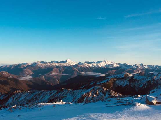
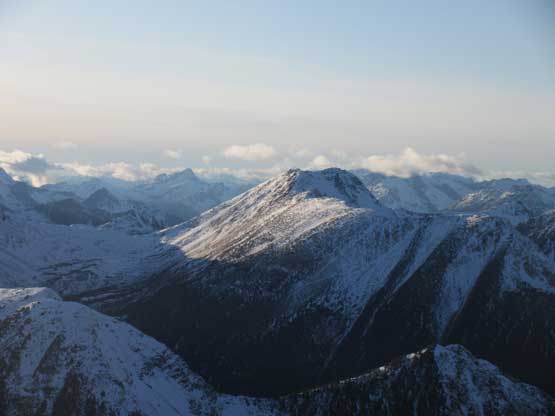
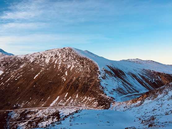
The lower sub-summit of Gotcha Peak from Blowdown Pass.
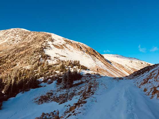
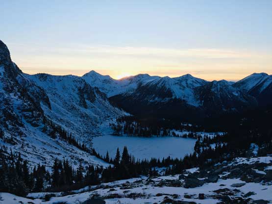
Arriving back at Blowdown Pass
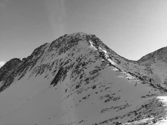
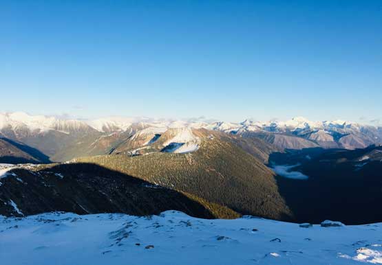
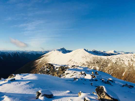
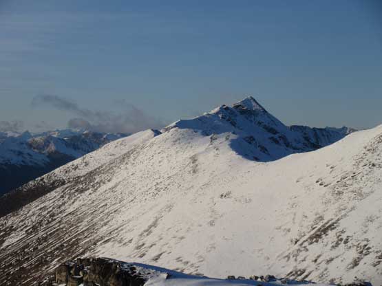
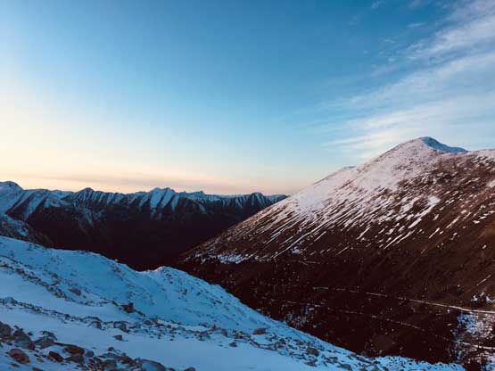
Gott Peak from above Blowdown Pass
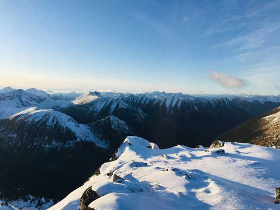
Fast forward. On the summit now looking east over Cottonwood Peak
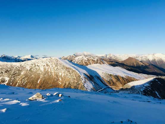
The lower ridge of Gott Peak in foreground.
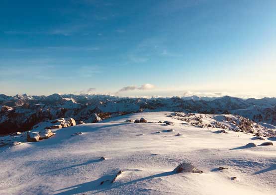
The summit area is fairly large but the snow wasn’t super supportive
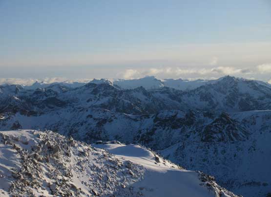
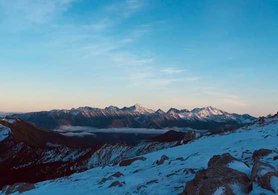
This is looking towards Siwhe-Stein Group in the far distance
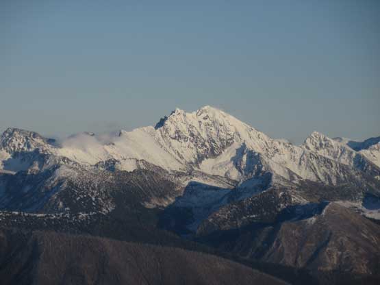
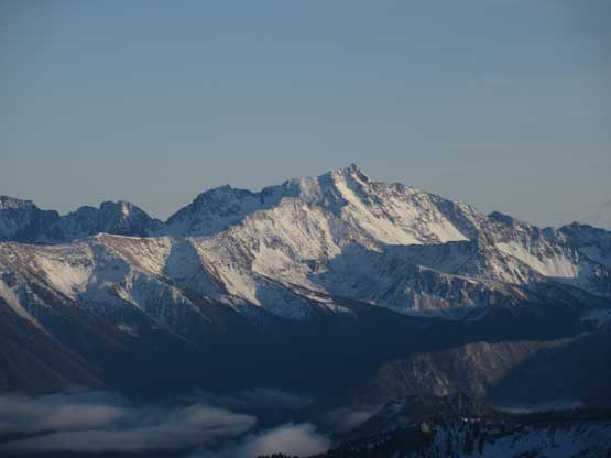
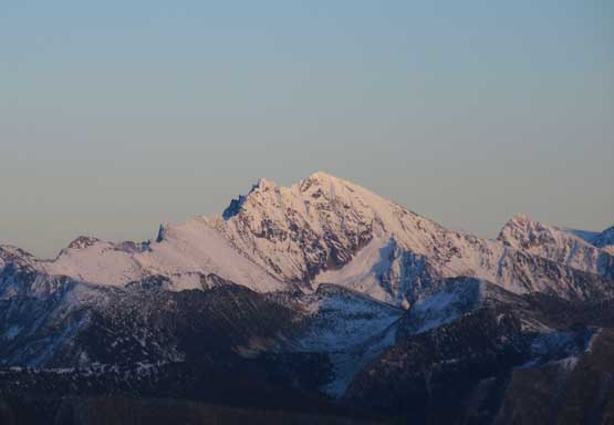
Petlushkwohap Mtn. and Skihist Mtn. dominating the southern skyline
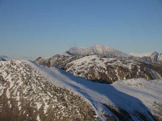
Gott Peak in full show, from the summit
The western view from the summit
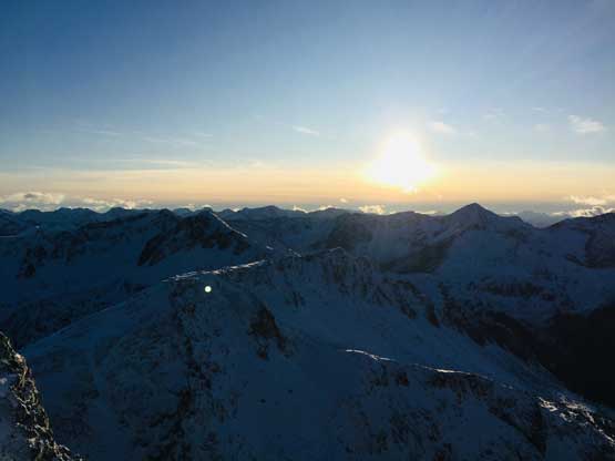
I arrived at the summit in the “early evening” hour
Siwhe Mountain
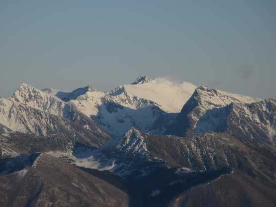
Skihist Mountain – highest and most prominent in SW BC
The uber-remote Doss Peak in the middle of Stein Valley Provincial Park
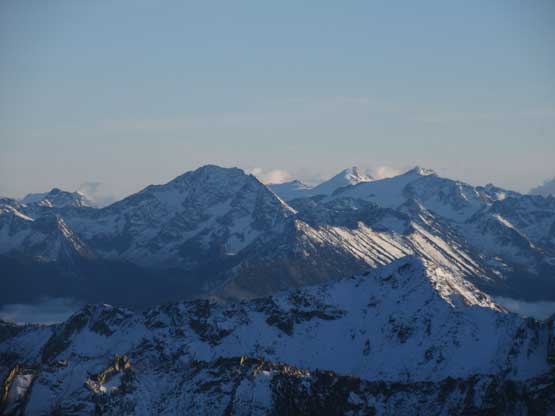
Mt. Neilsen in that dark face; behind are Kumkan Peak and Kwoiek Peak
Mehatl Peak on the southern Stein divide is also extremely remote
The last bits of sunshine on “Windfall Peak”. I did it solo over 2 days on snowshoes
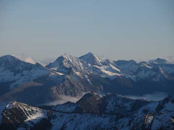
“Moomin Peak”
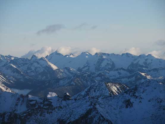
This is looking way towards Mt. Klackarpun on the south Stein divide
Elusive Peak is the bulky massif poking behind
Stein Mountain is the highest in this group of peaks
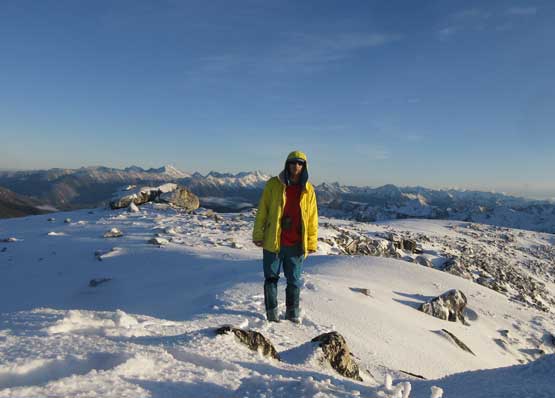
Me on the summit of Gotcha Peak
My phone died in the coldness so I had to spend about 10 minutes to warm it up in order to continue taking photos. Once having enough photos I went down retrieving my own steps. Despite the track I still ended up discovering more deep holes but generally speaking it was far easier to go down following the tracks. In short time I was back to the snowshoes and then the next stop was at Blowdown Pass. Alex had already started the return hike so I wasted no time to go down the road. I took the snowshoes off not far down from the pass and caught up with Alex in a couple kilometers. We also bumped into three scramblers descending from Gott Peak who turned out to be someone we knew from a Facebook hiking group, that we found out later on the internet.
Evening horizon over Petlushkwohap and Skihist
Halfway down from Gotcha Peak now
The gentle slopes of Gott Peak
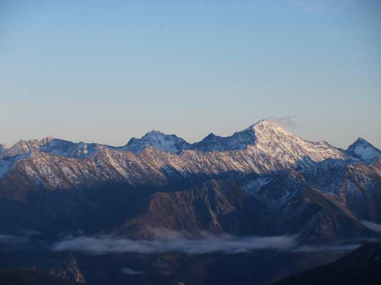
A closer look at Petlushkwohap Mountain
One last look at Siwhe Mountain
Sunset behind “Silent Hub Peak”
We got back to the truck right in time that headlamps weren’t needed. The drive out of Blowdown Creek FSR was slow but didn’t post much additional problem. The water bar that scraped the bottom of my truck on the way in didn’t scrap again on the way out. The rest of the drive back home was long and exhausting.
