Cerro Marmolejo
January 22-26, 2020
6108m
Santiago, Chile/Argentina
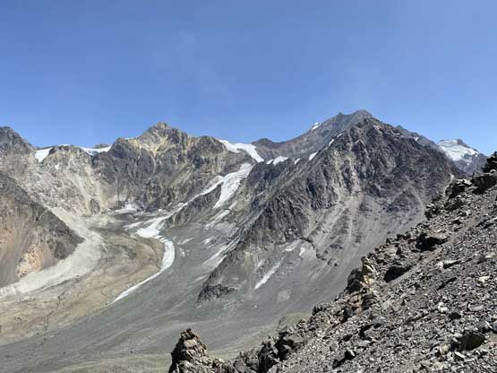
Cerro Marmolejo is a massif of glaciated volcano that locates only two hours’ drive away from Santiago, Chile and although infrequently climbed, is reasonably well-known among the locals. For us foreigners this peak is better known for the fact that it’s the southernmost peak on Earth that exceeds 6000 m elevation. Fortunately this peak also boasts a whooping 2000+ meters of topographical prominence making it a significant objective in the prominence-chasing world. Despite the volcanic nature, the landscape around Marmolejo is actually quite rugged and the ascent is far more physically demanding than a lot of the 6000+ meter volcanoes in the Atacama region further north. The trail-head is under 2400 m elevation and the approach trail is long and rather rough. There is a daunting river crossing not far from the start and the climb also involves at least two kilometers of glacier with at least a dozen crevasses and thousands of penitentes that can be two meters tall. There are locals servicing horses for the 10+ km approach to the base camp although most who went there probably went self-propelled.
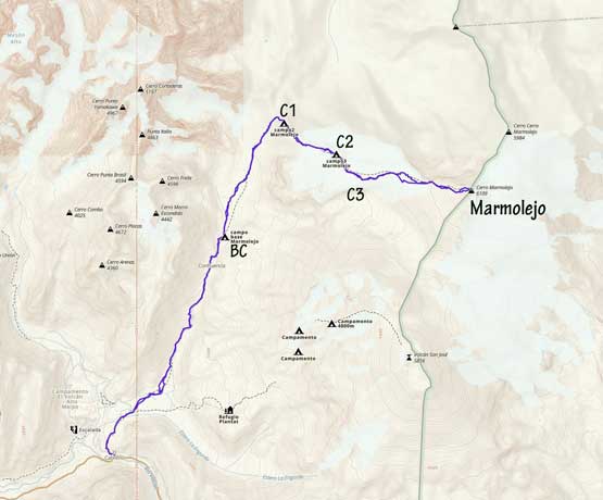
Cerro Marmolejo standard route. GPX DL
The decision to climb Cerro Marmolejo among Connor, Dave and I were a last-minute one in order to chase better weather. Earlier in this trip we had climbed the 8th highest in South America, Cerro Mercedario in San Juan province of Argentina. The original plan was to climb Ojos del Salado immediately after Mercedario, but the weather forecast called for unfavourable conditions in the Atacama. The area around Marmolejo has worse climate than the Atacama with more annual precipitation, but in this particular week the weather showed nothing but sunshine with very mild wind. At the very last minute we cancelled our flights as well as the car rental in Copiapó and instead, we booked three 6:30 am bus tickets to Santiago. Connor managed to also secure a rental SUV in Santiago. We did our shopping in the city of Mendoza for food and fuel because we estimated the schedule would be tight once arriving at Santiago. The bus ride took more than 6 hours and I slept for the most of it, but I did somehow wake up just as it passed by the south face of Aconcagua. The steep descent after crossing the Chilean border was also impressive with perhaps a hundred switchbacks. Once the bus parked we immediately took a taxi to the Chilean rent-a-car. We had a big meal while waiting for our vehicle and then Connor did an excellent job driving us out of the city mess towards El Morado.

Impressive switchbacks after crossing the Chilean border..

We were supposed to take two taxi but this driver was determined…

Stuffing in another huge meal before heading into the wild for 5 days
The drive to El Morado and then the trail-head was apparently quite scenic but I again, slept through most of it. Only the last two or three kilometers past El Morado (and Baños Morales) was unpaved but was passable in any vehicle. The “trail-head” was not nearly as neat as I was expecting and in fact, it’s literally in the middle of a large work zone. I gradually learnt throughout this trip that mining and the associated engineering is such a big thing in Chile. We did not feel safe to leave our vehicle and a shit ton of gears and bags for several days but wondering around we saw nowhere else that made sense to park. There were horses nearby so Dave went to talk (and tip) the owners hoping that they could at least keep an eye on our car. It was also very windy and dusty at where we parked so we tried pretty hard to be quick at the last-minute packing. And despite the lateness of the start (4 pm), the objective of this day was getting to base camp, a distance of 11 or so kilometer away with 900 m elevation gain.
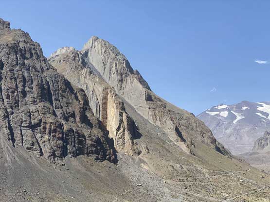
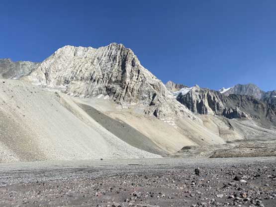
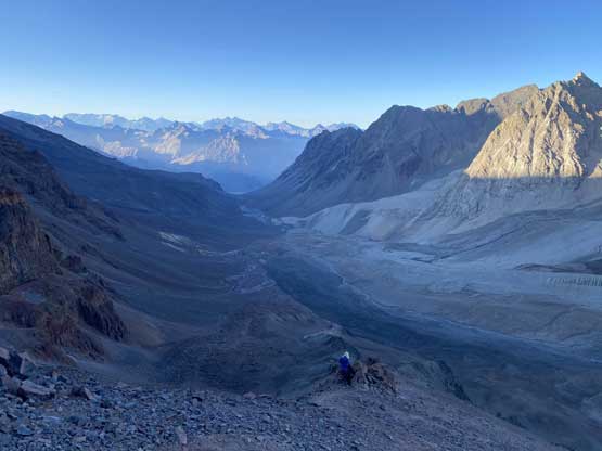
The area around Marmolejo is very rugged with shear faces all over the place

We were literally driving into a huge ass mining zone…

Perros at the trail-head to welcome us…
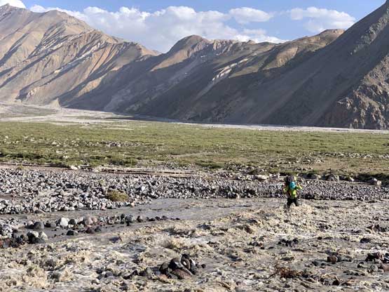
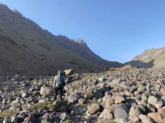
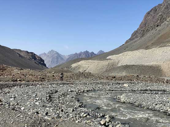
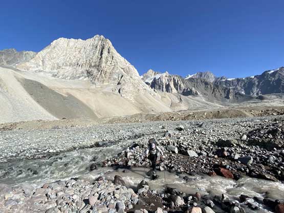
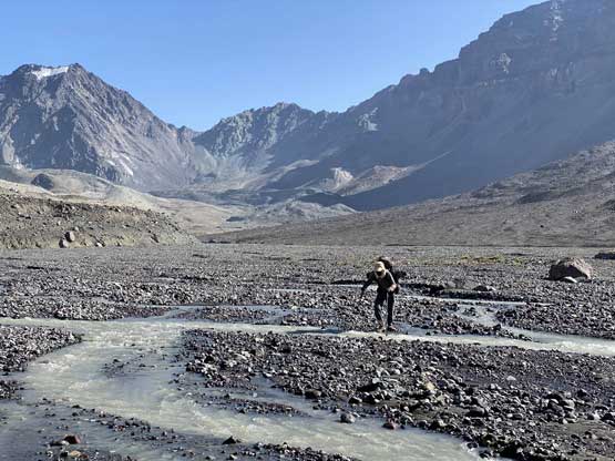
The start of the approach was also a wee bit confusing because we actually started by walking a ways down the mining road. The trail was also not well-signed. However, we did come prepared with a GPS track so did correctly identify the trail. After a while the trail led us into a flat, broad valley with Volcán San José straight ahead. The route then became “braided” while skirting around the south side of a fenced mining camp and after that, we were facing at the river crossings. There’s a minor, but raging stream before the main Estero Colina and even that stream required both Dave and I to take our shoes off. Connor managed to jump across. The main river appeared nearly impossible and we even saw several tents nearby, indicating we might have to wait till the following morning to cross. That would put us half a day behind schedule plus the water in Estero Colina would be too cloudy to drink. We opted to explore upstream and spent at least a good hour trying different spots to cross. I brought my river crossing shoes but Dave and Connor didn’t have the luxuries. They had to cross the river on their trail shoes and deal with the wet feet for the rest of this day. The spot I tried was furiously flowing and thigh deep. I crossed two third of the way but decided to turn back at the deepest channel. Meanwhile Dave and Connor found a more braided spot about 100m downstream so I went down and followed. It turned out to be easier than appeared but still more than knew deep.

Horses passed on just after we started on the trail

Dave and Connor starting the hike while the spirit was high.

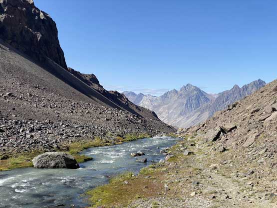
We soon entered this broad green valley. Volcán San José ahead.
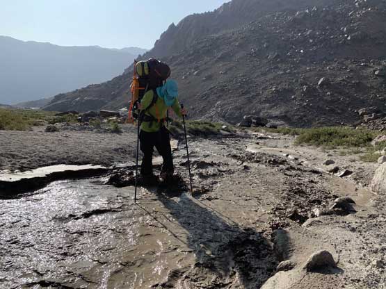
Me evaluating the first stream crossing. Photo by Dave H.

Checking out the main crossing of Estero Colina
Me fighting the current. Photo by Dave H.

Another photo of me crossing Estero Colina. Photo by Dave H.
We were not doing good on time so rather than drying things out we immediately got back onto the trail and resumed the long plod up the valley. The trail was more like a “route” with a shit ton of rocks and confusing spots that we had to watch our feet got pretty much every single step. The 40lb+ backpacks didn’t help neither. A while later we ascended a giant hill that’s at least 300m tall and then the daylight faded. I was so done with dehydration that I had no choice but drinking a liter of water straight from Estero Colina which looked rather like the Yellow River in China… The last hour or so of this day was done with headlamps on and thankfully we found a much cleaner stream higher up. We also crossed the braided Estero Colina back to the east side near the “base camp” and the crossing was significantly easier at this point, even in the dark. The base camp located at a neat spot at around 3300m elevation with a tiny but clean stream for drinking water, but at 11 pm all we wanted was to crash and sleep. We didn’t even bother to cook nor to set up tents, and rather just open-bivyed.
The trail was almost non-existent in a lot of places

The daylight was fading as we ascended a large hill

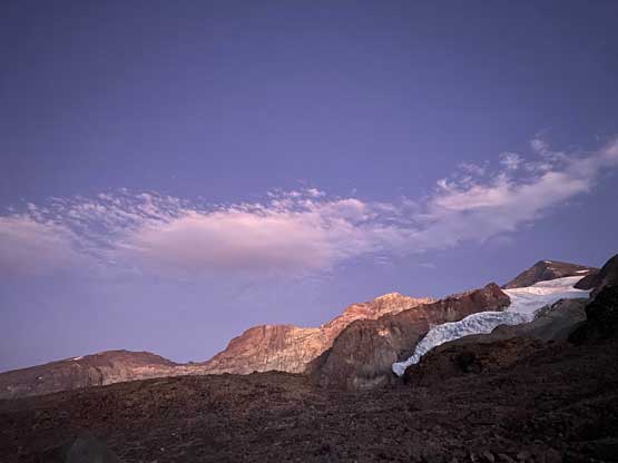
Evening colours high up on Marmolejo
Cerro Catedral de lo Valdes in the background
About to cross Estero Colina for the second time.
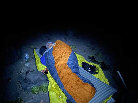
We felt asleep at the base camp right away…
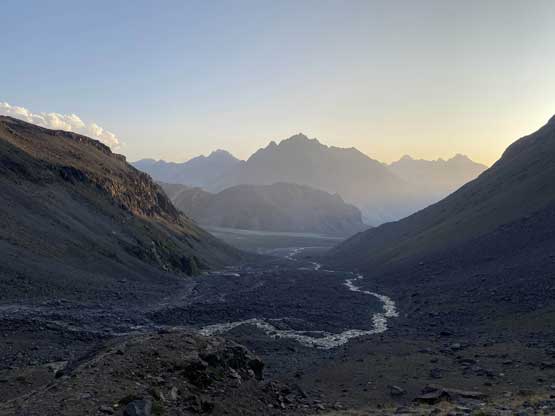
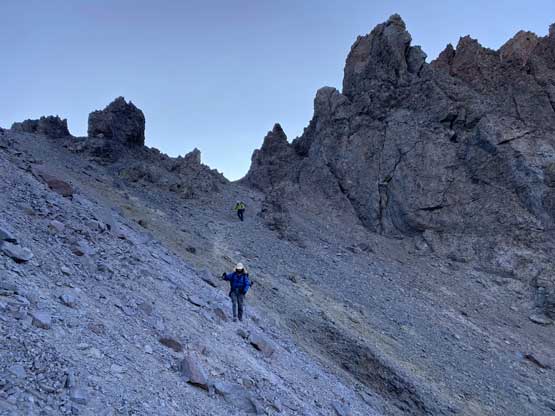
The objective of Day 2 was getting to one of the high camps on, or below Marmolejo Glacier so what laid ahead was another long and exhausting day. The 3 km death march up to the head of valley where Estero Colina originated from some dirt-covered glaciers was also longer and tougher than expected. There was literally no defined trail at this point and we just picked our way up and across rocks. The trail reappeared at the base of the 700m grunt up towards the ridge crest underneath “Camp 1” at 4200m so we took a lengthy break there. The next several hours grunting up the choss cone was one of the more miserable sections we did in this whole trip but at least there’s a path and it wasn’t entirely scree slogging. Our plan was to take a long break at Camp 1 but we found no water source whatsoever. We knew there’s a glacier higher up so the only option was to keep going. We eventually found running water after cresting a small ridge at 4600m and not far after that we decided to call a day and set up the tents. The day had been much harder than anticipated and we decided to push the summit attempt a day later. On the bright side, the location of our “Camp 2” was really gorgeous with expansive views. The others went to bed early but I stayed till sunset, which was definitely worthwhile.
The morning of Day 2 we resumed the death march up this valley
The going was rougher with hardly any trail…
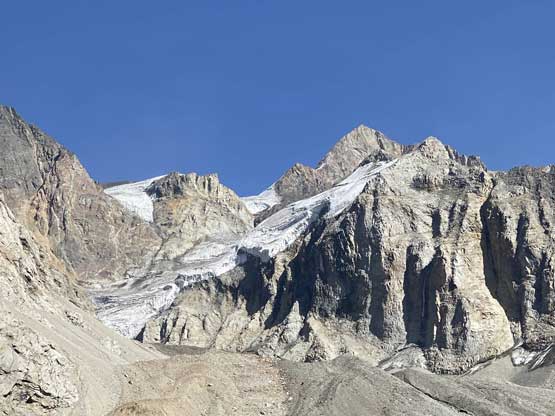
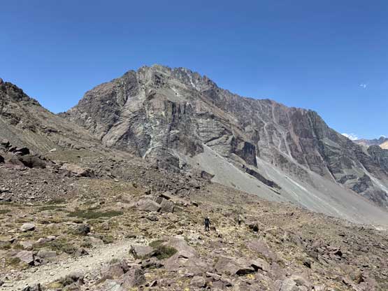
Shear faces and icefalls on Punta Italia

Slowly approaching the 700-m death grunt out of this valley…
Started the grunt.
At least the views were improving…

About to hit the halfway mark…
Dave grunting…
A couple hours later we made to the ridge and got to see the other side

Dave happy to have finished that section

Resuming the slog towards the 4200-m camp

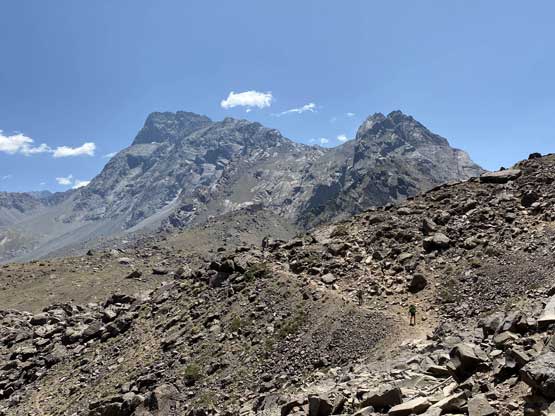
Plodding up with Punta Italia behind

Almost at the 4200m Camp 1 only to find out there’s no water at all

Our first view of the summit of Marmolejo, still days away…

A huge cleft on the west spur of Marmolejo

We had no choice but keep going, without water under the hot sun..

Dave with Cerro Cortaderas and Punta Italia behind

Finally found running water and we soon set up camp at 4600m

Sunset behind our tent
One more photo of the gorgeous sunset at Camp 2
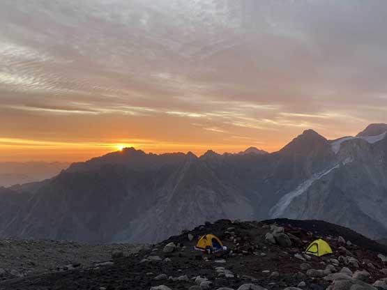
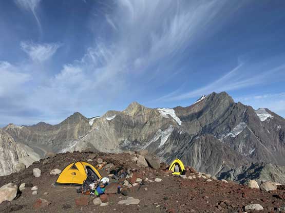
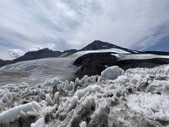
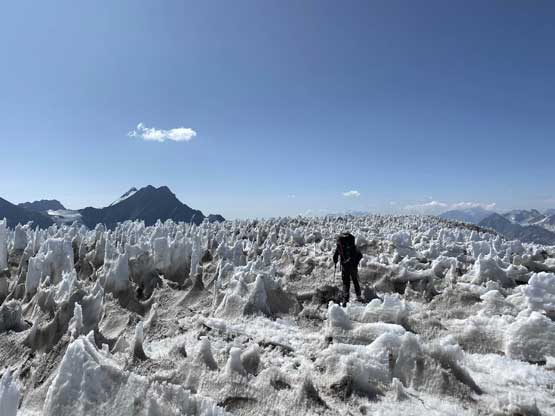
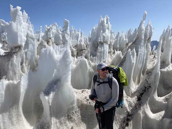
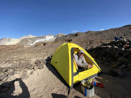
The Day 3 then turned out to be an easier day as all we needed was moving to high camp at around 5150m but this did require crossing the first half of Marmolejo Glacier. The high camp locates on of the rock islands in the middle of the glacier. The ascent from Camp 2 to the start of the glacier took another hour or two on loose rocks. The glacier didn’t appear too complicated but we expected to deal with an ocean of penitentes. The worst part lasted for a few hundred meters horizontal and the penitentes were well over our heads tall. However, the walk wasn’t as bad as one might expect and we did manage to keep a reasonable pace. Once the penitentes field ended we had a long cruising zone but to exit the glacier we were forced to traverse a ways climber’s right because of some shallow, but annoying crevasses. There were plenty of tent sites at the high camp plus running water. The upper glacier didn’t appear too bad and we were all psyched for the summit day tomorrow.
The morning of Day 3 at our camp

Dave’s tent with Cerro Cortaderas behind
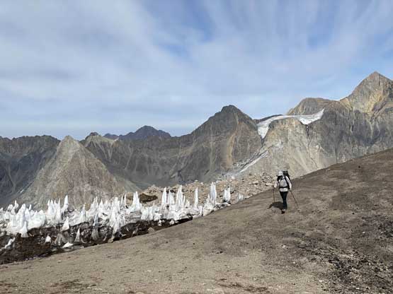
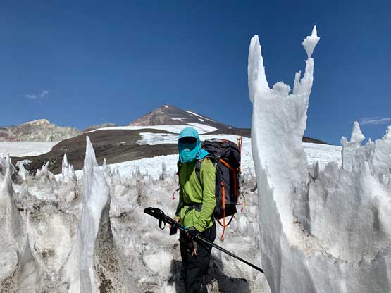
We started to see more and more penitentes
Excited to finally get onto the (lower) glacier
The summit was still a long ways and over 1000 m higher
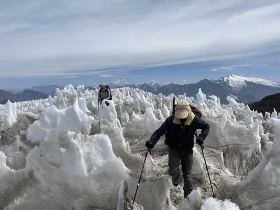
Connor negotiating the annoying penitentes field

After the penitentes the lower glacier was cruising
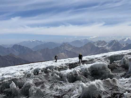
Until the exit of it where we had to deal with a maze of runnels

The setting of Camp 3 at 5150 m was really cool too

Our tent with Volcán San José behind
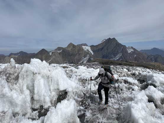
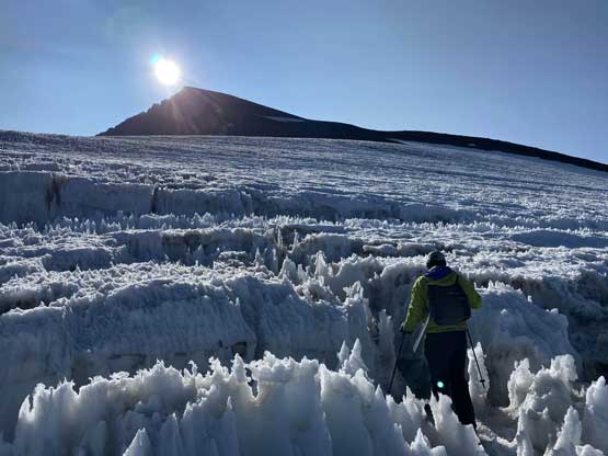
The elevation gain of the summit day would be under 1000m and the weather called for calm throughout the day, so there’s no need to start early. We all wanted daylight for the glacier travel anyway. Unlike the lower, flatter glacier this upper half did require us to strap crampons (Irvis Hybrids for me) but ice axes stayed in our packs. There weren’t a lot of large penitentes but I felt the smaller ones more annoying. In addition to that we had to route-find through a dozen bottomless crevasses and thankfully they all had solid, albeit scary-looking ice bridges. Not bringing a rope seemed like a questionable decision but at this point, we just had to be careful and embrace it. We all used some slightly different lines and all went.

Dave started the upper glacier in the early morning of Day 4

The first crevasse that we encountered. Not a big deal at this point
Another crevasse and this one was bottomless

Me tempting fate on an ice bridge. Photo by Connor M.

Connor crossing the same ice bridge…

Dave mastering the penitentes. It was slow-going to say the least
Upwards and onward we had more and more obstacles

We had to climb in and across this crevasse.

Dave climbing out of the crevasse.

Thankfully the upper section of this glacier was smooth.
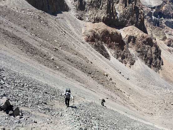
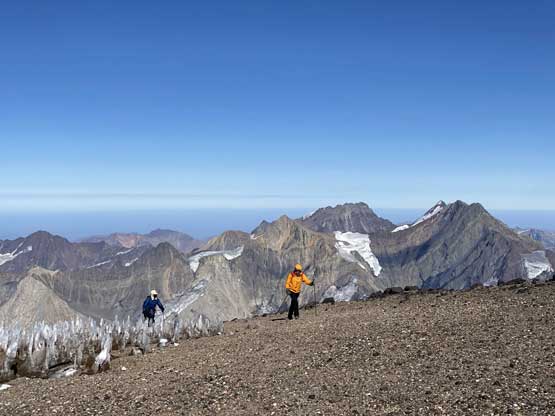
From distance we could see “trails” zig-zagging up the broad west spur on the upper mountain but once there we failed to find the path. The volcanic scree was easy to walk on anyway so we started to pick our own line. Connor led Dave staying far to the climber’s right side while I trended left. It was me who actually found the trail and once on the trail, the rest was more-or-less a no-brainer. Connor and Dave also found a trail but it’s not as big as mine. The slightly-higher-than-6000m altitude also made the summit push easier than Mercedario and the bonus was the absence of wind. I arrived on the summit about half an hour earlier than the rest of us. The views were also more dramatic with more shear cliffs and glaciers around.

Connor plodding on scree above the glacier

A view into what seemed like a huge but ancient crater
We skirted around another penitentes field

No more snow after that. Cerro Cortaderas (5197m) was starting to look small

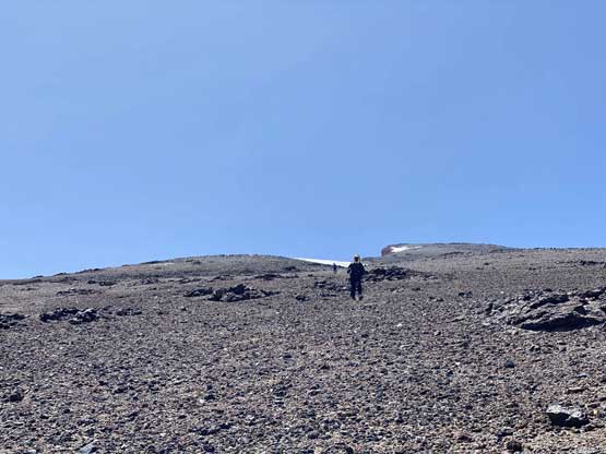
The plod was long and monotonous for 700 vertical meters

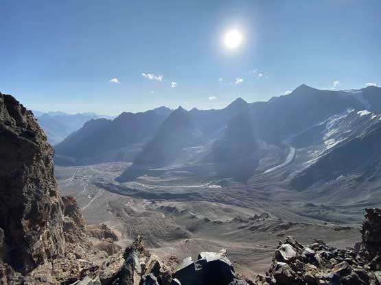
Partial Summit Panorama from Cerro Marmolejo. Click to view large size.

Partial Summit Panorama from Cerro Marmolejo. Click to view large size.

Looking over the north summit
Cerro Negro (6152m) in Argentina

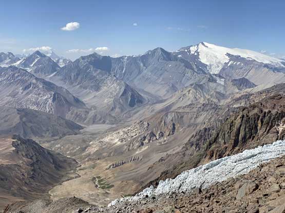
Volcán Tupungato (6570m) rises behind Nevado de los Piuquenes (6019m)

The massive south face of Aconcagua (6961m) behind Cerro Polleras (5968m)

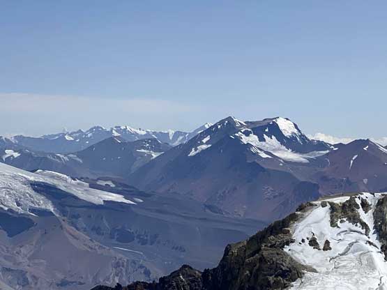
Nevado del Plomo (6070m) is one of the few ultras near Santiago

Me on the summit of Cerro Marmolejo

Our group shot on the summit of Cerro Marmolejo
We lingered for at least another half an hour before starting the descent. We used the trail that I found, and the scree plunging was very efficient. The crux was picking a safe line down through those crevasses especially under the hot afternoon sun. Again once on the glacier we started picking our own line, and again all worked out eventually. The line I picked involved crossing a monster crevasse on sketchy ice bridge but otherwise it was quite smooth-going. I also managed to avoid a lot of penitentes. Back to camp we took a long break and decided to carry down to “Camp 1”. The lower glacier was much less hazardous but with larger penitentes so we took our time soaking in the experience. It was my first time seeing such an amazing landscape. At “Camp 2” we each loaded about 3 L of water and an hour later we were all down to Camp 1, at 4200m. This is also a scenic camp but one has to wonder around a bit to see the entire Estero Colina valley.

Dave starting the descent

Me and Connor descending with Cerro Cortedaras as a backdrop
Plunging down the volcanic scree was really fast

Dave entering the runnels on the glacier

Lots of micro-terrain on the glacier
Connor embracing the penitentes ahead

We had to hike through this…
Me in the penitentes field. Photo by Dave H.
Dave and the penitentes

Thankfully we didn’t have to get onto that part of the glacier…

Connor on the glacier with Cerro Cortedaras behind
A view northwards towards Nevado de los Piuquenes

There were a few sections with large boulders to climb over

Dave arriving at the lower, Camp 1 at 4200 m
I wondered around to get some views of the valley we came up from
Dave cooking dinner. We each hauled 3 L water here as the camp’s dry

More views from the edge of the cliffs
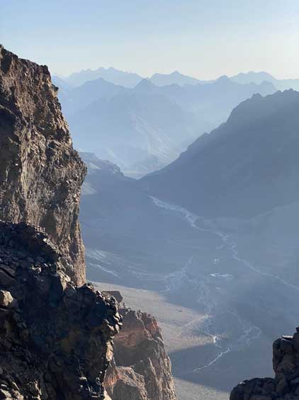
The next day we had to descend all the way there

A review shot of the summit and the glacier, that plunges a long hell of ways down

Nevado de los Piuquenes is the glaciated massif
It’s dusk time. Connor and I open-bivyed as it’s warm and calm
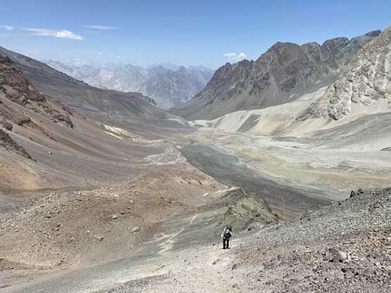
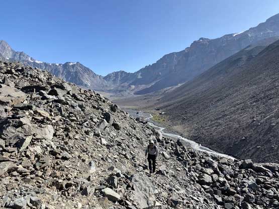
The objective of Day 5 was finishing the exit and drive back to Santiago and start preparing for Ojos del Salado over the following few days so we still had to start early. It was also nice to descend the horrendous 700m choss down to valley bottom before the sun hit. The 1-hour march across the valley floor back to the “base camp” was as tedious as we remembered from a few days ago. At the base camp we picked up more trash and committed to the final hike-out. Connor and I even managed to rock-hop and jump across the braided Estero Colina back to the west side. The next couple hours were pretty unpleasant because of the monotonous terrain, the shitty trail and the heavy packs. The main river crossing didn’t appear easy even in the morning hour, but at least much friendly-looking than a few days ago. Connor and Dave debated but wanted to keep their shoes dry as our trail shoes would also used for driving and traveling. They opted to descend to that fenced mine site in hoping they could let them use their bridge to cross the river. I, on the other hand, had my river shoes so didn’t give a fuck. The crossing was knee deep at most. It was apparently some “adventure” for them to get the permission to enter the mine zone but they did achieve their goals. It took a long while but all worked out. The rest of the hike-out was uneventful.
Committing to the 700m descent to the valley floor
Halfway down

Down to the valley floor, the going wasn’t getting much easier
Dave hopping across one of the several streams
Connor tried to rock-hop and jump across the braided Estero Colina
Dave on the exit trail. As you can see, we had to deal with up-and-downs
Believe or not this river came out of rocks so was clean

Much lower down now.

Cerro Cartedral de Valdes

I crossed the main Estero Colina here. It was knee deep only
On the last stretch of the exit hike now
Cerro Arenas et al. behind us

There are a lot of rugged peaks behind this mine site in foreground
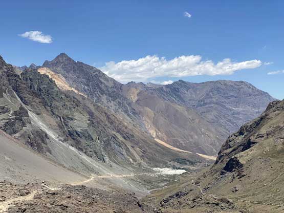
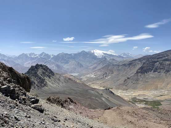
This is the valley we drove up from. Almost done…
We got out at noon so there’s enough time to get a proper lunch before driving into the city mess of Santiago. Dave found a restaurant on Yelp which proved to be really good. Later that afternoon Connor drove us into and across the city to one of the hotels near the airport. We confirmed that we could return the rental car at the airport and saved a lot of hassle. For the dinner we opted for a sushi restaurant. The food was excellent but the waiting was terribly long. We didn’t get back to hotel until 9 pm and didn’t go to bed until almost 2 am, as repacking and researching took time. The weather had improved for Ojos del Salado but the climb still turned out much harder than we thought.
