Maze Peak
December 14, 2014
2404m
Ya-Ha-Tinda Ranch, AB
Over the past year or two Ben and I have visited Ya-Ha-Tinda area a few times and Maze Peak was always in the discussion. It’s perhaps the most popular scramble in this area judging by the number of trip reports we could find. It’s a half-day outing with virtually no approach. It offers some hands-on scramble but no real consequence in case of a mistake. It’s located in the easternmost range of the Rockies and rarely gets significant amount of snow. Combing these factors it sounds like a perfect winter objective especially when condition doesn’t allow for bigger stuffs. Apparently Vern was thinking the same way so we all agreed to give it a shot in this past Sunday.
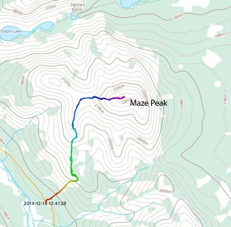
Maze Peak standard scramble route. GPX DL
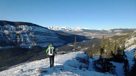
Apart from ascending this mountain we also planned to watch (and photograph) meteor showers around midnight. I myself did not own those fancy camera gears so you should check Vern and Ben’s trip report for the star pictures. We did see tens of shooting stars including 2 really bright ones. But I went to bed early due to the coldness.. There was apparently a temperature inversion going on and the morning was even colder… Nonetheless we managed to wake up by 8:30 am and drove to the “trail-head”. I give the quotation mark because there’s really no such thing of “trail-head” and we basically just parked at the same place where Bob Spirko and Sonny Bou parked.
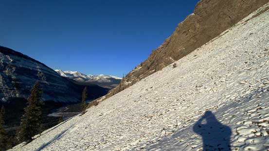
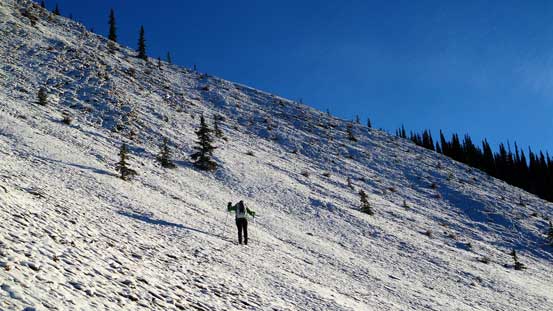
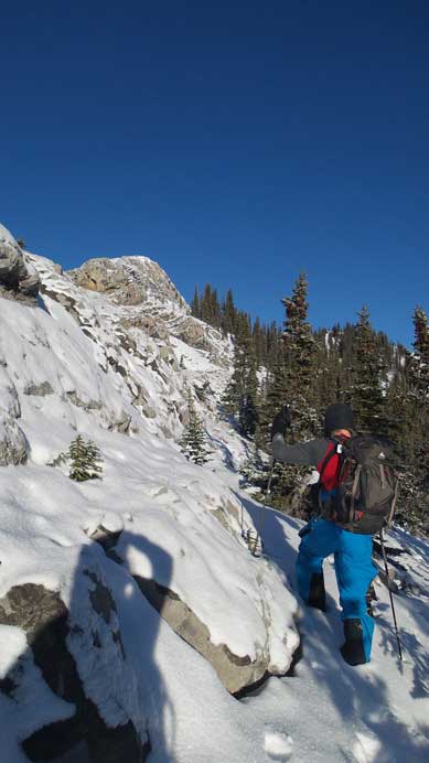
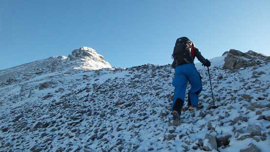
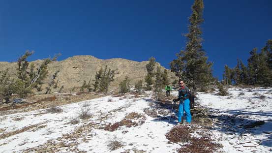
The first stage of this ascent was simply “going upwards”.. Right-away we entered the forest but just as expected, bushwhacking was nearly non-existent. In short time we arrived at a semi-opening area. There’s nothing rocket science but with all the fresh snow and the frozen ground this section was quite slippery. The terrain was quite steep for the next while until we crested the (treed) ridge immediately in front of us.
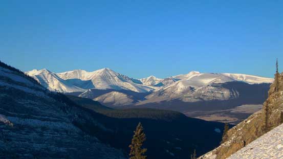
Already great views

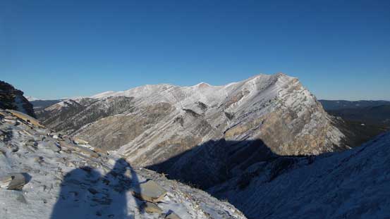
Behind us across Red Deer River is Labyrinth Mountain
Vern picking a line diagonally up
A zoomed-in view towards peaks north of the Ranch
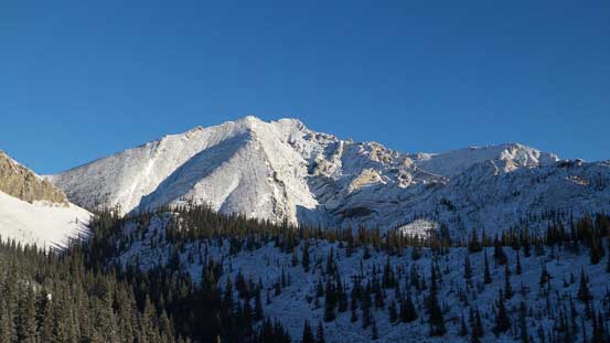
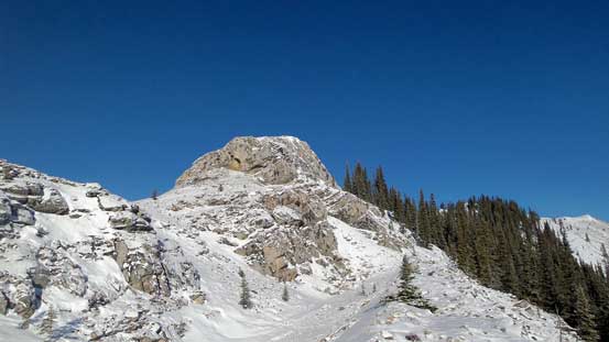
Cresting the ridge we could see our objective up high.
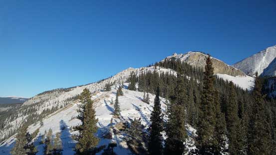
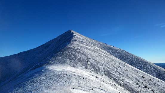
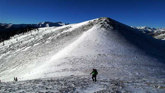
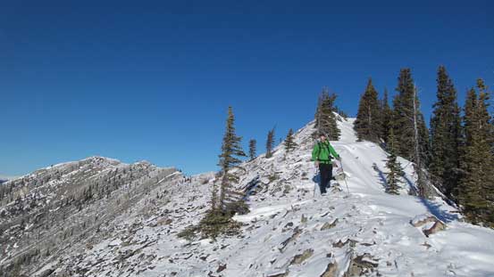
The next section was more-or-less following this ridge up curving towards climber’s left. Near the treeline there’s some optional scrambling if sticking to the ridge crest. We bypassed a step on climber’s left side but could have gone straight up. We also discovered a big hole that looked awfully like a bear’s den… Thankfully we didn’t wake anything up on this day. This long ridge section eventually brought us to a subsidiary bump directly west of the summit-push.
Ascending the ridge towards climber’s left
Vern enjoying this trip. Great view and very nice walk.
Ben attacking a short scrambling step
Typical travel on this ridge
Ahead is an optional scramble step
We bypassed it on climber’s left
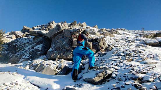
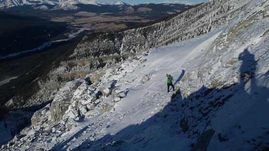
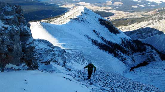
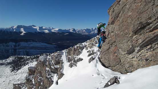
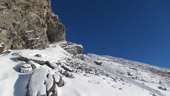
From here we’d lose about 50 m elevation to the connecting saddle with a little bit of hands-on scrambling. Up towards the summit we stuck mostly on the direct ridge crest but occasionally we had to detour either to left or right. We had to deal with a few moderate scrambling steps but nothing too tricky. Near the summit we also had to bypass a down-climb on the south (right) side due to the down-sloping snow covered slabs. The view was surprisingly good from the top but that could due to the fact we had perfect weather.

Descending from the subsidiary bump
Ahead is the summit push
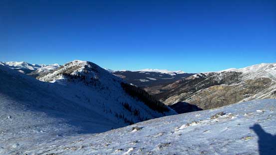
Looking across the saddle we could see Eagle Mountain
Vern ascending the typical slope
Perfect blue sky!
Bypassing the first slabby section on climber’s left
Back to the ridge
Down-scrambling a short step
Bypassing the second slabby section on climber’s right
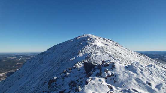
Near the summit
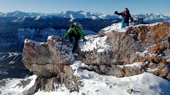
A bit more scrambling near the top

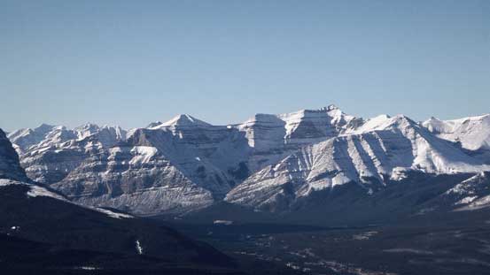
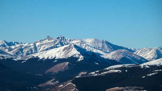
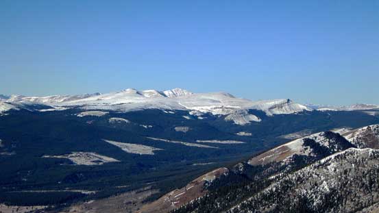
Summit Panorama looking towards the mountains. Click to view large size.
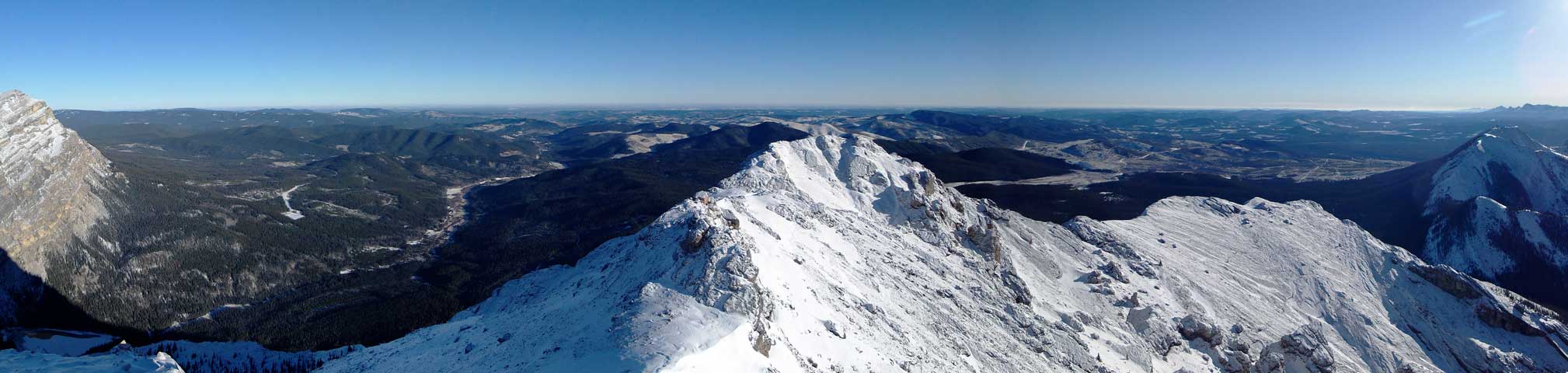
Summit Panorama looking towards the prairie. Click to view large size.
Dormer Mountain
Barrier Mountain
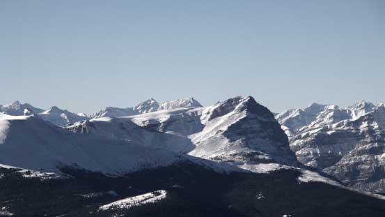
Warden Rock
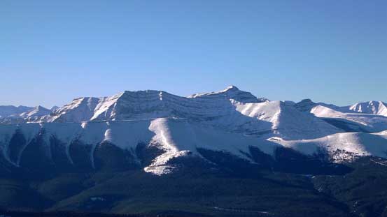
Wapiti Mountain
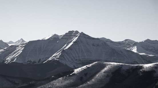
A striking but unnamed peak
Scalp Peak must be somewhere there

Me on the summit of Maze Peak
On the descent we basically just retraced our footprints. The place where we felt slippery in the morning was still slippery and hard on our knees but other than that the descent went uneventful. Our round trip time was 4.5 hours and it certainly felt like a short day.

Vern re-ascending a step
Descending the ridge
Descending the last steep slope. Slippery and hard on our knees…
Overall Maze Peak turned out much better than expected. It’s a short and very enjoyable outing. It does not have awkward bushwhacking nor long approach nor exposure and I’d recommend it as a winter scramble (or summer scramble) to anyone who loves the mountains.
