Nosebag Mountain
July 5, 2020
2244m
Lillooet / Seton Portage, BC
This is the easternmost named summit in Bendor Range that stretches a long ways south of Bridge River and Carpenter Lake from Gold Bridge all the way to Seton Portage in some remote countries of southwest British Columbia. The peak appears very much uninteresting on the map sources and has some very brief route information noted on bivouac.com. The rumour is that a trail runs up the long and undulating east ridge from Mission Pass on Seton Portage – Carpenter Lake divide but given the length of this ridge I seriously doubt about it. However, I did discover at least one cairn and some form of a trail on the uppermost east ridge after coming up from a different way, so who knows. Later I found out Clayton’s trip report on ClubTread but I somehow missed it when planning this trip.
Alex and I discussed about bagging Nosebag Mtn. in addition to Mission Peak to make a car-camping weekend trip. The most recent satellite images indicated there’s a recently-logged road that runs parallel to the east ridge starting from Mission Pass, for at least 15 km all the way to the base of Nosebag Mountain’s northeast flanks. We figured if we ever would do this peak then this was the only route that made sense. We had zero information about the status of this road other than it looked “okay” on the satellite images, so it’s a gamble that I wouldn’t put too much fate on.

Nosebag Mtn. via Carpenter South FSR. GPX DL
I noted to Alex that as long as we could get to within a “reasonable walking distance” to the road’s end we would do it no matter what. The start of this “Carpenter South” road wasn’t very inviting as it’s clearly just a narrow single track but I decided to try it nonetheless. After the initial hill the road improved. There were a few bushy spots along with some sketchy and narrow drop zones, but the road’s bed was in some superb conditions with zero ditch and rough spots. We did have to remove a couple fallen rocks. The mental stress factor was huge on the other hand, as we had no clue when we would hit an impassible obstacle and whether or not we could make a turnaround. This obstacle came at about 3 km to the road’s end and thankfully we could manage to turn around fairly easily. There were a few more obstacles after this landslide so I wouldn’t put too much fate on this road beyond that spot, even if it gets cleared up. We opted to car camp right at where we turned around, and decided to wake up at 4:30 am. There wasn’t a need to do alpine start for this objective, but we wanted to get it done and get out of this sketchy road as early as possible.

Car camping at 11 pm…
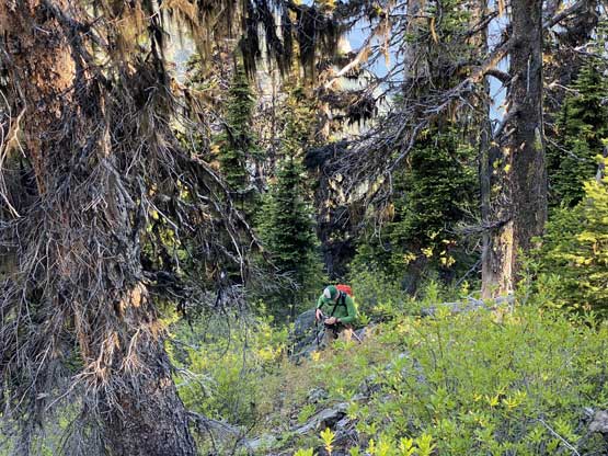
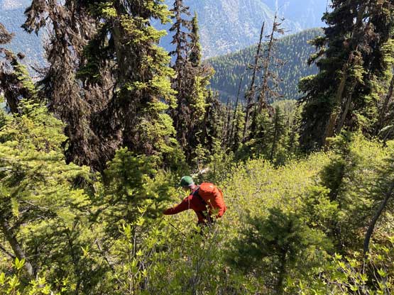
We discovered multiple obstacles beyond the landslide that stopped us so we didn’t feel bad to walk the remaining 3 km. There was some substantial amount of elevation loss and regain on the logging road that would certainly be frustrating on the return hike. It took us about an hour walking to the start of the bushwhack where I did a quick gear transition from trail-runners to mountaineering boots. The forest was steep and unrelenting but the brushes were not too bad. There was minor dead-fall issues and some underbrush higher up, but the bushwhack was no worse than “BW2” at least for the line we took. We stayed mostly on a ridge feature and that might have helped too. Higher up we encountered some rocky terrain but it’s always easier than it looked. We took a break just before the final grunt onto the east summit and the next thing we were arriving at the east summit soaking in some rarely-seen views.
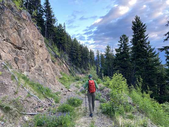
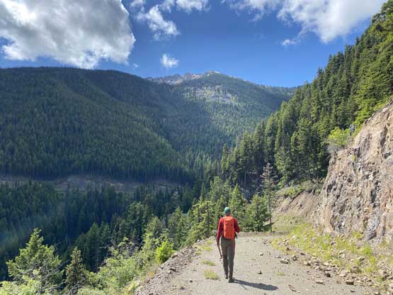
We had about 1 hour of road walk like this to start with..

Morning view of Carpenter Lake and the south end of Shulaps Range

Entering the forest. It wasn’t bad at the start

Some of the typical bushwhacking on our ascent line

Alex coming into an opening area
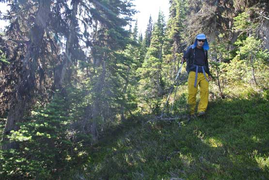
The upper forest had a lot of brushes but wasn’t too bad
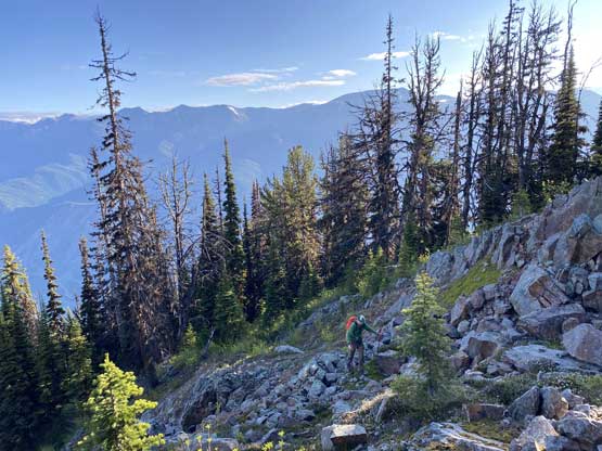
The north side of the ridge had some nice and open rocky slopes

Alex grunting up a steep open slope
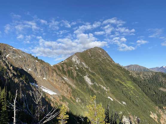
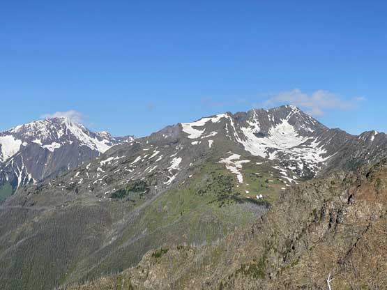
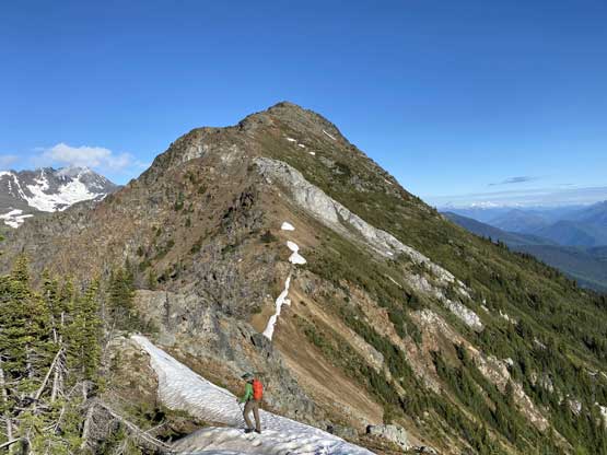
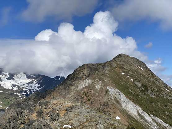
Our first unobstructed view of Nosebag Mountain

Me coming onto a flat stretch. Photo by Alex R.

A closer look at Nosebag Mtn. and the east ridge

A view up Whitecap Creek drainage towards Whitecap Mountain
This substantial summit to the NE of Whitecap Mountain doesn’t even have a name
All of these peaks are also unnamed..
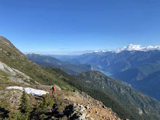
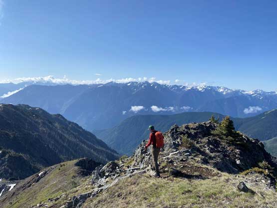
The traverse towards the true summit involved fair amount of descent into the col, which again would be frustrating on the way back. We utilized snow for as much as possible to speed up the descent. The ascent onto the summit via the east ridge was very straightforward but seemed to drag on for a long while.
Alex descending towards the saddle
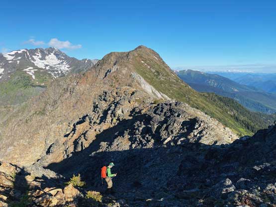
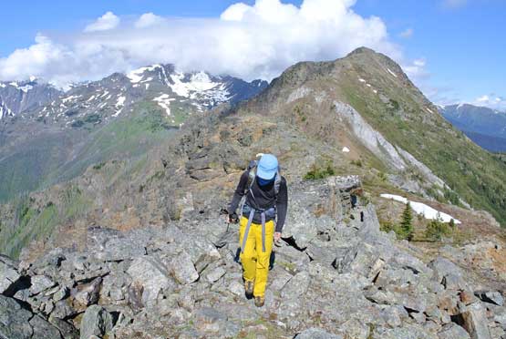
Nice and scenic ridge rambling
Alex with the true summit ahead

Summit Panorama from Nosebag Mountain. Click to view large size.

All of those unnamed summits to the SE of Whitecap Mountain

Looking down Whitecap Creek towards Mt. Seton in the distance
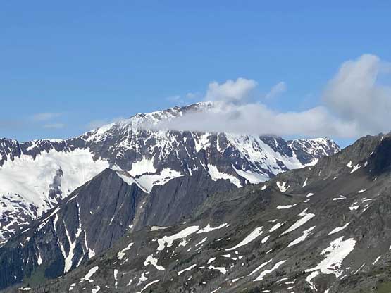
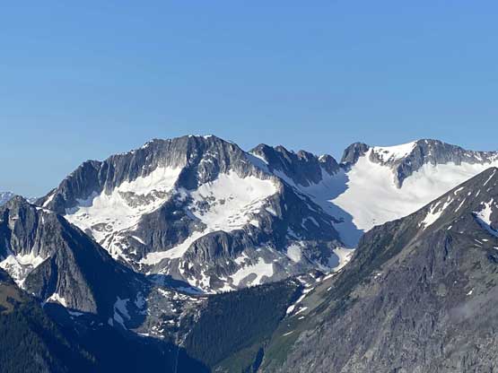
A zoomed-in view of Whitecap Mountain, 3rd highest in SW BC

Shulaps Peak is partially engulfed in clouds

This is looking towards Lillooet and Mt. Brew area
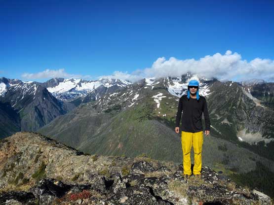
Me on the summit of Nosebag Mountain
We were hoping for a rarely-ascended summit but were disappointed to see a large summit cairn, along with some forms of a path and at least one other cairn on the east ridge. This showed that the locals must come up here fairly often but they don’t post on the internet. For us the city styled peak-baggers the mystery was still there to be resolved. We lingered up there for half an hour before committing to the descent. We easily traversed back onto the east summit and descended the route we took. We unfortunately got sucked a bit onto the face rather than the ridge and had to deal with some sustained “BW3” bushwhacking even though the descent line was no more than 50 m away from our up track. Lower down we merged back onto our up track and followed it down to the road with minimal bushwhacking. There was still an hour’s road walk at the end. The drive out of Carpenter South FSR wasn’t bad and we even got a rare cougar sighting.
Time to head home. It’s a long ways home, unfortunately..
Looking back at some big clouds starting to build up
Me slogging back onto the east summit. Photo by Alex R.

Alex heading down from east summit
Alex leading down into the bush. We had some BW3 to deal with

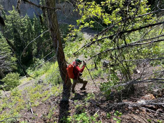
Me bushwhacking down. Photo by Alex R.
Another photo of me in the bush. Photo by Alex R.
Almost back down to the road now
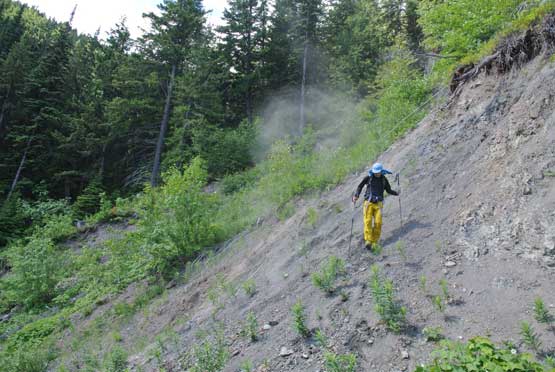
Me descending loose dirt onto the road. Photo by Alex R.

Carpenter Lake from the logging road.

Another photo of Carpenter Lake. This is a very long lake
As much as the road plodding went

It’s a cougar.. Oh wow…
The rest of the drive back home was such a gong show. I had to stop at the shore of Carpenter Lake to take a nap and had to make another stop just before Lytton, also to take a nap. I was exhausted. But after that I felt surprisingly fine but the traffic volume had jacked up considerably past Lytton. It was a bit of a slow show coming down to Hope, and once past Hope we were caught in a big ass accident. Thankfully we were there fairly early that the cops and ambulances hadn’t even arrived yet. Once past that accident scene the traffic didn’t quite improve. From Chilliwack all the way back to Langley it was a slow crawl that my Google app showed nothing but “red” and “orange” the whole way. I thought there for sure had another accident but nope, it was just because of the shear volume. I took a few detours to short-cut things a bit and saved probably around 20 minutes. The traffic on 16th Ave back into White Rock was pretty bad too with a huge line-up just before entering the town. We finished the hike at 10:30 am and eventually got back home at past 6 pm, not good for a journey under 400 km….
