Sunset Peak
November 24, 2013
2500m
Jasper – Skyline Trail, AB
Sunset Peak is an unofficial name of a small peak on the south section of Skyline Trail area. It’s the peak that guards Little Shovel Pass on its NE side. Most people don’t even know the “existence” of this peak and in fact, pretty much nothing shows up on Internet if simply searching “Sunset Peak, Jasper”. The name of this peak is only briefly mentioned in Chic Scott’s Summits and Icefields book and labelled on Gem Trek map. It’s so unofficial that I can’t even find a reference about how they got the name.
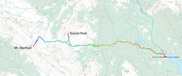
Sunset Peak and Mt. Aberhart snowshoe ascent route. GPX DL
In any case, based on the sparse contour lines on topo map, Ben and I figured it’s better done as a winter ascent. This was supposed to be done two weeks ago after the long trek up Elysium Pass, but due to physical exhaustion we had to postpone it. Two weeks later, good weather returned to Jasper area. We were also interested in the nearby unofficially named Mount Aberhart. They both look straightforward speaking technically, but anything on Skyline involves a long SLOG up one of the accessing trails. And to get them done in one day with heavy duty of trail-breaking in late November, we had to utilize the night time. This time we decided to start early. So we woke up at 5am at trail-head and after a long breakfast time we started at 6:20, about two hours before sunrise.
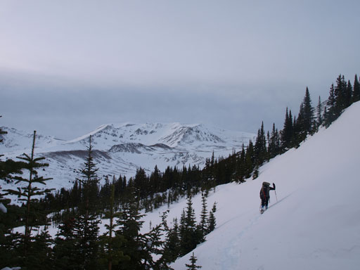
Ben had done the entire Skyline Trail a long time ago but I’d never been up the south section. Apparently I underestimated the work needed to slog up from this side. Despite the fact we’d start at Maligne Lake which has a much higher elevation than Jasper townsite, I found the south approach being more tedious and sloggy than from the north side (Signal Fire Road). The first section was 5km’s flat terrain to Evelyn Creek. Thankfully the trail was well maintained and very easy to follow in dark even with snow cover. The snow depth at trail-head elevation was about 20 cm and post-holing wasn’t too bad at this point. But thing started to get worse once we started gaining elevation. The switchbacks after crossing Evelyn Creek went on eternity and the treeline would never came closer, and at the mean time the post-holing got more and more tedious. Originally we thought about watching sunrise at above treeline and apparently we were too optimistic.
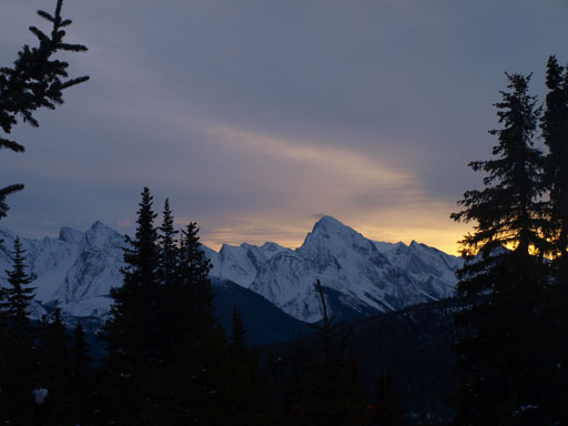
Samson Peak at sunrise time
There’s one avalanche slope to cross below treeline
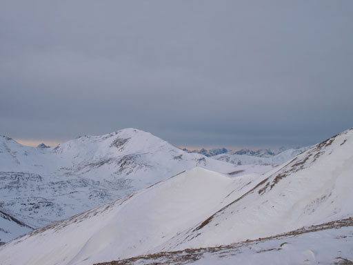
A group of unnamed peaks. Most peaks in this area are unnamed
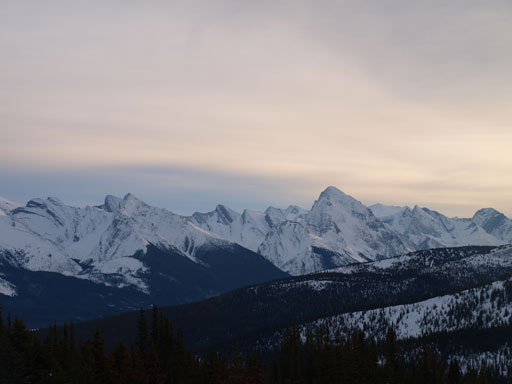
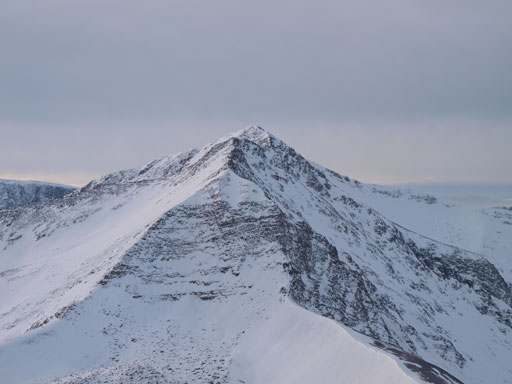
Samson Peak is the striking one; Leah Peak is the lower one on left.
Anyway we were getting there and eventually we passed Little Shovel Campground. Another half an hour or so’s slog we were looking at Little Shovel Pass in front of us in the distance, and our first objective, Sunset Peak, appeared to be a gentle slope on climber’s right side. The fastest way would be to escape from the trees as soon as possible to avoid more trail-breaking but that wasn’t the case for us since we had to do Aberhart. So we kept going towards the pass for quite a while until hitting the base of Sunset’s bare (wind-blown) slopes. We ditched our backpacks and snowshoes. The ascent slope was kinda foreshortened and took us quite a while and this peak was certainly higher than I thought (much higher than Bald Hills). The views were great though especially towards the Maligne Lake which wasn’t frozen yet.

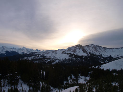
Almost at treeline now. Sunset Peak in the distance

Looking back from the same spot
Higher up, looking towards Mount Aberhart
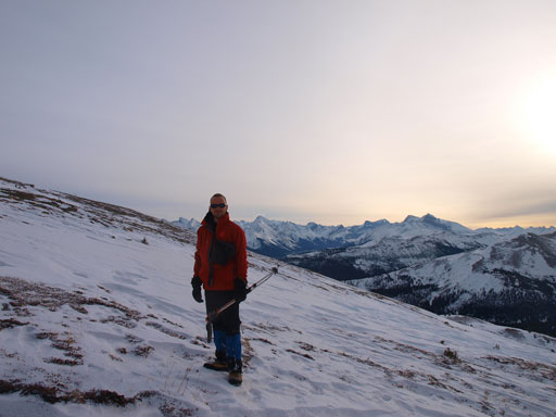
Ben on Sunset’s slope
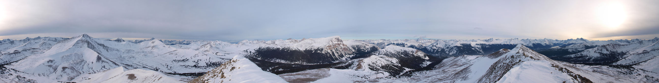
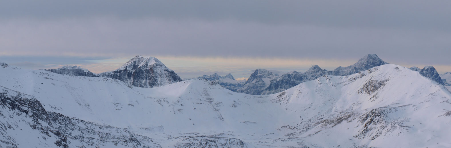
Summit Panorama. Click to view large size.
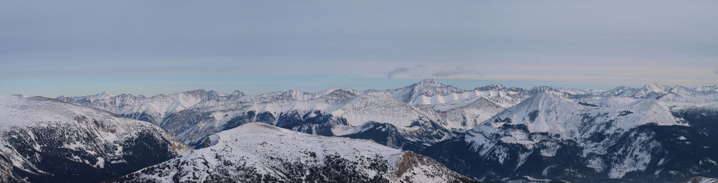
The front ranges. I don’t know much of their names
Many, many more front range peaks. Opal Peak right of center.
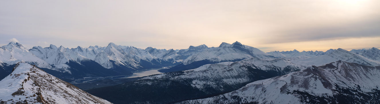
Panorama of Maligne Lake area
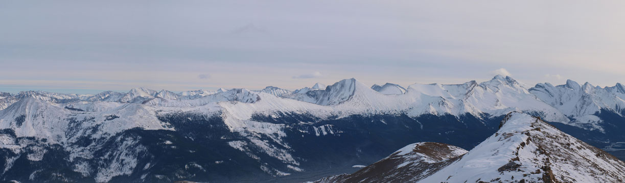
Panorama of Skyline Area. Big Shovel Pass left of center.

Even the Ramparts showed up!
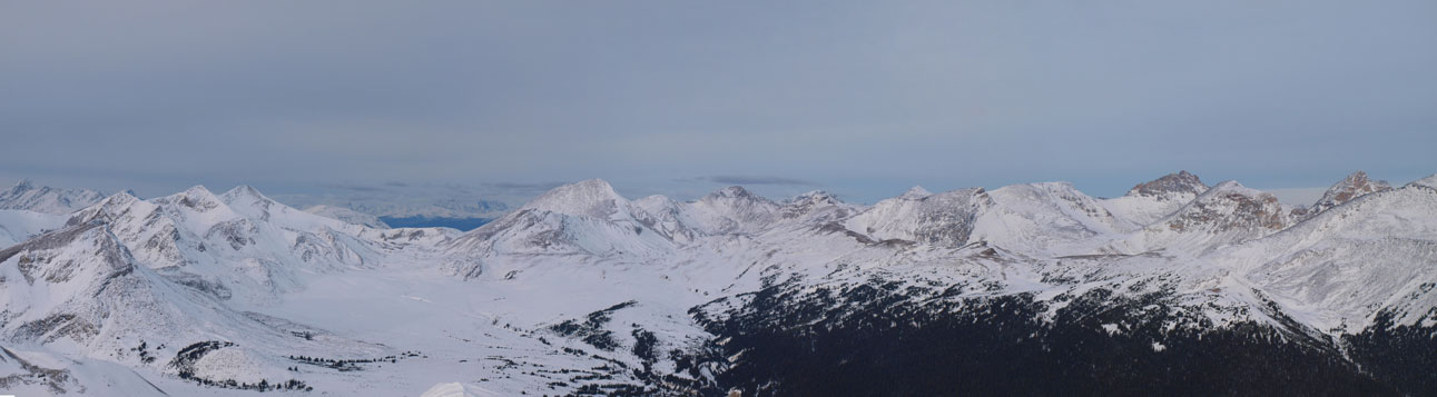
Mt. Hardisty (left) and Mt. Edith Cavell (right) poke from behind

Charlton and Unwin, with Monkhead, Warren and Brazeau behind
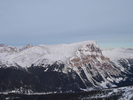
The Watchtower is the highest peak in Skyline area
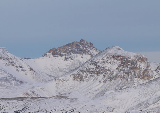
This higher neighbour is unofficially named “Trowel Peak” by bivouac.com
This interesting looking peak doesn’t have a name
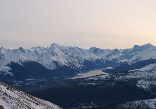
Maligne Lake
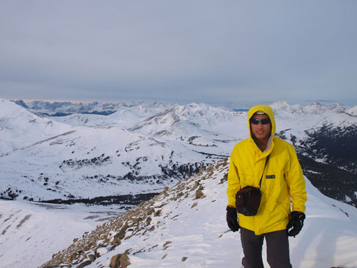
Me on the summit

Panorama from the summit again.
Since we still had a long day ahead we didn’t linger too long on the summit but immediately started to focus on the second objective of this day, Mount Aberhart.
