Mount Bourgeau
August 1, 2011
2930m
Banff, AB
Mt. Bourgeau is a fairly significant peak in Bow Valley and appears especially impressive when driving from Banff westwards along Highway 1 as this is that fortress-liked peak dominating the skyline. To reach its summit is a mere “easy scramble” and some folks may argue it’s nothing more than an off-trail hike. This seemed like the right idea for the 3rd day of this August long weekend. My parents and I just hiked up Tangle Ridge and then Fairview Mountain in the previous two days and we were looking for something a bit longer and a bit more scenic.
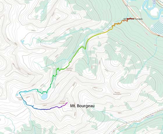
Mt. Bourgeau standard scramble route. GPX DL
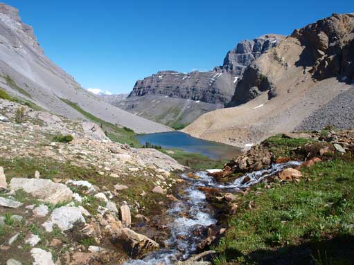
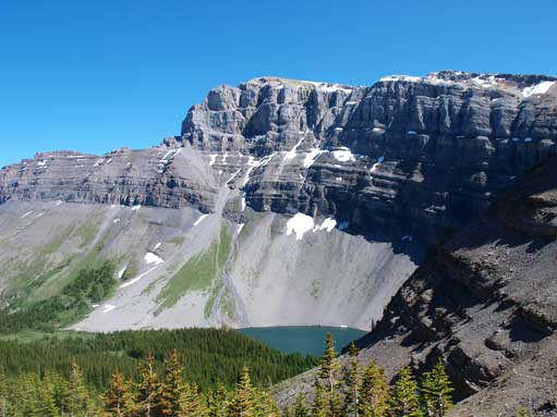
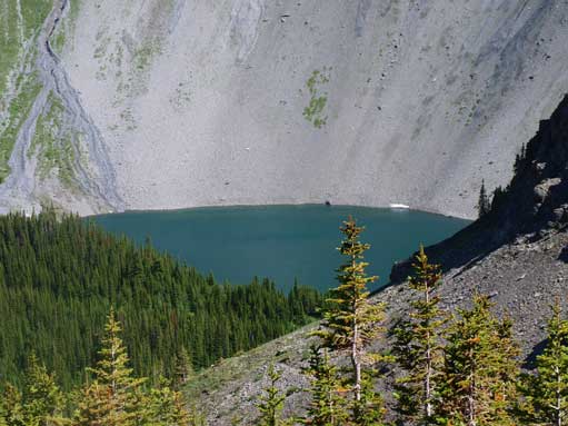
The trail-head is at Bourgeau Lake Parking Lot and was very easy to locate. The first 7.5 km of the trail to Bourgeau Lake was mostly in the forest with very limited view except for a fairly impressive waterfall about 2/3 of the way in. Then the trail climbed steeply up a headwall and soon after the headwall we entered a big meadow area, a typical bear country. Bourgeau Lake was 15 min away from this point. We rested at Bourgeau Lake for a while eating up all the berries that we brought up, as we didn’t want to encounter any bear on this day and we felt pretty lonely in this quiet morning. The view opened up as we following the trail/path towards Harvey Pass. We passed one unnamed tarn on this 1.8km trail, which was more attractive than Bourgeau Lake itself. Once at Harvey Pass, we could see the majestic Mt. Assiniboine rising above Harvey Lake.

After passing this waterfall, the trail grade steepens considerably

At the open meadows area, not far from Bourgeau Lake

The greenish Bourgeau Lake
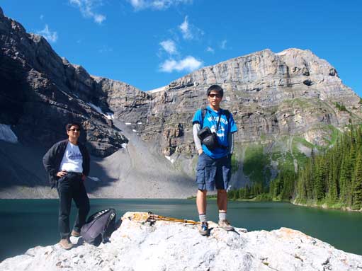
Dad and me

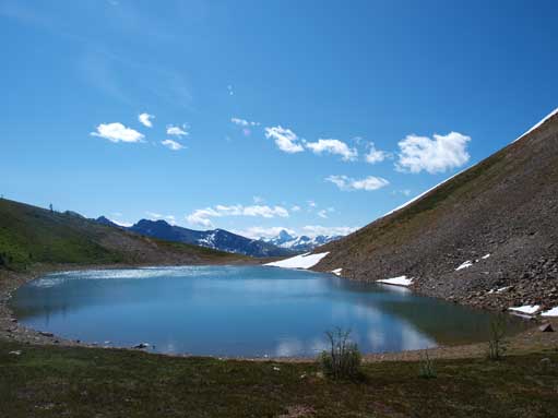
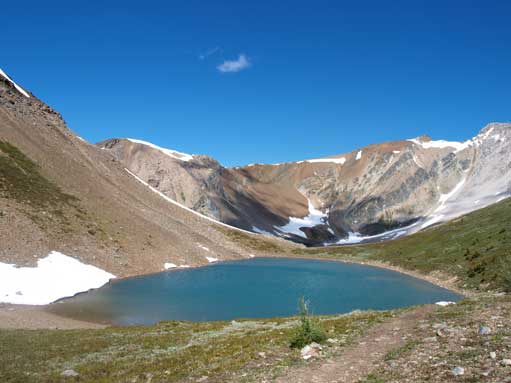
An unnamed tarn above Bourgeau Lake
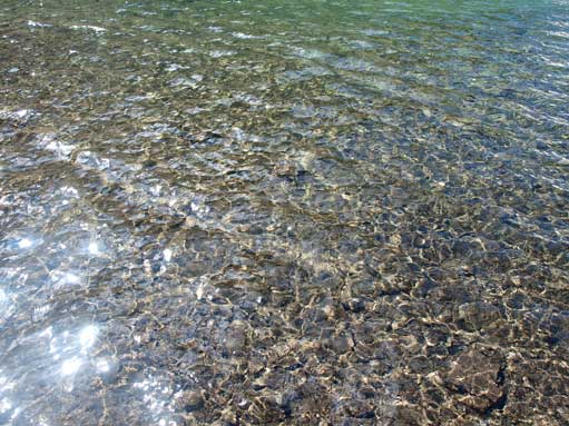
Water is crystal clear
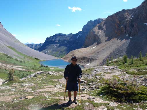
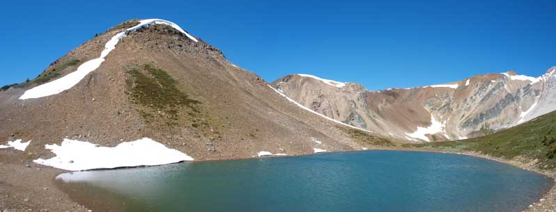
Me with that tarn behind
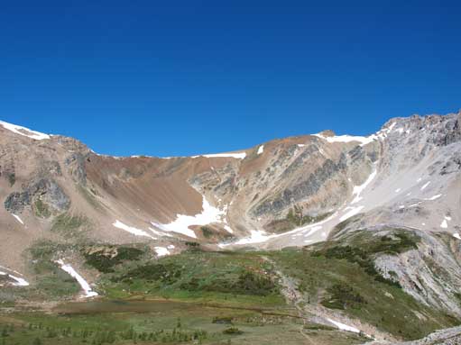
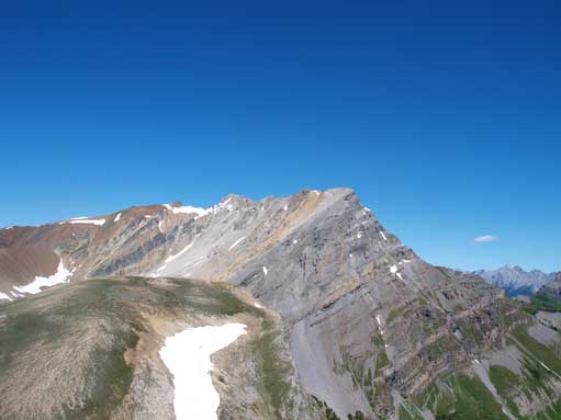
An interesting cirque on the subpeak of Brett
Harvey Lake sits at Harvey Pass. Assiniboine poking behind
Harvey Lake
Another shot of Harvey Lake
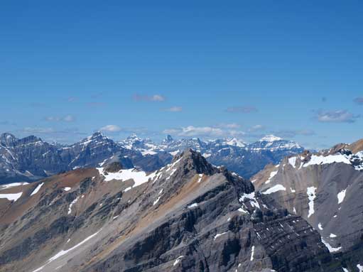
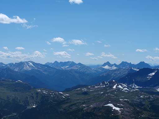
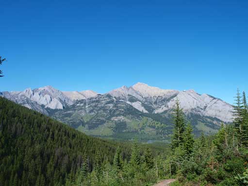
Now, we had to realize that it was still 3km long with 400m elevation gain to the summit of Mt. Bourgeau. However, by this point, all of the views to the west opened up. The higher we went, the greater view we could see. At one section the ridge narrows quite a bit. Mom wasn’t comfortable on exposure (well, I won’t call it exposed if you ask me now..), but we took our time and made through without incidence. At the summit, looking west, the Monarch and Mt. Ball dominate the view, and we could see as far as the Bugaboos in the Columbia Mountains. Looking north, Deltaform Mtn, Hungabee Mtn, Mt. Lefroy, Mt. Temple, and Mt. Hector rise behind the Massive Range. Looking east, Cascade Mountain and Mt. Rundle act as the guards of Banff town. Sundance Range and Mt. Assiniboine dominate the view to south-east and south, respectively. It was well worth the effort. Due to the big weather station and the flat summit, we had to wonder around quite a bit to soak in all of the views.
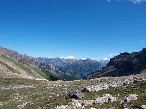
On the shoulder now. View opens up widely. This is looking back through the valley we’d just travelled through
A subpeak of Mount Brett
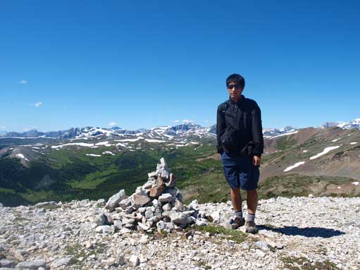
Me
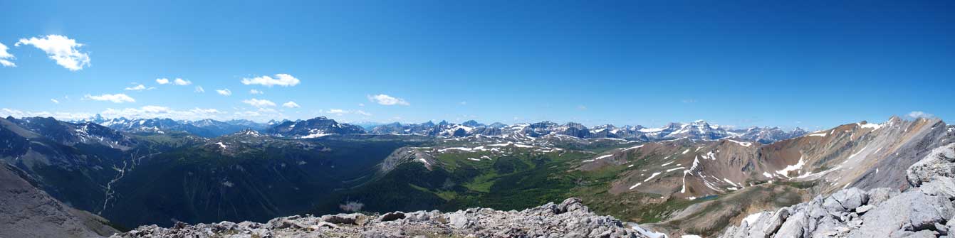
A panorama of Sunshine/Healy Pass area, with big mountains behind

There’s one somehow narrower section

This section gives a bit feel of scrambling
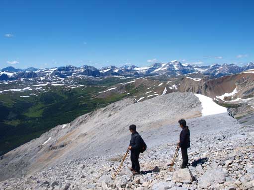
Dad and mon soaking in the views
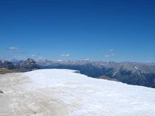
There’s a big cornice on the summit, obscuring the view

Looking towards Mount Assiniboine

Panorama of Massive Range
Zooming-in towards the Ten Peaks and Mount Temple
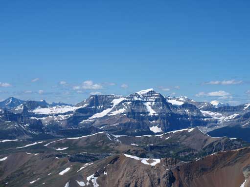
Mount Ball

Peaks in Kootenay N. Park
More peaks in Kootenay Park
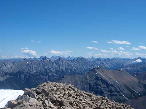
Sundance Range

Dad and mom on the summit, with the weather station behind.

Me on the summit
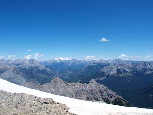
Bow Valley. Rundle on right; Cascade on left

We descended a bit to a lower sub-summit to get better views. This is looking back towards the main summit
We took our time on the way down as we all got tired. Mom slipped on the trail descending the headwall, but thankfully, no injury occured. Again, we felt uncomfortable on trail with big slope on one side by the time of August 2011… We didn’t linger around Bourgeau Lake as we were all scared of bears. We quickly made our way down, and the last 7.5km trail seemed to go on forever..

Mount Assiniboine

The unnamed tarn
The same tarn

Beautiful afternoon view of this tarn

More of this tarn
Bourgeau Lake and Mount Bourgeau
Bourgeau Lake
Mount Cory is the big one; you can also see The Finger on left.
Overall I think we picked a great set of objectives as one of my first few trips in the Canadian Rockies. Tangle Ridge, Fairview Mountain and Mt. Bourgeau have some similarities in the way that they’re all “easy scrambles” without very minimal objective hazard. The views were wide open and the approach is all fairly well defined.

What kind of gear do you think is required for this scramble/hike?
You don’t need special gears. Food, water, clothing, poles, headlamps, good hiking boots etc