Cemetery Hill
February 14, 2021
261m
Agassiz / Fraser Valley, BC
Cemetery Hill and Hopyard Hill are two lowly but officially-named bumps near Agassiz completely covered in trees with no trail/road that goes up their flanks. The satellite images review nothing but “green” on their slopes and I expected no view from their summits. There was no information regarding the ascent of any of these hills. I estimated these to be the worst dumpster-dives in Fraser Valley and I was correct. The forested travel was a lot worse than I anticipated with sustained “BW3” bushwhacking in pokey and brambly plants, and that’s in winter time when the leaves were dead. Maria C. “Ecowahm” and I wanted to get out together but the weather was not quite cooperating. On top of that, Maria had time constraint that she couldn’t leave the city until 9 am and I had to be back in town for work at 4:30 pm so our options were limited to “dumpster-diving”. I had done most of the pimples and bumps in Fraser Valley with the exception of Cemetery Hill and Hopyard Hill.
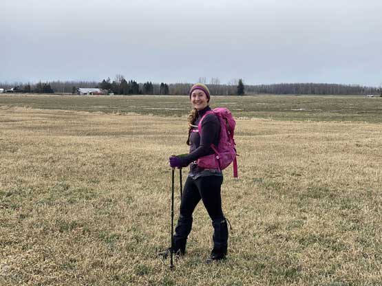
My original plan was to bushwhack up one, drive over and bushwhack up another one. Maria proposed an idea to do both as a traverse, making a heart-shaped loop because this day happened to be the Valentine’s Day. To link them up we would have to trespass some farm lands but I thought this was a cool idea so agreed. I had done all kinds of trespassing to bag peaks including one in a military base so farm lands wouldn’t bother me at all. Maria and I met in Langley at around 9:20 am. I let the Google Map to direct us to what seemed like a decent starting spot right next to Fraser River and once there, we were pleased to see that spot was actually designed for parking.

Cemetery Hill and Hopyard Hill tresbagging loop.
We decided to complete this loop in a clockwise fashion bagging Cemetery Hill first as this one appeared slightly easier than the other one. From where we parked we walked north along a road for over a kilometer to the base of Cemetery Hill. The dive into the forest appeared troublesome with extremely dense brambles guarding the bottom. However, there’s a house on climber’s left so we walked there and found a reasonable spot to get into the forest. I expected the forest to be most open and easy travel but the reality was the opposite. There sure wasn’t a lot of brambles but the underbrush was dense and sustained. The plants were very stiff, pokey and broke upon grabbing. This was a bit contrary to what I’m used to in the Coastal forest and resembled the bushwhacking I had done in Arizona or more arid areas. These hill also boast over 200 meters of elevation gain so they weren’t as short as one might expect.

Walking towards the base of Cemetery Hill

Right off the bat Maria got to taste some loose rocks

We walked passed this house to search for a reasonable spot to dive into the woods

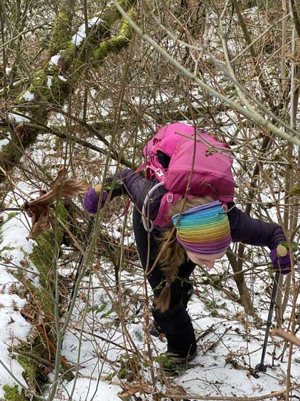
Maria hoping over an unavoidable dead-fall

Believe or not this was the easier parts
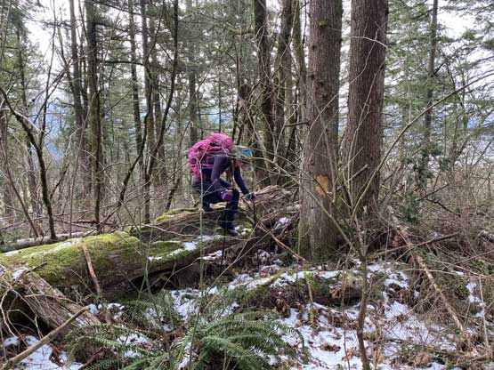
Just another dead-fall to hop over, with more pokey plants

Maria paid attention to details and found some mushrooms

Not sure why she’s still smiling…
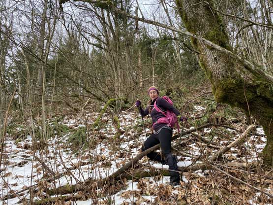
This sums up the ascent of Cemetery Hill

And yet there’s one more big tree to climb over
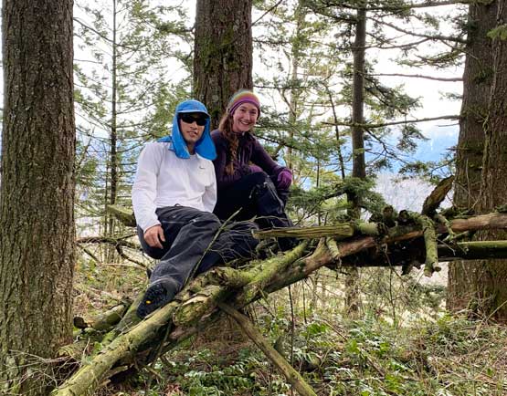
Maria and I on the summit of Cemetery Hill

Another group shot celebrating the success on Cemetery Hill
Once making the summit Maria and I immediately started the descent aiming for a south-eastern bearing in order to draw that aforementioned heart-shaped loop. I thought we must have picked a shitty line on the ascent but this descent route was just as bad with sustained bushwhacking the whole way. The downhill orientation surely helped us so the progress was not that slow. The exit of this line involved one 4th class down-climb with vege-belay and a band of very thick brambles that was impossible to avoid. Once down to the bottom we found a spot to hop across Hogg Slough (not frozen) using a dead tree truck as aid, then dived right into the farm lands aiming for Hopyard Hill.

This picture sums up the descent route.
Pick your poison. Your challenge is to do this in summer and I want to see it…

We were surprised to find a huge ass Douglas fir.

Maria descending into that 4th class lowering step

Using this tree truck to help hopping across Hogg Slough
Maria now walking across the (frozen) farm lands
