Kitt Peak
March 16, 2017
2097m
Tucson / Ajo Highway, AZ
Kitt Peak is more well known for the Kitt Peak National Observatory, the largest and most diverse astronomical observatory in the world with 24 optical and 2 radio telescopes. There is a winding, but paved road bringing thousands of tourists to (near) its summit every year. From geological standpoint, this is a fairly prominent peak at about 50 miles southwest of the city of Tucson in southern Arizona state, and also the highest in Quinlan Mountains so there’s still something worth noting. Judging by the location and the height I’d expect some outstanding views towards the surrounding desert landscape and I was absolutely correct.
I did this as a side trip on top of the long drive from Phoenix, AZ to El Paso, TX and earlier in the morning I had just completed a scramble up a roadside classic – Picacho Peak. I had the afternoon ahead of schedule but given the hotness I was not interested in anything outrageous. There is a paved road to pretty much the summit of Kitt Peak so I wasn’t going to fancy anything about it and a drive to the top and that’s it. The true summit would involve a few scrambling moves on granite boulders but that’s just a short detour from the upper parking lot.

Kitt Peak motorized ascent route via SR 386
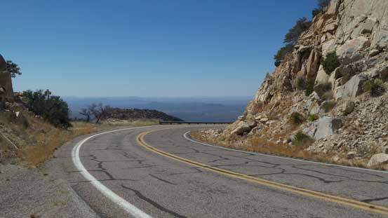
For the sake of reason this is essentially a motorized ascent I’ll have to talk about the drive. Westwards along Ajo Highway from Tucson the “atmosphere” felt pretty remote partly because of the desert landscape and party due to the fact it’s very close to the Mexican border. There’s even one place that the border patrollers would stop you and ask some questions. They wanted to see your passport, where you are heading for and stuffs like that. The turn-off to SR 386 was well signed and the condition of this road was very good – 13 miles and all paved. The traffic was nearly non-existent which was not to my surprise and about half an hour later I arrived at the top. There are lots of roadside turn-offs so I took numerous stops for photo and I have to say I was never tired of those views.
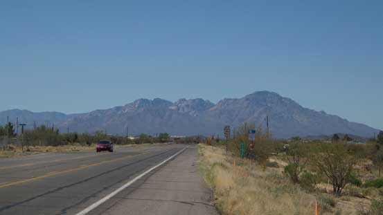
Kitt Peak seen from Ajo Highway
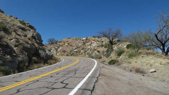
The start of SR 386
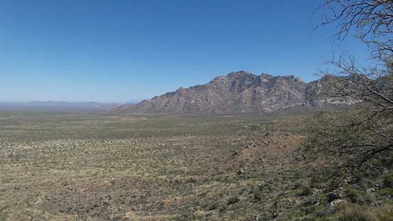
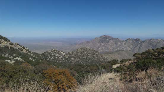
A look at Coyote Mountains from lower elevation
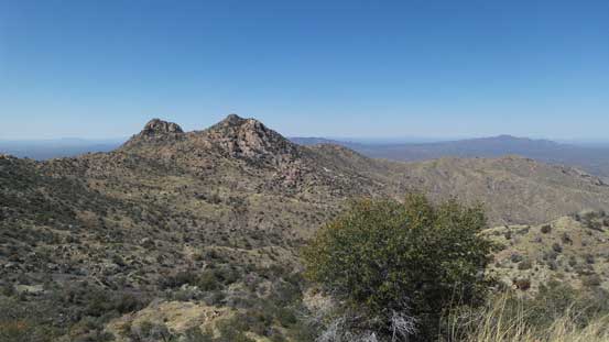
One of the bumps along the way.
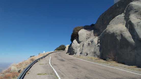
Driving into the sky
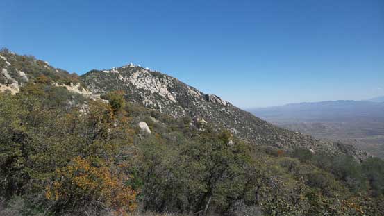
A look at the summit area

Gaining height rapidly. This is looking southwards

The summit ahead with that huge observation tower
From the upper parking lot, looking east towards Coyote Mountains

This is looking west. Note the road in foreground.
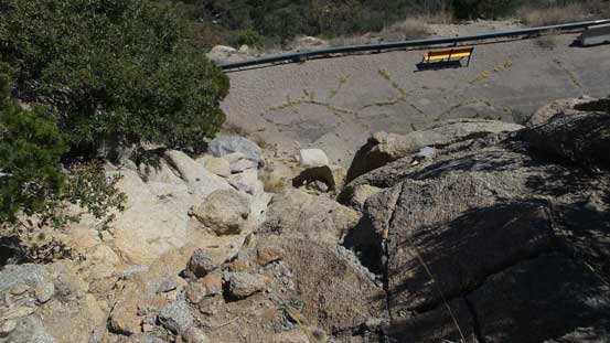
From the upper parking lot I firstly walked back for about 200 m along the road and then took a side branch towards the tourist’s observatory tower. I did not go into it and instead, left the road and went for a short scramble to the true summit in order to “claim” this peak. There was surprisingly some fun scrambling on granite rocks. I then went into the observatory tower and took the elevator to the second floor. Ironically that was the highest point anyone without permission could visit, but still not the highest point as the true apex would be the top of this building. Oh well.. Back down to the road I walked all the way to the southern edge of this large summit plateau and got some nice views looking towards Baboquivari Mountains before leisurely walking back to the parking lot.
Walking up this side road (closed to vehicle travel without permission).
The scrambling section to get to true summit.
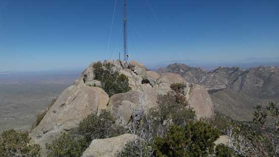
This is the true summit ahead.
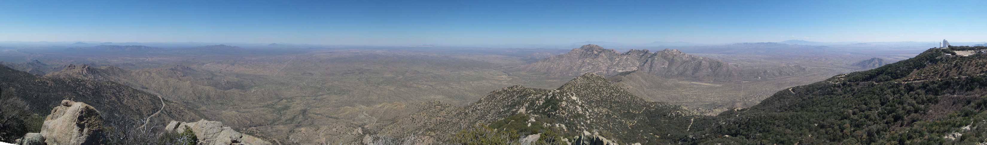
Summit Panorama from Kitt Peak. Click to view large size.

Coyote Mountains to the NE
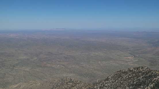
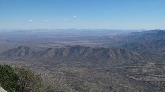
A vast Sonoran Desert landscape looking north.

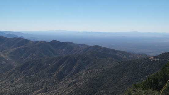
This is looking east. Mt. Wrightson on the skyline.
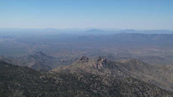
Looking west into the barren Tohono Nation Reservation
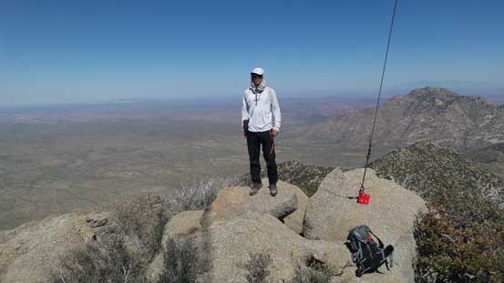
Me on the summit of Kitt Peak
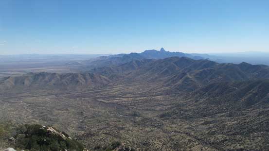
From the southern edge, looking towards Baboquivari Mountains
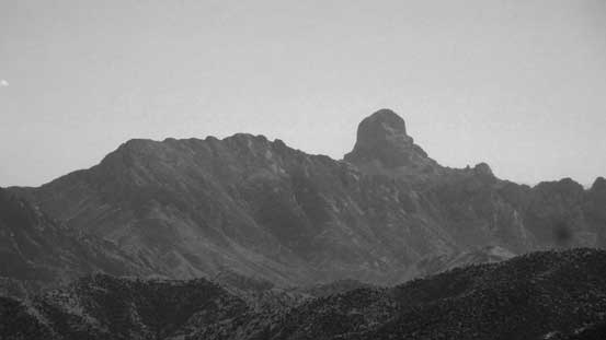
A zoomed-in shot at Baboquivari Peak – easiest route goes at 5.6
More about looking south. In the distance it’s Mexico
A south-east view.

Looking back towards the summit area.
Turning the engine on I wasted no time and drove down that winding road, and then another hour or so later I was back in Tucson. Seeing a Subway on the side of the road I took a short stop for a (very late) lunch and then resumed the long drive eastwards. The desert landscape in southern Arizona was very scenic and with weather on my side I enjoyed some spectacular sunset and dusk views at somewhere in between Benson, AZ and Wilcox, AZ. Then continuing due east I pushed all the way to Lordsburg, NM before taking the next break which was the very needed dinner stop. I was already tired now but it was still far from my pre-set destination of this day, so pushed on. Then through the metro area of Las Cruces, NM I crossed the state border into Texas. Following the instructions in my iPhone I went to a nearby Albertson in the city of El Paso for some food before continuing pushing on, and eventually after about half an hour down east along SR 62 I was completely done so pulled out and slept.
