Coronado Butte
March 12, 2017
2183m
Grand Canyon National Park, AZ
For those into peak-bagging, Coronado Butte is advertised as one of the best in Grand Canyon’s south rim. Elevation wise this is one of the taller buttes with its summit height almost the same as the south rim’s, while position wise Coronado Butte sits roughly halfway between the Village and the Desert View observation tower. There’s a decent trail heading down (New Hance Trail) from the rim but it’s unmarked on the park’s map and in fact, there’s even a “no parking” sign at the trail-head to discourage anyone who wants to visit this place. For that matter you’d have to park at one of the few pull-outs nearby which can fit only 3 to 4 vehicles so there’s plenty of solitude around this place. On top of that, the easiest route to reach this summit goes at “3rd class” scramble with plenty of route-finding challenges and is certainly not for the faint-of-heart. Summing it up this sounds just like the adventure I was looking for so on the 3rd day of my stay in Grand Canyon, I knew I had to check this one off.
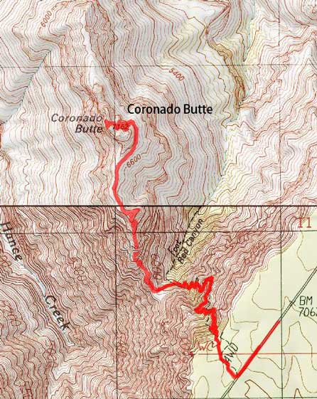
Coronado Butte scramble route. GPX DL
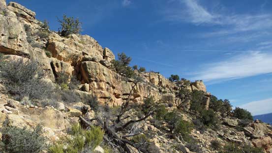
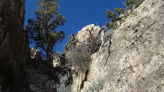
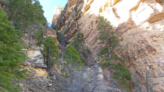
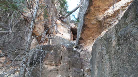
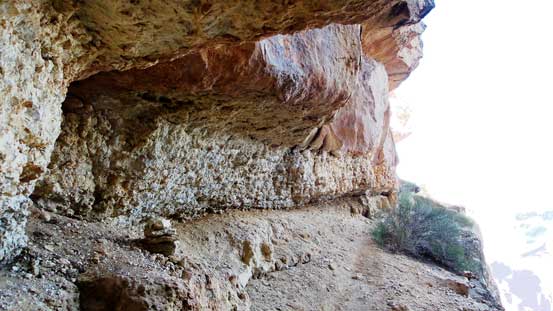
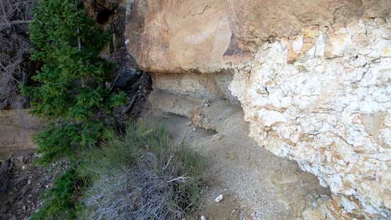
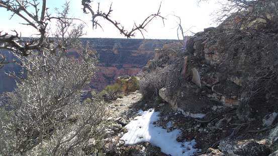
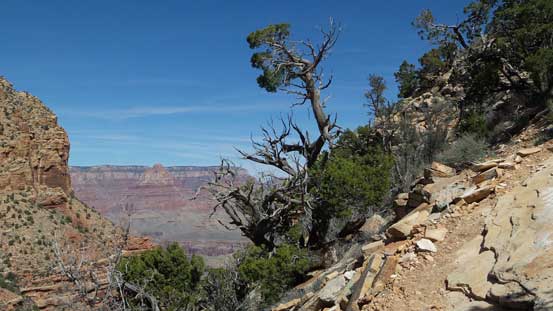
I did not bother to watch sunrise on this day. I slept in till pretty much whenever I wanted, had some breakfast in the small town of Tusayan and then drove northwards into the park. There were already three cars parked in those aforementioned pull-outs but I did manage to get a spot. After gearing up I walked backwards (towards west) for about 500 meters and then correctly located the trail-head, with some very clear signs saying “you cannot park here”. I had no idea why they wanted people to stay off this trail but I did not see any sign of “no hiking”, so into the woods I went. A short stretch of dirt roads led me to the proper trail-head and here it’s becoming more “official” again with maps, registrations and so on. Just like the previous two days I encountered ice on the very upper reach of New Hance Trail but they did not impose much of a problem. This trail was also considerably steeper and rougher comparing to the Bright Angel but for someone coming from Vancouver coast I would not call this “steep” nor “rough”, not even close.. 400 vertical meters down into the canyon I left the trail and headed for the saddle.

This is the Jeep road leading from Highway towards the trail-head
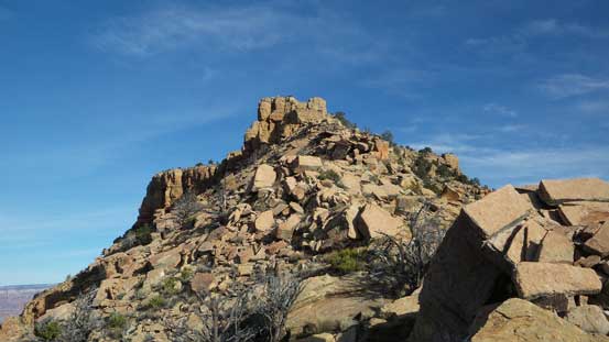
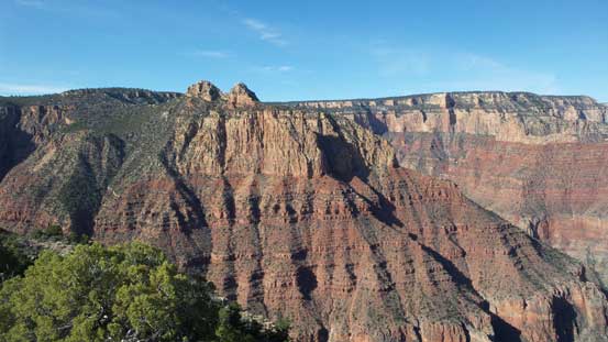
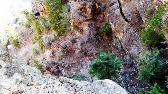
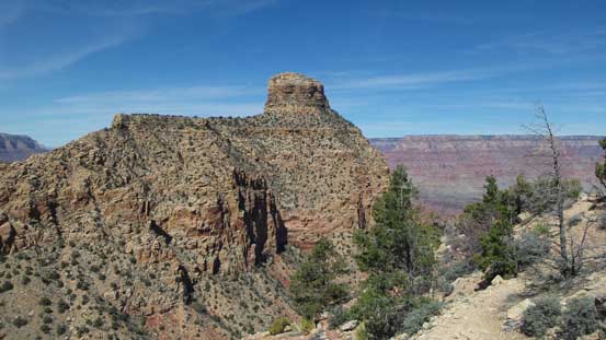
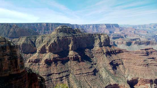
Down below the rim, this is the first sight of Coronado Butte
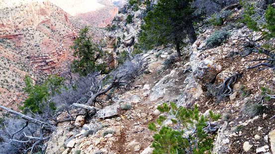
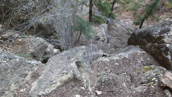
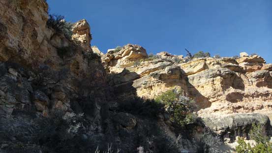
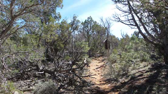
The typical conditions on New Hance Trail
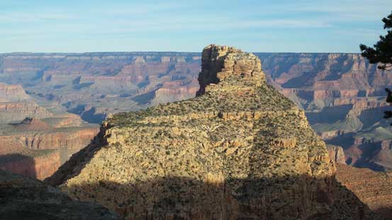
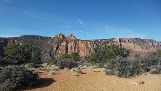
Coronado Butte catches everyone’s eyes who hikes down this trail.
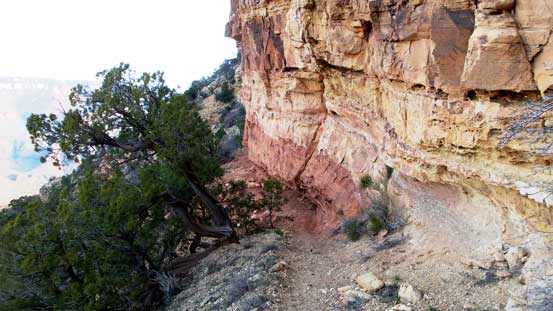
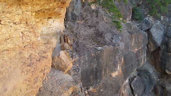
The trail traverses around a corner
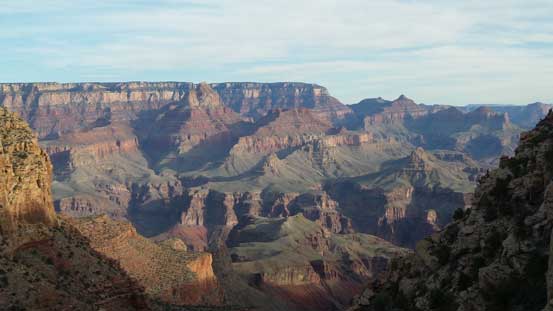
Morning view of the Vishnu Temple, Jupiter Temple, etc. on the North Rim

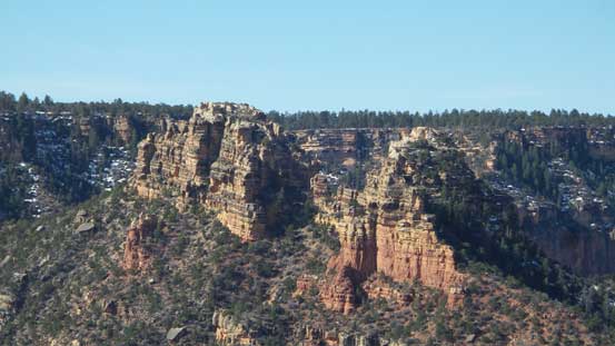
The striking twin peaks of Sinking Ship
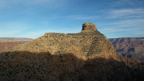
Another look at my objective – Coronado Butte
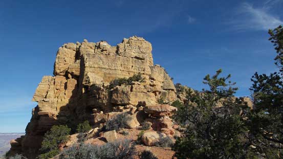
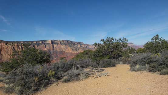
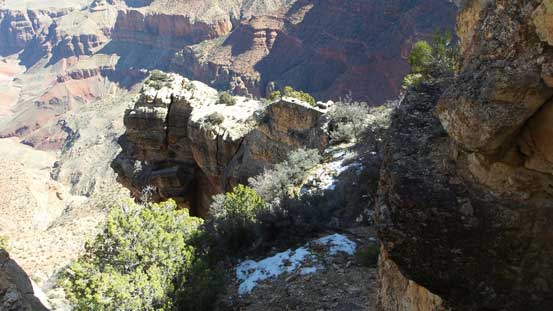
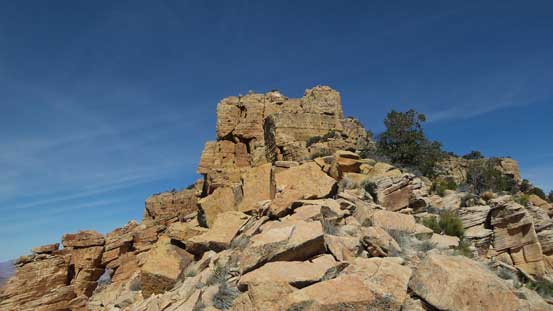
Upwards from the saddle the route was initially very obvious – just follow the spine of the ridge up. It’s mostly a class-1 or 2 trudge with occasional use of hands for balance as there’re plenty of boulders around. The first obstacle came near the “middle bench plateau”. Just below the plateau there’s a cliff band which I must skirt around on climber’s right side for quite a ways to find a break. The gully that breaks this band has a very characteristic tree in the middle and I spotted it instantaneously upon arriving. The traverse of the “middle bench/plateau” was nice and scenic but then looking ahead the summit fortress was pretty intimidating.

From the saddle, looking ahead up the lower slopes
Looking sideways across the lower slopes
Grunting up into the sunshine…
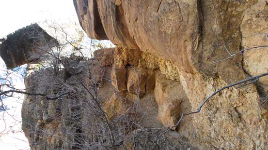
This is the first obstacle that must be skirted around on the climber’s right side
Skirting around on climber’s right side
Finding a break to gain the plateau
This break in the cliffs was easy to see
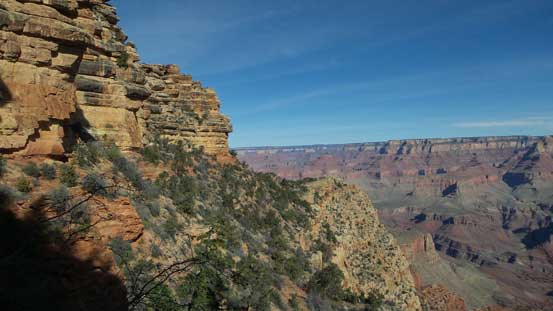
Nice views from the plateau
Another view from this plateau
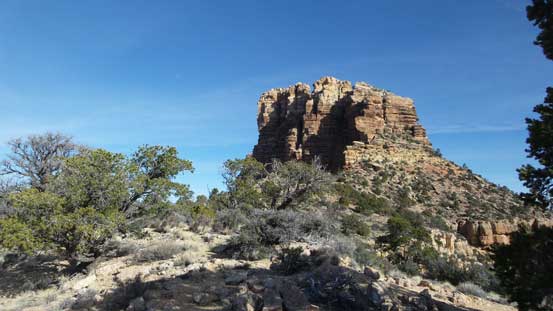
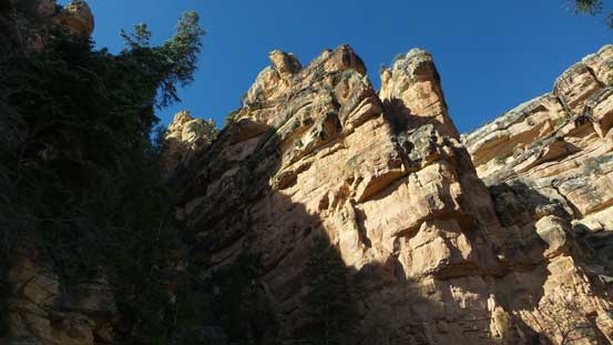
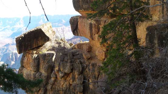
Looking ahead towards the summit block

Agaves..
Sinking Ship

Looking back at the plateau
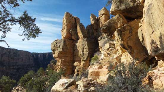
Just like The Battleship on the previous day the attack of the summit block starts from the climber’s right (east) side, but this time I did not have to skirt all the way around to the far NE corner. The route consists of three parallel gullies on the east face and you partially climb each of them in a sequence. The details sound complicated on paper but once sticking your nose in, it’s actually not that bad especially given the few cairns marking the critical exit/entrance points. This time I resisted the urge of gaining elevation too soon and managed to follow the climber’s path most of the way into the first gully. The section in the first gully was the longest. There’s a down-sloping Class 3 step near the top of this section that felt a little bit awkward but nothing troublesome yet. Then traversing into the second gully was on a not-so-wide ledge hanging at least 30 meters in the air which was kinda interesting.
Traversing into the first gully. It’s a big one that cannot be missed.
Looking sideways across the summit block. The terrain is rugged here…
Going up the first gully
This is somewhere around the lower crux.
Near the end of the first gully where I had to traverse out to the right
This is the critical ledge linking the first and second gullies
Looking back at the narrow start of this ledge
It’s exposed….
Around a corner, this section is only about 1 feet wide with deadly exposure…

Looking ahead up the second gully
A review shot of the second half of the traverse into second gully
Another picture showing this narrow ledge
The ascent of the second gully was the easiest in my opinion. There’s no particularly cruxy step but the ground was a bit on the loose side. Exiting the second gully was pretty obvious too and the bench traversing over to the third gully was much wider than the previous one, so easy going. The crux didn’t come till the end where I had to climb up a short, but pretty blank wall near the top of the 3rd gully. I wouldn’t be surprised if there had an easier variation but since the route dumped me there I just gave it a go. The line followed a diagonal mode from bottom left to the top right with a few interesting moves to start with, but fairly short-lived, and then the next thing I was standing on the summit soaking in the views.

Scrambling up the second gully
This is the third gully
There’s still remnant snow on the upper portion of this route…

This is the upper crux of the route. Believe or not it’s only “Class 3”

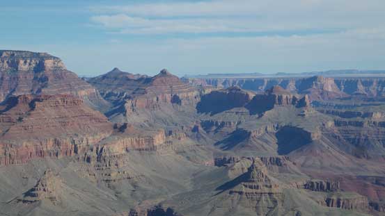
Summit Panorama from Coronado Butte. Click to view large size.
The twin summits of Sinking Ship are now below me

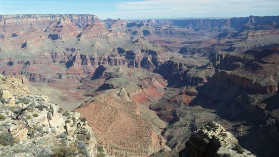
Looking at the North Rim. Angels Gate is that striking peak in the foreground
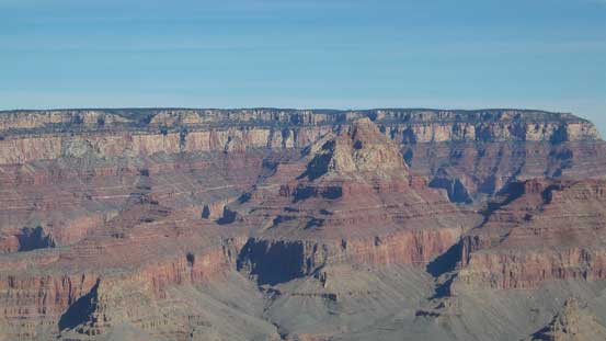
A closer look at Vishnu Temple, foreground right of center
Jupiter Temple, Gunther Castle and other peaks upstream in the Grand Canyon
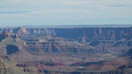
This is also looking upstream and I could see the upper plateau in northern Arizona

Escalante Butte and Cardenas Butte with Palisades of the Desert behind

Looking down at Solomon Temple and the Colorado River

The northern extension of Coronado Butte shows some impressive towers

Hance Creek which eventually drains down into Colorado River
A panorama of the Grand Canyon
Another shot of the North Rim

Me on the summit of Coronado Butte
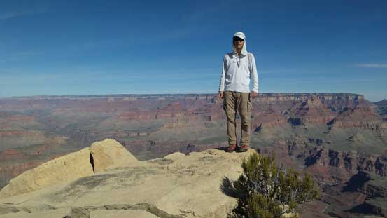
Another shot of me on the summit
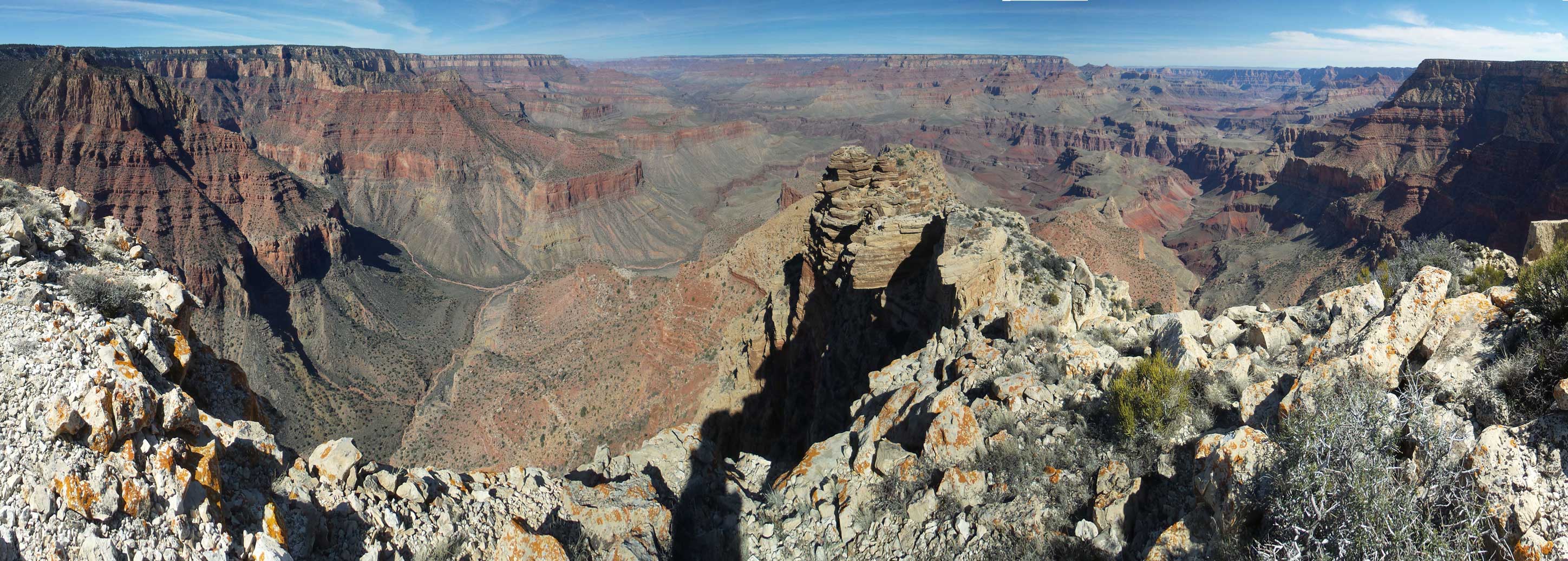
A full panorama from Coronado Butte. Click to view large size.
I did a lengthy stay on the summit since I had brought everything with me this time. Down-climbing the crux wasn’t too bad since I had fresh memories about those moves, although the down-sloping nature of the footholds did make some questionable “trusting”. The rest of the descent down into the first gully was smooth sailing followed by another difficult, but fun down-climb of the lower crux. And then it’s a scree plunge down the lower gully. There’s a lot of elevation to lose on the lower part of this mountain on nothing but rubble and boulders so felt quite tedious. Once back to the saddle I took another break preparing for the final 400 m grunt back to the south rim.
Down-climbing the upper crux
Traversing out of the third gully

Onto easier terrain now
The typical blocky terrain on the lower route

Almost down to the saddle now
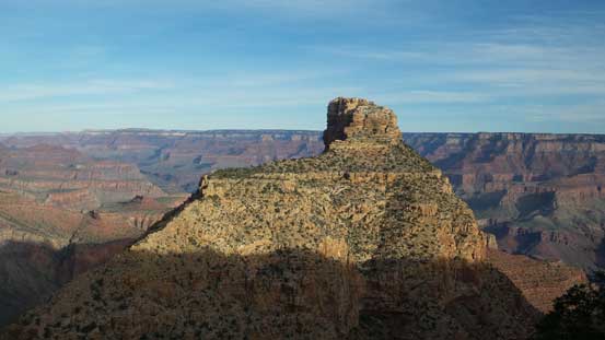
There’s not much to note about this last section of the grunt other than perseverance and patience. At this point I was already thinking about what should I do next so time flee by fairly quickly. Before going to Tusayan for food I went to check out the nearby Moran Point mainly to get a head-on view of the objective I just ascended.
Hiking up the New Hance Trail now
Looking back at my objective
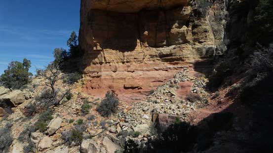
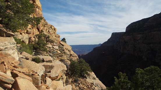
Some random shots from New Hance Trail
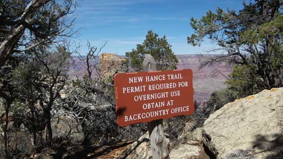
This is the trail-head sign of New Hance Trail
Back onto the rim now
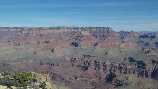
Coronado Butte from Moran Point
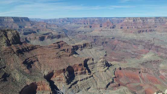
Grand Canyon from Moran Point

One last look at Grand Canyon from Moran Point
I then had a well-deserved Mexican lunch in Tusayan before heading south towards Flagstaff, AZ. I could easily spend another few days in Grand Canyon but I wanted to spread things out and visit more place. Weather looked good to give Humphreys Peak a shot for the following day so I had to move on. Now having the entire afternoon ahead I decided to hike up Slate Mountain in the SR 180 corridor north-west of Flagstaff for more views.
