Snoqualmie Mountain
January 26, 2023
1914m
Snoqualmie Pass, WA
(Updated. Based off the most recent survey using Theodolite and differential GPS units by Eric Gilbertson in Oct. 2023 the pinnacle ~200 m east of the tourist’s summit is proven to be roughly 2 feet taller, hence it’s the true summit of Snoqualmie Mountain. I’ll eventually have to come back to finish off the business. The following trip report documents the ascent of the west/tourist’s summit.)
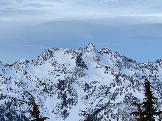
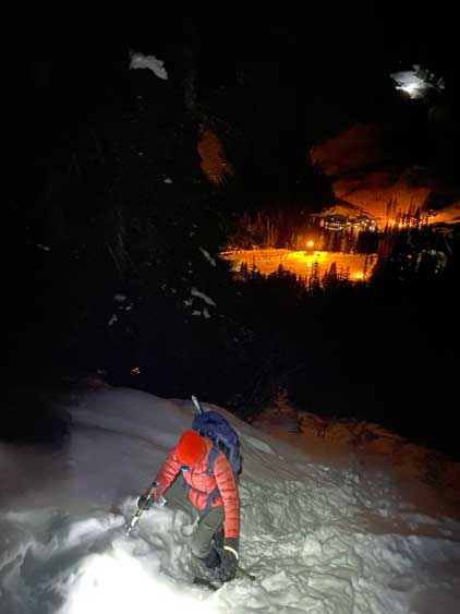
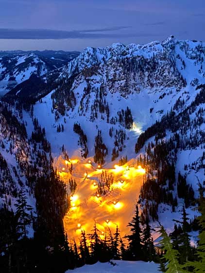
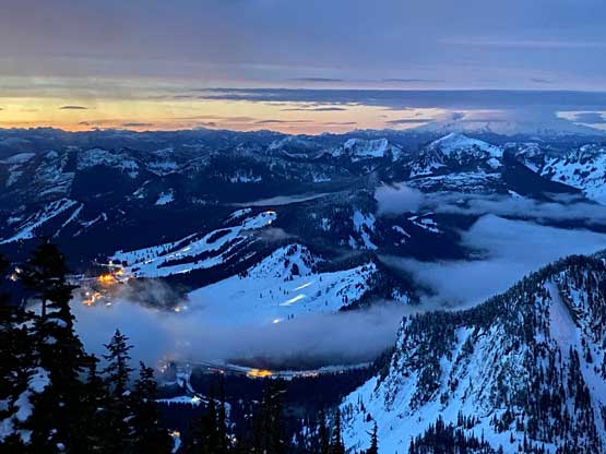
The namesake mountain of Snoqualmie Pass locates north of the pass right next to Alpental ski resort. This is a broad and ledgy summit visible from a lot of places. With the standard route being nothing fancier than a “walk-up” in summer months this is also one of the more popular objectives in the area. The summer route can also be done in winter when the snowpack stability is good. It’s a relentlessly steep grunt from the parking lot all the way to the summit. I determined that it’s possible to ascend this peak in dark, watch sunrise from the summit and then rush home for work in the afternoon/evening and I managed to convince Nikita to join force for the sufferfest. There’s a brief weather window on Thursday morning and we decided to see if we were lucky to get some incredible views. I wouldn’t be able to finish work until 10:30 pm on Wednesday night and we didn’t leave White Rock subsequently until 11 pm. As usual I always preferred to do this kind of trips with a car-camp instead of a single, home-to-home styled push.
I opted to drive us there in the Tacoma as I couldn’t make sure the entire drive would be snow-free. It turned out that the highway to Snoqualmie Pass was dry, but the secondary road into Alpental ski resort was mostly snow covered and slippery. I switched to 4×4 and I was glad to not be in the Corolla here. We made there in less than 3 hours. The trail-head was easily located but there wasn’t an obvious parking lot designated for hikers, so we drove back a short ways and parked in the massive skier’s lot. The alarm was set at 4 am so we had as much as 2 hours to catch any sleep.

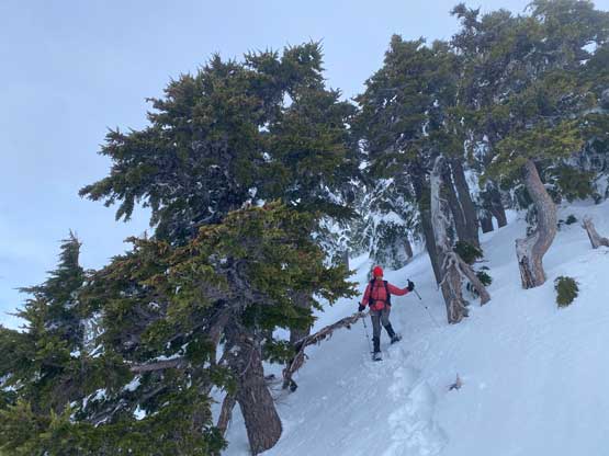
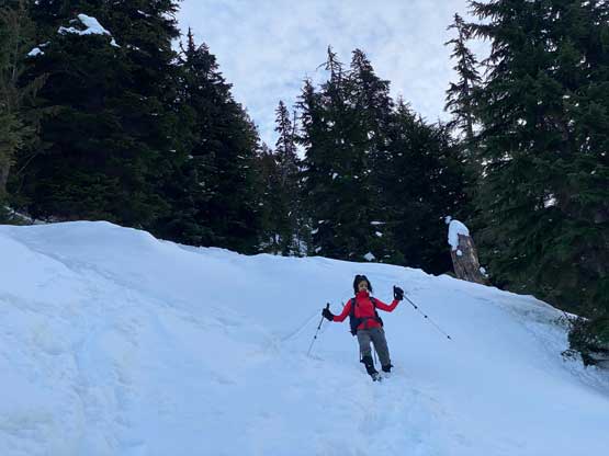
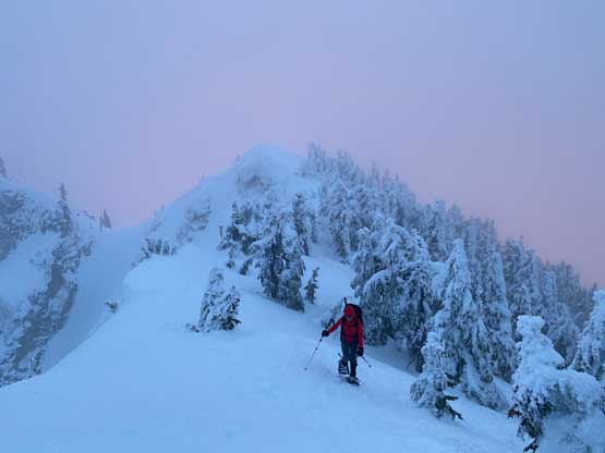
Dragging our tired selves out of the comfort of sleeping bags was technically the crux of the whole trip but my trips are j-o-b kind of commitments and we must execute the pre-made plan. The temperature wasn’t too cold and in fact, it’s a bit too warm to be ideal. While ascending the forest we got constantly “rained” from the snow melting on the trees, and the snowpack condition was horrible. There were about a foot of fresh snow from a couple days prior and this entire layer was either “mush” or “sugar” with minimal support. Thankfully a snowshoe track had been laid and we just followed. Without this set of tracks our work load would be easily doubled. There were a few particularly steep spots that required vege-belaying. We also ascended a little bit too high at 1350 m and were forced to traverse leftwards under some cliffs. After making a short descent into a gully we picked up the tracks again and followed into the treeline zone. A set of skin tracks that seemed to be made at least a day or two later than the snowshoe tracks showed up out of nowhere and we started to utilize this newer tracks more often.

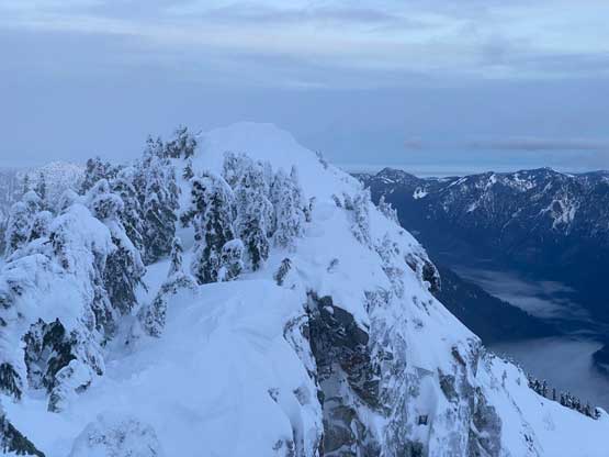
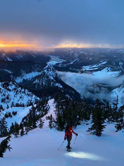
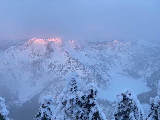
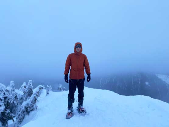
The snow condition improved as soon as we stepped out of the dense forest but the crust was still not able to fully support our weight. For the steep slope at 1550-1600 m elevation we opted to follow the snowshoe tracks and then we were on the broad south ridge. The slope angle on the upper route was actually the tamest but the winds were increasing and the temperature had finally dipped down to below freezing. The snowshoe tracks were mostly eliminated by the winds and the fresh snow so we either made our own tracks or followed the skin tracks. A layer of clouds had unfortunately engulfed in obscuring the summit, but morning horizon behind us to the south-east was still incredible. I thought we wouldn’t be able to see the actual sunrise but the views were “good enough”. As expected, we ascended into the white-outs and onto the cold and miserable summit. To our surprise the clouds then dissipated temporarily reviewing some views to the north, but again we couldn’t see the actual sunrise.


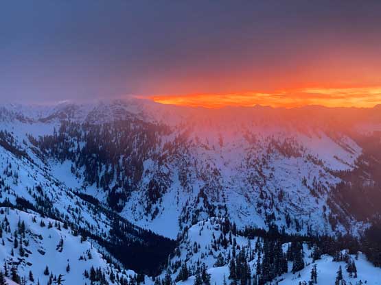


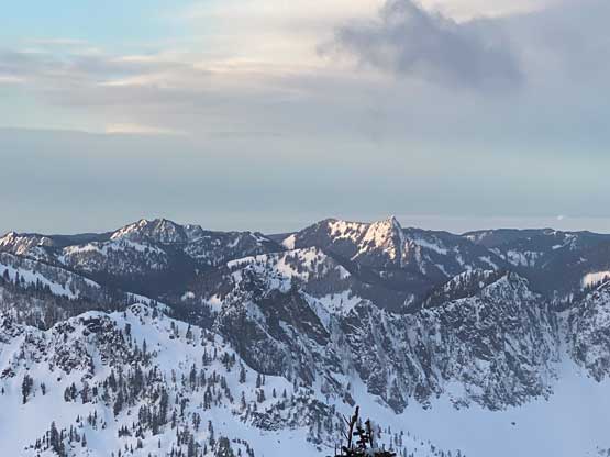
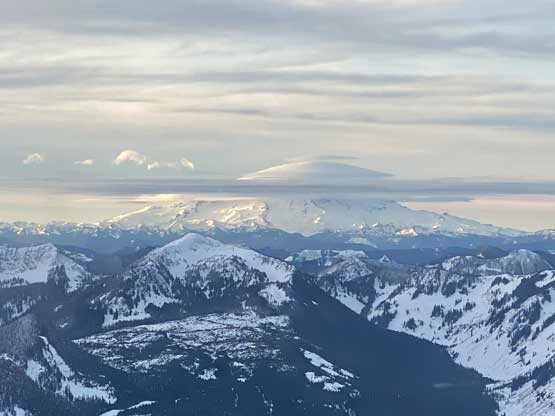
After determining the views wouldn’t get much better we reluctantly descended, mostly by following our own tracks. The breakable crusts on the upper route were horrible for downhill snowshoeing so we had to descend step by step. Thankfully the views kept improving so I constantly stopped for photos. The snow conditions changed to mush as we descended into the trees and that was also awful for descending on snowshoes. There was no plunging or gliding in this kind of condition and we must descend step by step as well, making some painfully slow progress. Our round trip time was 4 hours 15 minutes. We finished the trip just when the resort skiers started to show up for the day, and immediately drove away. I needed to pull over for one short nap along I-405 and eventually got us back to White Rock at around 1 pm. I managed to catch another hour of sleep at home, then showed up at work, unpacked and repacked at night. The next morning I would wake up at 3:50 am to fly to Monterrey, Mexico for a few days of peak-bagging.