Thunderbolt Peak (CA)
July 12, 2019
4268m
Bishop / The High Sierras, CA
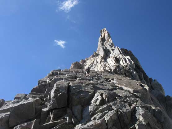
Thunderbolt Peak is considered by many as one of the two hardest 14ers in the “Lower 48” although some might argue that these two, Thunderbolt and Starlight, are merely bumps on North Palisade that do not boast enough topographical prominence to qualify as separate summits. However, the presence of Thunderbolt and Starlight is what makes the CA 14ers list attractive to me. Without the technical challenges on these peaks I doubt I’d ever be interested in the 14ers especially considering how far I have to drive to get there (from Vancouver, BC). The standard route on Thunderbolt Peak is via SW Chute – 3rd and 4th class scramble finishing on a 5.9 summit block, which is usually aided by a “lasso technique” well described in this linked article. The most efficient way to tag the summits of Thunderbolt and Starlight, along with North Palisade which is also one of the harder 14ers, is by a traverse of them. The ambitious plan is to traverse all five 14ers from Thunderbolt to Sill but it’s easy to lazy out on the last two making it a three-summit outing. A bivy along the ridge at 14,000 feet is required for all but the elitists.
With dreary weather persisting across all regions of BC, Alberta and Washington state I started checking weather forecasts for the far zones. I firstly considered Wyoming and Idaho but I didn’t like the chances of thundershowers. I wanted to go somewhere that’s 100% sunny and I sure found one at the very last minute – the High Sierras in southern California… I talked to Matt Lemke about going south and he agreed. The original plan was North Palisade via U-Notch Couloir but we jacked up the ambition to do the partial Palisade Traverse. With Matt’s technical expertise on complicated 5th class terrain I figured this might be my best shot on putting down the cruxes of CA 14ers. The next question was how to get there. I briefly considered flying but with such a short notice I couldn’t find a great deal plus I didn’t like dealing with car rental thing and we still had to drive a fair ways from Las Vegas or Sacramento. Driving down from Vancouver is about 18 hours not counting the traffic delays but such wouldn’t deter me. I picked Matt up from Bellingham at around 10:30 am and down south we went in the rain. The weather did not clear up until near Klamath Falls of southern Oregon late in the evening. We continued driving into northern California and found a decent spot to car-camp.
The next morning we resumed the drive. After a long boring stretch we took the first food break at Susansville, CA and then the next stop at Renton, NV. For both Matt and I this was our first time driving on the famed US-395 and I have to say the views were pretty damn awesome. It’s nowhere as drastic as the Icefields Parkway of Alberta, or the Sea-to-Sky Highway of British Columbia but as far as the standard goes in the SW desert states this is definitely a scenic drive. We briefly stopped at Mammoth Lake to meet up with Matt’s friend and chat about the conditions and climbing in Sierras. An hour later we stopped in Bishop for a luxurious Mexican dinner before driving up to South Lake trail-head at 2900+ m elevation. The temperature was pretty reasonable at the trail-head but the mosquitoes were horrendous. It was almost as bad as the Nunavik region in NE Canada and I regretted for not bringing my bug net. The trail-head zone was clearly labelled for “no camping” so instead of pitching my tent and winning a ticket we decide to just play dumb and sleep in the front seats of my truck. We spent at least half an hour swatting mosquitoes and the hot temperature made the sleep extremely uncomfortable. Needless to say, we both got nearly zero hour of sleep..
Thunderbolt, Starlight, North Palisade Traverse. GPX DL
The alarm went off at 5 am but we waited until almost 6 am to get out of the sleeping bags. We spent the next hour cooking breakfast and sorting gears. A couple additional items were ditched but it’s hard to go light on this trip because we needed to be prepared for rock, snow and overnight. The first hour of hike to Long Lake was uneventful. The north face of Mt. Goode stole the show and generally speaking I found this area much more rugged than Mt. Whitney zone further south. We started to encounter patches of snow and lost the trail several times. At the outflow of Saddlerock Lake we loaded the water bottles but we found better sources higher up halfway up the grunt towards Bishop Pass. The pass area was broad and flat and we again, lost the trail in the sun-cupped snow. We picked up the trail on the south side of Bishop Pass and followed it for a couple hundred meters before bailing for the long, cross country traverse towards the slightly higher Thunderbolt Pass.
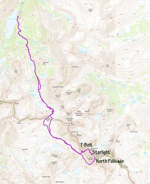
Alpenglow behind South Lake not far from the trail-head
The north face of Mt. Goode came in view
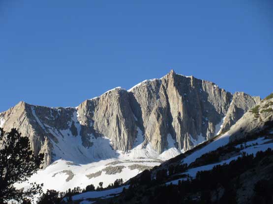
Mt. Goode and its reflection in Long Lake
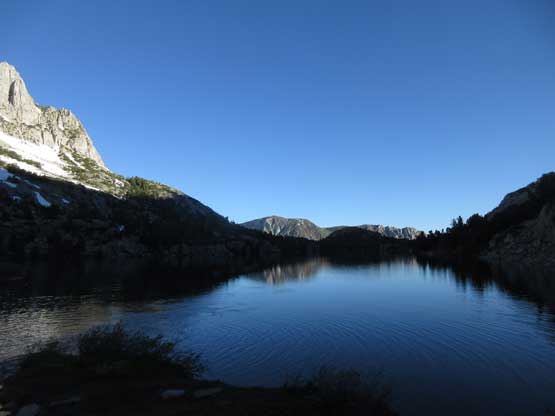
Another shot of Long Lake
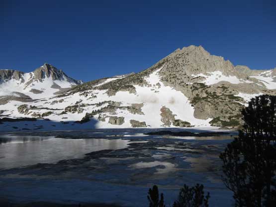
Saddlerock Lake and part of Mt. Goode behind
Another shot of Saddlerock Lake. It’s still partly frozen…

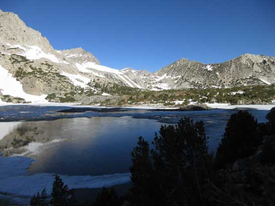
This is Bishop Lake with the mellow south slopes of Mt. Goode behind
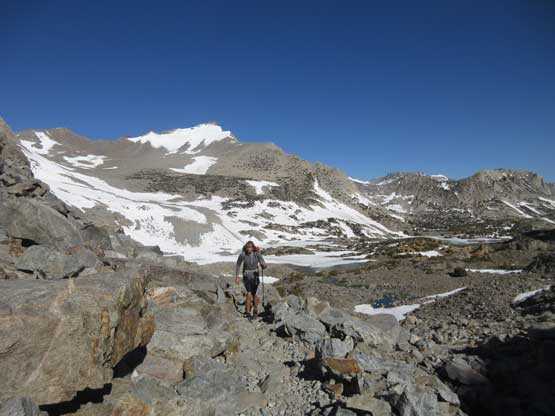
Matt slogging upwards towards Bishop Pass
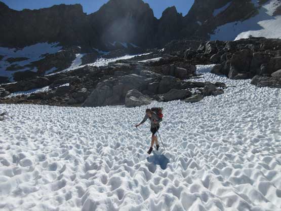
As you can see, the snow here is very sun-cupped…
Bishop Pass with Picture Puzzle (yes, that’s a peak’s name) behind

The broad and flat Bishop Pass at 12,000 feet

Picking up the trail down south side of the pass.
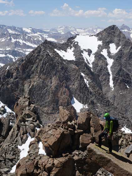
The first 1/3 of the traverse towards Thunderbolt Pass was easy on a mix of rock slabs and snow and there were still streams of running water to load up our water bottles. The later 2/3 of the traverse was a shit show slogging on sun-cupped snow. The sun cups were literally 2 feet deep at places and the snow offered little support. It was worse than post-holing and made us look like a drunk pair. After what seemed like a long time we topped out on Thunderbolt Pass, ditched some unnecessary gears (trail-runners, poles and some food), then cooked a Mountain House meal before starting the climb. The traverse is normally done by starting first thing in the morning with a bivy at Thunderbolt Pass, but we figured the snow gullies would be easier to ascend in the afternoon when the snow’s soft. Matt only brought microspikes for traction and I didn’t bring the steel crampons neither.
Columbine Peak to the south
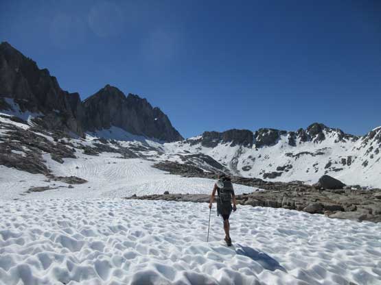
Ahead is the few kilometers’ plod towards Thunderbolt Pass
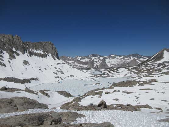
Barrett Lakes in Palisade Basin are still very much frozen
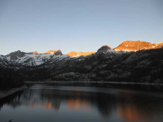
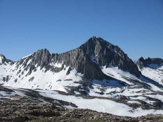
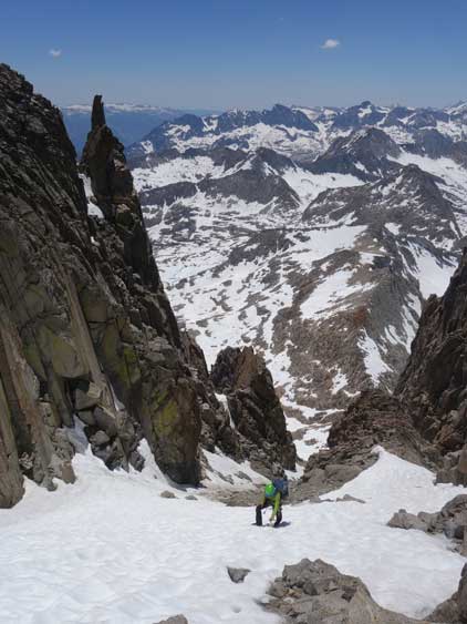
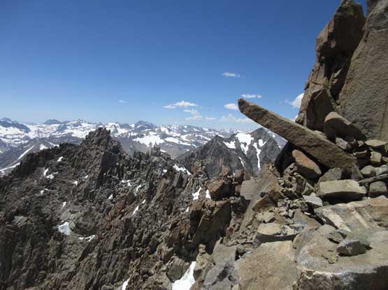
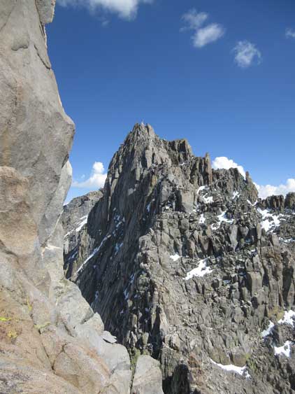
The west faces of North Palisade are super impressive
At Thunderbolt Pass, looking back at the west faces we just traversed under
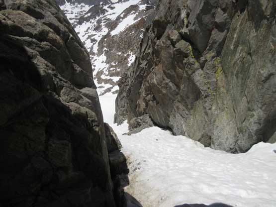
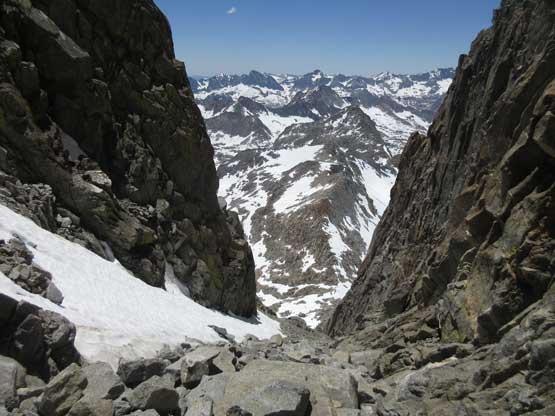
Dropping down the south side of Thunderbolt Pass to head for the chute
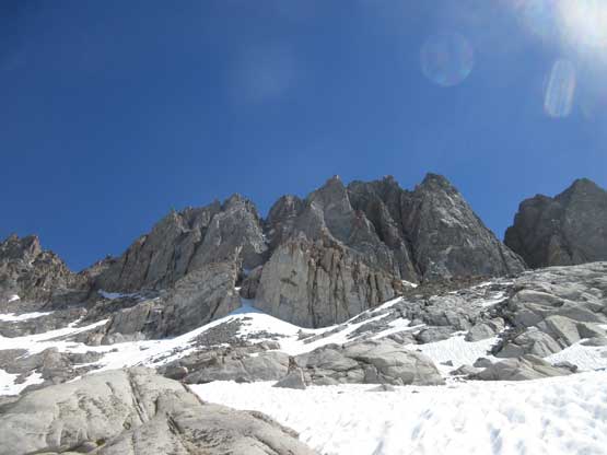
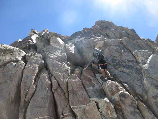
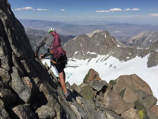
The lower half of the SW Chute was fully covered in snow which made for fast travel. The slope angle was 30-40 degrees and all we needed was an ice axe. With no acclimation and coming straight from sea level we started to feel the effect of altitude because we couldn’t go too fast despite the easiness of the terrain. Halfway up the chute we came to the chockstone and found the 3rd class bypass ledge on climber’s right, which was easily done by a short cat-walk and then a short step of face climbing. There was no further difficulty worth noting until cresting the high notch on the summit ridge but such slog was physically demanding with the heavy pack and at altitude.

Me slogging up 35 degree snow in the SW Chute
From just underneath that chockstone looking down at the lower SW Chute
Matt wondering what’s lying ahead..
Me heading for the 3rd class cat-walk traverse. Photo by Matt L.
Matt following up the 3rd class cat walk. It was awkward with a pack

Matt scrambling up class 2 terrain above the chock stone
This is the middle section of the SW Chute.
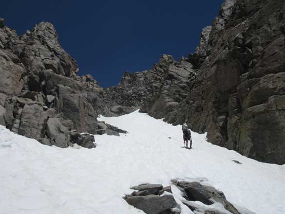
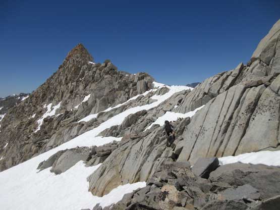
Matt leading up another field of snow. It looked easy but was actually quite steep
Me following up the upper snow field. Photo by Matt L.
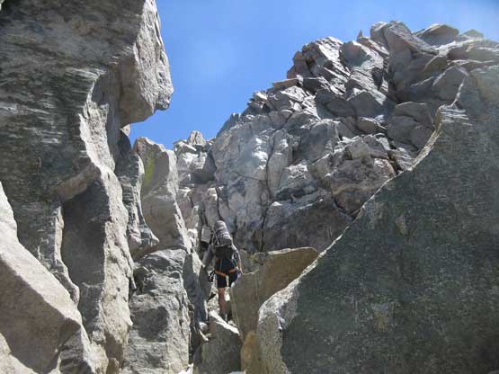
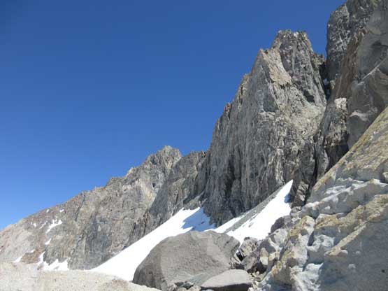
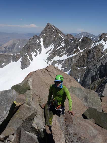
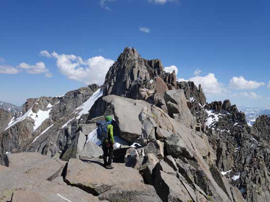
Near the notch. The terrain became steeper and more blocky
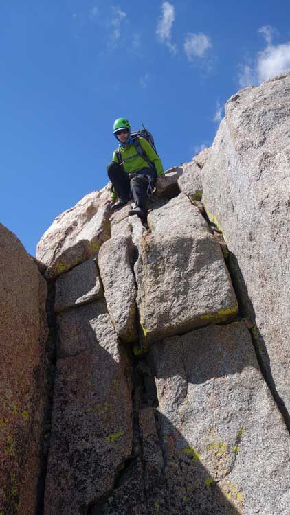
This diving board rock is cool.
Me posing on the diving board. Photo by Matt L.
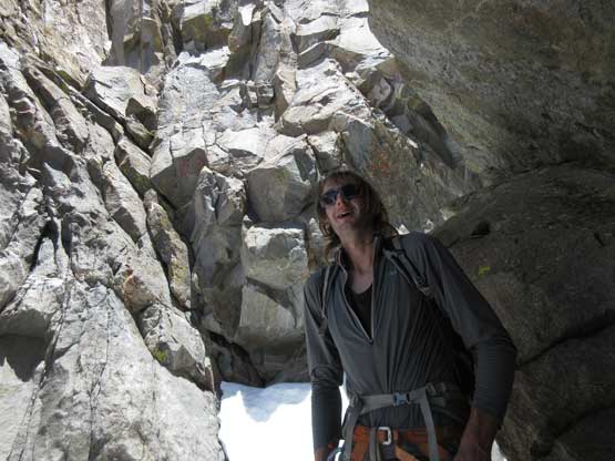
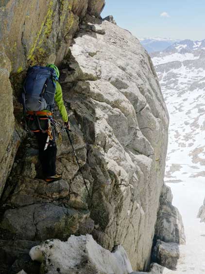
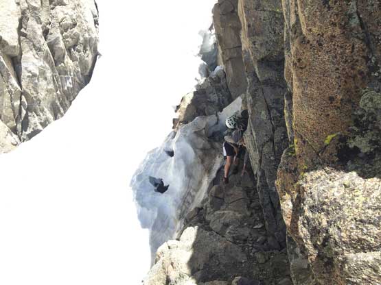
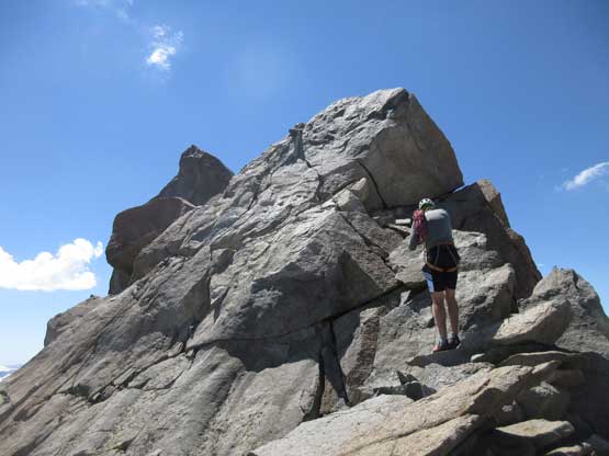
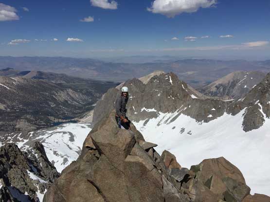
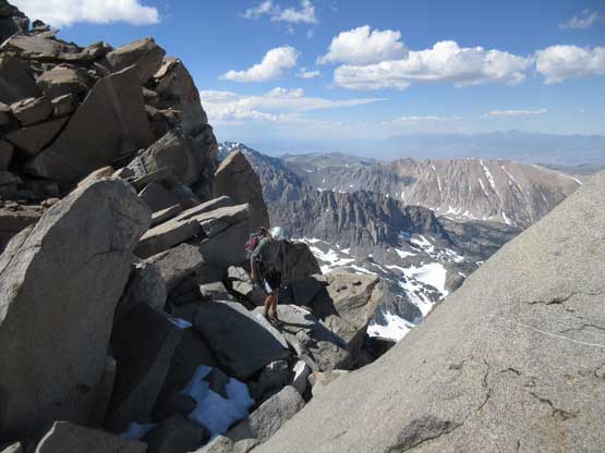
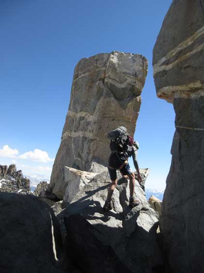
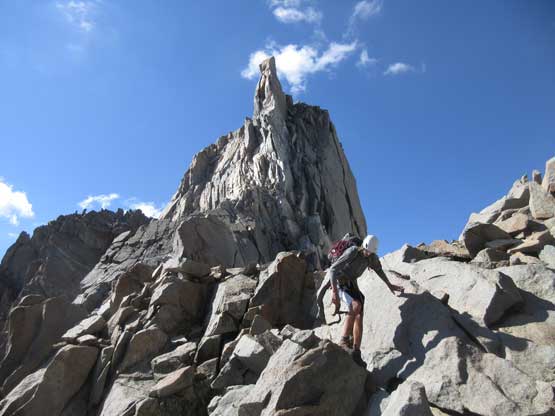
At the notch Matt tried to climb straight up on the 4th / low 5th rock towards the summit monolith and meanwhile I swapped the mountaineering boots for rock shoes. Matt came down after 15 minutes and decided to try the roundabout “class 3 bypass” on the east (back) side. It looked no easier than what he just tried but since we had the beta we had to at least take a look. Getting onto the ledge required traversing very exposed snow and once around the corner, we found more snow but in general the climbing stayed within the realm of 4th class. The snow was a little dicey to traverse/climb on rock shoes but following Matt’s steps made the mental game much easier as opposed to lead and route-find in front. One particular step was awkward enough that we both had to remove the backpacks to climb, and more 4th class climbing brought us to the base of the summit block, and this time, on the south side of it. We decided to take a short break and Matt changed to rock shoes as well.
Matt trying to climb straight up. CA 4th / low 5th is no joke…

After a while Matt came back down and went for the ledge traverse.

The high notch offered neat views to the north-east side

Around the corner this is a strenuous step that we took the pack off to climb
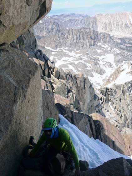
Me climbing exposed 3rd/4th class snowy terrain (on rock shoes)…
Me arriving at the base of the summit block.
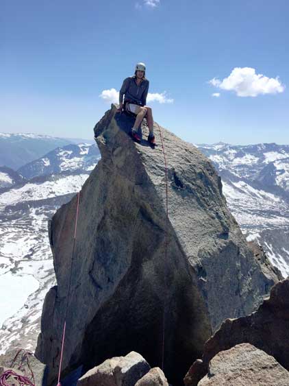
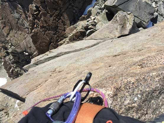
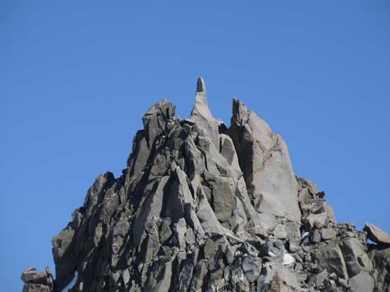
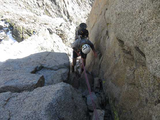
Getting to the base of the summit block involved an exposed ledge traverse. Once there we sorted the ropes and Matt got the “lasso technique” done in one shot. We then secured both ends of the ropes to rock anchors and Matt went up first and rappelled off a single strand. Now with one rope free of tension I could, and did try to properly free climb but after 10 minutes I gave up. I stemmed up a second block of boulder and made a step across while pulling on the rope, and then simply batman up the rope for a few more steps to the highest point. Matt took off the rock anchor and I threaded the rope through the top station and did a double-strand rappel back down. Then we easily scrambled back to where we ditched the backpacks. The climb of the summit block took us exactly one hour.
The packs were dropped and we were now heading for the summit
This is a lower monolith to the north that we did not have to climb
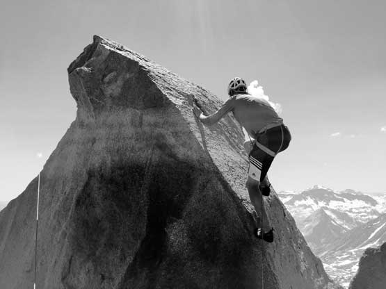
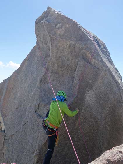
Matt got the lasso done and now climbing to the summit
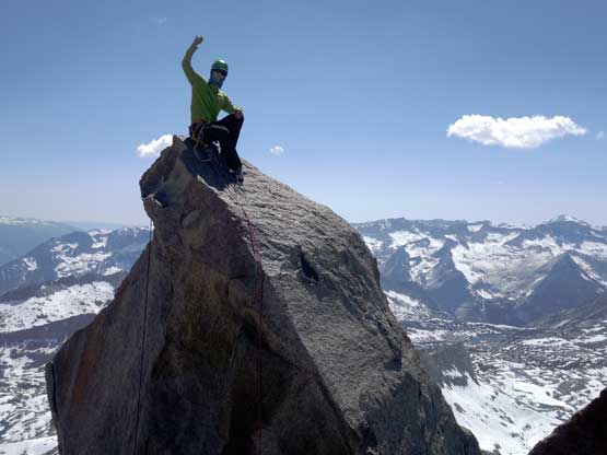
Matt on the summit of Thunderbolt Peak
Me trying to free climb it but soon gave up..
Me on the summit of Thunderbolt Peak
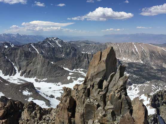
The lower, north monolith from the true summit of Thunderbolt Peak
Matt on a lower sub-summit. Photo taken from the true summit
The other side of the true summit is a shear drop.
Traversing back across the exposed ledge to get back to where we ditched packs
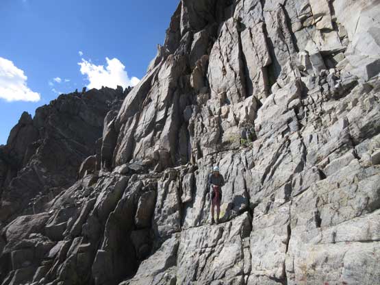
Not doing much of unnecessary lingering we resumed the traverse, over 3rd class boulders and some small patches of snow, to the top of the 5.6 chimney. We down-climbed some 3rd and 4th class rocks and found a decent anchor. One full length rappel (one 60 m rope) got us off Thunderbolt Peak’s technical section and then a long stretch of 3rd class down-climbing on slabs brought us down to Thunderbolt/Starlight saddle.
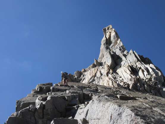
The infamous summit bottle on Starlight Peak.
Me staring the traverse towards Starlight Peak. Photo by Matt L.
Matt on the easy portion.
A bit of route-finding near this block.
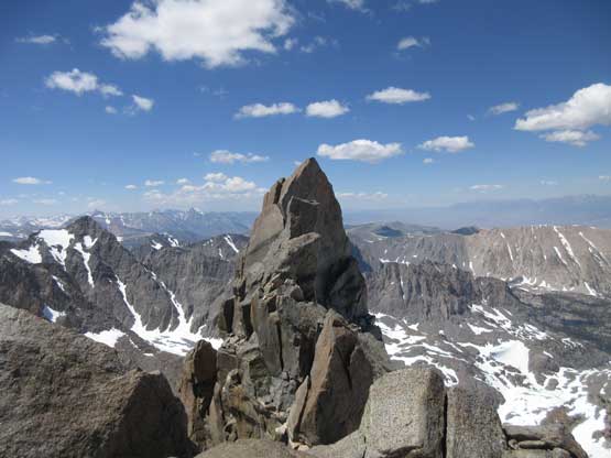
Starlight Peak looks impressive from here..

Me scrambling down easy 3rd class terrain. Photo by Matt L.
Me continuing down-climbing. Photo by Matt L.
Matt starting the rappel to get off that 5.6 chimney
Rope managing is the key to be efficient
Matt down-climbing 3rd class slabs below the rappel
Another photo showing Matt down-climbing 3rd class slabs
Almost down to Thunderbolt/Starlight col, looking back at Thunderbolt
We thought about bivying at the saddle but there’s still 4 hours of daylight time to kill and none of us wanted to just sit there doing nothing, so up Starlight Peak we went.
