Sowerby Peak (Barr East)
May 30, 2021
1971m
Hope / Hunter Creek, BC
“Sowerby Peak” is the unofficial name given to the highest summit of a long ridge at the headwaters of Sowerby Creek and Hunter Creek, not far from Jones Lake and also not too far from Hope. This peak had been known in the past as the “east peak of Mt. Barr” and to be honest I personally would prefer to call it the “true summit of Mt. Barr” instead of assigning it a separate name. The officially-named Mt. Barr has very low prominence and is largely connected to the ridge of “Sowerby Peak”. However, the name “Sowerby Peak” had started to gain some popularity on the internet these days (including being adopted on Google Earth) so inevitably this would become more and more distinguished from Mt. Barr and people would start to call them two distinct summits, so I decided to follow this trend.
The way I wanted to do Mt. Barr and “Sowerby Peak” was always from Jones Lake via a steep bushwhack until Duffy’s “Unnecessary Crew” published an alternate approach from east fork of Hunter Creek. Duffy’s trip was last Saturday and the report made it look like a smooth sail without any bushwhacking, so Alex and I decided to immediately follow their route the weekend after. My day-off was on Sunday. The best weather was on Saturday but Sunday’s weather was also “acceptable” so we pulled the trigger. Alex and I met in Abbotsford at 5 am and drove up Highway 1 in my trusty Taco. The Hunter Creek FSR was as expected, steep and loose in spots. The worst was actually to crawl up the initial hill above the highway that almost required me to switch to 4Low. The deactivated portion of this road beyond the hydro project was quite long resulting in a slower-than-expected drive, but we had no issue making to where the previous group stopped at 950 m elevation. The road was blocked by boulders beyond that spot and only ATVs could drive across the obstacles. The spot where we made the turn-around could only park 2 vehicles max.
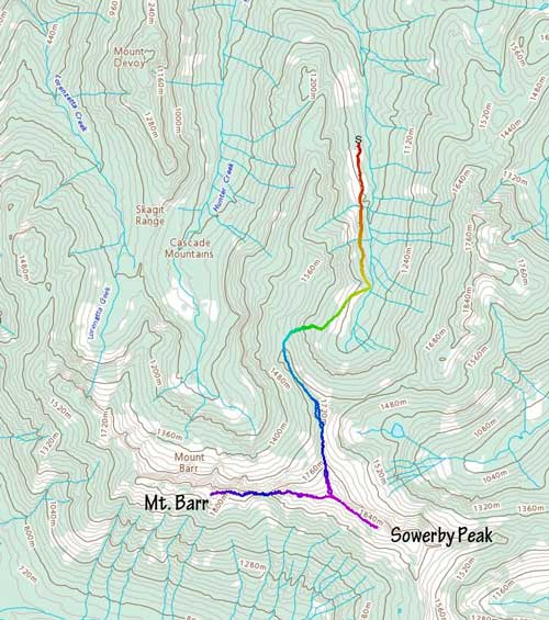
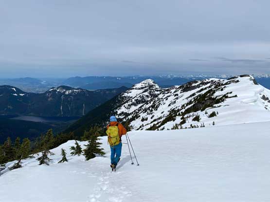
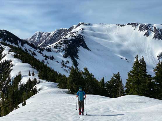
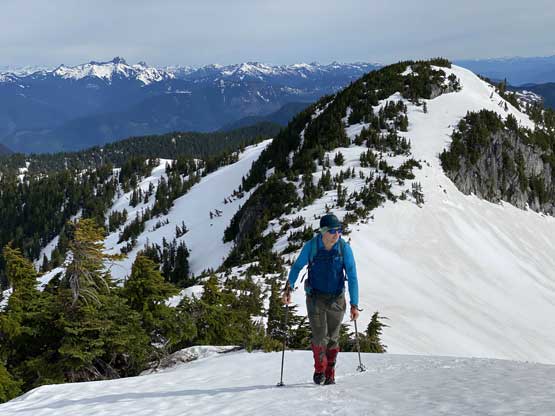
About 15 minutes into the plod we started to encounter patchy snow and the snow did not become continuous until another km or so further at around 1050 m elevation. The road then did a rightward turn and after that, we started to gain elevation rapidly. At 1300 m the last switchback of the road we followed Duffy’s GPS track bailing into the forest. The next while was grunting 300 vertical meters up this steep forest to the ridge that divides the east and west forks of Hunter Creek. This zone required a lot of step-kicking but we both managed it without having to take out ice axe nor donning crampons. Once hitting the ridge the views suddenly opened up.


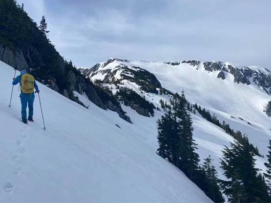
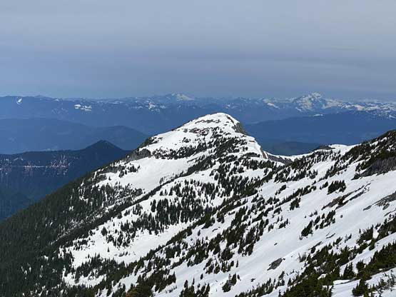
We followed the crest of the ridge for another kilometer due south-east until directly in front of a subsidiary bump. According to Duffy’s GPS track we were supposed to bypass this bump on the west side and sure we did the same. The snow was a bit too firm for us to comfortably traverse some steep slopes and as a result, we were forced to do a weird-ish line. We kept debating between to keep traversing on snow versus to gain the ridge sooner than later and in the end, opted for a combination of the two. It worked nonetheless albeit some scrambling on rocks and bush was needed. After bypassing this bump the next section was a long and foreshortened slog to the high ridge that connected “Sowerby Peak” and Mt. Barr. This stretch kept on dragging forever. I thought I could make it in one push but I ended up calling for an energy break 50 vertical meters under the ridge.


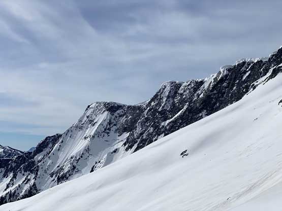
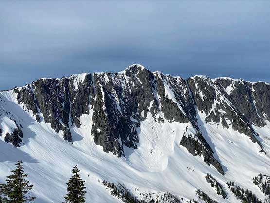


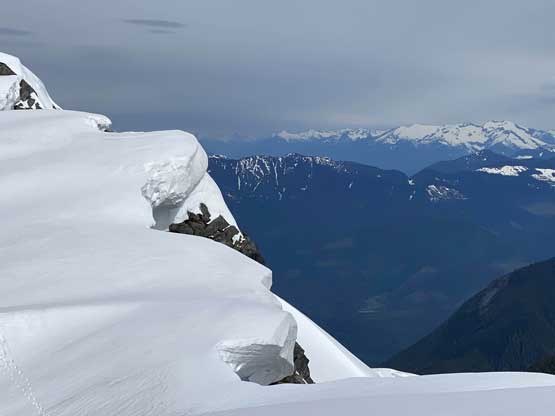
The route brought us directly onto the “west summit” of Sowerby Peak which was reported to be only 3 m lower than the east one. The traverse to the east (true) summit was mostly straightforward but we did have to be careful about the cornices. There were monstrous cornices dangling over the north face waiting to drop. We did not do the final 2-meter elevation gain fearing the entire “summit” was on a gigantic cornice. Therefore we did not get that 360-degree panoramic view from this peak.


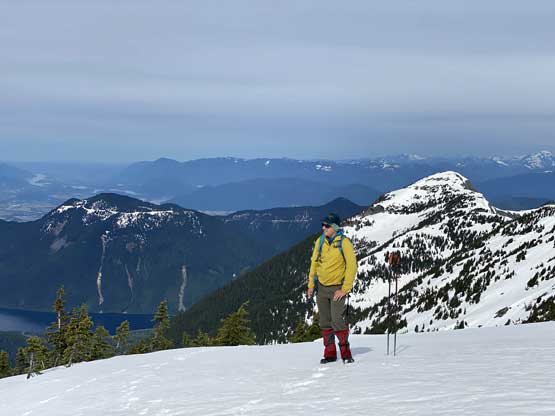

After having enough of the south-side views we leisurely reversed followed our tracks back over to the west summit, and immediately continued the westward traverse towards Mt. Barr.