Beaver Dam Mountains High Point
December 23, 2021
2068m
St. George, UT
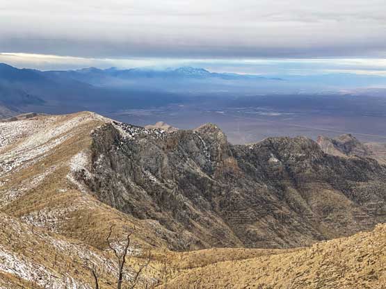
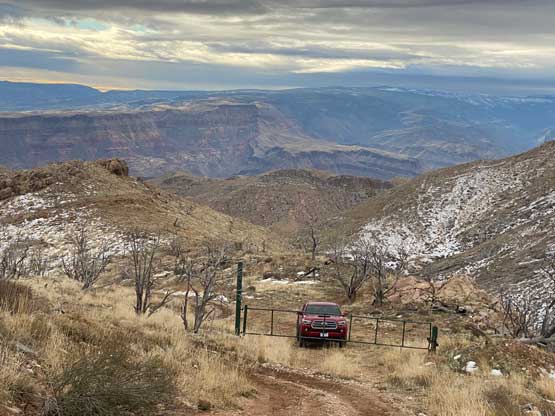
Beaver Dam Mountains locate to the SW of St. George on the border between Utah and Arizona. These peaks are generally not very exciting, but the highest point boasts over 600 m prominence. The high point is also known as Scrub Benchmark which is the name of the USGS survey marker that had been put onto the summit. A service road goes all the way to the summit but the access requires a high clearance, 4×4 vehicle with aggressive tires. An experienced driver with the right vehicle could attain this summit by driving to the top, but most 4×4 vehicles would have to be parked at the gate about 2 km from the summit, or lower down. The hiking distance fully depends on the vehicle and the driver’s ability to handle the rough road.
This was the 4th day of my Christmas-New Year peak-bagging trip and I already made down to St. George, UT. I drove out of the city at around 9 pm following Google’s direction to the start of the dirt roads. The landscape had fully transitioned from the snowy interior plateaus to the desert floors. The first dozen or so kilometers into Bulldog Canyon was mostly easy driving. About 2 km from Bulldog Pass I turned left onto a narrower spur road and not far after the road had become 4×4 terrain with lots of large rocks to crawl across. Over the next couple kilometers I encountered several extremely rough sections with the last stretch towards the gate pushing the limit of my Taco with all terrain tires. I had to switch into 4Low to get the job done. I thought about to drive the gate’s bypass but in the pitch dark I knew nothing about what’s laying ahead, so turned around and parked at the gate. There was also patchy snow at this elevation. That night the weather was worse than forecasted with intermittent rain events. I did not sleep well as I worried about flash flooding and the difficult drive-out.
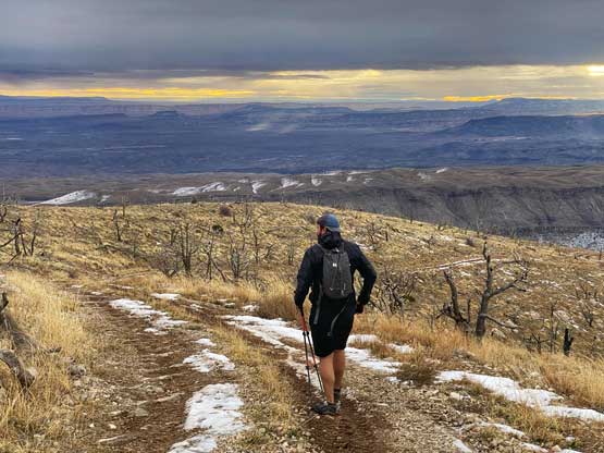
Thankfully the rain stayed intermittent and never became torrential. At about 8 am I woke up and then another hiker (Daniel Glatz from Alaska) showed up from behind. My B.C. licence place was a good indication that I must be a peak-bagger from far to the north so after some brief talking we recognized each other out. I asked Daniel to give me several minutes to get ready so that we could hike this objective together.

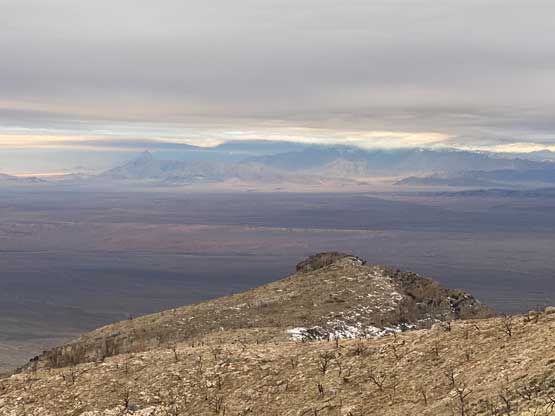
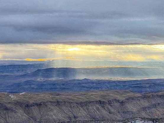
Despite the less-than-ideal weather the scenery was better than expected. The hike was mostly done in open terrain and the views included some canyon features and some morning lights. The ascent was nothing fancier than a sub-hour plod on a road and in fact, this was the easiest day for me in this entire 22-day trip. There’s another high point about 1 km to the NE that had the same contour line on the maps, but none of us felt keen to check that out.


The walk back to the truck was uneventful and we finished the hike at 8 am or something like that. I offered to drive Daniel down to where he parked. The drive was not too terrible as the downhill always felt easier than the uphill. Daniel had a rental truck with high clearance but unfortunately it’s only 2WD with stock tires, so he had to park as soon as the road became rough, which was at least 2 km away. We had a delayed breakfast at the start of the dirt road just before getting back onto the highway.


I thought about making another ascent, but the weather had turned worse. I drove to the nearest McDonald’s in Mesquite for some wifi and the next destination was Adam Walker’s home in Las Vegas. The traffic through the city wasn’t too bad except for a stretch in the downtown where one freeway merged onto another. I made to Adam’s home just before 1 pm and spent the rest of the day resting. Adam and I had to pack up for our road trip down south into the lower elevation deserts.
