Mount Clarke
August 10, 2020
2159m
Chehalis Area / Harrison West, BC
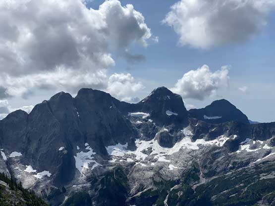
Mt. Clarke is by no doubt an iconic summit in the Chehalis area highly visible from most summits in the Fraser Valley. This rugged massif boasts an impressive north face dropping into the upper Winslow Creek, and a long and jagged NE Ridge that composes of several towers including Recourse Peak and Viennese Peak. The standard route is however, an unpleasant and contrived slog (class 3) documented in Matt Gunn’s Scrambles in SW British Columbia. For those capable of alpine climbing the more aesthetic way is to ascend the NE Ridge (5.6) as part of the “VRC Traverse”, traversing the entire ridgeline from far to the SE of Viennese Peak all the way over Mt. Clarke. This route is considered as a local classic although fair amount of suffering on unpleasant terrain is required no matter what. My original plan about Mt. Clarke was by the scramble route but I changed my mind this year. Lily and I had been talking about this group of peaks for a while via the “VRC Traverse” and we pulled the trigger upon seeing a window towards the second weekend of August.
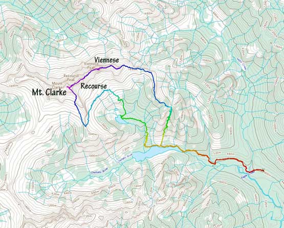
Viennese, Recourse, Clarke Traverse. GPX DL
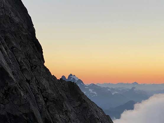
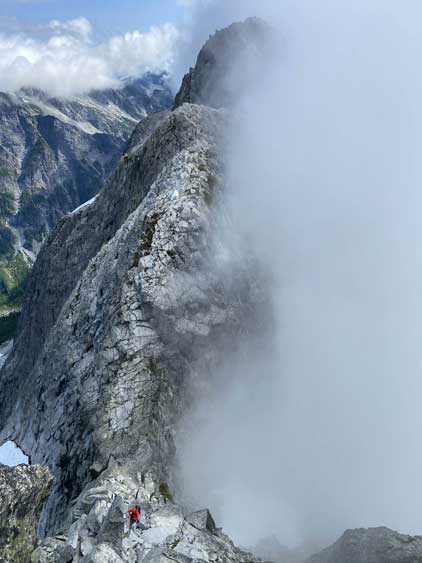
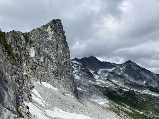
On the first day we climbed up and over Viennese Peak and Recourse Peak and bivyed on the SW Ridge of Recourse Peak not far from Recourse/Clarke col. The sunset was incredible and the night was not too cold to shiver through. In the morning we woke up in the mist so slept in. The mist still came in and out after a while so we should get up regardless. We spent some time cooking a warm breakfast as we brought the stoves up there anyway. Packing up all of our gears took a while. We then traversed some easy terrain and did one rappel into the deep chasm of Recourse/Clarke col. The reference said an “optional rappel” but upon inspecting we determined it’s pretty much mandatory unless one wants to down-climb exposed and unknown class 4 slabby terrain.

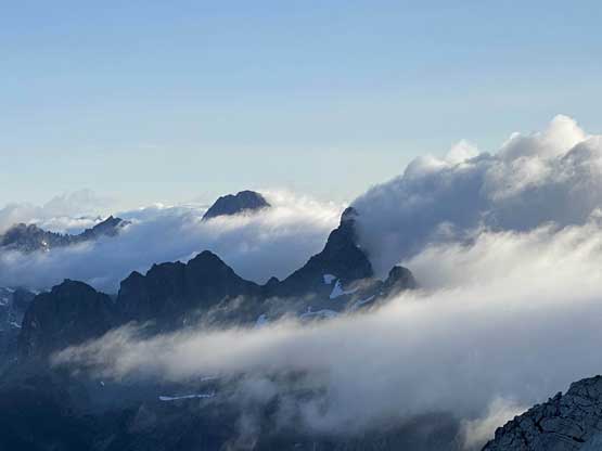
The NE Ridge/Face of Mt. Clarke in the previous evening
Mt. Judge Howay at dusk. Too bad it’s partly blocked

The SW Ridge of Recourse Peak at dusk
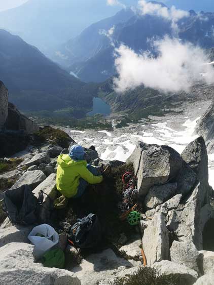
Me waking up in the morning. Photo by Lily Q.
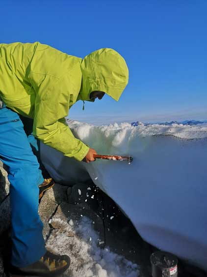
Me chopping snow for water. Photo by Lily Q.

It’s breakfast time… Photo by Lily Q.

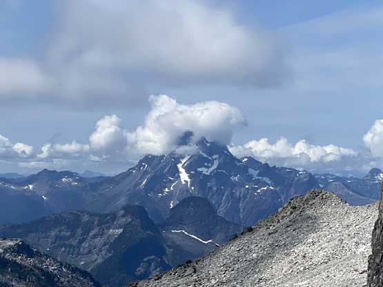
Recourse Peak in the morning. As you can see, the mist’s coming in and out

The north face of Mt. Bardean from our bivy ledge
Robertson Peak has only been climbed 3 times…
Grainger Peak and Nursery Peak in the mist

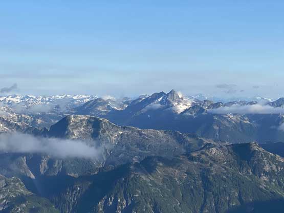
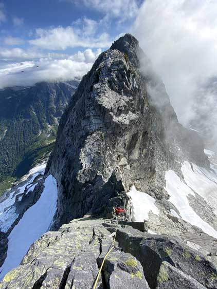
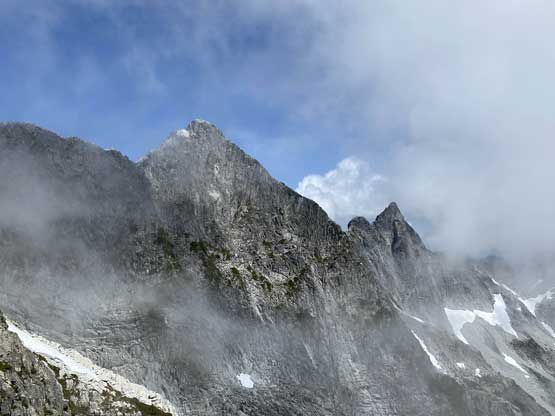
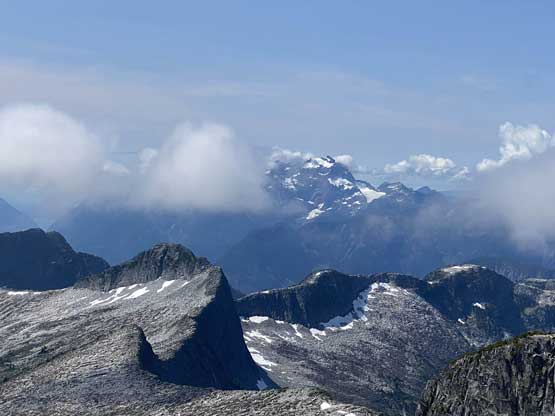
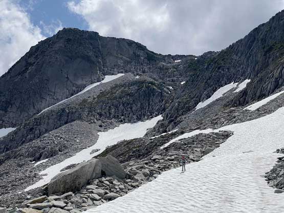
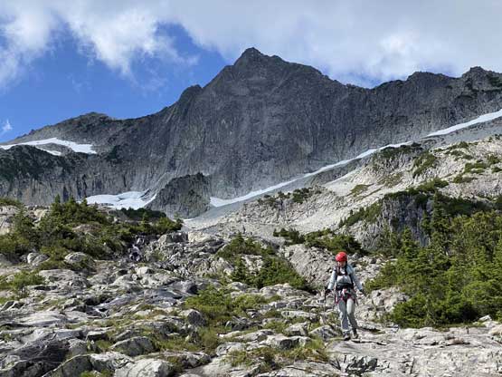
A full show of our route up Mt. Clarke

Looking across Winslow Creek valley into some of the most remote parts of SW BC
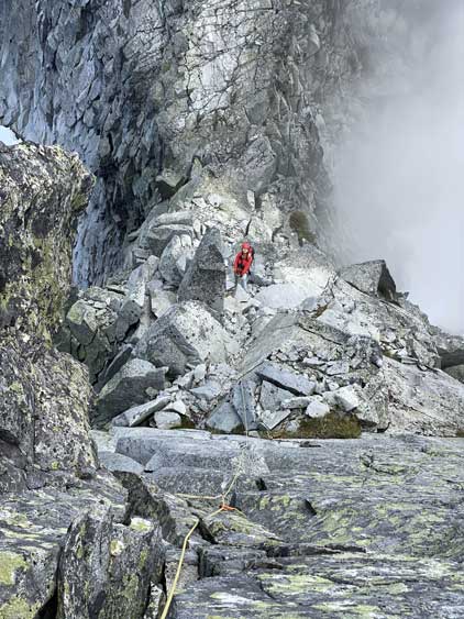
Me rappelling into Recourse/Clarke col
Lily rappelling into the col
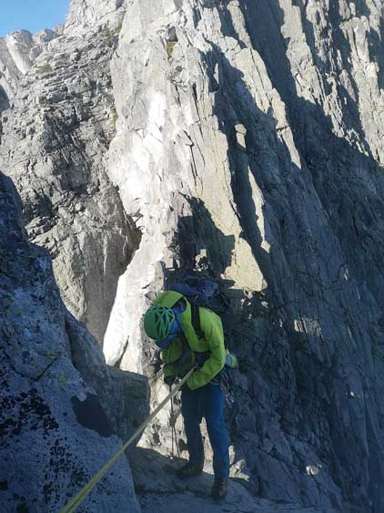
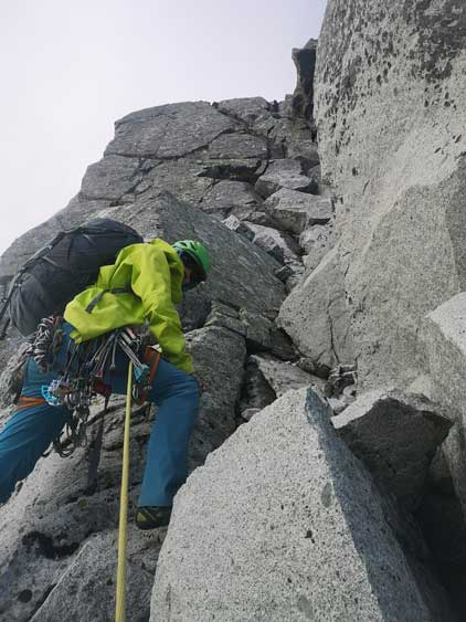
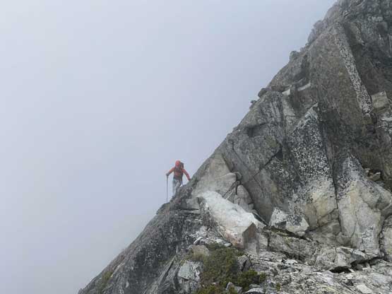
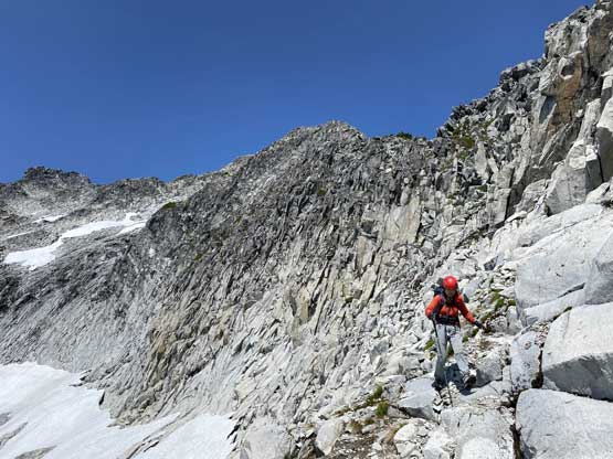
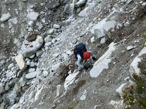
The climbing up NE Ridge of Mt. Clarke didn’t look too hard so I volunteered to lead even though Lily’s a much stronger rock climber. I wanted to gain more experience on terrain I felt relatively comfortable with. I thought about ditching the pack due to the 5.6 grade but decided to carry my own pack. Based on the experience on Viennese Peak I knew how difficult was to haul up two packs. I felt the first pitch being much harder than the second pitch probably because I didn’t really know how to climb cracks. There was one set of crux moves near the top of this pitch that a crack climber would felt no problem. I, on the other hand, did not have much confidence making crack moves so it took me a long time figuring out a solution. I put in two cams (sizes 2 and 3) and went for a committing mantle move on climber’s left side completely skipping the cracks. It worked, but felt harder than the 5.6 grade. When Lily came up she commented that I basically read the rock wrong and picked a harder-than-necessary line.

Me starting the 1st pitch. Photo by Lily Q.
Lily coming up the upper section of Pitch 1
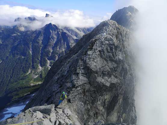
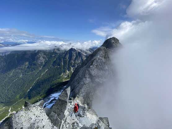
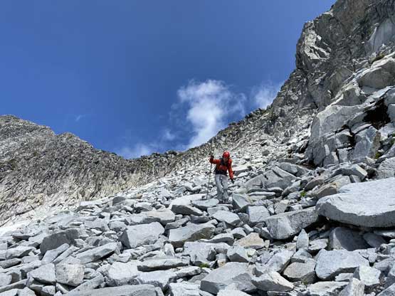
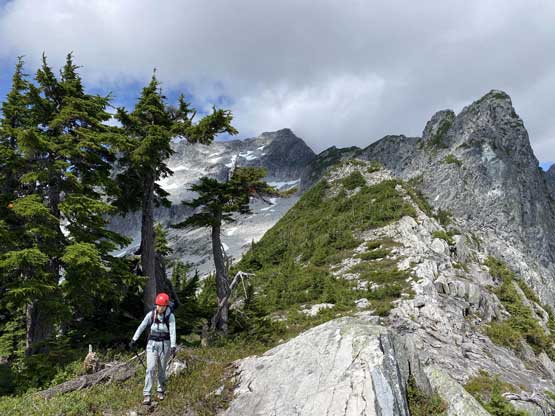
Lily took over the lead to the base of the second pitch and because of the length of the rope she had to belay me over there. The terrain between the two steps was just “scrambling”. Looking at the second step I opted to lead again, and this time I had minimal issue getting up. It’s also a much shorter pitch than the first one. The communication was difficult upon reaching the upper station thank to the strong winds and the failure of my walkie talkie. I had somehow turned the walkie talkie into another channel. This was the first trip that I ever used that thing so I had little clue what’s going on. Beyond the two pitches we decided to unrope and scramble. The terrain was stiff 4th class with fair amount of exposure but the rock shoes were the game changer. Unfortunately the summit was soaked in clouds that after waiting for half an hour with no sign of clouds lifting we decided to head down saving the views for another time… Well, chances are we won’t be coming up here in another time as the descent’s such an unpleasant shit show…
Me coming up to the second pitch. Photo by Lily Q.

Lily belaying me at the base of the 2nd pitch
Looking back from the start of the second pitch
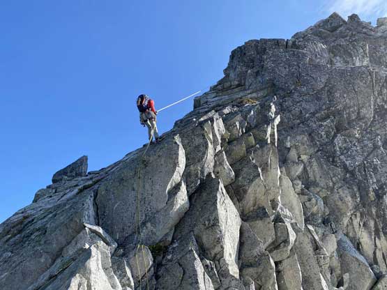
Me ready to lead more 5.6.. Photo by Lily Q.
The mist’s creating some dramatic feel
Looking down from just above the hardest spots

Back to scrambling terrain again

This step was awkward and exposed. Class 4

Lily and I on the summit of Mt. Clarke
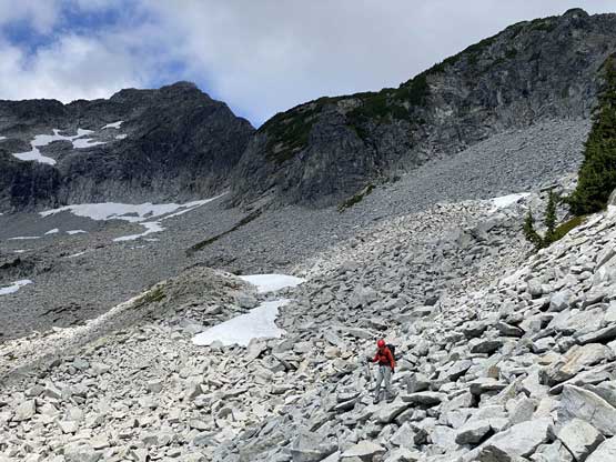
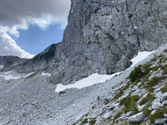
There are two ways to descend – the short-cut via SE Ridge with at least one rappel, and the standard scramble route that’s longer and more unpleasant. We wanted to descend the short-cut but we feared that we didn’t bring enough snow gears (only one ice axe and one pair of crampons among the two of us). We also had Jeff Han’s GPS track for the scramble route so in the end we opted to play safe. There were fair amount of 3rd class scrambling on the uppermost SE Ridge but the terrain became shitty as soon as we dropped off the ridge crest to the south. It wasn’t difficult, but unpleasant with nothing but boulder hopping and side-hilling. After a long while we had to regain some elevation to a bushy col and descend some slippery grassy ramps to the east side. This was then followed by a long-ass side-hill traverse with hardly any elevation loss to the basin immediately under Recourse Peak and Viennese Peak. We wanted to avoid elevation change in this stretch so did our best to trace the contour line on the GPS map. The result was some sketchy side-hilling on wet grass, bushwhacking and one added rappel into a loose gully. We could have worked around the gully but wanted to avoid unnecessary elevation regain.
Descending 3rd class terrain on the uppermost SE Ridge

Continuing down SE Ridge out of the mist

The descent off SE Ridge
Finally started to see more of Recourse Peak and Viennese Peak

The summit’s free of clouds again…

Lily down-scrambling
Mt. Robie Reid started to show up
Dropped into the south side basin and time to start traversing
This looked very fun…
Mt. Judge Howay was shy to show up on this day…
The north faces of Mt. Bardean, Mt. Ratney and Stonerabbit Peak
More about the side-hilling on talus across the south side basin

Regain elevation to a bushy col
Traversing this col to get back into the east side basin
The long-ass horizontal traverse ahead.
At least we had a little bit of snow to ease things a bit
This is the typical terrain on the east side basin traverse
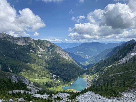
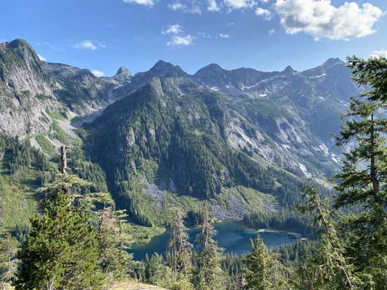
At least the view down to Upper Statlu Lake was great
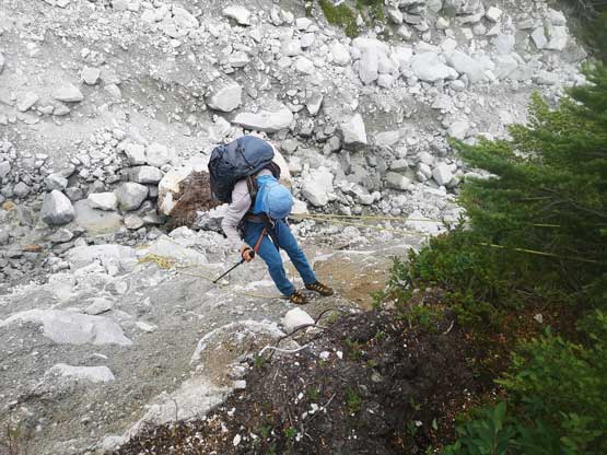
Me rappelling into a choss gully. Photo by Lily Q.

Lily rappelling into the same gully
Then, scrambling out of some compact hard choss

Side-hilling on wet and slippery heather… For a long while…
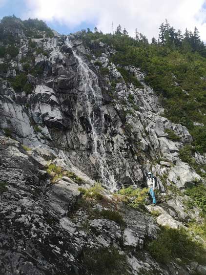
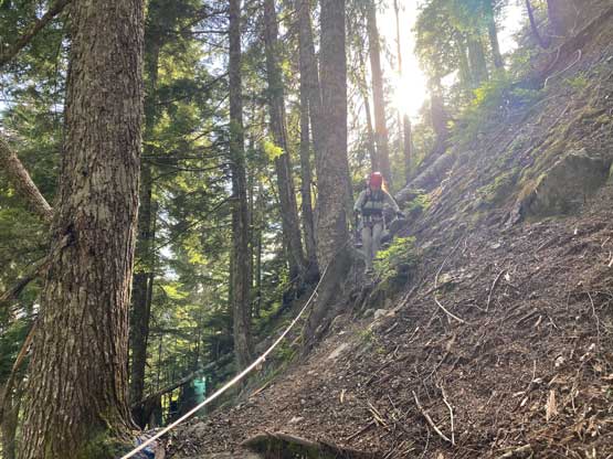
Eventually we could finally descend straight down towards the upper Statlu Lake but the terrain was a mix of heather slopes and granite slabs that the hiking felt very unpleasant on my mountaineering boots. There were at least enough cairns to mark the route that we didn’t have to check GPS zillion times. The most critical point was to traverse skier’s right and bushwhack down and around an imposing waterfall cliff. This waterfall wasn’t obvious from above but we did do our homework and we had a GPS track to follow. It seemed odd to leave the most obvious path into some dense, BW4 bush but we had to. We probably didn’t pick the best line through the bush but at least the orientation was down-hill. I simply didn’t give it a damn fuck and just thrashed through letting the gravity do its job. Once we could see the bottom of the waterfall we bailed out of the bush and went back into the creek beds. The descent from there down to near the upper Statlu Lake was surprisingly not too bad, but then we spent almost half an hour wondering around to locate the trail. We wondered back and forth on the lake’s shore and in the alders and eventually decided to just bushwhack tracing the GPS track. Eventually we found the trail, and immediately the trail did at least 50 m of elevation regain. I checked the GPS at least 10 times and it did seem like we were definitely on track, so it’s frustrating. The trail then suddenly did its steep descent towards the lower Statlu Lake. The grade was very steep and there even had some exposure on this trail. The exposed stretches were aided by some fixed ropes, at least.
Finally headed down again. Viennese Peak behind

Following Jeff’s GPS track traversing horizontally into dense bush

BW4 bushwhacking in its finest

At least the gravity could aid us on the downhill direction
Me after the waterfall bypass. Photo by Lily Q.
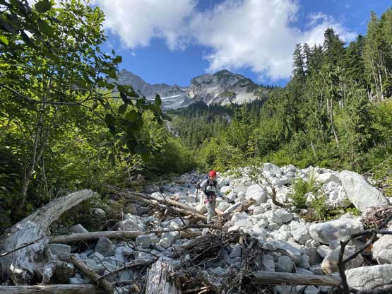
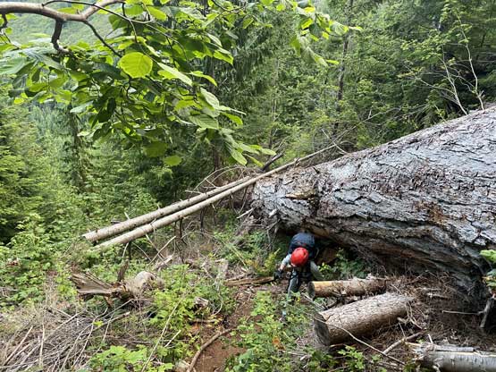
We then had a long section of walk in dry creek beds

Down to Upper Statlu Lake now

A little sign of civilization but now what?
More bushwhacking to find the trail
The trail was steep and exposed at places

As typical as the descent towards the lower lake
Finally able to see the lower Statlu Lake now
I was very beat and called for a break partway down this section. I ate pretty much all of the remaining food and still felt shit, so I ate some of Lily’s food as well. At least I did manage to regain some strength. The trail around the lower Statlu Lake was in a decent shape and my job was to not miss where I ditched the trail-runners. It actually took me a while to find the pair of shoes. It felt extremely good to not have to wear the sweaty mountaineering boots again, and the rest of the plod back to the truck was uneventful. We made back just before it’s dark enough for headlamps.

Finding the trail to contour back across lower Statlu Lake

Statlu Lake

Statlu Lake with Mt. Bardean behind
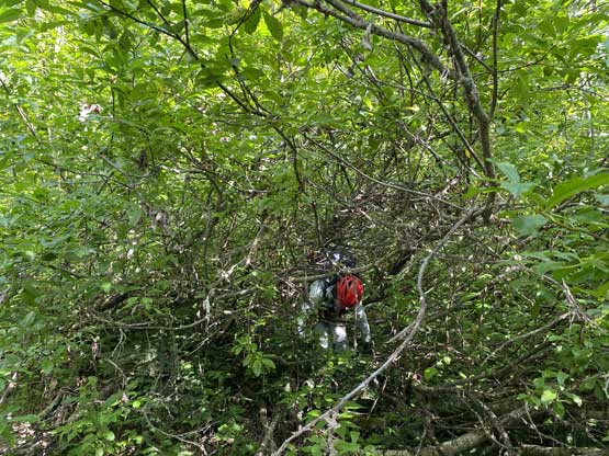
The main trail wasn’t very pleasant neither…
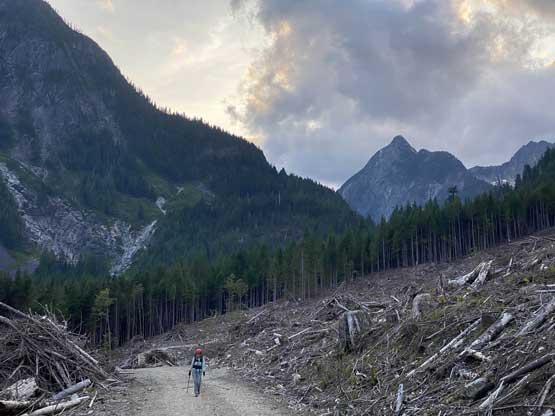
About 1 km of road walk to link up several sections of this trail

The hiker’s foot bridge crossing Eagle Creek near the end…
We were not home-free yet as there was still 40 km of rough roads to drive out of Mystery and then Harrison West FSR. Even with all terrain tires I had to crawl slowly thank to the zillion pot-holes and washboards. We eventually got back home at around midnight and that concluded another successful, type-2 kind of mission in the South Coast. Not sure how much would I recommend the “VRC Traverse” if you are here for the “climbing” parts. It’s definitely more mountaineering than climbing and you need to enjoy exploring and be okay with the approach suffering. One needs to be competent on a great variety of terrain, from bushwhacking to 5.8 rock climbing and have a superb level of fitness. On the other hand, if you “have to” bag these peaks and is capable climbing then the “VRC Traverse” is definitely more enjoyable than the standard scramble routes. At least by doing the traverse one only needs to do Mt. Clarke’s scramble route in a single direction. It’s honestly not too bad for SW BC standard, but I’m more of a Rockies mountaineer than a South Coast explorer… Mt. Clarke is by no doubt a trophy summit, but I’m 100% sure it won’t see me a second time..
