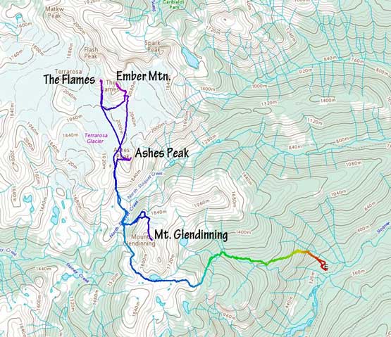
Mount Glendinning
May 21, 2022
2053m
Sloquet Creek / Garibaldi Provincial Park, BC
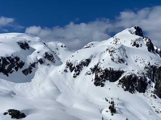
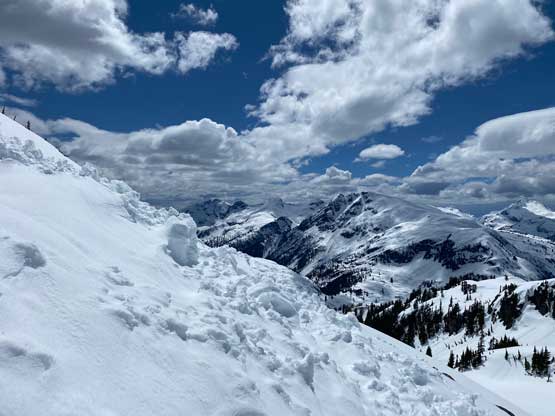
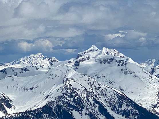
Mt. Glendinning locates on the immediate south side of Fire Spires, but is detached from the group and considerably lower than those spires. Because of that this peak is overshadowed. Even the main peaks in Fire Spires are rarely-ascended so this peak sees even fewer visitor. This area was traditionally approached from Fire Lake to the north and from that direction Mt. Glendinning would be the farthest objective that requires a 300-m drop. Records of ascents are very poorly documented in SW BC. I know this peak has been climbed according to bivouac.com but I’ll be surprised if Mt. Glendinning had been done more than a handful times. A year ago Matt J. published a new route going into the Fire Spires from the south side and this route puts Mt. Glendinning onto the frontline. When Alex, Phil, Francis and I decided to finally make a foray into the zone we opted to do Mt. Glendinning as a side detour on Day 1. The approach is written in Ember Mountain’s trip report as that’s the primary objective in this trip.
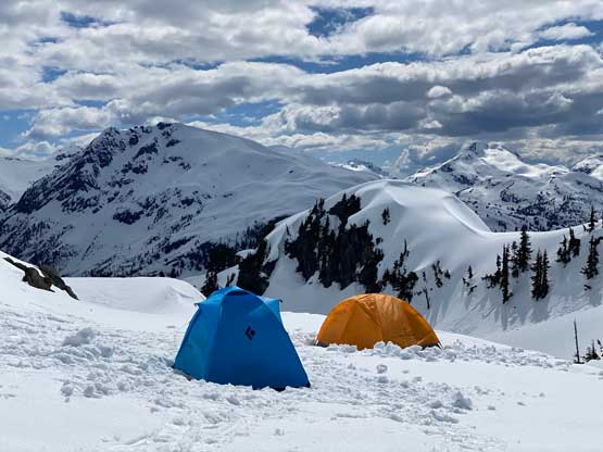
I had no “beta” asides from a few pictures of Mt. Glendinning’s north slopes taken by Matt J. and Thomas M. over the past two years on their respective day-trips to Ember Mountain. The route turned out a bit more complicated than expected with a few unavoidable steep rolls to ascend/traverse on the lower range. The four of us left camp at 2 pm. We had to initially ascend a slope of avalanche debris followed by a diagonal traverse to climber’s left. Towards the end of this traverse we ascended a few 35+ degree rolls. The snow conditions were perfect for snowshoeing (soft but not slushy) as otherwise we would have to ditch the ‘shoes and don crampons.

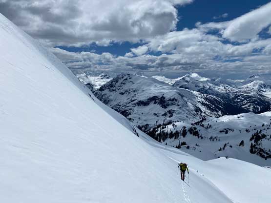
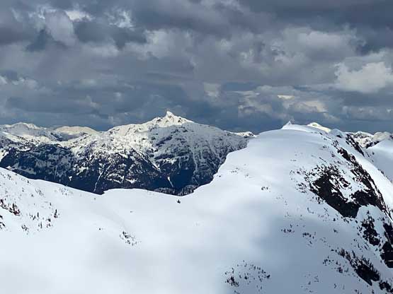
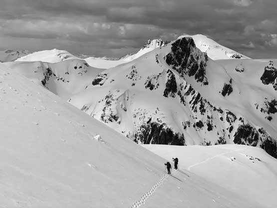
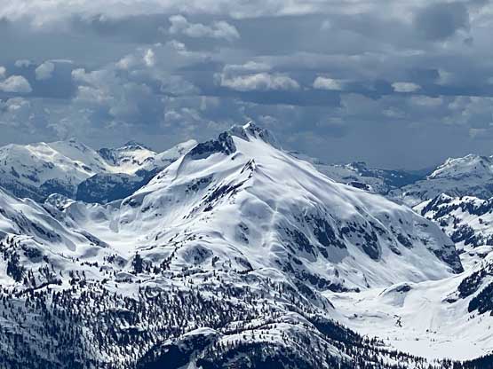
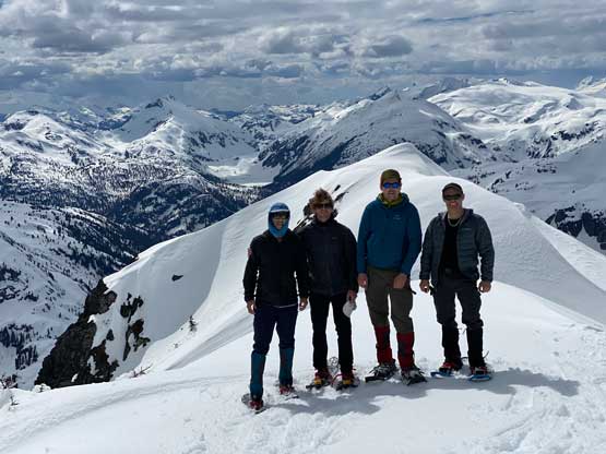
The end of this traversing stretch brought us onto the north ridge/slopes which we followed to the last 100 m elevation. Mt. Glendinning boasts three summits with the leftmost (southern) summit being the highest. We were able to traverse across the north slopes of the central summit directly to central/south col and from there we made another pitch of steep snowshoeing to the true summit. The last 2 m looked to be on a vertical snow lip but the backside offered a feasible route, so all’s good. We stayed on the summit for over half an hour to soak in the incredible views.


The descent was rather uneventful as we mostly just needed to follow our own snowshoe tracks. Francis had to take the snowshoes off to swap for crampons as his snowshoes were not the trusty MSR Lightning Ascents. Lower down I led us a variation to avoid that few steep rolls but we still had to descend a few steep, albeit not-as-long slopes. The snow conditions had turned slushy so I just glissaded a few 35+ degrees sections to speed things up. We made back to camp at 4 pm. It was still too early for dinner so I went into the sleeping bag for a couple hours’ nap.