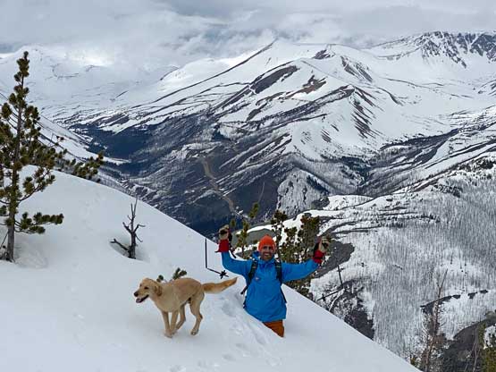
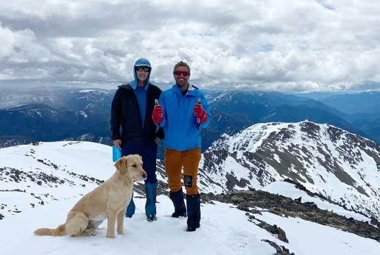
Yalakom Mountain
May 28, 2022
2424m
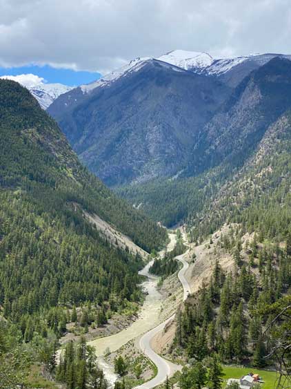
Yalakom River, BC
Yalakom Mountain is not a difficult objective, but the challenge for us Vancouverites is the drive, which requires over an hour and half’s navigation on logging roads north from Lillooet. Getting to Lillooet itself is already beyond the tolerable range for most drivers. The access into Yalakom River Valley is also somewhat restricted but we’ve learnt in this trip that the blockage situation is actually not a problem for us hikers. The weather forecast was initially calling for rain for all areas but the “far east” so that’s why Matt and I planned this objective. The forecast improved at the last minute for the closer-to-home zones but we decided to stick to the original plan as we both needed this peak anyway.
To make the day-trip a little bit less exhausting I opted to drive to Matt’s home at 11 pm at Friday night after work. The two of us then departed North Vancouver at 3:15 am in the morning. We brought bikes because we knew very little about the current road and blockage situation but did not end up using them. Matt is the fastest driver I’ve ever hiked with and with his excellent skills we managed to cruise up to Lillooet in under 2.5 hours, shaving at least 1 hour off my driving time. We actually arrived in Lillooet 20 minutes earlier than 6 am meant we had to wait in front of the A&W for breakfast. We then drove up Bridge River Road to Moha Junction and then turned onto Yalakom River FSR. Up to this point the drive had been the same as Mt. Birch’s a couple weeks prior, but Yalakom Mountain is much farther up the valley than Mt. Birch. On that previous trip I thought the First Nation’s road block was already removed but I was wrong. The blockage is actually further up the valley than Mt. Birch’s starting point meaning we still had to content with the situation after all. The woman (Christine from St’At’Imc Territory) was still there living on the road so we parked the truck and turned off the engine. The conversation turned out way more friendly than I would have expected. Christine was not concerned about our 1-day hiking use but I can see why hunters or even long-weekend campers ended up being turned around.
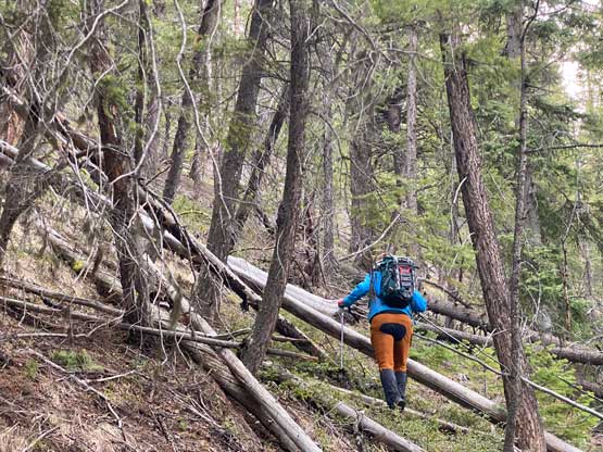
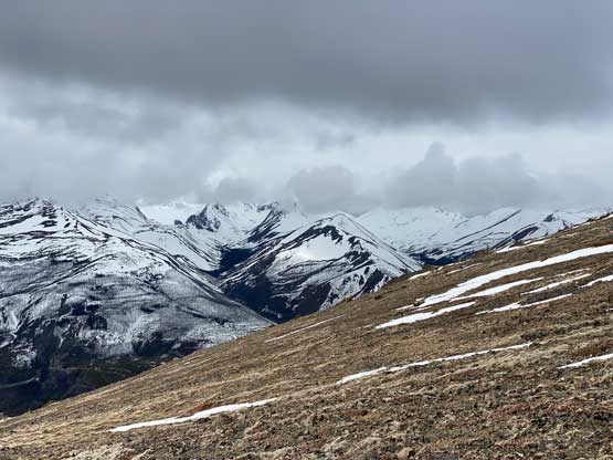
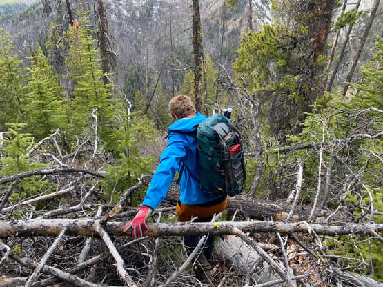
There’s not much information about Yalakom Mtn. asides one brief trip report on bivouac.com. The trip reported mentioned a trail on the far NW Ridge system but there’s no GPS track. Instead of putting our fate on that old trip report we decided to just bushwhack up the shortest possible way. I knew from other trips in this area that the forest is usually open with minimal underbrush. The road up to the spur heading towards Big Dog Mtn. was well-maintained by the mining company but immediately after that the condition deteriorated drastically. The last kilometer down to a bridge crossing Yalakom River to the east side was narrow and rough such that I actually had to get out to move some rocks out of the way. Our planned starting point was right after the bridge so we turned around the parked. A few hours later after the trip I rode the bike farther up the road and within 500 m distance I encountered a landslide that would block all vehicular access. I have to say that we were pretty damn lucky overall about this mountain’s access.
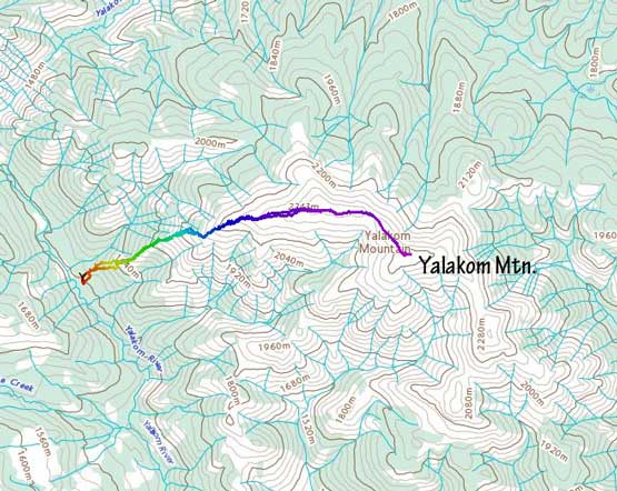
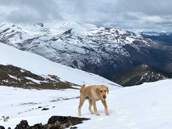
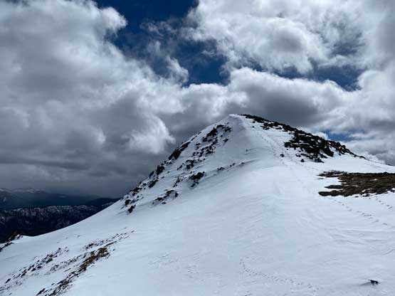
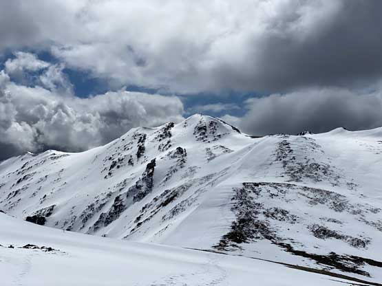
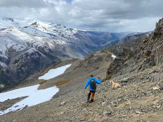
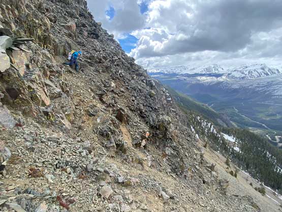
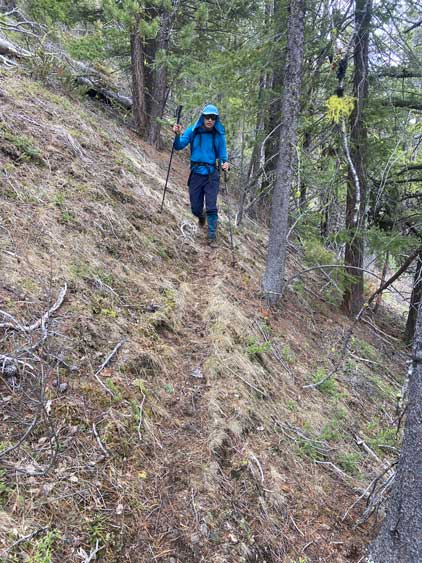
From where we parked there’s about 500 m elevation gain in the steep forest with unknown bushwhacking situation. We ended up encountering only one band of dense pick-up-sticks and the rest was mostly cruise-sailing in open forest. The soil was soft enough that the footing was actually not that slippery after all. Based on the satellite images I was anticipating a cliff band at around 1950 m and I was correct, but the difficulty was nowhere as I thought. I was thinking we might have to traverse a long ways due south into a broad gully (possibly filled with snow), but it seemed to me that we could just stick to the ridge crest. The rock quality was not great, but the scrambling was never worse than “class 2+” with very minimal exposure.


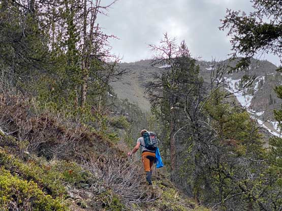


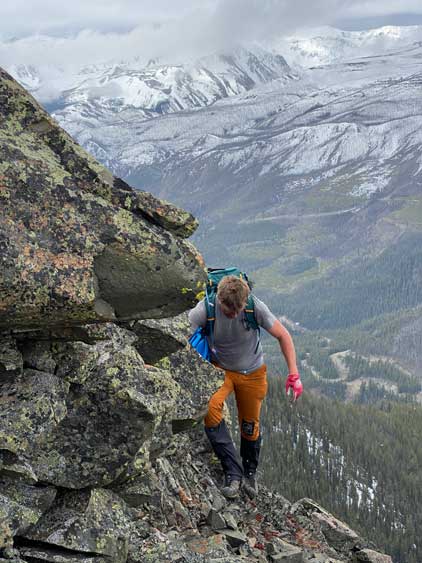
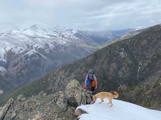
The next section still had some trees and as a result, the north side of the ridge was holding some deep and unconsolidated snow. Thankfully we were able to traverse the south side of the ridge crest by staying mostly on dry rocks. We did have to wallow through a few patches of deep snow but nothing warranted the use of snowshoes. From 2200 m elevation onward the terrain petered out that it was just a long plod on climber’s left (north) side of the ridge to a substantial false summit on the NW/W Ridge of Yalakom Mountain. Matt made the call to start traversing under the sub-peak to avoid unnecessary elevation gain/loss/regain and upon seeing the rest of the route we ditched the whole backpacks. The traverse to the main summit had a few minor dips but was entirely on easy terrain.

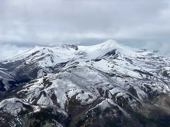


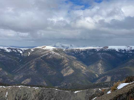


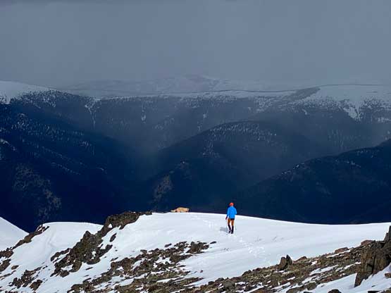
There seemed to have a few cells of intense storms (possibly thunderstorms) to the north so we didn’t linger too long on the summit. We mostly power-walked back to the ditched backpacks and then plunged down roughly following our own route. Matt led most of the way pushing the speed and I pushed pretty hard to keep up the pace. I was somehow strong on energy on this day so didn’t end up being too far behind, but 20 meters above the finish-line a tree branch that I grabbed snapped resulting a fall that put a big scar on my left shin. Our round trip time was 4 hours 20 minutes. Given the fact we drove all the way to the base of the route this was pretty much as expected.


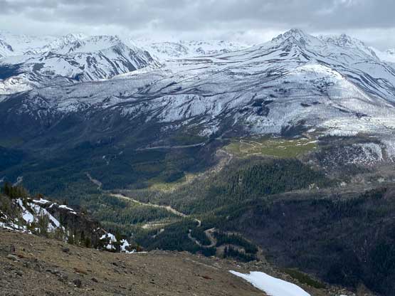


We finished the hike before noon but the road’s blocked by landslides so we couldn’t drive farther for other peaks in the area. With the whole day ahead we no longer needed to rush. On the way out of Yalakom FSR we stopped to have a longer conversation with Christine. I then slept most of the way to Duffey Lake. I had no idea how Matt kept himself awake after so many hours of driving especially on winding and narrow roads. When I was the driver I usually needed a nap break on trips with less than half of this one’s driving distance. We made to Whistler at around 5 pm resulting in another batch of Splitz burgers. Twig was starting to become famous at that place. I eventually got back to White Rock at 8 pm, which was not bad at all. This felt like a big trip after all due to the 10+ hours of total driving time, but I think I eventually put in more calories through food than burnt in this short hike.