Rockypoint Ridge
June 16, 2013
2700m
Brisco / Bugaboo Area, BC
There was some disagreement regarding our objective for the second day of our first ever visit into the Purcell Mountains. I figured that since we didn’t bring glacier gears then The Judge was probably a good full-day scramble objective. Eric, on the other hand, always goes for the biggest views, and he suggested to hike up Rockypoint Ridge as documented in Hikes around Invermere and the Columbia Valley which would give a nice view of Howser Towers. I wasn’t very keen on this since I thought it would be very luxury to drive up a lengthy logging road, and spend a sunny day for just a hiking objective. Ben, being the driver, chose to go the Bugaboos. I have to thank them a big time for picking this one. The trip was far from “short and easy”, and the summit view is one of my favourites to date!
With still about 2 hours daylight we decided to drive to trail-head by Saturday evening. We mysteriously missed the correct Westside Road and had to drive an extra 10 kilometers or so’s very rough logging road to get back to the major Bugaboo FSR. As soon as we left Invermere, the entire drive was on an unpaved road. The correct route wasn’t too bad though, and I’m pretty sure a small car can make to at least the trail-head for Rockypoint Creek. There were a whole lot potholes but nothing too serious. The trail-head for Conrad Kain Hut would be another 15 km in so I don’t know the condition further up. The trail-head for Rockypoint Creek is just after the 29 km marker on Bugaboo FSR.
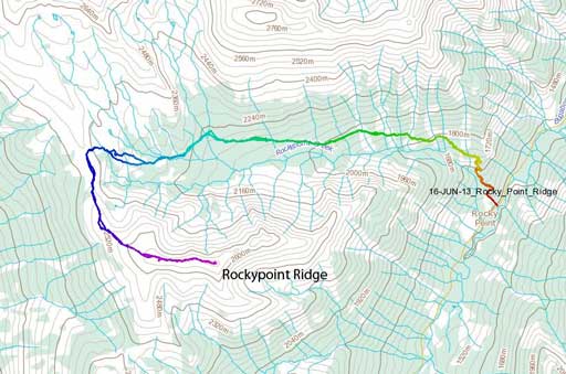
Rockypoint Ridge hiking route. GPX DL
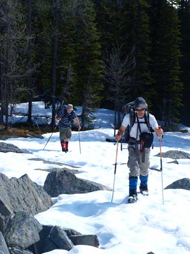
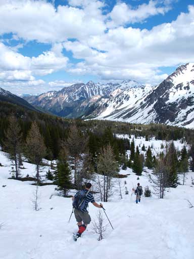
Like the day before, we were hoping to see the alpenglow on all spires so we set up alarm at 3:30 am again, but too bad, we got too tired and my alarm didn’t work and everybody slept in until almost 7:30.. The book says 2.5-3 hours one way to the high pass, so we really didn’t expect a long day. I packed snowshoes just in case. The trail was very easy to follow for the first 1.5-2 hours or so, as we were essentially following a road up. The road was obviously not drivable. It’s designed for snowmobile travel. There were a couple large avalanche paths to cross on the way in. Once the trail goes into the forest again, the snow started, and after crossing two streams/creeks back to back we eventually lost the trail. We also had no clue where that cabin was. From here on the snow became continuous and I strapped snowshoes on which were very helpful. It was still doable without snowshoes though, but it was a lot faster on the ‘shoes. We pretty much aimed directly towards the pass through open forest. There were abundant larches at treeline and that would make this area an excellent fall camping spot.
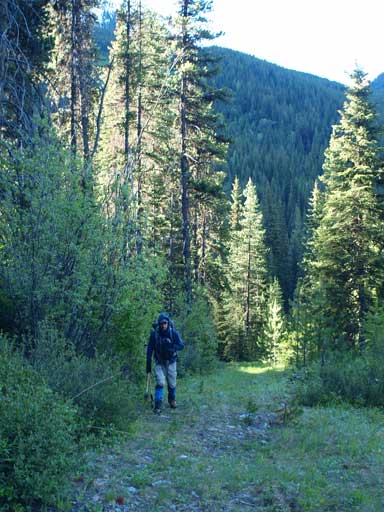
Ben hiking up the “road”
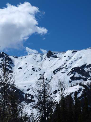
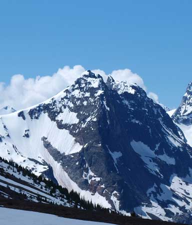
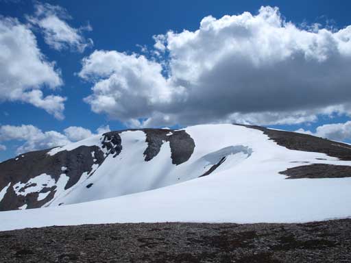
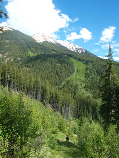
Our objective, Rockypoint Ridge. Ascent route goes all the way up this valley and then loops back
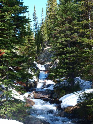
There are quite a few stream crossings
Ben and Eric hiking on the snow. I already strapped my snowshoes on
Like many summits in the Columbia Valley, this one also has a “green tower”
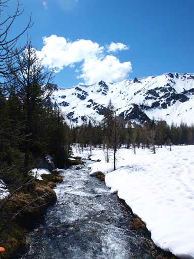
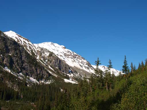
Gorgeous views as we approaching treeline
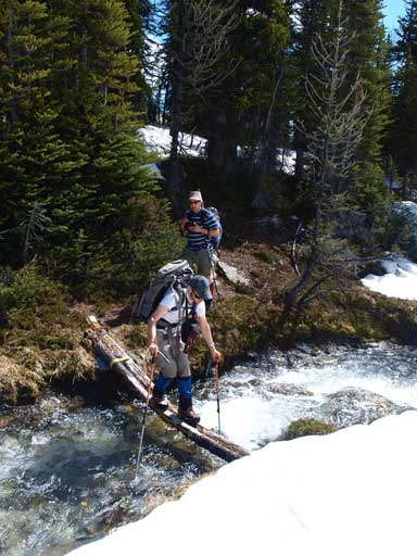
Cross another stream

Ben and Eric hiking up the snow. I didn’t need to post-hole since I brought my snowshoes up
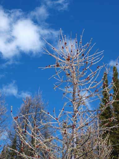
Beautiful trees with blue sky being the background
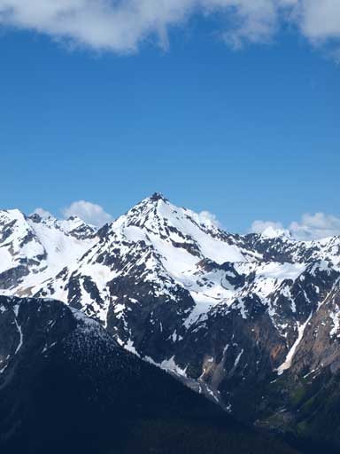
Rockypoint Ridge again
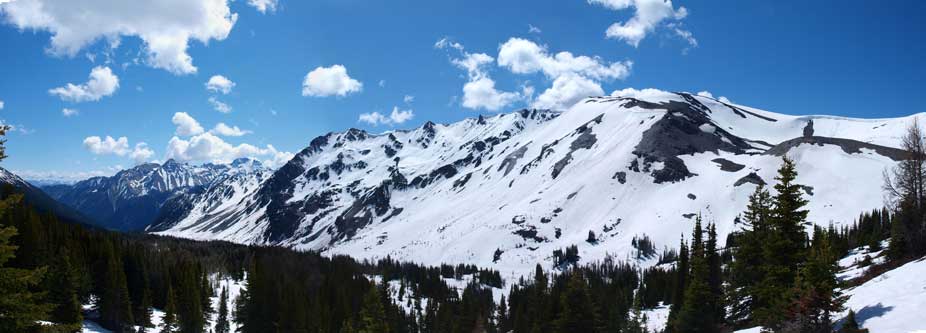
Panorama from this alpine environment. Looks very skiable
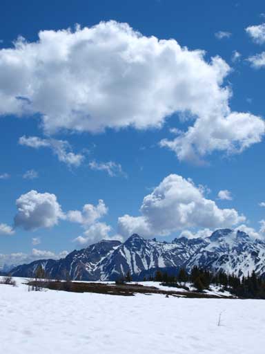
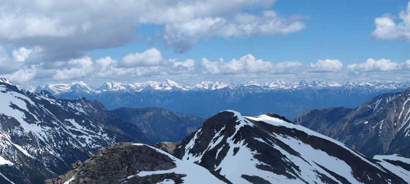
Clouds above unnamed peaks on Septet Range

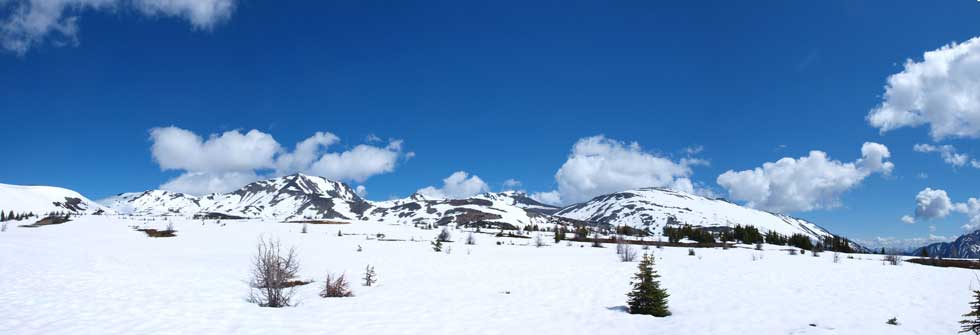
Another panorama of this bowl
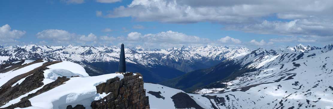
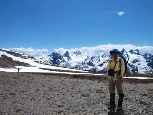
There was a steep snow slope to ascend before topping out on the ridge. And once I could see the other side, oh WOW, can you believe that!! A whole panorama of all of the spires from the Bugaboos to the Vowells fully showed up. That quickly boomed up my energy, and after ditching my snowshoes I bolted up towards the summit which was still quite far away on climber’s left side. The view didn’t change much since it was a sunny day. The best viewpoint of Bugaboo Spire is near the pass. The best viewpoint of Howser Towers and Vowell Glacier is from the first false summit, and once making to the true summit we could finally see Pigeon Spire and the most difficult, Snowpatch Spire. It took us surprisingly, almost 6 hours to get up here. The elevation here is at about 2700 meters which is (surprisingly) roughly at the same height as some of the smaller spires like Eastpost.

Panorama of Bugaboos and the Vowells from just topping out on the ridge
Northpost Spire is one of the scrambles in the Bugs
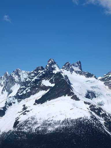
The impressive Bugaboo Spire is a major climb
This impressive spire doesn’t even have an official name. According to Google map, it’s East Peak
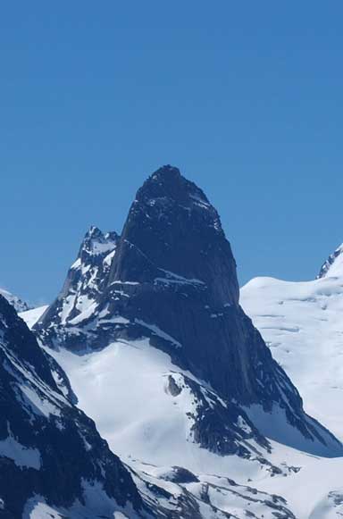
Thunderstorm Tower
It’s a hike to the false summit of Rockypoint Ridge
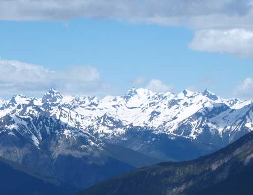
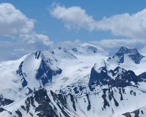
The distant glaciated peaks on Carbonate Range. International Mountain being the highest
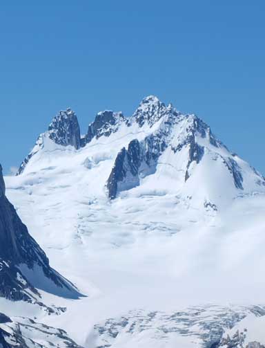
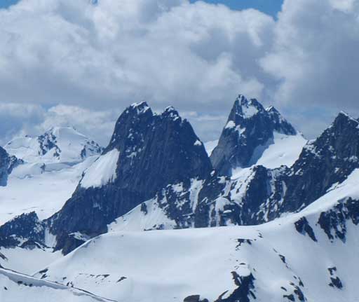
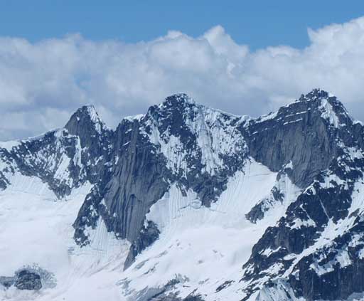
Howser Towers.
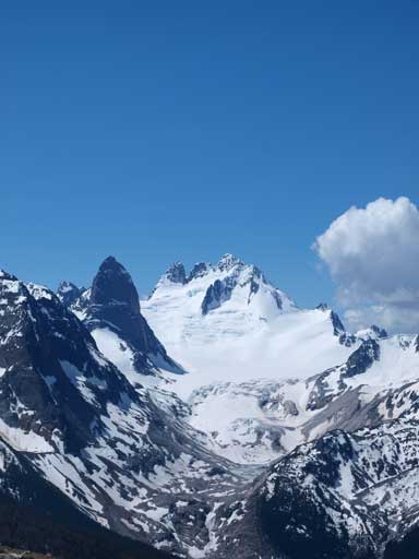
Bugaboo Spire and Howser Towers
The impressive unofficially named spires. East Peak and Thunderstorm Tower
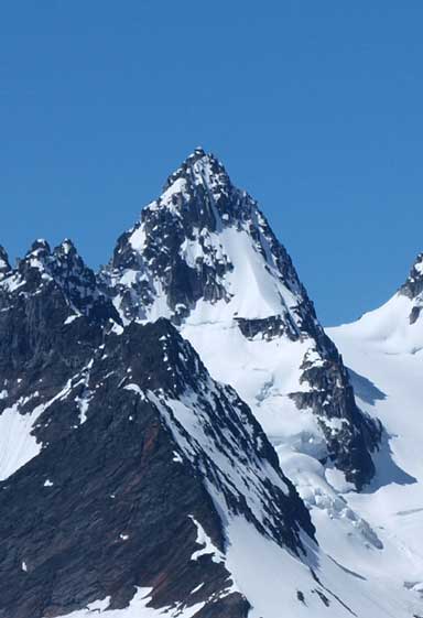
Vowell Peak

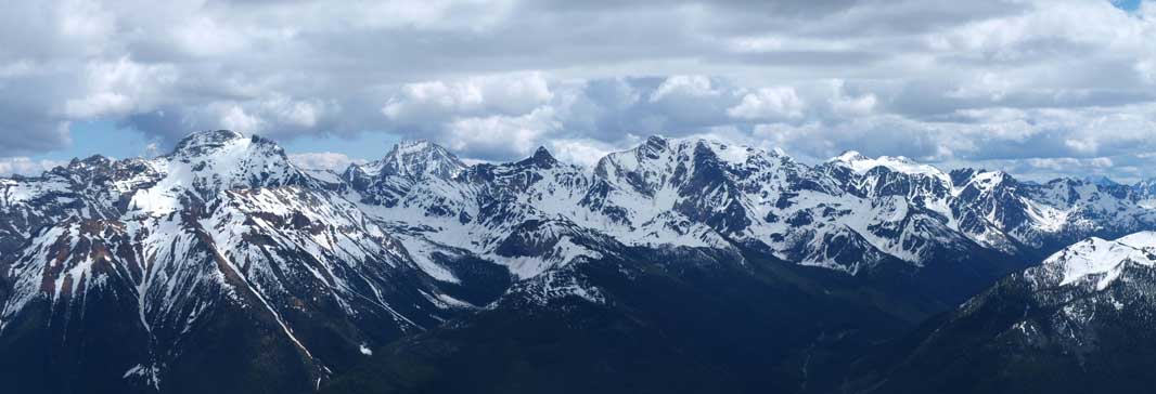
Panorama of this area. Click to view large size.
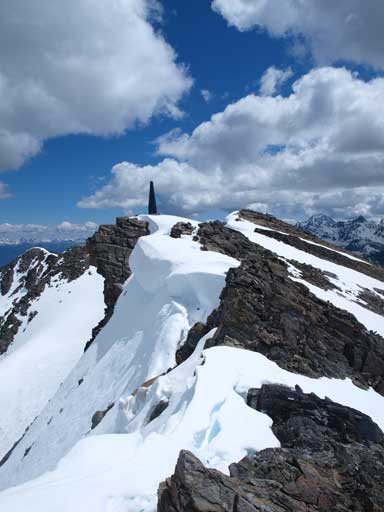
Almost at the summit now
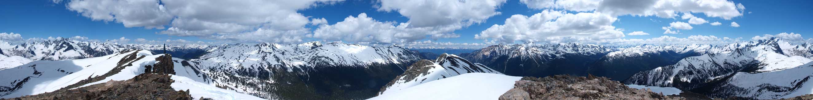
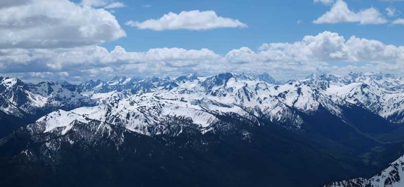
Summit Panorama. Click to view large size
Zooming-in towards the distant Rockies
Most peaks on Septet Range are unnamed. The big one poking behind is Mount Ethelbert
More less known peaks towards south
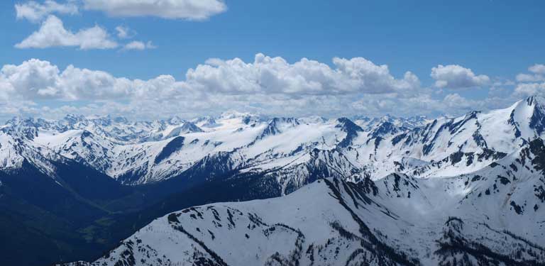
And more..
Looking North
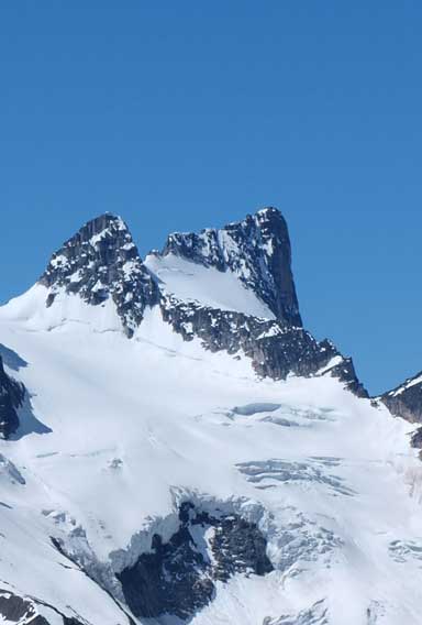
Snowpatch Spire and Pigeon Spire
Howser Peak
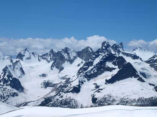
The group of Spires north of the popular Bugaboo region
Wallace Peak, Snafflehound Spire, and Spear Spire

Mount Conrad
We took a long stay on this summit. There was a brief weather window revealing the Goodsirs in the Rockies towards east. All the peaks nearby to the north and east are unnamed. They definitely deserve more attention. I will come back for the highest in that group for sure. I will also come back to this area to scramble up a couple Spires, and climb the major ones. I think everybody who has visited this area will say this is a must-visit, and it certainly only took 5 seconds to convince me after seeing them! There were more post-holing on the way down, but since it was mostly down-hill it was still fast going. We retraced our footprints/snowshoe tracks back. The old road was quite steep to hike down, and it was pretty hard on the knees.
Time to say goodbye to these spires.

Eric and Ben descending the only steep snow slope
Back to the post-holing terrain

Glacier lilies
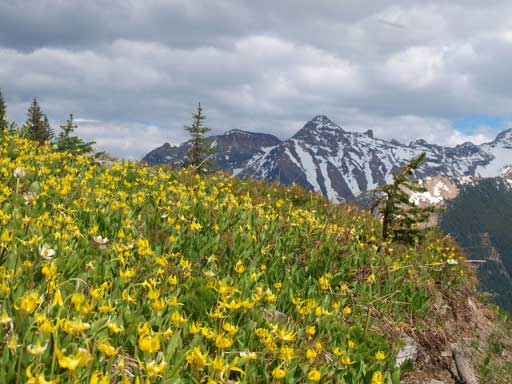
Glacier lily field
Hiking down the steep trail/road.
Our round trip time was just under 10 hours, and we certainly didn’t have time for a second objective. Ben was the man on this trip. He drove 8 hours back to Edmonton all by himself. All in all this was a awesome weekend spent in the Purcells and I’m sure I’ll be back here sooner than later.
