Kaumu o Kaleihoohie
February 14, 2023
1670m
Big Island, HI
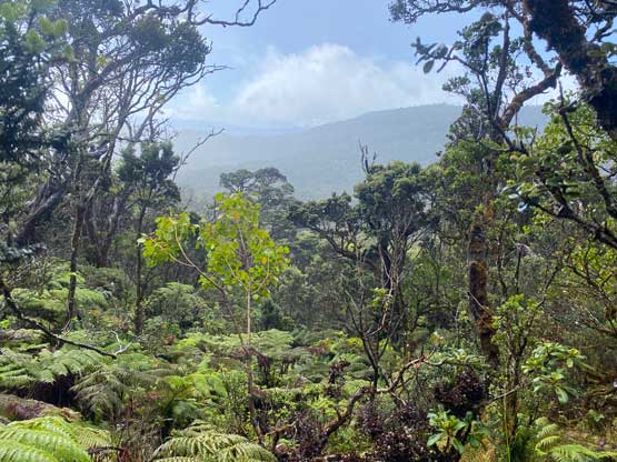
Kaumu o Kaleihoohie is the highest peak in Kohala Mountains on the NW corner of Big Island. This part of the Big Island gets much more precipitation as it’s exposed to the trade wind and because of that, the mountain tops and the windward slopes are covered by dense tropical jungles. An ascent of this peak offers some very different experiences than the typical higher altitude volcanoes such as Mauna Kea and Mauna Loa. Most hikers aren’t even aware of this objective but that’s too bad. You will most likely get soaked through by the jungle, the rain and the mud but the hike is worthwhile. The lower flank of this peak is actually in an arid leeward zone and offers some expansive views. This peak is also one of the 4 peaks on Big Island that boast over 600 m prominence.
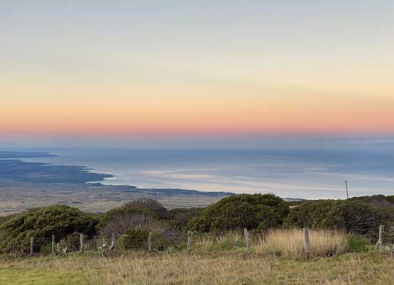
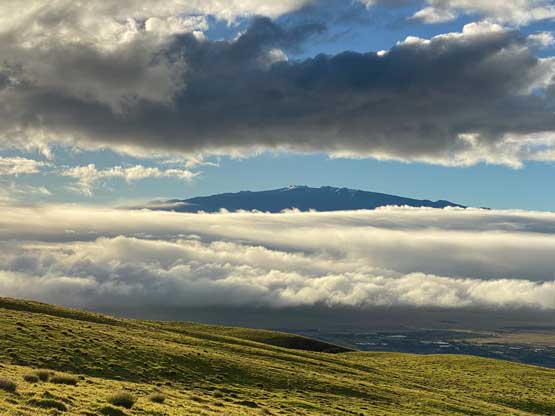
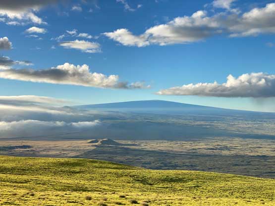
Nikita, Raphael and I decided to embrace the jungle adventure on the 3rd day of the Hawaii smash-and-grab trip and this trip happened to be on the Valentine’s Day by coincidence. I don’t think any person with sanity would opt to date the tropical jungle but that’s apparently our decision. The weather forecast was still calling for the 4th day to be the clearest so we would leave Mauna Kea for the last day. The beta wasn’t super clear whether or not trespassing is required but hopping over several barbed wire fences and gates would definitely be mandatory judging by what I read online. Not wanting to take any chance on the success I decided to wake us up at 5 am in the dark again to beat the authorities, if there’s any. The weather pattern on the Big Island is also generally clearer in the morning than in the afternoon. The drive to the trail-head at Koaia Tree Sanctuary was about an hour from Kona. We had clear skies in Kona but it was drizzling in Waimea, but then the weather went back to “mostly sunny” when we parked the vehicle a few miles west of Waimea. The micro climate in the Kohala Mountains is apparently complicated and unpredictable.


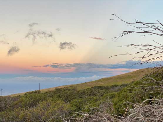
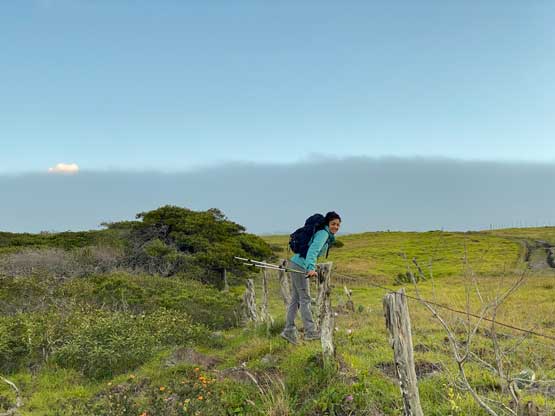
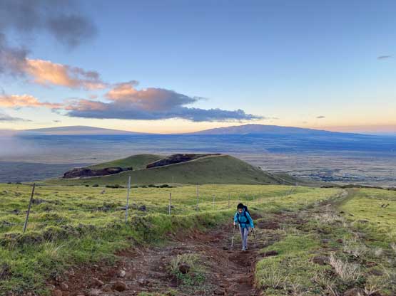
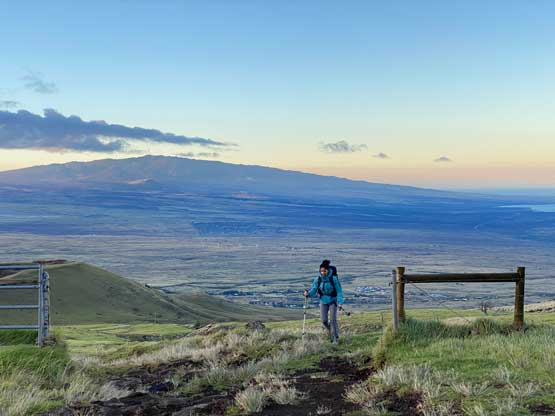
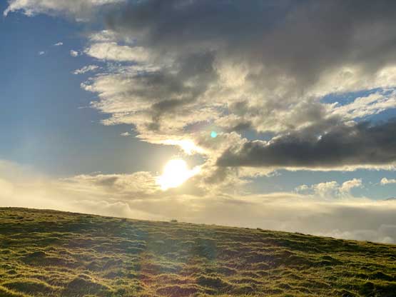
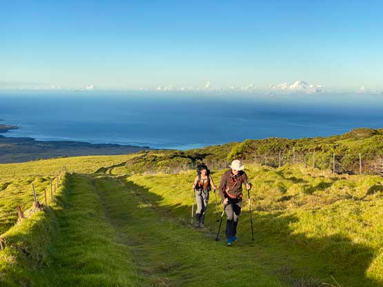
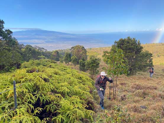
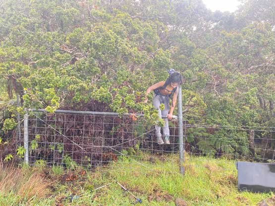
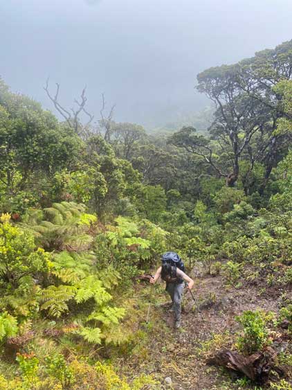
We should have just started the ascent by walking the ATV road but somehow decided to enter the tree sanctuary. The trails in the sanctuary wouldn’t lead us anywhere so a short while later we hopped the fence and went onto the ATV/Jeep road. The next stage was simply plodding up the road to the end and the views were amazing behind. The clouds were being pushed across Kohala Mountains from the north side but they wouldn’t reach this far down low on the lee side. We had clear skies until near the end of the road when we suddenly entered the drizzle. The vegetation had also changed abruptly from cactus to jungles. The “beta” wasn’t very clear about the section from the end of the road to the hunter’s trail below Eke. On the ascent we opted for the more obvious way by staying adjacent to the fence line and it was harder than it sounded like. For the most parts we were able to pick up game trails but we also needed to push through sections of thick brushes. We were thoroughly soaked by the wet bushes and the rain before even entering the real jungles. Numerous fence lines and gates also needed to be hopped over, so we talked about to descend a different variation a few hours later, which did not turn out to be an obviously better choice.
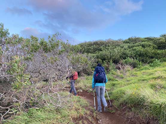


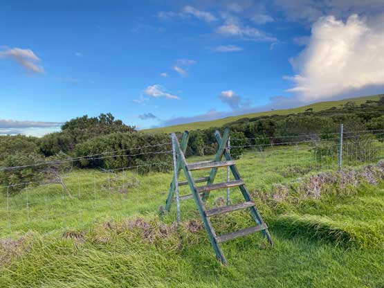


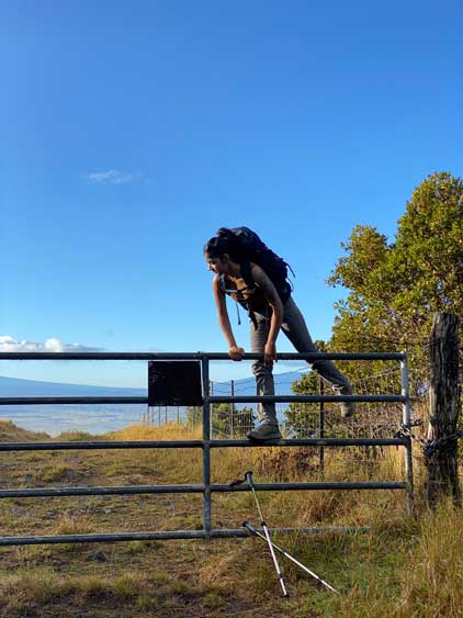


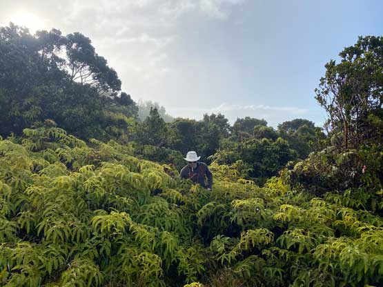
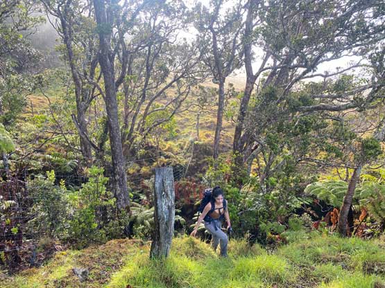

A few times I wondered if we should just hop over the fence into the jungle but managed to resist that temptation. The correct place to bail into the jungle according to the two sets of GPX tracks that we previously downloaded was assured by a wooden ladder and some form of a trail-head sign, reminding hunters/hikers to clean our boots upon returning. I was anticipating an actual trail in the jungle heading to the shoulder of Eke but what we actually found was just a flagged path. The path was not very obvious and would be extremely difficult, if not impossible to follow without the flags. Nonetheless with the combination of the GPX tracks and the flags we somehow managed to stay on route.


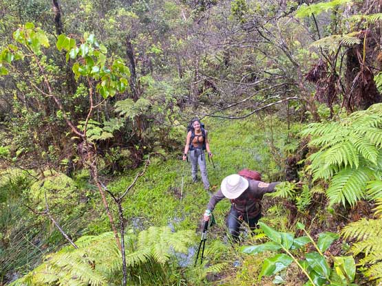
We ascended over the west shoulder of Eke and dropped about 50 vertical meters down into the broad saddle between Eke and Kaumu o Kaleihoohie. The weather had turned into a steady rain by this point even though we could see glimpses of blue skies above. The rain was purely from the moisture of the low-level clouds. Near the bottom of the saddle we encountered sections of swamps as mentioned in other trip reports. We were already soaked to the bone by this point so there’s no point in trying to stay dry. I simply post-holed through the swampy zones and sank shin deep at times. Raphael warned me the risk of losing the shoes in the mud and I quickly realized what I was doing was probably not that smart. The ascent of Kaumu o Kaleihoohie from the saddle was also more complicated than anticipated. It’s difficult to stay on route and the path was steep and scrambly. The ascent also took longer than expected and required some degree of perseverance. The true summit was also completely forested with no view whatsoever but it didn’t matter that much. It’s probably raining 350 days a year here anyway.


After some obligatory victory shots we reluctantly started the descent. The rain had become heavier and we all put on the rain jackets for some extra bits of warmth. The original plan was to ascend Eke on the way back. Given our soaked selves it was very tempted to skip that bonus summit but all three of us were stubborn peak-baggers and skipping an officially-named summit would not be considered as acceptable. After regaining Eke’s west shoulder I led us thrashing eastwards to the viewless true summit, took a couple shots and resumed the descent to get out of the jungle.


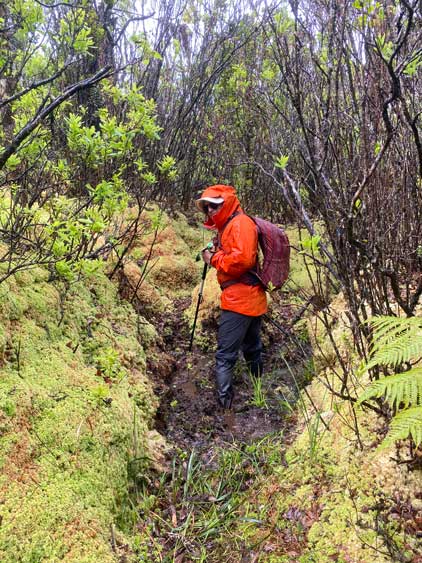


One set of the GPX track (from Sam Grant) had descended a different route so we planned to follow that instead of retracing the fence lines contouring. This descent variation started off nicely by following an abandoned dirt road, but we still had to face that eastwards traverse/contouring at some point. The line we opted to pick involved a lot of post-holing in high grass, a few fences to hop across as well as several deep gullies to scramble into and out of. I could not say whether I definitely preferred our ascent route or the descent route. Each of them had their own merits and downs so pick your poison. The rest of the descent was rather uneventful and as expected, the rain had stopped and the sky had turned blue once we descended into the lower flanks. After finishing the hike we took our time to change to dry cloths and then drove into the town of Waimea for food. While waiting for lunch I ran to the nearby McDonalds (free wifi) and spent about 20 minutes to update my socials. The food was great but the expenses were at least 50% more than in Vancouver. We then drove to Laupahoehoe Beach to prepare for Mauna Kea‘s ascent on the next day.