Mount Abel
February 4, 2024
1822m
Vancouver Island, BC
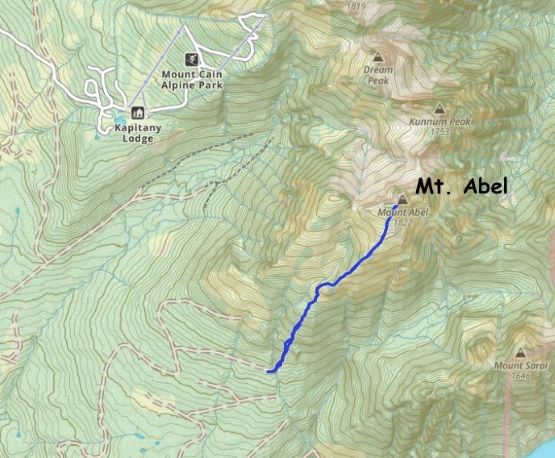
Unlike the more-fabled neighbour Mt. Cain that requires technical climbing, Mt. Abel is nothing fancier than a “walk-up” via the south slopes. Fortunately (or unfortunately), Mt. Abel is the taller of the two and subsequently boasts more than 1000 m prominence. This group of peaks locate on the vast lands of northern Vancouver Island but the access is actually quite straightforward thank to the nearby ski resort. Logging roads that branch off from Mt. Cain ski resort’s access had been pushed to as high as 1100 m elevation on the south side of Mt. Abel. Asides the short but intense bushwhacking to reach the alpine this south-side route is very tame by Vancouver Island’s standard. At least two friends of mine from Vancouver, B.C. had done this route in 2023 so there’s some fairly recent beta. Raphael Smith proposed to do a winter ascent. I was initially rejecting the idea due to the lengthy driving on logging roads, but this winter had been abnormally warm. The torrential amount of rain to as high as mountain tops in the previous week had washed away a lot of the snow, which led to the closure of Mt. Cain ski resort. Raphael was able to talk to the resort’s employees on Facebook and confirmed the absence of snow anywhere below 1000 m elevation. I then agreed to come along, but with a chainsaw to take care of the downed trees, in case there’s any.
There’s at least 3 hours of driving from Nanaimo to the ski resort so taking the 10:45 pm ferry from Tsawwassen to Duke Point would require me to do an all-nighter push. I was not particularly keen on that, so I rescheduled and cancelled some of Saturday’s work and then booked the 5:45 pm ferry leaving Tsawwassen. This was not an easy decision as I needed money for some expensive upcoming trips. I also confirmed with Chris H. that a Subaru Forester could definitely make to the end of the road so I would be driving Kate’s Subaru instead of my Tacoma. Raphael was already on the island and the plan was for him to drive out a few hours earlier to scout out the access, to further take in account of the unknowns. While relaxing in the ferry I received a text message from Raphael’s inReach that he indeed had driven to the road’s end. I replied that we should aim for the “best case scenario” to do two P1000m objectives with the second one being Mt. Romeo if the snowline was that high, but more on that later. Kate and I made to Campbell River at around 9:30 pm and stopped to cook some food. We had decided to bring some of our own meals to be cooked and we found a perfect spot with some street lights to do that. The drive from there to the road’s end was largely uneventful and we arrived at around 12:30 am. The road was only a little bit rough on the final kilometer and could have easily be driven in a 2WD car if not because of the steepness, and we sure encountered not a single patch of snow. I wondered about the state of the bushwhacking but I made myself to not think about that until the first light in the morning.


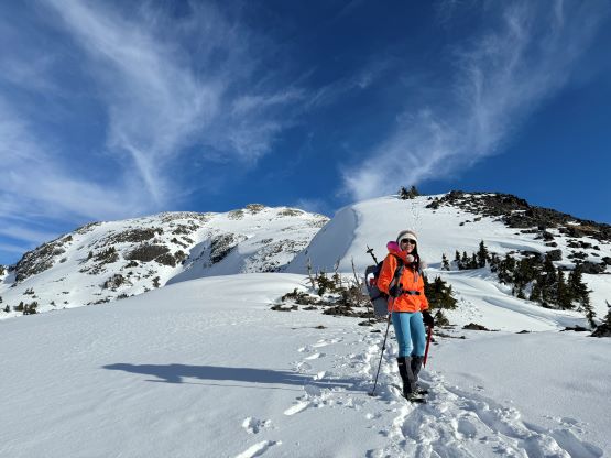
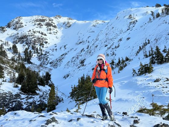
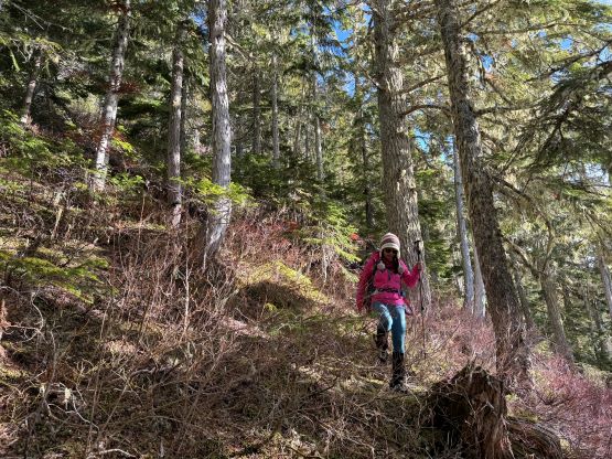
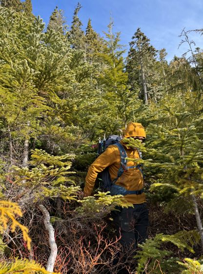
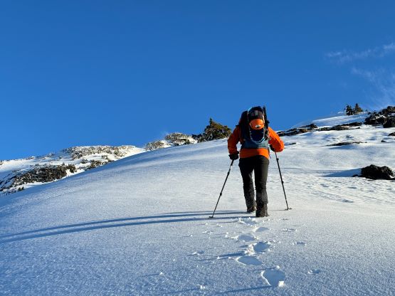
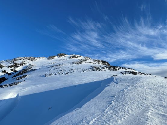
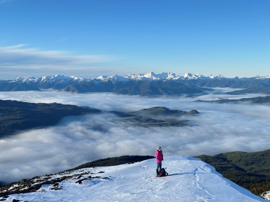
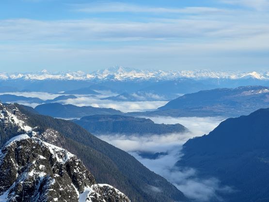
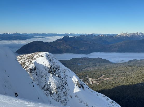
The plan was to start hiking at 7 am but Kate and I were a bit slow in making our breakfast. We eventually started at 7:20 am. The sunrise was about an hour late here than in Vancouver so the head-lamps were still put in use. The bushwhacking was indeed intense but honestly wasn’t as bad as I was anticipating from Matt’s trip report. Matt usually understates the bushwhacking difficulty so I was expecting a level-4 kind of thrashing, but it was level-3 at the most. I led us ascending a line in between Matt’s two GPX tracks so it’s possible that we actually picked a better way, but who knows. In about half an hour we had pushed through the cut-block and the subalpine forest above was also not that bad. Again, I was anticipating a nightmare kind of bushwhack so a slick forest with pick-up sticks and a ton of underbrush was already considered as “better”. We eventually hit the snowline at 1350 m and never needed to don snowshoes nor the crampons that we had brought. This was not far from the treeline so we would soon be treated with views.


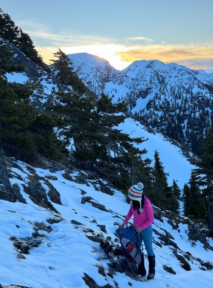


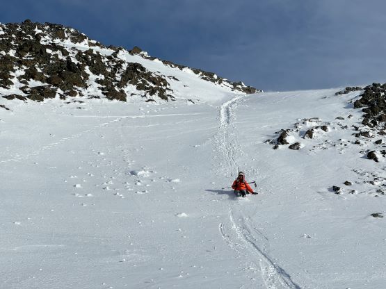
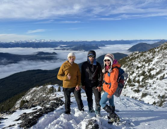
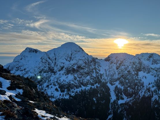
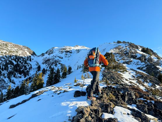
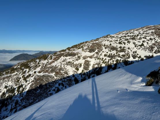
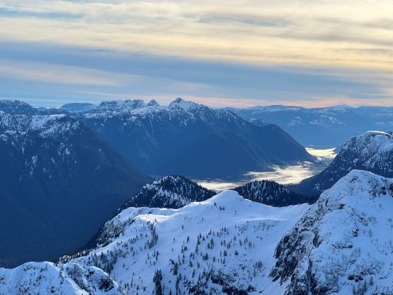
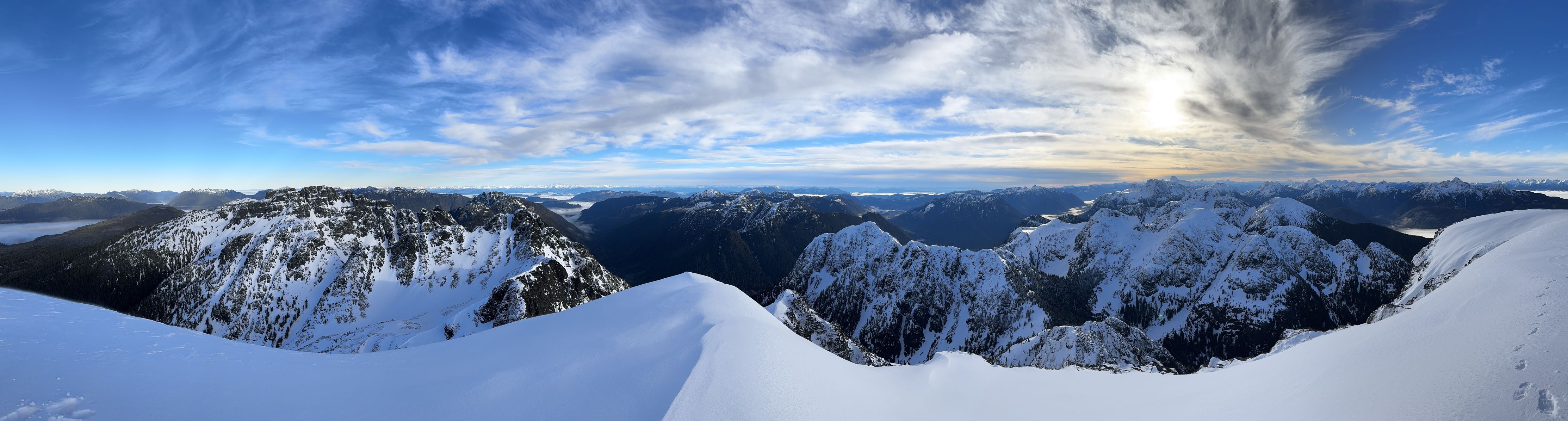
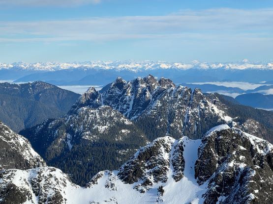
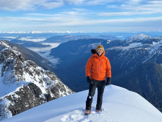
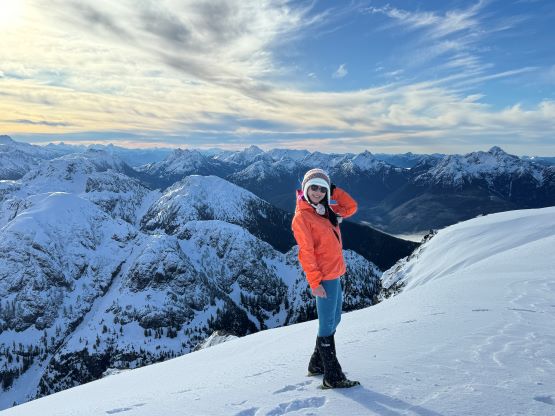
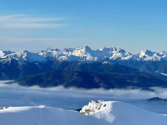
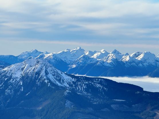
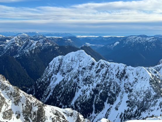
There’s a rock buttress blocking the access to Mt. Abel’s SW Ridge. The reference GPX track went climber’s right but the winds were pushing from that direction. Instead of embracing the winds I decided to explore a way on climber’s left. We had to deal with a section of slippery scrambling but the route went reasonably well. Kate was not happy about that scrambling section but found a different way using vege-belays after struggling for a few minutes. The rest of the ascent was then just a long plod up the SW Ridge and the scrambling was class 2 at the maximum. We also stayed on snow for as much as possible and some slopes were a bit steep and firm. The true summit was on climber’s right side after gaining a saddle feature on the summit ridge. I made Raphael to go ahead as I needed to stay behind with Kate. Raphael initially went towards the wrong way but quickly realized the mistake, and we regrouped on the summit. The views were amazing as expected, but the cold winds had definitely shortened our stay.


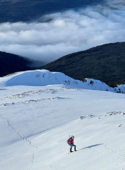


The descent was rather no-brainer as we just needed to follow our own tracks. To descend those few firmer slopes we opted to glissade. We might have put a dent on the lifespan of our pants but it’s much faster (and more enjoyable) than gingerly down-climbing. The bushwhacking was at least three times easier now with gravity assisting us, and we finished the round trip in under 4.5 hours. We were more or less on schedule so the decision was made to rush to Mt. Romeo for the second P1000m of the day.