Harvey’s Pup
March 11, 2021
1512m
Lions Bay / North Shore Mountains, BC
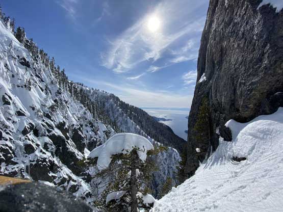
Among the North Shore peaks Mt. Harvey doesn’t stand out by any measurement but it does boast a steep north face with an obvious “ramp” that cuts diagonally across the face making an aesthetic winter route that I had soloed in 2017. Right next to the North Ramp sits an impressive outlier unofficially named “Harvey’s Pup”. Unlike most of the peaklets in North Shore Mountains this one boasts at least 50 m prominence and does not have a “tourist route” to the summit making it very legit to qualify as a separate summit. There are really only two published routes. “Harvey’s Pup” is not a secret in the rock climbers’ circle as the “Pup Buttress” is documented in the Alpine Select and has at least half a dozen well-written trip reports online. However, the grade of 5.10a combined with the added SW BC challenges such as the vagueness of beta means it’s out of the league for someone not veteran in rock climbing (ie. myself). The route that actually intrigued me was a traverse from Mt. Harvey’s hiking trail diagonally down into the climber’s descent gully. This route has only one trip report on the old ClubTread forum but the report was poorly written that it’s nearly useless as beta source. The traverse likely involves “vertical bushwhacking” and the climb on the Pup’s south face out of the gully was reported “maybe stiff class 3” in that report but upon consulting with at least one local climber I’ve determined that rating was likely sandbagged. Those guys were competent climbers and they rappelled the face so that indicated the ascent was definitely more challenging than “class 3”.
For a few years I thought about to just copy their trip and figure out that ugly traverse and I’ve spent hours analyzing photos taken from various angles, and yet I could not convince myself the feasibility of that traverse, or I should say I didn’t want to embrace the level of vagueness and unknown of that route. Upon further research I came up with a third solution, that was to ascend the climber’s descent gully to near Pup/Harvey col in winter conditions. The descent gully had been reported to involve half a dozen rappels on wet slabs with sketchy anchors in summer conditions, but what about in winter… There was zero information online but the Sentinel Hub satellite images taken in April suggested the gully could very likely be completely filled in with snow that the climb would be no harder than a simple ascent of 45-degree snow. The downside would be the unknown challenges on the south face as winter conditions would make it into the realm of mixed climbing, but the North Shore Mountains usually holds unbelievable amount of good-quality snow that the snowpack might actually ease the difficulty. At least that’s what I was hoping for but I would not count on that. The maximum amount of snow occurs each year around the first half of March in this part of BC so that’s the time I wanted to try this route out. On technical missions like this Winnie M. would be the ideal partner and we pulled the trigger at the last minute upon seeing what seemed like a prime window for the North Shore Mountains. There had been some snow events but numerous gullies had been skied recently with no instability reported whatsoever.

Harvey’s Pup via climber’s descent gully. GPX DL
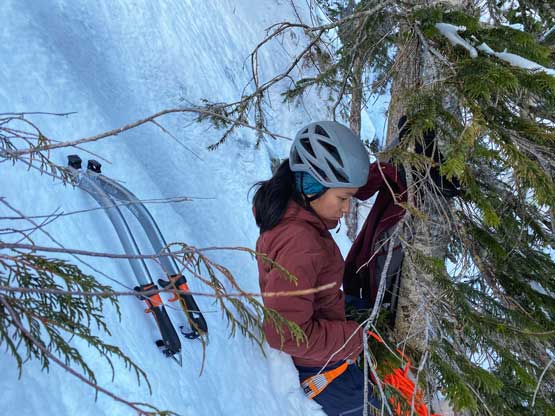
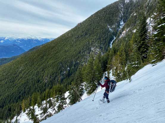
In terms of technical gears we brought one 60m rope, a small rock rack, 3 pickets and lots of slings as we anticipated abundance trees for natural protections. We unfortunately had to carry snowshoes as the snowpack hasn’t fully transitioned into spring mode yet and my pack’s weight was over 35 lb at the start, a wee bit heavy for a day-trip. Winnie and I left Vancouver around 6 am and started the plod before 7 am. The parking at Lions Bay was not a problem in the early morning hours. There’s very little worth noting about the first few switchbacks up the deactivated logging roads to the Magnesia Creek spur junction. We took the left branch and soon encountered patchy and then continuous snow. The snowshoes were strapped on at around 750 m elevation and the start of the gully was at 900 m elevation. We snowshoed a few hundred meters up the low-angled lower portion of this gully. About 15 cm of low density fresh snow had accumulated on top of the hard-as-fuck avalanche debris and the snowshoes definitely helped our ascent.

Snowshoeing on Magnesia Creek Road

Reaching the base of the ascent gully. Harvey’s Pup ahead

We were still snowshoeing at this point.
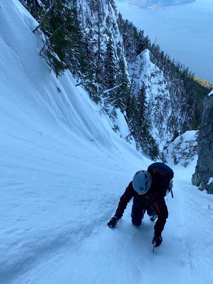
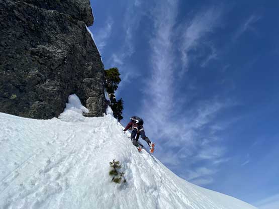
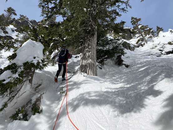
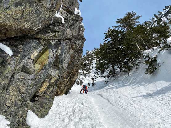
Just about when the couloir started to narrow down into the first constraint we found a flat spot under climber’s right side of the wall to ditch snowshoes and strap crampons on. This first constraint was about 40-45 degrees only but narrowed down to under 3 meters wide. We were both attracted by the ice wall and we promised each other that if we finished the climb with spare time we’d do some laps on the ice. Above the first constraint we had a while of mellower terrain leading into a major fork in the couloir. We would pick the left (narrower) branch shooting straight up towards Pup/Harvey col. The terrain would soon steepen to 45 degrees and we both ditched the pole and took out the second ice tool. The snow climbing was fairly mellow thank to the superb conditions. We did encounter a few stretches of front-pointing but for the most parts we were able to kick bucket steps into the slope. Near the top of the gully I led us trending climber’s left into a zone of 50-degree forest and we kept soloing until what seemed like a 60-degree icy pitch stopped the further progress. I gave the rope to Winnie and she soloed it with no problem. I soloed it halfway up but didn’t quite trust the ice tool placements so asked her to drop the rope down for a belay. Awkward… After about 10 minutes of heavy spindrifts the rope finally reached me and now with safety on my side the steep snice climbing felt actually quite fun.
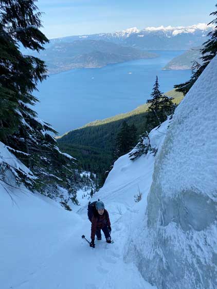
Approaching the first constraint

Winnie starting the left fork of the gully heaving for the high col

At times we were wallowing in deep and unconsolidated snow

Me climbing the lower portions of this gully

Winnie now much higher up in the gully
Winnie dealing with a while of front-pointing on neve snow
This is Winnie soloing the first pitch
A sideways view from my position under the pitch
Winnie at the belay station above Pitch 1
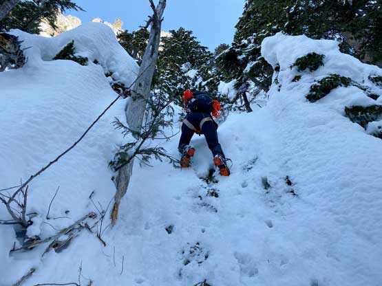
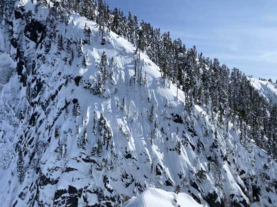
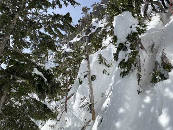
I found a slightly bigger tree just to the left of Winnie and built a bomber belay station for her to lead Pitch 2. We couldn’t see what would be the optimal line but we had to aim for the bottom of an obvious rock buttress on the upper mountain. The line that I saw with the least amount of resistance involved some traversing on down-sloping but low-angled (possibly slabby) terrain out climber’s right but Winnie being a climber, charged straight up the pitch attacking the rock bands head-on. This turned our Pitch 2 into the crux of the trip. I was barely able to follow it up without falling. Upon seeing the upper route I offered to lead Pitch 3 but I forgot to take the rock gears from Winnie’s harness. The rock step turned out harder than appeared and I didn’t feel comfortable stepping onto the down-sloping terrain without protection, so gingerly down-climbed to Winnie and grabbed the nuts and cams. Up I went again I managed to place a nut into a crack and now with protection I soldiered onto a bomber tree and then muscled up the rock step to the bottom of the aforementioned rock buttress. Traversing out climber’s right involved one more bushy step that I had to use all forms of vege-belay techniques to man it through. Then onto an easier snow bench, around the corner of the buttress onto the east side of the summit block I climbed a few more meters of steep and loose snow and belayed Winnie up on a bomber tree station. The passage to the summit from this point was just a simple 45-degree snow climb.

A topo of P2 and P3 of our climb

Winnie starting the second pitch

Partway up Pitch 2, looking down

Winnie belaying me starting the Pitch 3

The rocky zone on Pitch 3 was harder than it looked from below
Above the rock zone traversing under the giant rock buttress

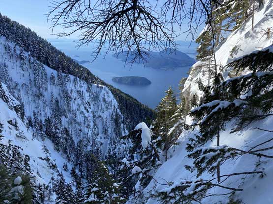
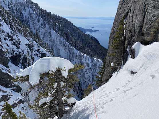
Around the corner I got to see the impressive Mt. Harvey’s north face

Belaying Winnie up to the station above Pitch 3

A sideways shot from my belay station showed the terrain angle here
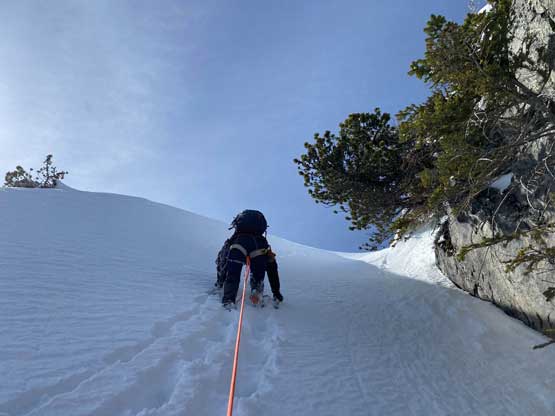
I belayed Winnie to run the last slope to the summit
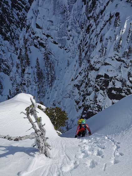
Me soloing the last snow slope to the summit.

Partial Summit Panorama from Harvey’s Pup. Click to view large size.
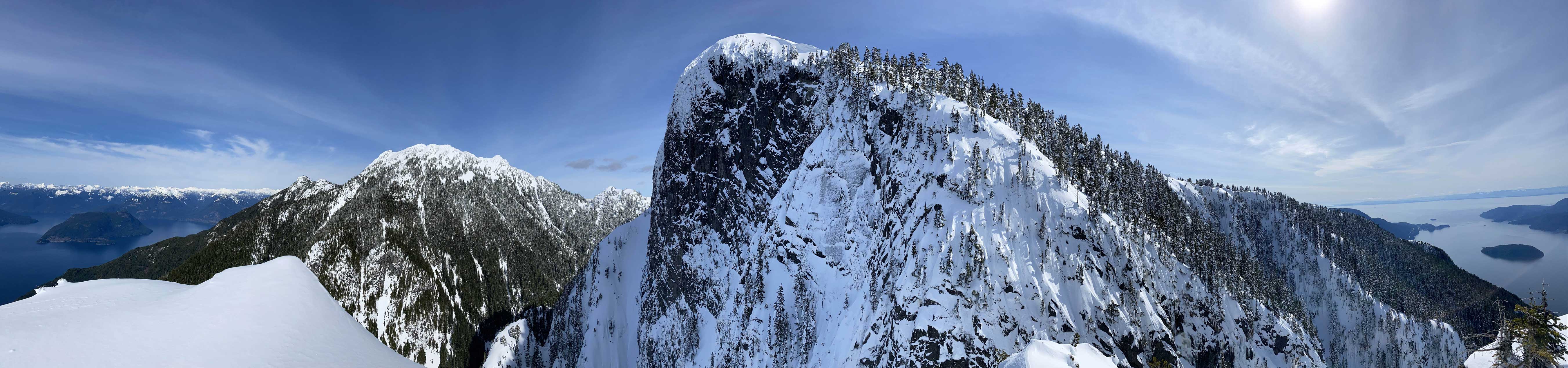
Partial Summit Panorama from Harvey’s Pup. Click to view large size.

Bowen Island and Mt. Gardner

Anvil Island and Leading Peak with Sunshine Coast behind

I yet need to do Hat Mountain

I traversed the summit ridge of Brunswick Mtn. three years ago in March
This shot shows that a direct descent from Mt. Harvey to the pup isn’t possible

A head-on view of Harvey’s North Ramp route

Could you see a potential traverse route from Mt. Harvey’s trail to the pup? mm…
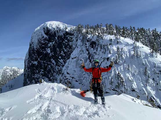
Me on the summit of Harvey’s Pup

Another photo of me celebrating the summit of Harvey’s Pup
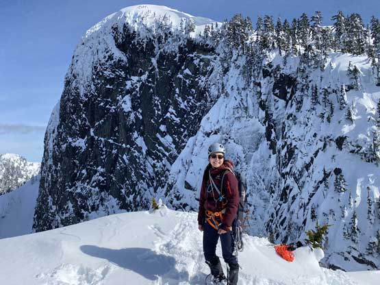
Winnie on the summit of Harvey’s Pup
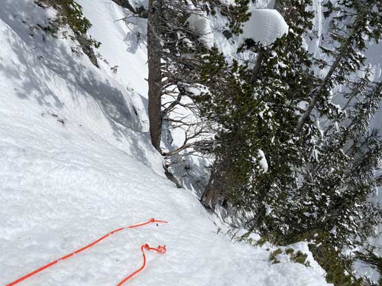
The summit was surprisingly spacious so we lingered a long while soaking in the views. We were not in a hurry to descend as we were doing great on time. For the descent we decided to gingerly down-climb the upper route around the rock buttress to save some hassle. Then I led three rappels down roughly our ascent line from one tree station to another. The last rappel was optional but the trees were too good to not use. By this point the gully/couloir was baked under the sun for a few hours so the down-climbing no longer involved front-pointing. Fresh snow balling under the crampons were pretty annoying though, but nonetheless we made some fast progress down the gully. Lower down the sun’s out again and we each did two laps on that short ice wall. This was my first ever time climbing on waterfall ice and I had to say it’s very fun. Descending the lower gully on those hard avi debris was not as fun but not difficult.
Down-traversing back across the mellow ramp under the rock buttress
Winnie down-climbing around the exposed corner around the buttress

Preparing for the first rappel

Winnie on Rappel #1
Looking down the second rappel…
This sideways shot shows the true angle of the terrain around Pitch 1
Winnie finishing Rappel #2

The third rappel got us a ways down the gully

Time to down-climb soft snow
Staying away from the runnel for softer foot placements
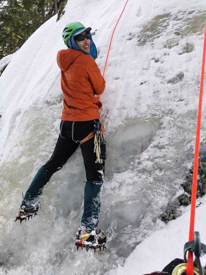
Me practicing ice climb. Photo by Winnie M.
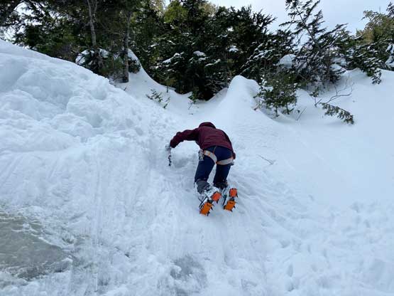
Winnie down-climbing snice after cleaning up the anchor

The lower gully was mellow enough that we just walked facing outwards
It looked easy here but actually not thank to the frozen debris

Snowshoeing down the approach road until we ran out of snow

The last few kilometers were a slog
Our packs became progressively heavier and heavier as we picked up one piece of gear after another. We wore crampons all the way down to the Magnesia Creek road then snowshoed down until we ran out of snow. The rest of the plod down to the truck was uneventful but unpleasant. Our round trip time was just under 10 hours including everything.
Obviously the Pup Buttress is still the way to do this peak for those capable of rock climbing at the grade of 5.10 but for peak-baggers not willing to up their rock game to that level, I think our way is the most efficient and also the most enjoyable way to tag this summit. This entire trip was type 1 fun except for perhaps the approach. I’m just surprised that nobody had done Harvey’s Pup the way we did (at least nothing can be found on the internet).. How difficult is Harvey’s Pup? I think it joins Spindle Peak, The Camel and East Lion to be one of the hardest summits in North More Mountains via the easiest possible route.
