Mount Parker (East Harrison)
May 23, 2021
1696m
Ruby Creek / Harrison East, BC
Mt. Parker locates at the headwaters of Ruby, Bear and Garnet Creeks in the “East Harrison” area. There are logging roads being pushed high up in all three valleys but Bear Creek FSR is gated near the bottom. The peak itself is largely uninteresting from mountaineering perspective and an ascent is seldom heard. I’m sure the locals in the Fraser Valley do go up there secretly but in this modern era I judge the popularity of a peak by the amount of posts it gets on social media. In this case, there had been none until last weekend when someone shared a report on the “SWBC Peak Baggers” Facebook group. The approach that he took was from Ruby Creek FSR and he was able to drive 14 km up the road meaning the peak could then be easily done as a before-work exercise. I have to note here that Ruby Creek FSR is not even marked on bivouac.com which has been my primary source for FSR information, and because of that I had never thought about to access Mt. Parker (and possibly Mt. McNair) from the south.
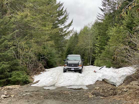
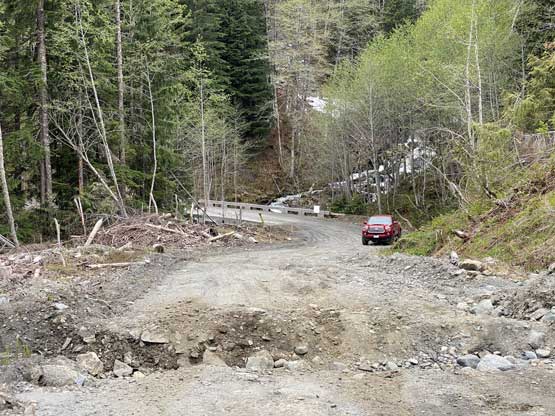
The weather for this past Sunday had been a mixed bag with precipitation forecasted to start in the PM. There seemed to have a brief window in the morning and the farther east the better the forecast was. I had a few hours to collect my thoughts after coming back home from Klesilkwa Mountain in Chilliwack Lake area and in the end I decided to push for Mt. Parker solo. I had to be back home by 4 pm for work and I was already tired from the lack of sleep recently, but the weather in the foreseeable future looked rather dreary and I did not want to miss this morning window. I drove out of White Rock at 9:30 pm and made to Ruby Creek in an hour and half. The going up the Ruby Creek FSR was smooth for a few kilometers until the grades picked up. From around kilometer-6 onward I encountered at least 100 water bars. None of them provided a challenge for my trusty Taco but it was very annoying. The ditches gradually became deeper and bigger as I drove past around km-11 and eventually I decided to park in front of a deep ditch right after a bridge at 780 m elevation. The ditch was not wide nor “big” for that matter, but deep and steep. This spot was only 1 km from where the previous guy parked and I estimated at the worst case scenario, an extra 1.5 km of walking each way. It was almost midnight so I quickly went to sleep.
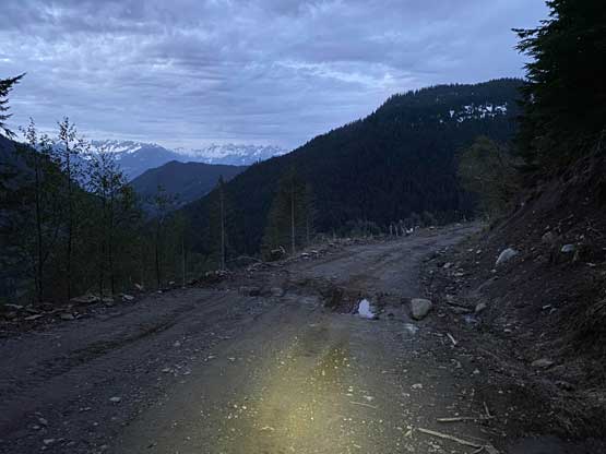
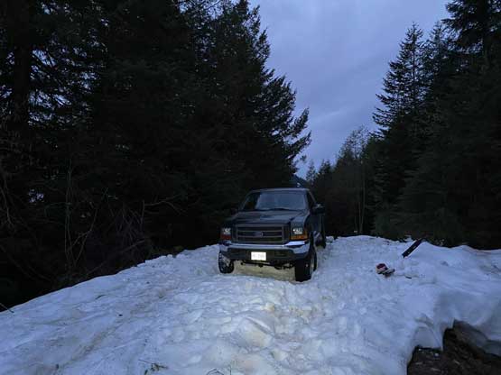
At around 3:20 am I woke up hearing something and sure enough, two guys came over and knocked my door. I thought they were police or some kind of construction workers but then I realized there’s no way I was in anyone’s private property as I did not encounter any sign of “no trespassing”. I hesitated to open the door but had they been thefts trying to rob my vehicle they would have just smashed the window or flee upon seeing someone still inside the vehicle, so there might be some problems. I opened the door and sure enough, they had driven past this spot an hour ago and got their truck stuck in a deep patch of snow. Part of me wanted to help but there were two problems. Firstly there’s a reason why I parked at this spot because I did not want to drive across that ditch ahead. They did say that’s the worst spot but that didn’t mean this ditch would get any easier. And two, despite that I had driven thousands of kilometers on logging roads I had zero experience of rescuing nor any knowledge about mechanics and in fact, I had never even touched a tow strap yet. I deeply believe if one day I finally had to call for a rescue on inReach it’ll be a truck problem on a remote FSR, so I said no to them and went back to sleep. I did ask if their truck’s in any danger of slipping further and they said no, so the best bet for them was to continue walking down and (hopefully) find someone else more experienced to help. Of course the sleep did not come easily so after 20 minutes I got up and started cooking some breakfast. I spent 10 minutes preparing a hot meal of ramen before starting my plod, still in pitch dark.

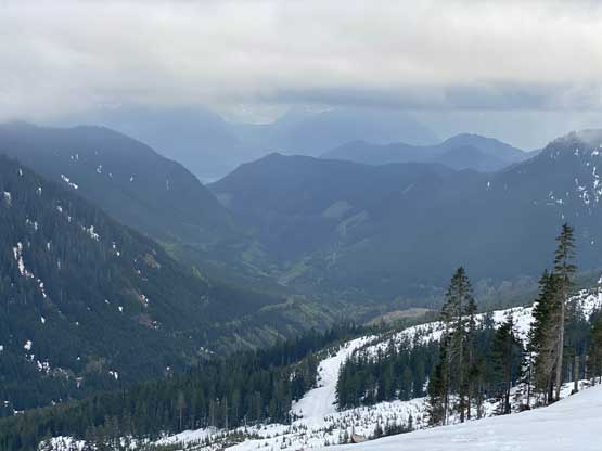
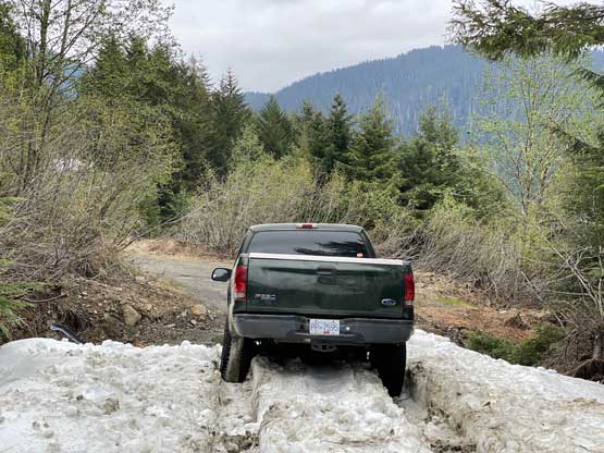
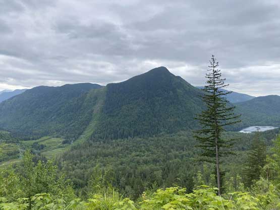
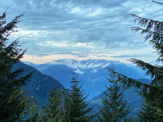
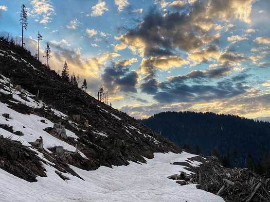
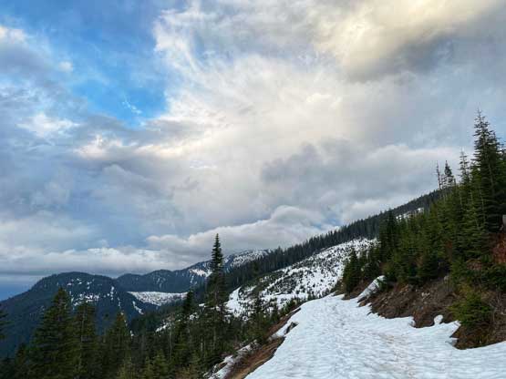
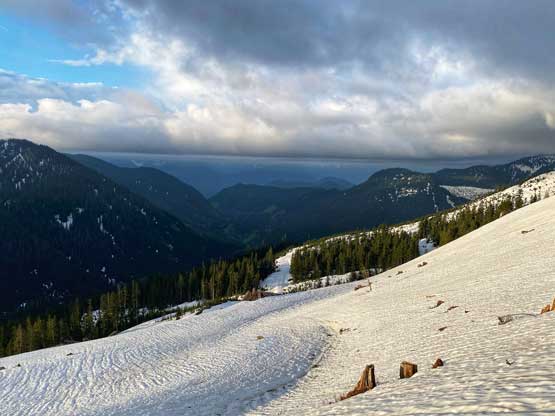
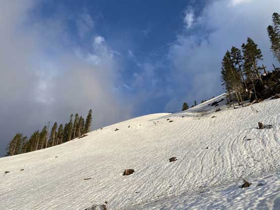
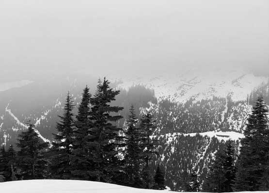
As expected, the road was in a great shape after that initial ditch and sure enough, after 1.5 km / 25 minutes of walking I came to their truck. There’s one more person in the truck but it seemed like he was sleeping so I didn’t bother to wake him up. The patchy snow soon became continuous in another few hundred meters and surprisingly I found a fresh set of tracks to follow. Initially I thought those must be tracks from the other guys but there were also pole tracks and the foot prints were clearly left by sturdy hiking boots if not mountaineering boots. After a couple switchbacks the tracks were still heading towards the direction I wanted and at this point I was confident that someone must have seen the recent Facebook post and went after Mt. Parker on Saturday. There was an annoyingly long and flat section around 1200 m but the view from this stretch was not bad. The weather was unfortunately, not nearly as clear as I had hoped for, though watching the morning light combined with a band of low clouds rapidly closing in from west was kind of cool.

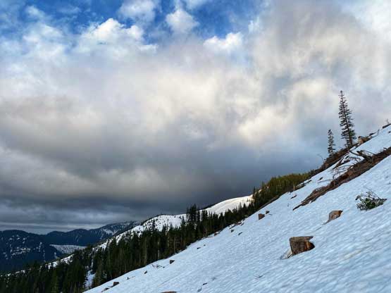
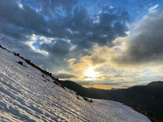
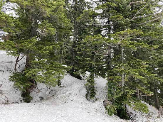
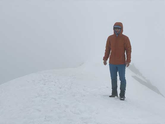
The route then ascended a steep-ish cut-block for at least 100 vertical meters into the mature forest onto SW Ridge then stuck close to the ridge crest. At one point the tracks split. I followed their up-tracks because it’s easier to use the up-track’s foot prints but the up-track got a bit steep and exposed. I could see why they picked a variation on the descent. The clouds had unfortunately fully obscured the summit so the last half an hour was spent only to put a check mark on this summit. I waited on the summit for another 15 minutes. I even got some cell signals so checked the weather forecast, and not to my surprise, it had degraded since the day before. I figured there’s zero chance of getting any view so I quickly started the descent.
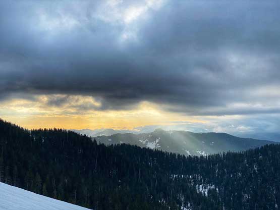

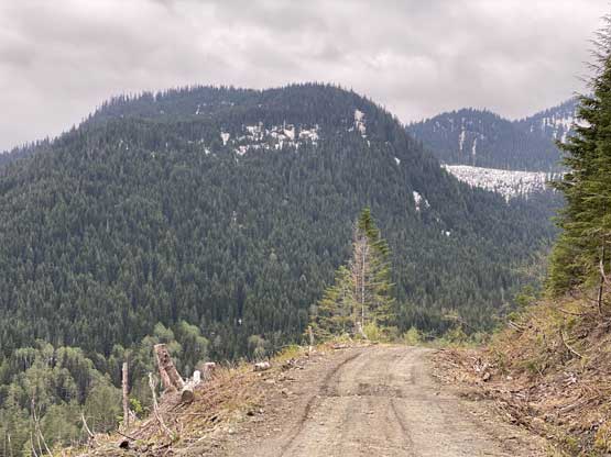
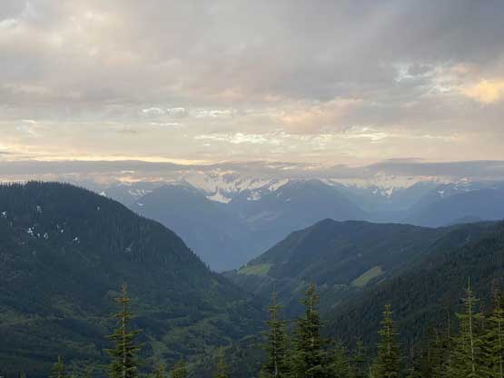
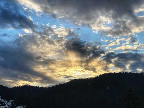
I plunged down the soft snow following the descent tracks. The down-tracks did some long traversing but still better than the up-tracks in my opinion. While descending the steep cut-block I got to enjoy a few long glissades and also at this point, I had descended below the clouds ceiling. I did take some photos on the hike-out, but the views were rather so-so. The truck was still there unfortunately and the guy was still sleeping so I assumed that the two guys were still walking out for help. I did not see them on the drive-out but I did see a few parties camping on this FSR so I assumed that nobody offered them a tow. Part of me felt bad for not offering them a help but I’m not someone pushing into unfamiliar fields without the assurance of certainty. My round trip time was 4.5 hours and I got back home at lunch time.