Field Peak
January 14, 2021
1563m
Harrison Lake East, BC
Field Peak is an officially-named but forested bump north of Bear Creek but south of Talc Creek about 15 km down East Harrison FSR. My first time coming across this peak was reading Simon’s trip report on ClubTread a few years ago. This did not sound like a pleasant trip but Simon did not discover the easiest/most efficient way to reach this summit, as he found out on the descent (and later at home). I thought Field Peak would make an ideal winter objective especially when avalanche conditions weren’t the greatest. The views looked reasonably nice in Simon’s trip report so I still needed to do it in good weather. A few years later I finally came across one perfect oppourtunity. The avalanche condition was “High” or “Considerable” across all zones but a brief high pressure system kicked in granting good visibility on Thursday. I was supposed to work in the afternoon and evening but considering the shitty weather we had been receiving recently I decided to go out nonetheless. I bailed the work in afternoon but kept the evening work because I couldn’t justify losing a full day’s worth of money for this dumpster summit.
To make sure I could definitely get back home in the evening and still have reasonable amount of sleep I decided to head out on Wednesday evening to sleep in my truck. I drove out at around 10:30 pm and made to the gate on Bear Creek FSR at around 1 am. I had some doubts about the road conditions after the massive wind storm we just had, but ended up not having much of a problem. I woke up at around 8 am on the next day and leisurely cooked a ramen breakfast before starting the plod.
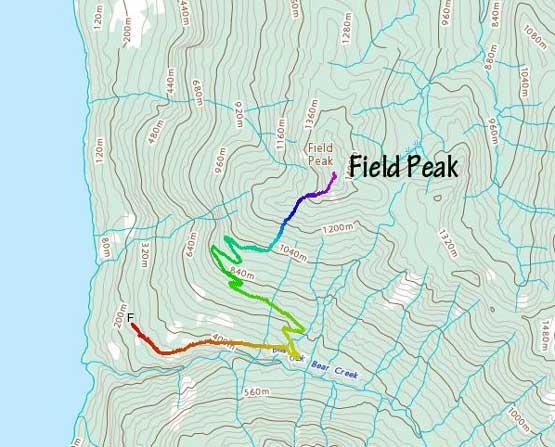
Field Peak from Bear Creek FSR. GPX DL
I had done enough of research about the direction of the logging roads and there really wasn’t much magic about it. I had downloaded both the Gaia topo (spur roads already on the map) and the satellite images and there’s zero excuse to get lost. After a couple kilometers and a few switchbacks I started to encounter snow at around 700 m elevation and the snow soon became continuous and I strapped the snowshoes on. The weather was more overcast than anticipated but the cloud layer was pretty high. I snowshoed to the highest point on this road at around 960 m elevation and left the road into a massive cut-block. I had the option to use mature forest at this stage versus the cut-block and chose the latter. I’m sure the mature forest would be easier to ascend but I liked the open terrain in the cut-block for views. The snow condition was kinda shitty in the cut-block though and I frequently discovered weak spots sinking knee+ deep into the wet cement. The cut-block was also steep enough to slide in the right conditions but on this particular day the snowpack depth was not thick enough to impose avalanche concern.

The typical plod on Bear Creek FSR
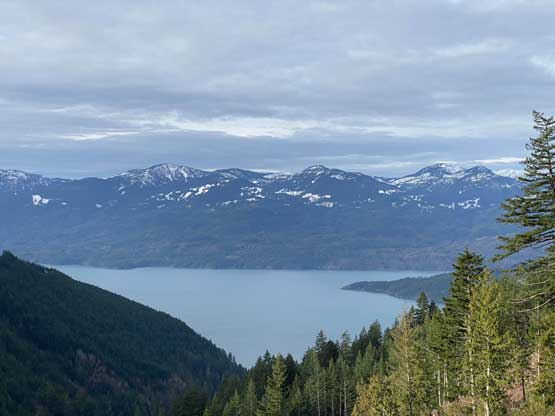
Already decent views down to Harrison Lake

The road was in a great shape. You should consider biking if that’s an option..
Mt. Downing and Mt. McRae behind Harrison Lake
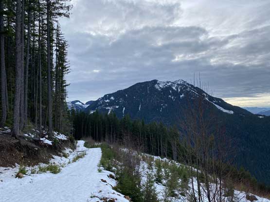
Looking back towards the forested Lookout Peak

This is the cut-block that I ascended at the end of the road plod

A wide-angled shot of Lookout Peak from partway up the cut-block

Me on the upper end of the cut-block with Harrison Lake behind
After the while the cut-block gave way to mature forest and the next 200 m elevation gain was very steep (35-40 degrees). The snow condition was icy and firm in the forest and definitely put my Lightning Ascents in test. I did manage to ascend through the steepest zone without taking the snowshoes off. At one point I considered swapping snowshoes for ice axe and crampons (I brought them knowing the conditions could be icy) but didn’t end up making the transition. Above 1200 m the grade eased and the snow condition started to become wet and saturated cement that was not supportive enough for my weight. My progress was pretty slow for a while. The ascent on the west-ish ridge above 1400 m had a few more steep and tight spots. The true summit was mostly forested but I already got the views I wanted from various viewpoints along the way.

The typical forest. It’s a lot steeper than appeared here
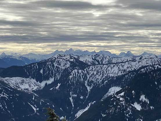
Looking south to the Cheam Range peaks on the skyline
Mt. McNair to the west

The upper Bear Creek drainage with infinitely many logging roads
Lookout Peak in foreground.
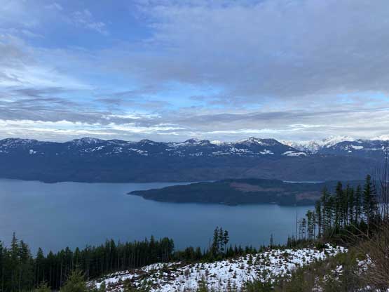
One of the better viewpoint of Harrison Lake on the upper west ridge
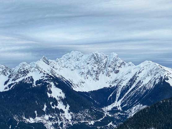
The west face of The Old Settler
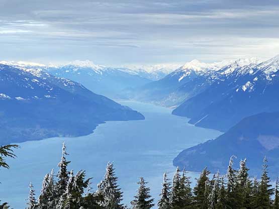
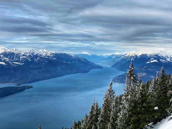
This is already from the summit looking at north end of Harrison Lake

Me on the summit of Field Peak
I didn’t linger too long on the summit because I needed to get back home as early as possible to not miss the evening work. The descent in the forest was fairly technical thank to the shitty snow conditions. I had to be extra cautious in both the saturated cement (to not step in a weak spot and face plant) and the icy sections. For that steep zone I again, refused to use crampons and ice axe and instead, I just down-climbed facing into the slope on snowshoes. The descent back through the cut-block was a shit show as the snow no longer supported my weight and I sank frequently to knee or even thigh deep. Once back onto the logging road the plod had become much easier.

Harrison Lake and Long Island

The Chehalis VRC Group – Viennese, Recourse, Mt. Clarke

Stonerabbit/Ratney Group with Mt. Judge Howay behind

Another view looking south past Lookout Peak

Looking back at my snowshoe tracks on an open area on the ridge

Sections of this ridge was very steep

Fast forward down to the logging roads now

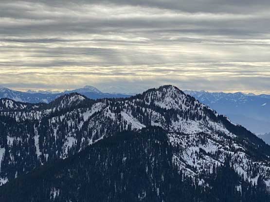
The elusive “Doctors Peak” and “Trio Creek Spire” in Chehalis area
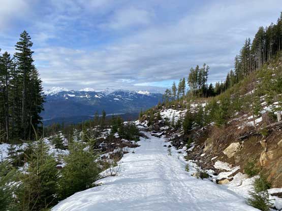
Looking ahead to the logging road plod. Still having snowshoes on
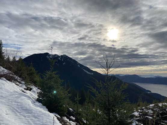
One last look at Lookout Peak

Running out of snow now

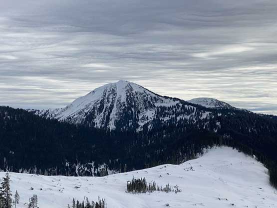
Mt. Klaudt and “Cartmell Peak” from a lower viewpoint

A wider angled shot from the same viewpoint
Taco parked…

Looking north up Harrison Lake from a viewpoint down on the road

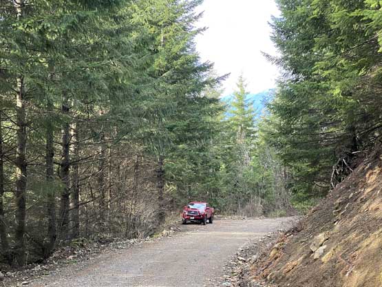
My truck parked for a photo

A random waterfall on East Harrison FSR
My round trip time was just over 5.5 hours on a non-rushing pace. I also took my time driving down the FSRs and stopped a few times for some photos. The rest of the drive back home was pretty easy without much of delaying. I did not quite earn myself napping time though so the work turned out to be tiring and miserable, but manageable.
