Tetrahedron Peak
September 25, 2018
1739m
Sunshine Coast / Tetrahedron Provincial Park, BC
Tetrahedron Peak is the highest peak in its namesake provincial park of Sunshine Coast not very far away from Lower Mainland, but thank to the requirement of expensive ferry rides this area remains quiet and somewhat obscured. I’m sure the locals frequent these peaks but very few Vancouver-based scramblers visit the area on a regular basis. To me the cost is also a major deterring factor but I also hate to climb a mountain with a time constraint (due to ferry schedule). I’ve moved to Vancouver for over three years and still due a visit to Sunshine Coast. An ascent of Tetrahedron Peak had always been on my mind but every time the plug was pulled for one reason or another… This September had been dreary but towards the end of the month a high pressure system finally kicked in. I wasn’t sure what exactly to do but my “peak database” once again reminded me I still hadn’t done anything on Sunshine Coast yet…
One might expect the standard route of Tetrahedron Peak definitely comes from “Tetrahedron Plateau” near Mt. Steele but it’s the opposite. The access via Mt. Steele trail has been done, but involves a major elevation drop on terribly bushy terrain making a very long outing. The easiest option is via SW Ridge accessed by a user-maintained “Tetrahedron Trail” from Rainy River FSR on the south side. I picked the third option, an ascent via East Ridge accessed by “Rainy Mountain Trail” also from Rainy River FSR. The benefit was that I could tag both Tetrahedron Peak and Rainy Mountain on the same trip, but there’re several major downsides. The ascent via E. Ridge is reported as “terribly bushy 3rd class” that I apparently underestimated the challenge. I did do a ton of homework including emailing Bruce Mitchell who built the trail systems around the area. I changed my mind at the last minute and decided to car-camp there on the previous night. Lily and I would take the 9:15pm ferry over on Monday evening, and then aim to catch the last ferry back (10:20pm) on Tuesday evening. This way we could earn about 2 extra hours and I was damn glad we made this call..

Tetrahedron Peak (via East Ridge) and Rainy Mountain Traverse. GPX DL
Monday had been a not-so-busy work day such that I had plenty of time to get ready. By 8:00pm I picked Lily from her home in New Westminster and then made to the Horseshoe Bay terminal about half an hour before the scheduled ride. I wasn’t expecting much from this ferry ride but we got treated by a very memorable bright full moon behind the horizon. Once we got off the ferry I let the GPS app to do its work leading us over to Rainy FSR at Port Mellon. The original plan was car-camping at the trail-head but unfortunately the gate keeper couldn’t let us in at midnight. Apparently the drive to Rainy FSR involves trespassing a private property and they only allow recreational access in daylight time. This sucked. We then spent about half an hour looking for a place to crush but failed to find a decent one. The final decision was simply pitching our tent on a small pull-out on the roadside. The factory’s noise was horrible…
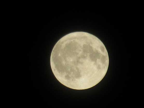
This was a pleasant surprise… Wasn’t expecting it at all..
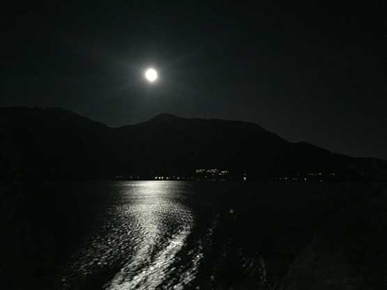
On the ferry over to Sunshine Coast
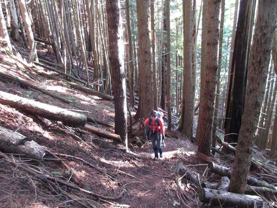
The next morning we got up at around 6:00 am and drove back towards the factory after it’s “bright enough”. The same gate keeper gave us permission this time. The drive up Rainy FSR wasn’t as “2WD” as what others reported. The road wasn’t terribly steep, but narrow and very rough at places with lots of rocks to crawl over. For once again I was glad to have a Tacoma for tasks like this. The trail-head was correctly located with the aid of my Gaia GPS app and the parking was at a small pull out about 50 m farther up the road. The trail was easier to follow than I was expecting and after a short bit of descending we reached that infamous three-wire bridge. The bridge crossing over Rainy River was a little freaky but nonetheless we both made across with no mishap. The trail then continues along an overgrown logging road before branching off into the woods. This critical junction marks where “Rainy Mtn. Trail” branches off from the main “Tetrahedron Trail”. The lower portion of this trail switchbacks up the secondary growth forest to a small waterfall, before ascending steeply straight up on a hogback feature. There were a lot of ribbons anywhere along the trail.
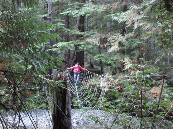
Lily crossing the 3-wire bridge over Rainy River
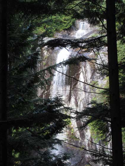
This is that waterfall we passed by
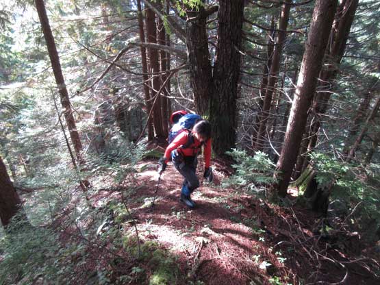
Lily ascending the typical lower Rainy Mountain trail
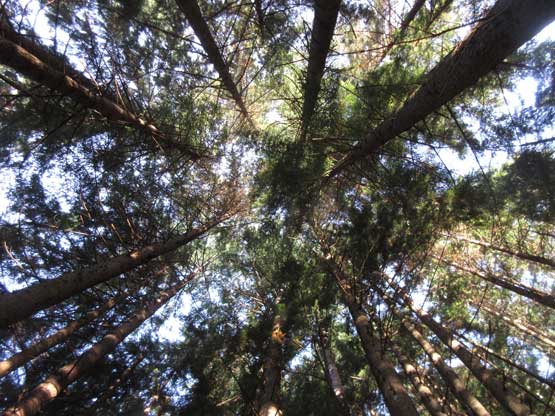
The canopy is very thick
After a while we’d done the switchbacks. Now ascending a hogback feature
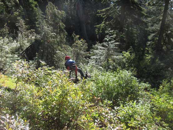
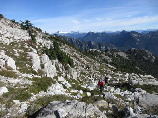
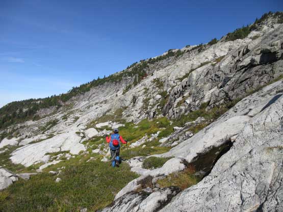
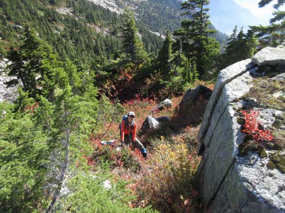
At roughly elevation of 900 m the trail ascends into the blueberry brushes. The brushes were extremely wet from the previous days’ rain and the morning dew. There’s no break in this overgrown bashing and at times we felt like “bushwhacking” even though we were following a clearly-marked trail. The abundance of ribbons meant staying on trail was not difficult, but staying dry was impossible. In no time we were both soaked to the bone. The upside was the juicy berries. It was the berries that kept our stoke level high but honestly speaking the hike was miserable to say the least. Eventually we broke out of the forest at a “slab town” greeted by the warm sunbeams. The general bearing was trending a little bit climber’s left aiming at the skyline ridge. I thought we were on our own here but soon enough we picked up ribbons and cairns again. The “trail” continues into the alpine and onto the E. Ridge of Rainy Mountain. We ascended the ridge for a long while before making a long, horizontal traverse over to the south ridge. Our decision was to traverse an “obvious bench” under Rainy Mountain to Rainy/Tetrahedron col so there’s no need to ascend too high here.
Ascending the upper portion of Rainy Trail. It was very overgrown
Fast forward. Into the alpine now with “Polytope Peak” behind

The edge of Rainy’s E. Ridge is sharp. Looking down into the headwaters of Rainy River
Onto the E. Ridge of Rainy Mountain. Looking up..
Lily finishing the first section of the traverse under Rainy Mtn.
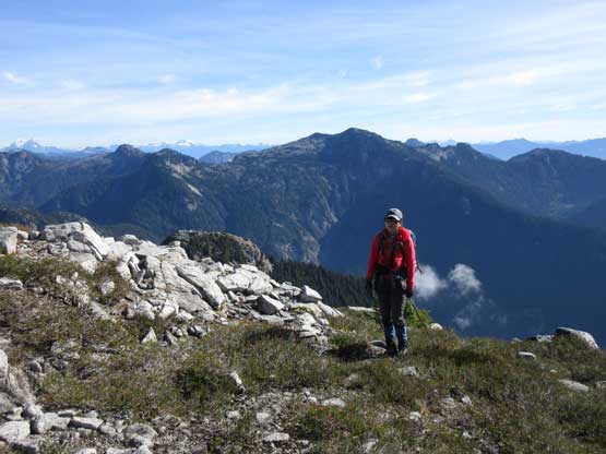
Lily arriving at a low col on Rainy’s South Ridge, with Mt. Varley behind
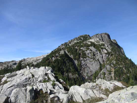
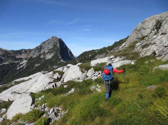
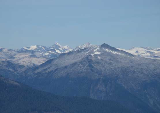
Around a corner on the south ridge of Rainy Mountain we finally had our eyes on the first objective – Tetrahedron Peak and its East Ridge. The “bench traverse” across Rainy Mtn.’s SW Face was the experimental part but appeared fairly trivial with only minor route-finding issues. Much of this traverse was done on gigantic granite slabs intermittent by some bushes. The worst was near the end. Apparently we ascended too high and had to lose about 100 m down into Rainy/Tetrahedron col. This part sucked with lots of steep heather slopes and bushwhacking.

Our first sight of Tetrahedron Peak. The E. Ridge is straight ahead
Starting the second stage of the traverse under Rainy Mtn.
Lily traversing the grassy bench aiming at our first objective
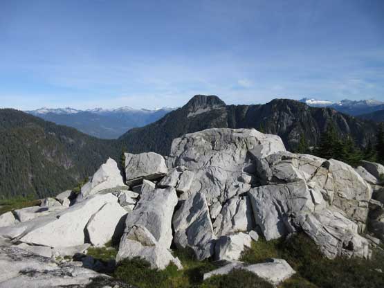
The terrain here is the typical BC coast’s granite slab town
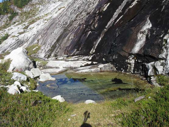
Passing a cool little tarn. It was tempting to drink straight from it
The traverse became worse and worse as we approached the other end
We had to lose about 100m elevation here
Lily warming up for what would come up next…
A bit of break from bush, at Rainy/Tetrahedron col
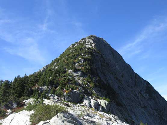
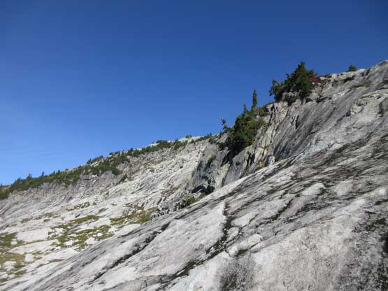
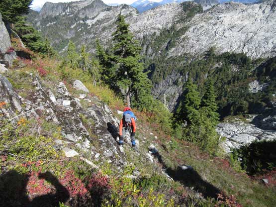
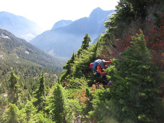
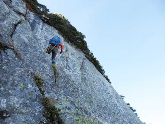
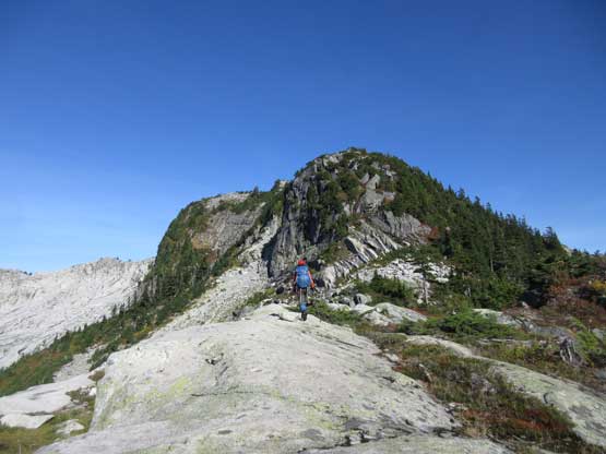
The E. Ridge of Tetrahedron Peak appears easier than it actually is…
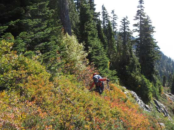
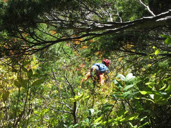
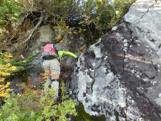
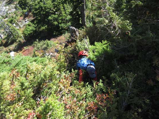
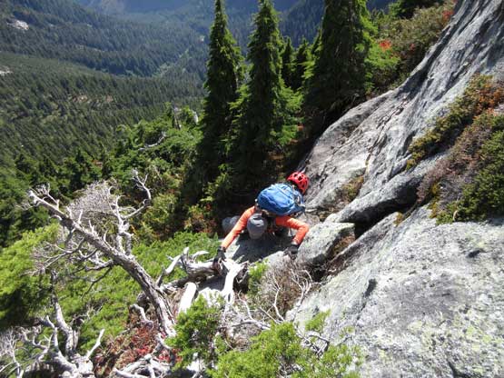
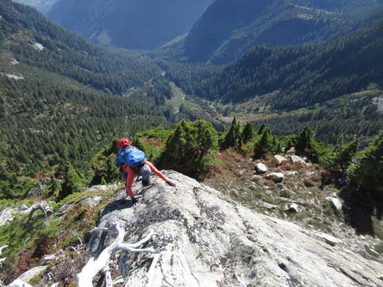
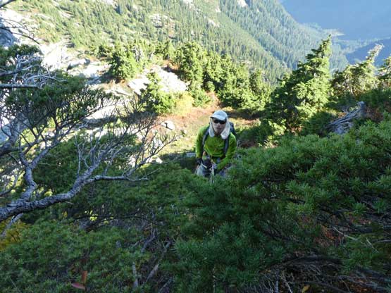
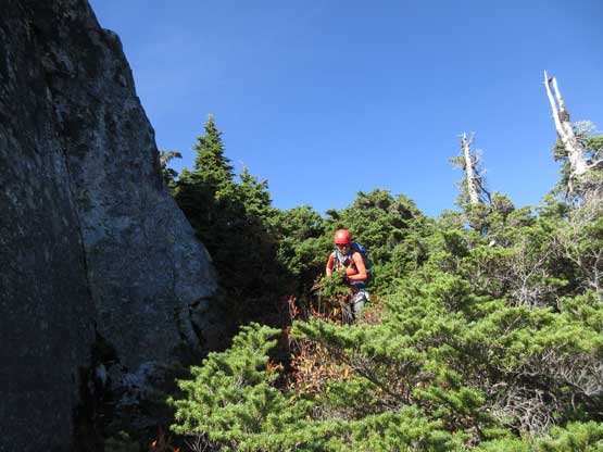
At the col I finally decided to switch footwear donning Trango Towers because the trail-runners performed terribly on steep grassy slopes. The E. Ridge of Tetrahedron Peak would be mainly bush thrashing with some 3rd class scrambling. The ridge started off easily but only for a short moment. Not far up we got our taste on the thrashing and it soon became full-on. I didn’t know whether or not we had picked the easiest line but the route sucked balls.. For a long while the game was almost vertical pulling-up using pure arm strength. Fighting through the tight branches wasn’t easy neither.
The east ridge starts off nicely and easily…
Me approaching the first bushy pull-up. Photo by Lily Q.
Lily pulling up the same step. Photo taken from above
A brief opening doesn’t mean it’s getting better…

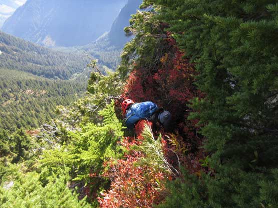
Me bashing up the next uber bushy step. Photo by Lily Q.
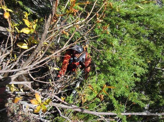
This is what this step look like from above.. It was brutal…
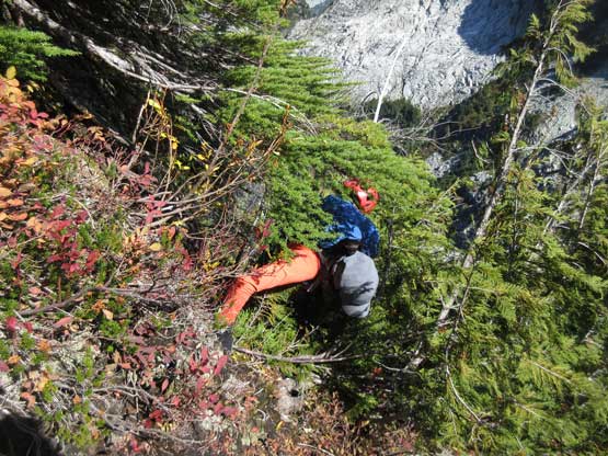
Lily fightin’ gravity up the next bushy pull-up…
This step wasn’t much better. The tree branches were stiff.
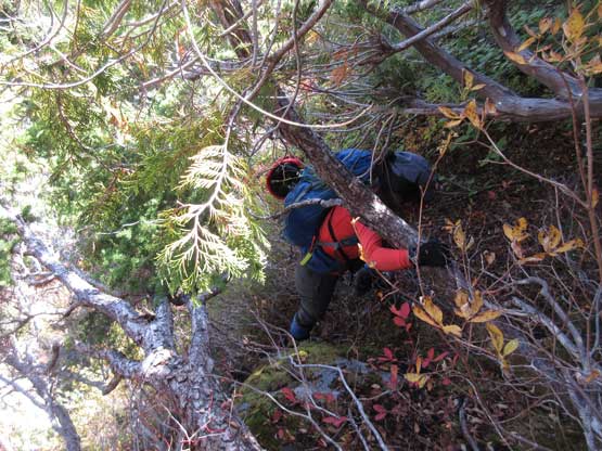
As typical as it gets on the lower E. Ridge
The view was getting better and better though. This is Rainy Mountain
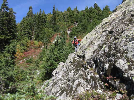
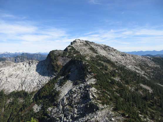
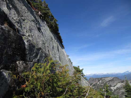
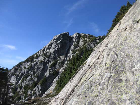
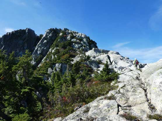
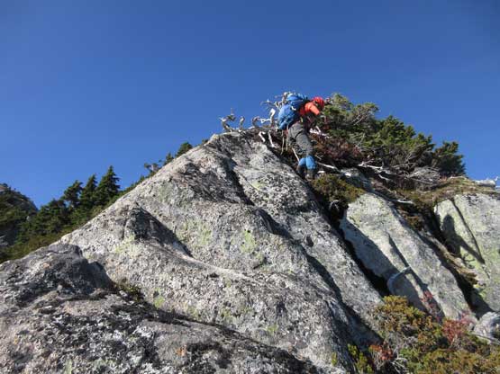
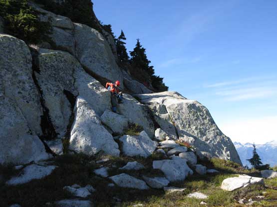
About halfway up the face/ridge the terrain eased off a bit. The bush was temporarily replaced by 3rd class bluffs requiring some careful route-finding. The steep granite faces forced us farther out climber’s left onto some narrow ledges and then there came more bush thrashing. And then we ascended an exposed pitch of “class 3” on down-sloping ledges. The last section was actually quite easy and we checked off both summits just to be sure. It turned out that the first (east) summit was the highest one, and the views were far-reaching, as expected.

Lily scrambling up a wet, 3rd ramp on the upper mountain
There are many bluffs like this on the upper route.
Route-finding is the key in order to stay within “3rd class” terrain…
There was still bush thrashing on the upper route…
Traversing climber’s left onto slabs to avoid more bush..
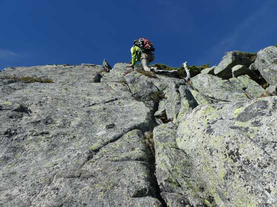
Me scrambling up a fun pitch of 3rd class. Photo by Lily Q.
Looking down at Lily starting up the same pitch
Higher up this is Lily ascending an exposed corner slab
Me working my way up the last stretch. Photo by Lily Q.
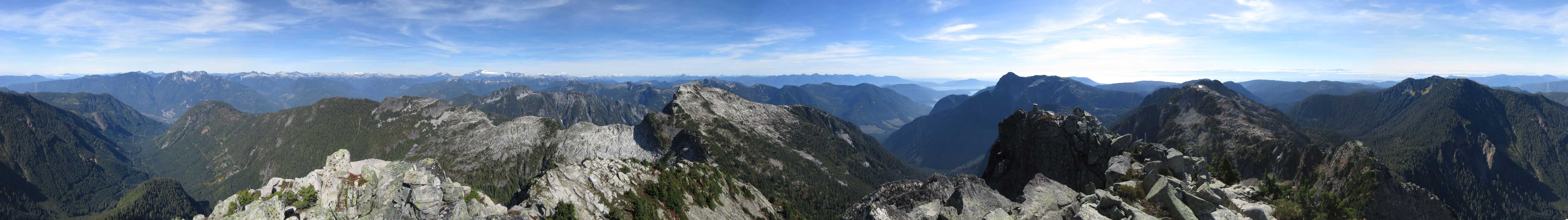
Summit Panorama from Tetrahedron Peak. Click to view large size.
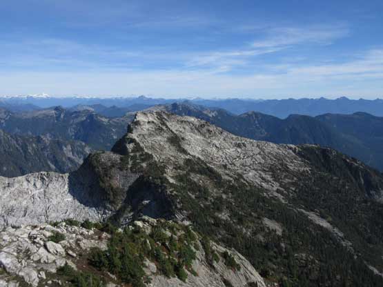
Rainy Mountain would be our next objective
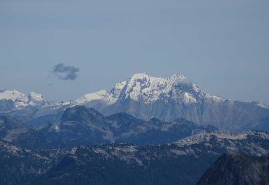
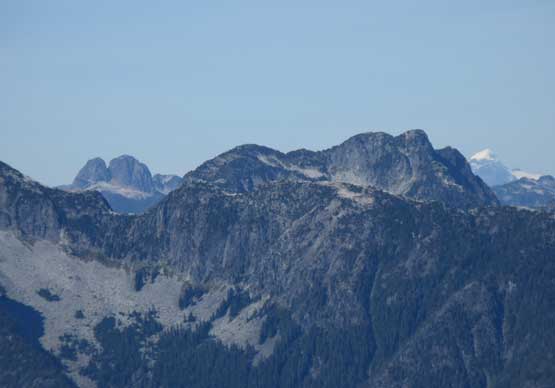
This is a super zoomed-in shot towards Mt. Garibaldi massif
The unusual perspective of Sky Pilot Mountain massif
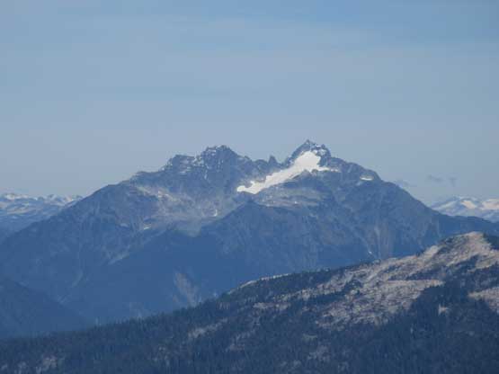
Mt. Tantalus and Mt. Dione, also from an unusual perspective
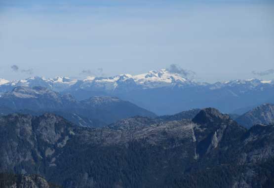
Ossa Mountain and Pelion Mountain on the northern Tantalus Range
Looking over one of Tzoonie’s sub-summits towards Ashlu Mountain
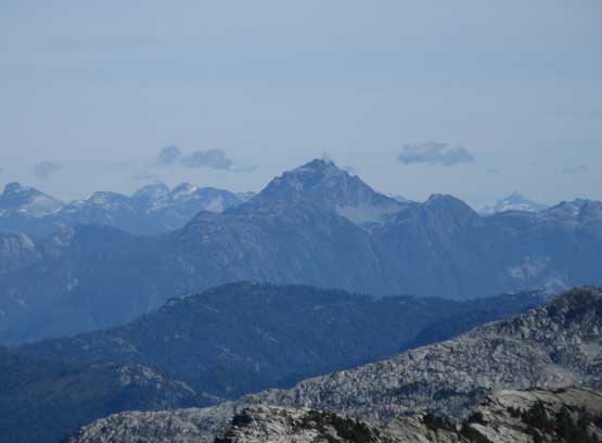
Behind the shoulder of “Misery Peak” towards the iconic Earle Peak
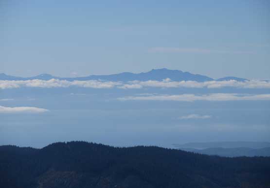
Mt. Arrowsmith in the southern Vancouver Island was even visible

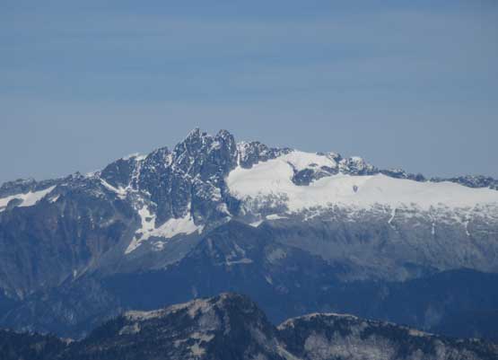
Serratus, Alpha and Sedgewick on the southern Tantalus Range
This is looking at Mamquam Mountain on the skyline
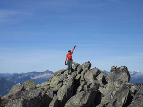
Lily on the summit of Tetrahedron Peak
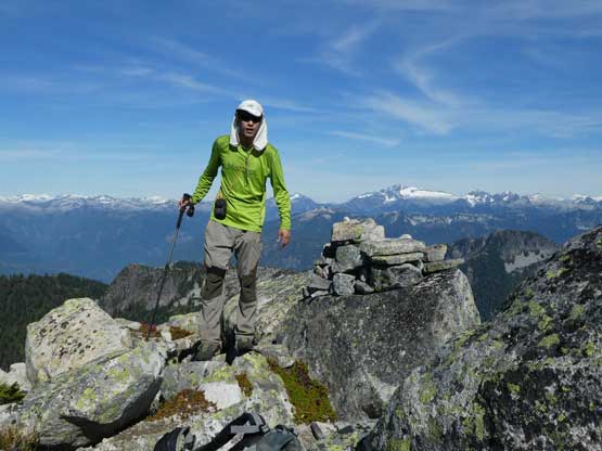
Me on the summit of Tetrahedron Peak
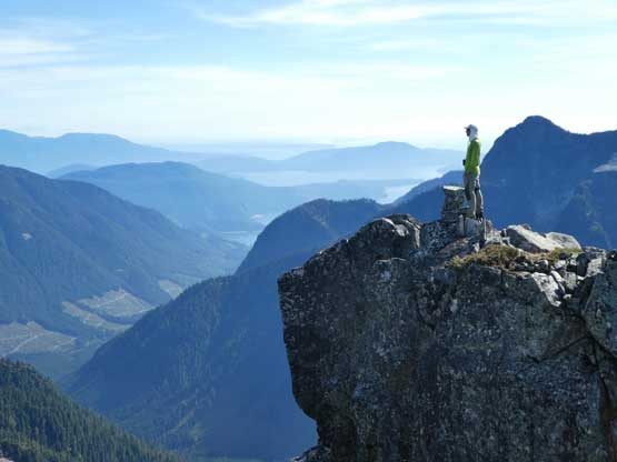
Me posing on a lower sub-summit for some Insta photos…
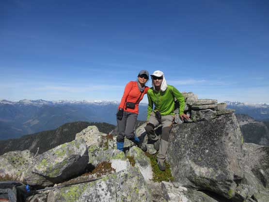
Lily and myself on the summit of Tetrahedron Peak
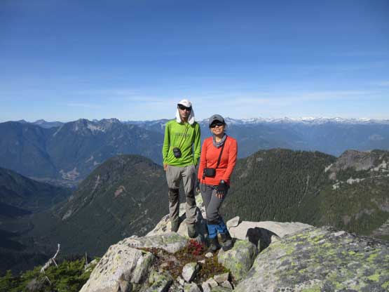
One last photo of the two of us on the summit.
On the ascent I had thought about descending the SW Ridge straight down into the valley but realized I had ditched the trail-runners along with a pole at the col… The trail-runners were pretty beaten but I did care about the pricey carbon fibre pole.. On the good side we had brought a 30-m rope along with harnesses so the aim was to skip as much as bush thrashing as possible by making rappels off bluffs. I have to say that bringing a rope was a smart idea. On this type of unknown BC 3rd class bluffy terrain it’s always a good idea to have some backup plans. We did three rappels and the descent was overall not the worst of nightmare. It was still a miserable thrashing game and far from something I would recommend. The second rappel was the most memorable as we literally rapped a line through trees…
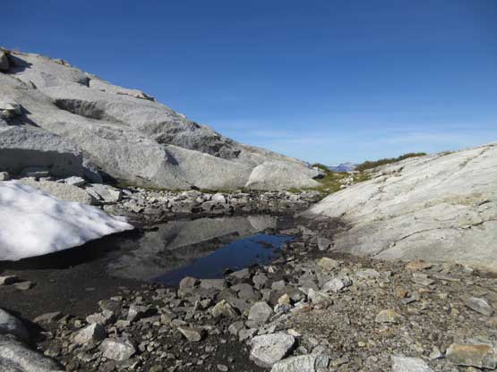
A very small pool of water near the summit
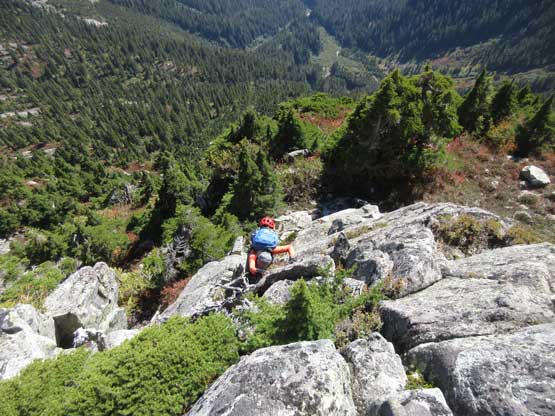
Carefully down-climbing some of the 3rd class terrain
Me leading down the first rappel. Photo by Lily Q.
Lily on the first rappel
A bit more of down-climbing on the upper route
Into the bush…
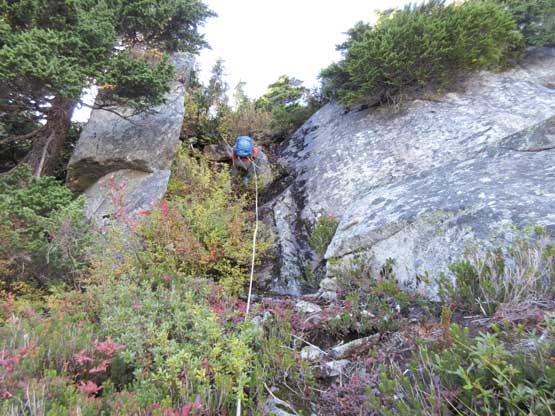
Lily on the 3rd rappel. I liked rappelling much more than bush thrashing
Down to the col now, looking at Rainy Mountain
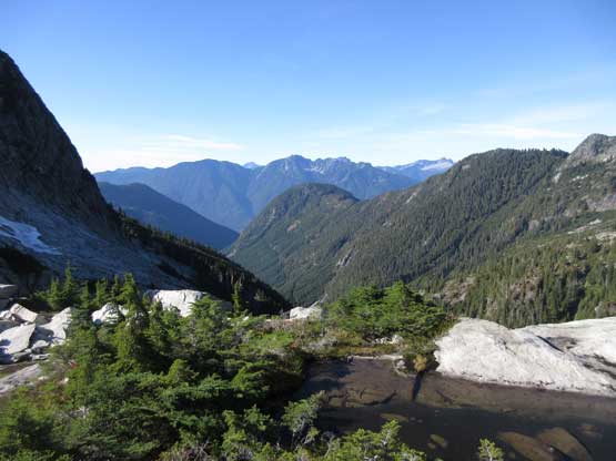
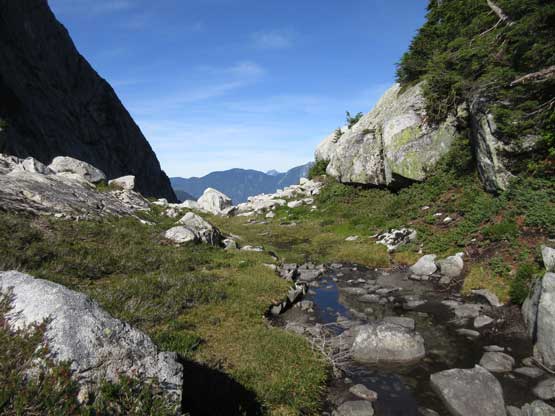
A view from Rainy/Tetrahedron col
Once back to Rainy/Tetrahedron col we were not doing good in time. However, the main reason of picking the challenging East Ridge of Tetrahedron Peak was to tag Rainy Mountain in the same batch and after paying so much blood in the bushes we just had to justify our choice. Regarding the E. Ridge of Tetrahedron Peak I think it’s harder than people made it sound on the internet. If you are keen on BC coastal thrashing then go for it, otherwise take the standard SW Ridge route. However I want to warn you right here that, the access of SW Ridge might be an adventure in its own. There’s no “easy” way up Tetrahedron Peak and make sure you’re mentally and physically prepared.
