Mount Morrison
December 9-10, 2017
2358m
Ryan River / Lillooet South FSR, BC
There are a whole bunch of peaks named “Mt. Morrison” out there in Canada and this is the one on Ryan River – Lillooet River divide not far from Pemberton Icefield. This is an area that sees very few visitors despite the close proximity to Pemberton and the main logging roads in Upper Lillooet Valley mainly due to the access logistics. Tremendous amount of elevation gain with at least some degree of bushwhacking is required no matter what, and then thank to the deactivation of Ryan River Road the access has become even harder these days. The peak itself isn’t even a major summit. But for hardcore peak-baggers a rarely-ascended peak such as Mt. Morrison does make a decent prize.
Alex and Dean had attempted it 4 years ago in spring time but ran out of daylight time. This time Alex managed to put together a group of 5 with each of us being some of the toughest adventurous peak-baggers out here in the coast, and we learnt from the previous mistake so a full 2-day time frame was planned. The only difference is that everyone would be on skis except for me on snowshoes but that’s fine. I’ve done a lot of snowshoe trips teaming up with skiers and I do have a rough idea about how to pace it.
With the plan solidly set we all managed to squeeze into my Tacoma with the gears all dumped on the truck’s bed by 5:30 am. The drive to Pemberton was uneventful and then we turned left. After about 20 kilometers down the Pemby Valley the road turns gravel which marks the start of Lillooet South FSR. The short spur road that we used to access Mt. Morrison isn’t even marked on bivouac.com, but fairly obvious once we got there (BR 200). It’s hard to count on being able to get far on this BR 200 but the spur was in a surprisingly good shape although I did bottom the truck out once. Eventually after two turns we parked at roughly 420 m elevation. The road was still fine but we started encountering frost and ice such that without winter tires nor chains it seemed dumb to push any further.

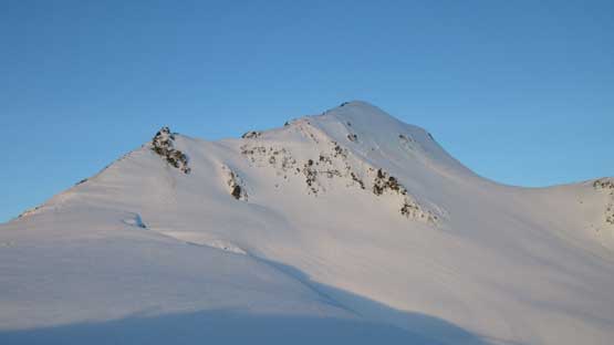
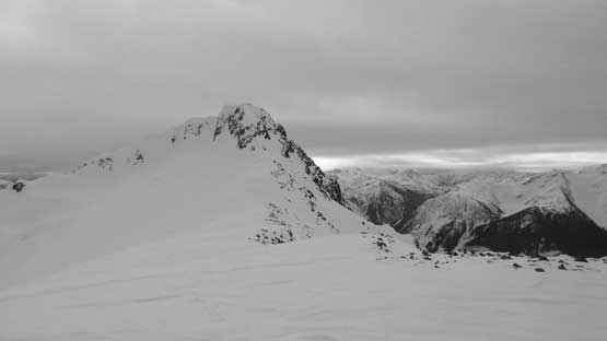
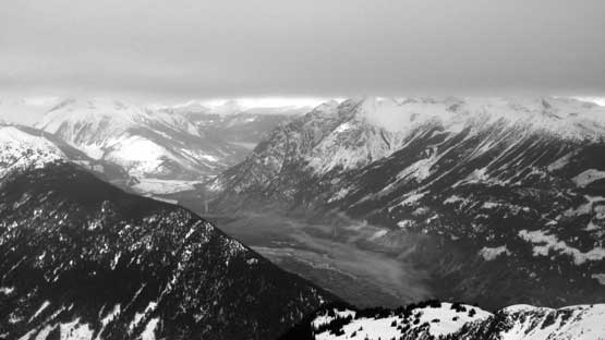
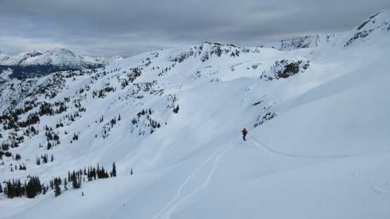
Mt. Morrison from Lillooet River Valley. GPX DL
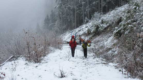
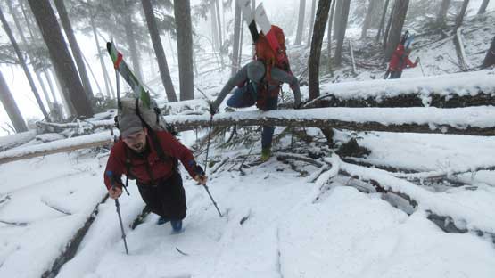
As typical as BC adventures go we again started by walking up the road. Fallen boulders and large patches of ice indicated we did make a good call for parking lower down. It’s worth noting that the satellite images on Google Earth are outdated. The spur roads now climb to about 850 m elevation and the last two switchbacks weren’t shown on the map. As a result we entered the forest too early. For about 200 m elevation gain the travel was painful with plenty of deadfalls and that’s especially true on this sustained incline with overnight packs plus skis/snowshoes. After a while we got out of the forest and ascended the edge of a semi-covered cutblock which was a little bit better, but not by much. The bushwhacking was replaced by post-holing and that’s it. Above the cutblock we then had to climb a short, but very steep bluffy section before finally donning snowshoes and skis. The next 200 m elevation gain wasn’t much better neither with still lots of deadfalls to negotiate. Pain in the ass on skis but not too bad on snowshoes.
Ben and Dean plodding up the upper BR 200
Now into the woods. Sometimes you really have to work for it.
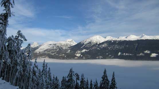
Merging into the edge of a cut block we got this inversion view
Me leading up the cut-block post-holing game.

Alex marching up.

Finally able to don snowshoes and skis. Photo by Alex.
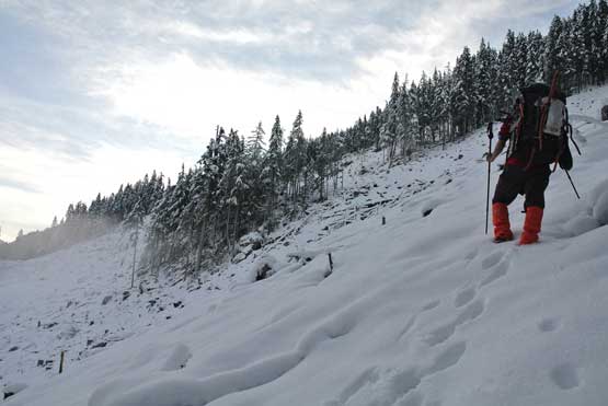
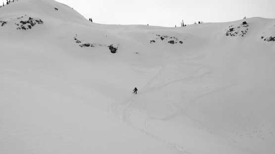
The general bearing was shooting straight up this forested slope which essentially just a truncated spur on the side of the main U-shaped Upper Lillooet Valley. The grade was very sustained with no rest break whatsoever, thrown in a few very steep rolls just for more fun. The only good thing – the snow depth did increase gradually. About 2/3 of the way up this forested grunt the other skiers eventually caught up and took over the lead. The post-holing really slowed me down but on skis they did have a better flotation. I was struggling for a while as following their skin tracks I still sank occasionally plus I had to deal with the constant side-hilling travel, but if going straight up I’d have to break my own trail entirely. I ended up taking the combined method of two. Upwards, onwards and repeat… Near treeline we had to ascend a stretch of 40 degree forest and thankfully it’s the skier’s turn to struggle now.. We traversed out to the right and then there came the treeline zone – about 300 m gain on steep bluffy zig-zagging path to eventually crest the ridge. This area sucked a big time. Apart from the steepness we did’t have enough snow to fully covered the boulders.

This is where we traversed right to get out of the steep forest. Photo by Alex

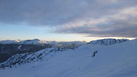
Good view of Mt. Sampson across the Lillooet River
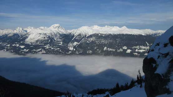
This is one of the most gorgeous inversion I’ve ever seen.
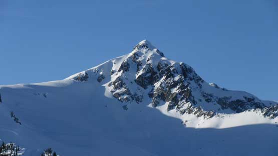
A zoomed-in of the main summit block of Mt. Morrison

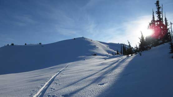
After a long while the grade finally eased a bit.
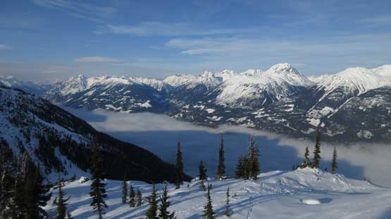
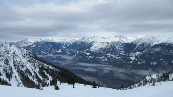
Another view into the Upper Lillooet River valley.
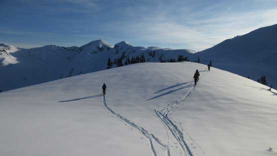
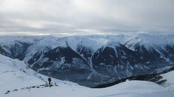
Finally onto the ridge it’s such a drastic change of pace. A few rolling hills ahead with each one bigger than the previous but in terms of elevation gain all left was about 200 meters to the “base camp”. Traversing these open rolling terrain was such a blast on skis and trying to keep up with these guys certainly put my snowshoeing fitness into test. I did manage to keep up but that’s counting that I stayed entirely on the skin tracks (hence minimal trail-breaking) while motoring on full force. Personally I don’t know if there’s any other snowshoer able to keep up with this pace especially with a full winter overnight pack. There had been some discussions about where exactly to camp but in the end we opted for a wind scoop on the main divide. It was only 2:20 pm so we had plenty of time to kill at this scenic spot.
Finally onto this broad, but undulating ridge now.

Soldiering on.

Skinning up with our objective behind. Photo by Alex
The terrain is prime for skiing now.
Ascending towards the highest bump of this day. Looking back.
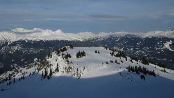
This is just another unnamed peak along Ryan – Lillooet Divide.

Discussing where exactly we should set up camp.
The decision was to keep soldiering on….

Home sweet home.

An evening view looking south into the Pemby Icecap peaks.
By now we had put behind more than one vertical mile of elevation gain. The weather cooperated with not much wind although there were high clouds rolling in from the west. The main highlight was making a fire on snow. Daniel even came prepared with a handsaw and we did find dead trees on the south side of the ridge. After a few trips back and force we got plenty of woods to keep a big fire up for a few hours and it surely did not disappoint us. It kept going until past 9 pm and then we figured it’s probably a good idea to at least catch a few hours of sleep…

Why not making a fire since we had so many hours to kill?! Photo by Alex

The fire’s growing big. Photo by Dean
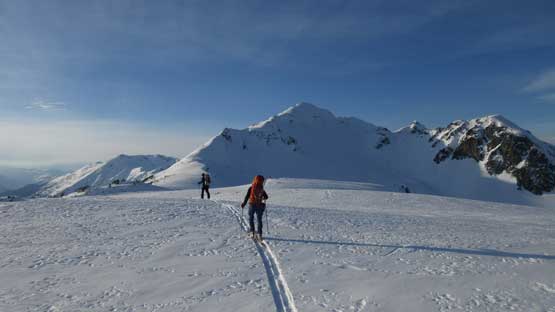
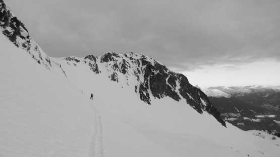
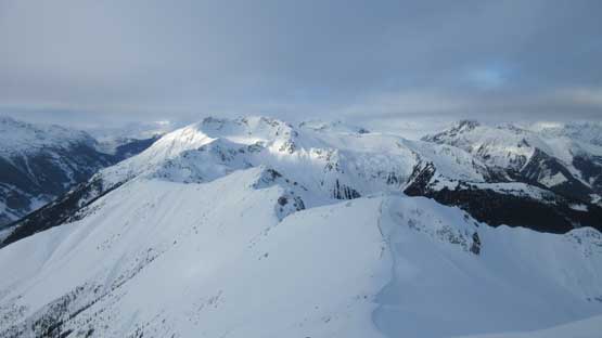
The morning of Day 2 we woke up a bit later than planned. Lots of high and middle clouds were rolling in just as forecasted but at least our peak was still clear, so off we went. There are quite a few ways we discussed and we eventually picked the “middle route”. The first aim was a “high col” immediately to the right of a sub-summit. It looked pretty steep to get up there but actually not too bad. About 35 degrees at the maximum and we all managed to skin up. I simply followed behind on snowshoes while ruining the skin tracks. The second stage was losing about 100 m elevation on the north side glaciers to contour around a buttress feature. Easy peasy. And the third stage was re-ascending all the way to the SE Ridge of Mt. Morrison and this was again, done on the north glacier.

Mt. Sampson at morning alpenglow.
This is just a sub-summit of Mt. Morrison. We are aiming at the right hand shoulder

Daniel plodding up.
As expected there were clouds rolling in.

Looking back at Ben starting this long steep traverse
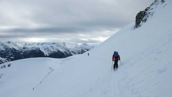
Traversing and then ascending towards the high col/shoulder
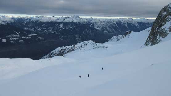
After dropping about 100 m we were skinning up the north glacier now.
Onto the SE Ridge the next task was simply following this wind scoured ridge to the base of the summit block. There’s just enough snow to keep the snowshoes and skis on so we didn’t have to bootpack. The summit block appeared tricky and it sure was, to a certain extend of course. I could spot two possible lines but decided to check out the south side first. And once around I spotted a neat couloir. At this point I didn’t know whether or not this couloir would go but climbed it nonetheless. It steepens to about 45 degrees at the top and guess what. It dumped us right on the summit so not bad, not bad.. The summit celebration was short as we still had a long ways to go.
Finally onto the SE Ridge now. This is looking at another sub-summit
Dean looks tiny comparing to the Ryan River valley
From the base of the summit looking south down Ryan – Lillooet Divide

This is the summit block. Our gully goes up on left side behind view
Ryan Peak

Climbing up the gully. Photo by Dean

Summit Panorama from Mt. Morrison. Click to view large size.
A closer look towards the headwaters of Lillooet River

This is looking back down the divide towards Pemberton side

The Lillooet River is now 2000 vertical meters down below us.
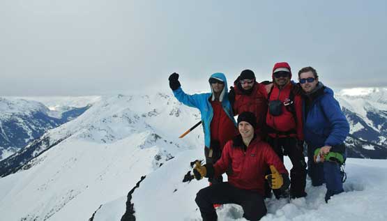
Our group shot on the summit of Mt. Morrison
Down-climbing the couloir was easy and fun and then the skiers decided to take a steep line off the east face. I like down-climbing steep snow so opted to follow anyway. The top 20 meters was done by facing in and after a while the grade mellowed out so I could plunge down facing outwards. Near the bottom I even opted for a long glissade which was very fun. The rest of the descent down that north glacier was a fast plunge but then re-ascending back to the “high shoulder” was a grunt. By now the snow had become soft and sticky. It seemed like I wasn’t the only one having that balling problem so nobody was having fun. The run back to camp was so-so and then we spent another half an hour breaking camp. As always the crux was to dig those pegs out (t-slot anchors).

Dropping into the couloir. Facing in, step by step…

Continuing down-climbing.

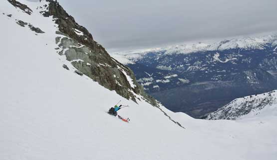
Alex skiing down the east face

Ben having fun on the east face steep ski descent.
I opted to down-climb the upper face and then glissade the lower face…

Re-ascending back towards the high col/shoulder
Skiing back to camp. The snow’s getting very sticky now.
As discussed earlier in the day we opted to descend the “valley option” instead of re-ascending back to our approach ridge. It started out pretty nicely but then I noticed the skiers were slowing down. The snow was simply terrible as they stuck under the skis so then the decision was to climb back up to the ridge crest. This costed us about 150 m elevation regain. The skinning wasn’t much better neither, but at least once it’s over all left was only downhills. I thought I would for sure be much faster descending the terrible snow and then the steep forest on snowshoes but I was wrong. The condition combined with the 35 degree ish grade had created the worst combo for downhill snowshoeing. Wherever its soft I couldn’t trust the plunging and wherever it’s hard I simply couldn’t plunge. So I had to descend step by step with lots of micro-switchbacks and side-hilling traverses. Apparently it sucked on skis too but anyway they were about 15 minutes ahead of me when we eventually got back to the clear-cuts and the logging roads. I followed the ski tracks exploring the higher branch of that road which was easier, but added extra distance. And of course the last stretch of the slog (snowshoes off) was painful as always.
Taking the valley exit option but we soon realized it wasn’t the smartest idea
Daniel’s making turns despite the horrible snow conditions.
Back onto our ridge approach now. This is the last view before forest time.

Fast forward… Down to the cut-block now. We explored a different exit here.

Oh the familiar road slog at the end…
Loading the gears onto the truck took no time and then I paid close attention on the water bar that I bottomed out earlier. This time I negotiated it much slower and didn’t have any issue. The rest of the drive back home was actually better than expected with only two major congestion. The first was getting out of Whistler due to the volume of traffic and the second was somewhere along Highway 1 at North Vancouver due to an accident.
Overall this was an awesome Type 2 quality suffering kind of trip with good friends. Would I recommend it? Absolutely nope to anybody. But if you are a die-hard peak-bagger you will want to do it. Just make sure you time it right and have endless energy. There’s for sure more than 2000 m cumulative elevation gain required.
