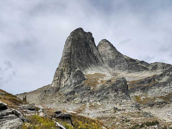
Gimli Peak
September 6, 2021
2806m
Valhalla Provincial Park, BC
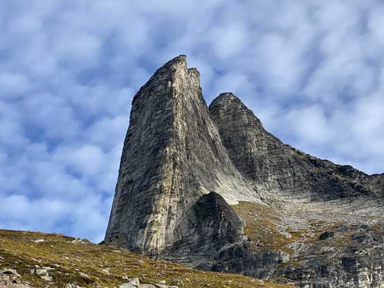
Gimli Peak is by no doubt the most famous summit in Valhalla Provincial Park or even in the entire region of “West Kootenays” because of its iconic profile as well as the easy access. The impressive rock horn offers a classic alpine rock route on which one climbs straight up the spine of the south ridge facing the approach side. This route is not too far from my reach but a bit too sustained for my current ability so I wasn’t too keen. Instead, the climber’s descent route is a mere 3rd class scramble on the east face ledges. This does sound a wee bit “too easy” for such an important summit but between the two options I eventually chose the safer one. It didn’t take long for Holly and I to agree on Gimli Peak to be the primary objective during our first foray into the “West Kootenays”. I did know there were a few more fun scrambles in the Valhallas but we didn’t have a lot of time to fully explore the park.
Earlier in this trip we scrambled Ymir Mountain after making the long drive into Nelson. That scramble only took us under 4 hours round trip so we took our time in the town of Nelson having a proper dinner. The drive from Nelson to Gimli Peak’s trail-head would be almost two hours so we did have to hurry up eventually. After a smooth drive into the small community of Slocan we turned onto the Little Slocan FSR. This first logging road was in a fine shape but the second spur, namely Bannock Burn FSR was reported to have “96 water bars” that required a high clearance, 4×4 vehicle with skills. Holly’s vehicle was far from being the best off-roader but I determined it should be “good enough” for the task. It turned out that our worrisome was totally unnecessary because the road was apparently fixed with all but the last two or three water bars filled in. The drive was still slow but other than the steepness of the grade I did not think this was any harder than the road into the Bugaboos, which meant with some skills and careful driving one can probably drive up in a 2wd car and park at the last switchback only a few hundred meters from the actual trail-head. The last few hundred meters did have a few water bars in addition to rougher road bed. We got to the trail-head just after 9pm and slept inside the vehicle. There were about ten other vehicles parked so it wasn’t that busy overall.
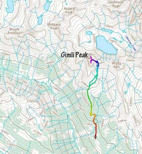
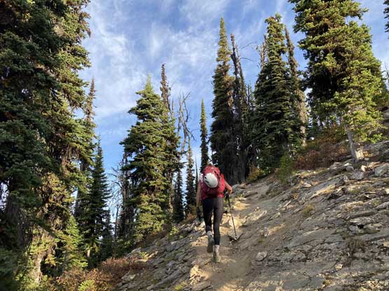
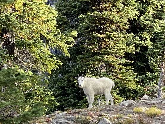
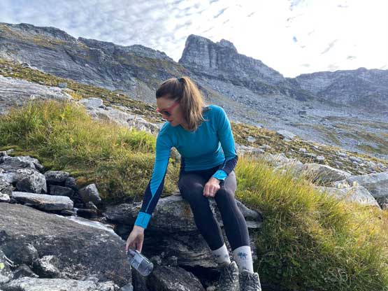
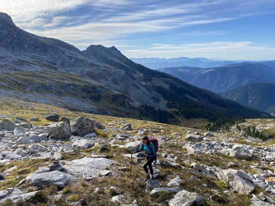
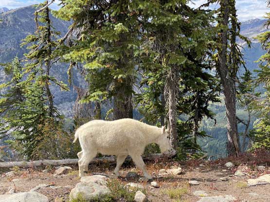
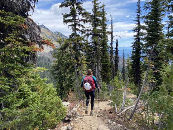
The objective on this Labour Day Monday was to scramble Gimli Peak and push as far back as possible as we must get back home before 9 am on the following morning. This meant we woke up at daybreak and started the plod just after it’s bright enough to not need head-lamps. Holly set a fast pace plodding up the Gimli Ridge trail and we made to the treeline zone in just over an hour. We encountered a baby goat just as seen in every other trip report. At the grassy meadows around the last trees we left the trail and made a traversing ascent towards the east shoulder. En route we had to scramble into and out of a deep gully. Had we ascended any higher we would have to lose significant elevation to detour around this obstacle. Somewhere after crossing this gully we found a valuable source of water and loaded up the water bottles, and meanwhile I had swapped footwear from trail shoes to mountaineering boots.


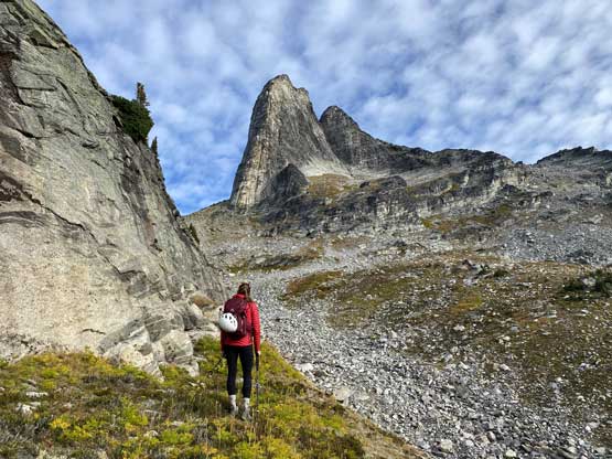
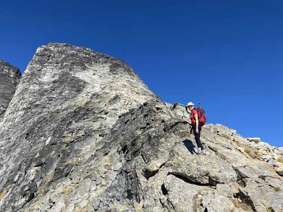
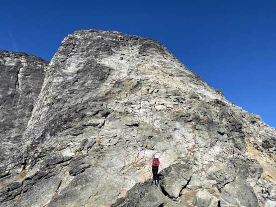
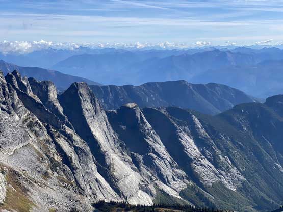
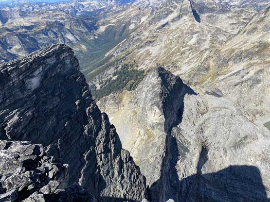
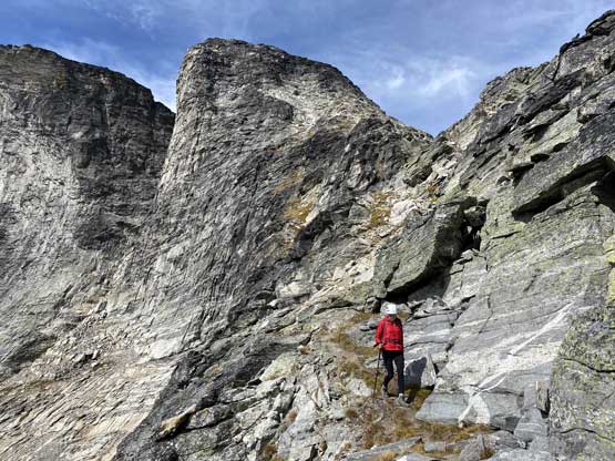
Once the grassy meadows gave way to unstable boulder fields we faced the ugliest section of this ascent. The route was reasonably well marked but we must scramble up through a long stretch of loose rocks with some moraine types of choss thrown in. We also got off-route just before reaching the “east shoulder”. Instead of following a path and cairn traversing back out climber’s left along a ledge we chose to scramble straight up. The punishment was a field of car-sized boulders and some unnecessary scrambling to get out of a “notch” feature. This off-route section had a stiff 4th class move at the bottom but soon after that we joined the proper route.

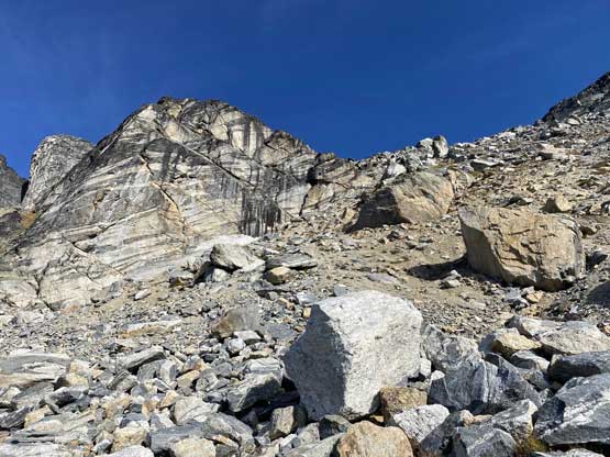


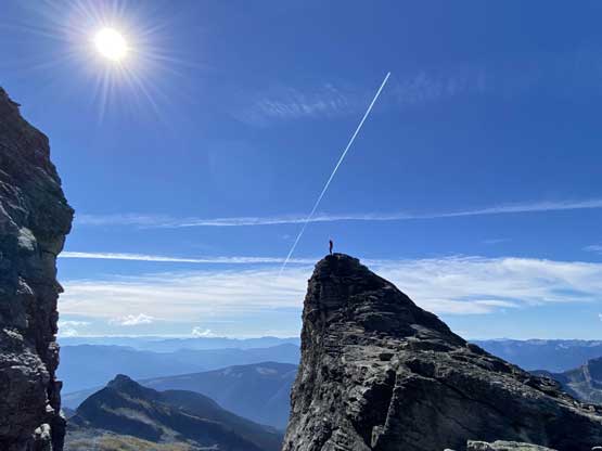
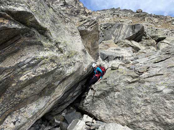
The on-route “class 3 east ledges” did not appear nearly as daunting as some people made it sound like and in fact, after halfway up we soon realized it’s actually more of a “walk-up” had we stuck to the cairned paths. Holly spoke out the concern that this peak was become “too easy” for her like so my suggestion was to pick our own route scrambling straight up through some rock bands. We were at the steepest parts of the east face at this point and I led us climbing at least two or three zones of “4th class” even though there were easy bypasses right beside us. We actually felt this was fun and in no time we topped out on the summit.


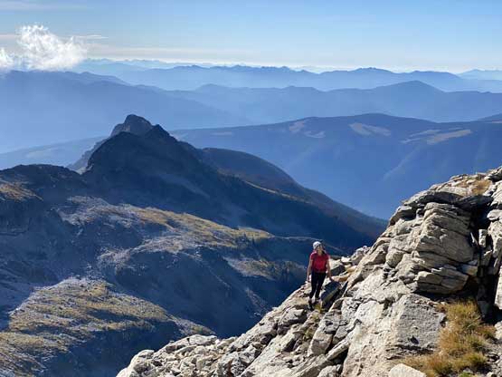


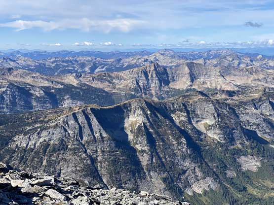

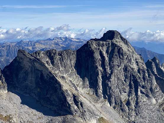


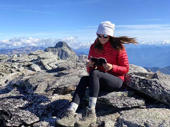
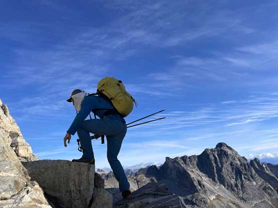
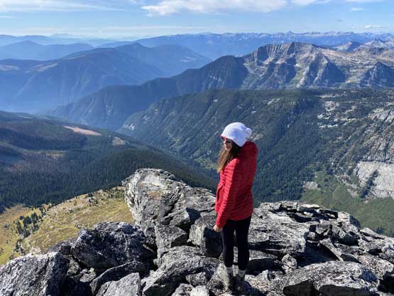
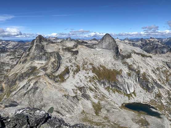
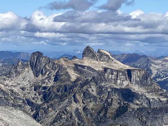
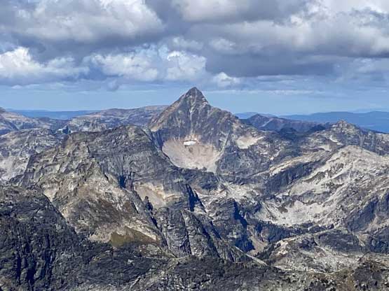
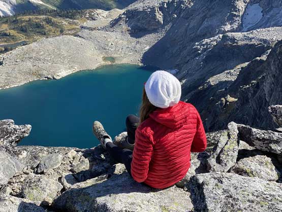
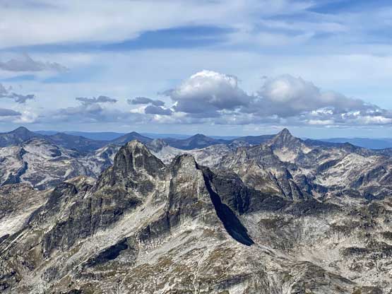
The summit of Gimli Peak was rather spacious so we decided to explore around to see if there’s better views. Our first spontaneous decision was to scramble towards the top-out of the south ridge. I did not know what to expect on this section but the view was far better than expected. We had to scramble into a shallow notch separating the main summit with the south ridge and scramble along some narrow ridges with shear exposure. We went as far south as we felt like and scrambled back to the main summit. I then did a short exploration towards the north end of the summit plateau, which was cool but not as great as the southern extension. In total we spent over 2 hours on the summit either wondering around or just relaxing.


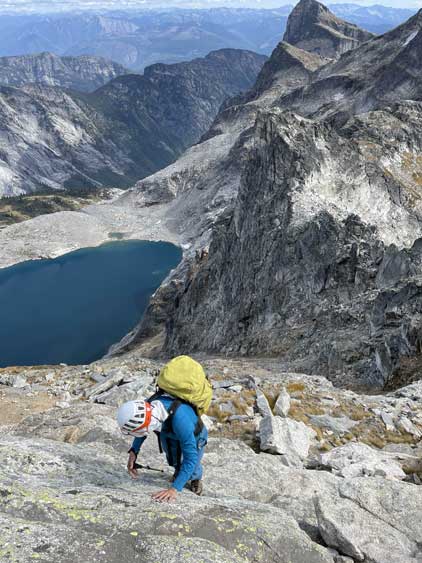
On the descent we again, decided to down-climb those few 4th class steps just to make this scramble spicier than needed. The first down-climb was quite committing with all holds being down-sloping but the rest still felt very easy. Lower down we found the proper “path” to avoid that car-sized boulder field but there’s no better route to descend through that moraine type of choss zone. Back through those unpleasant terrain we did not stay on the exact track we used a few hours earlier, but I cannot tell which was actually better, so pick your poison. The rest of the descent was uneventful and our round trip time was just under 8 hours taking in account all of the breaks.


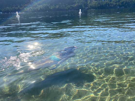
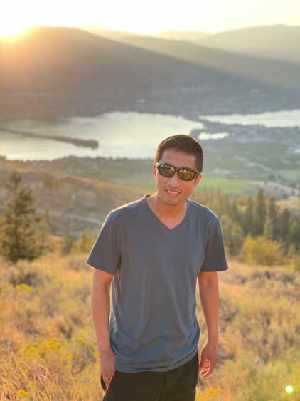
The parking lot was a busy and dusty place so we wasted no time and immediately started the engine. The drive out of those FSRs was pretty chill and in short time we were back in Slocan. We then pushed westwards through the town of Castlegar into Christina Lake. It was around 4 pm so we stopped for a swim in a spot that Holly had previously visited. This was very fun and I started to regret missing out some of the swimming oppourtunities in the past trips. Holly then did an amazing job driving us all the way to Osoyoos for a dinner and en route we stopped at the switchbacks above Osoyoos Lake to watch sunset. Holly was still very awake and pushed all the way into Manning Park and I took over the drive to get us to near Hope before calling it a day at midnight. We slept for about 5-6 hours and eventually got back home at 8 am in the morning. There’s definitely far more driving than hiking in this trip but we both felt this was an excellent introductory to the West Kootenays and we certainly will be back.