Ijen / Merapi
July 23, 2023
2803m
Java, Indonesia
“Where did you go in your summer vacation?” “We went to Bali” “Oh cool! How’s the beach and girls?” “Nah, we went there to bushwhack… Hours and hours of horrible bushwhack.” “Oh gosh…”
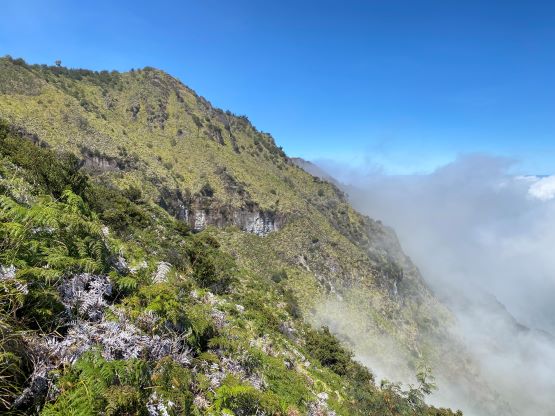
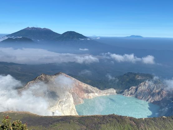
The Ijen volcano complex is a group of composite volcanoes with Gunung Merapi being the highest one, on the east side of the crater lake. “Merapi” means “mountain of fire” in English and this is not to be confused with Gunung Merapi in central Java. The name of this peak is somewhat complicated and confusing, but in my interpretation, Merapi can be considered as the true summit of Ijen volcano complex. Hundreds, if not thousands of tourists and hikers go to Ijen’s crater rim each day from midnight to mid-morning for sightseeing purposes, but the true summit is rarely ascended, probably no more than several times in a year. There’s a faint trail on the NW Ridge but it’s very overgrown and difficult to follow. Several hours of heinous bushwhacking is now required to reach the true summit.
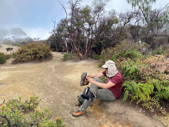
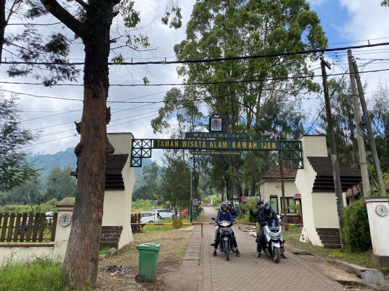
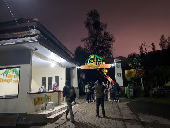
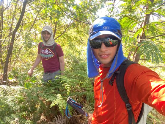
A few friends of mine recommended Ijen after knowing I’d be in the area, but I wouldn’t spend a day there just to see the crater lake. I understood that this lake is very important from tourism point of view, but I’m a peak-bagger and I needed a proper summit. The highpoints along the crater rim do not boast over 100 m prominence to be independent peaks, but the high point of the entire complex, namely Gn. Merapi boasts over 1200 m prominence. Adam and I were eventually convinced to give it a try despite the lack of “beta”. Those who logged this peak on Peakbagger likely did not ascend the true summit, and our “beta” was solely from the website gunungbagging.com. The information provided there was detailed enough to get the job done, but they did not provide a GPX track for us to follow. I also think their words are outdated as the bushwhacking was significantly harder than expected. This isn’t an objective that legally requires a guide, so we only hired a private driver of the day. The driver (Agus) came to pick us up at 4 am and we made to the park’s gate at 1800 m elevation by 5 am. Agus would be there waiting for our return, and there’s an entrance fee of ~10 dollars per person. This is an extremely touristy area with people pushing to sell us head-lamps, gloves and face masks. We had our own essentials but did briefly consider to buy a mask but didn’t bother in the end. In retrospect it wouldn’t be a bad idea to have one as this volcano farts large volume of gases rather frequently.

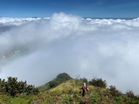
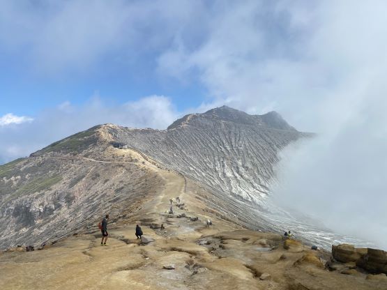
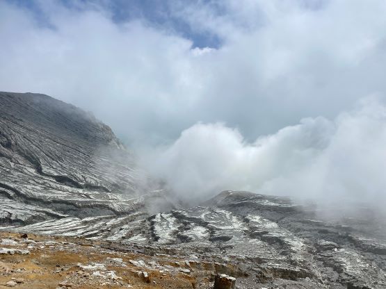
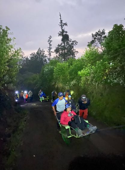
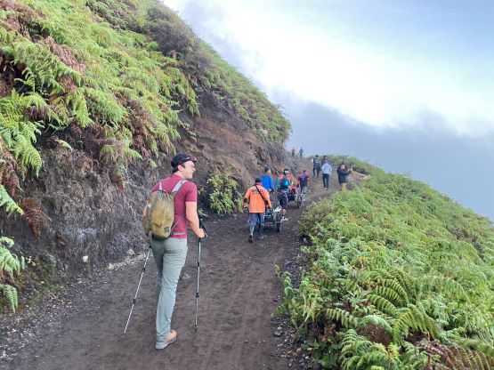
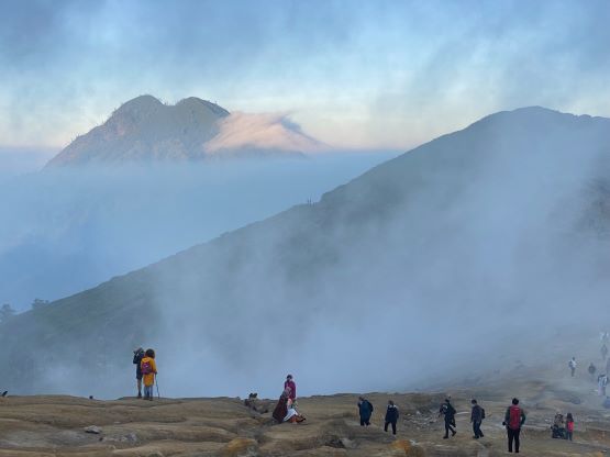
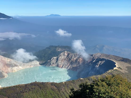
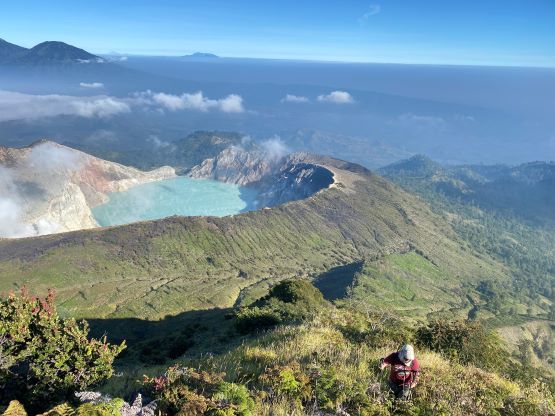
On the hour-long approach to the rim we passed about 100 people including some sitting in wheel carts being dragged up by the porters. They called those “Taxi” services. They tried hard to sell us the offer but we refused. The weather had been mostly cloudy but we soon learnt that the sky wasn’t actually obscured by the clouds, but rather by the fumes. The wind direction was not in our favour such that the whole touristy area around the rim was in a smoke white-out. The smell was terrible. Adam and I pushed on without doing any unnecessary lingering and we briefly came out of the smokes on the eastern rim, where we also got some glimpses of views down into the crater lake, apparently the largest acidic lake in the world. For everyone else this was already the destination, but for us this was just the approach.


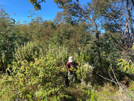
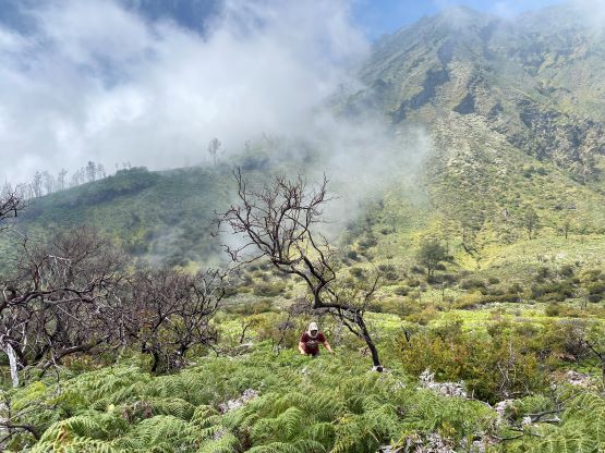
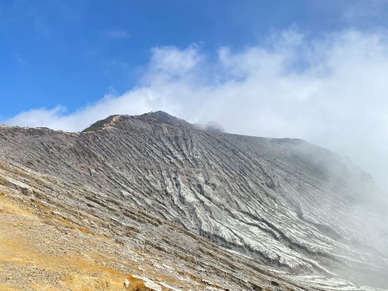
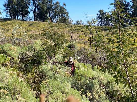
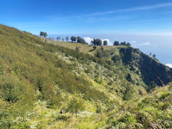
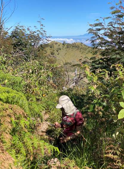
We searched back and forth trying hard to find the “vague trails” described in the Gunung Bagging website, but to no avail. We eventually decided to just commit to one path that seemed like a “trail”. The path disappeared in no time, and we thrashed down into the ravine losing about 30 m of elevation. This stretch took more than half an hour and the bushwhacking was quite bad. There were a few wetter sections (near some small creeks) and we got thoroughly soaked. We did find a “trail” near the bottom of the ravine and I thought we were relieved, but I was being too optimistic. The trail disappeared in the ravine and we had to do more bushwhacking to gain the lower NW Ridge of Gn. Merapi. We found the trail on the NW Ridge again, but the state of this trail was horrible. It was essentially a bushwhack even though we could see the path for most of the time. For the few sections that we lost the trail, the thrashing was horrible and easily reached the 4th level in our PNW grading system. Thankfully the state of this route didn’t get too much worse as otherwise we probably would turn around. Several hundred of meters were dispatched on this NW Ridge and then we topped out on the upper crater rim.


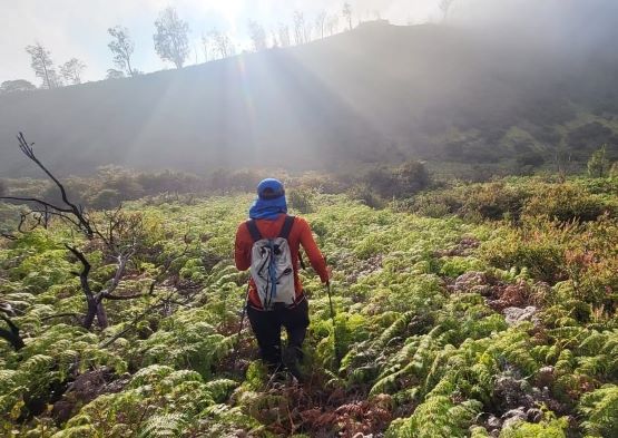

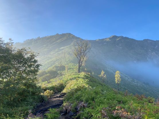
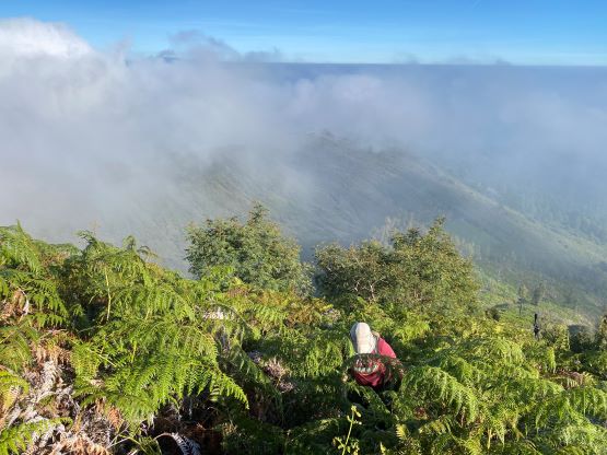

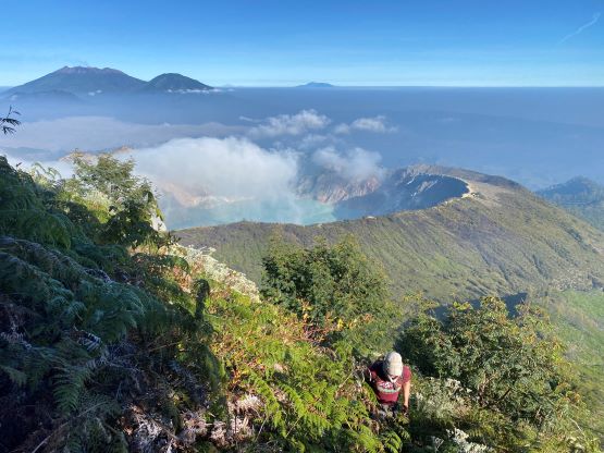
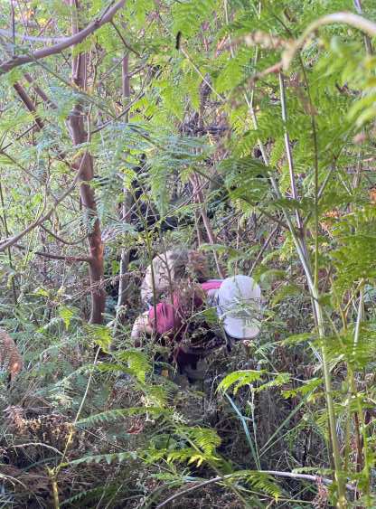


The traverse across the rim in a clockwise direction started off easily with mostly open terrain, but soon deteriorated. The true summit is hidden behind the obvious “summit” ahead of us, so we had to traverse around this fore summit. The other option was to ascend up and over the false summit, but the bushwhacking wasn’t particularly appealing. The route that we chose traversed low and around, but still involved a stretch of horrendous bushwhacking. To make it worse, we were on side-hilling terrain and for at least 50% of the time I was unable to see the ground. Full body wrestling was required for at least an hour and I would grade this part “BW4” for the least. The only reason that we kept going was the lack of thorny plants, but they weren’t completely absent. For once in a while we would come to one and they often surprised me. I ended up having to pick thorns out of various parts of my body after the trip. Thankfully with perseverance we pushed it through and made to the summit ridge. The final stretch leading to the true summit was unfortunately also covered in that thick forest and required another great deal of thrashing. At this point we just didn’t give a fuck. The true summit was completely covered in the forest and offered no view whatsoever. There are two high point contenders and I insisted to thrash to the farther one just in case some surveyors come here (maybe in 50 years) and claim that we didn’t actually make the summit. We didn’t want that to happen.


On the descent we were able to follow the “path” that we just made and got out of that true summit area with ease. Adam then proposed to follow the other route described in that reference trip report. I was not particularly happy about that because I always prefer to stick to the known and I especially dislike making gambling on difficult terrain, but I eventually gave in. Adam’s judgement was correct and we indeed found a better way to get back to the NW Ridge, with hardly any notable thrashing. The descent off the NW Ridge was also simpler as the gravity was now doing us favour. For bushwhacking the worst is on side-hill terrain, followed by uphill, and on downhill it’s never that terrible unless we are talking about thorny stuffs. In short time we were back into the ravine. The plan was to follow that lower trail out, but it didn’t seem to go towards the direction we wanted. I suspected it’s just an animal trail, so we bushwhacked back up to the Ijen crater rim. The rest of the descent was a piece of cake by comparison. I jogged most of the downhills and finished the round trip in under 7 hours. I had previously told the driver that we’d be back in 4 hours at the worst case scenario as I never anticipated so much bushwhacking, but thankfully I was able to catch cell reception on several parts of the route, so I was able to keep the driver updated.