El Capitan (TX)
March 17, 2017
2464m
Guadalupe Mountains National Park, TX
Not to be confused with the worldwide famed El Capitan in California’s Yosemite National Park, this one is far less known and sits on the westernmost reach of the state of Texas, right next to the state’s highest peak – Guadalupe Peak. The rock formation of this peak is equally impressive with its limestone tower rising boldly above the desert floor sticking into the sky. Unlike its taller neighbour, there’s no maintained trail to the summit of El Capitan and combining with its shear profile I’d say this is a bigger lure for peak-bagger like myself. For obvious reasons the primary objective was still Guadalupe Peak but I knew I wouldn’t want to go home without attempting on El Capitan.
The route information was not well spread on the internet but from the only trip report available the route could be easily deduced. I would have to ascend most of the way to the summit of Guadalupe Peak before dropping towards the col on the desert type of bushy slope. This seemed “interesting” to say the least but as soon as I saw the actual slope I knew it’s not going to be as bad as it was described, so after leisurely tagging the Texas’ state highest point I didn’t waste much time but immediately focusing on my next business.
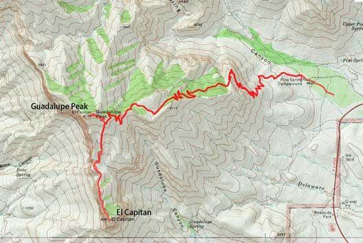
Guadalupe Peak and El Capitan ascent route. GPX DL
First of all I would spend a couple minutes swapping sneakers for my La Sportiva Trango which is apparently the more suitable footwear for off-trail travel in a desert. The steepest section was right off the bat but even so, the scrambling was pretty trivial. I lost elevation in no time and lower down I started to trend a bit towards down-climber’s right slowly merging into a dry gully. There’s some bushwhacking involved near the bottom of this run but nothing really worth noting for someone coming from the wild west coast… After crossing the gully I easily picked my way over to the col. Upwards and onwards it was pretty fun to stay on the edge of the overhang.

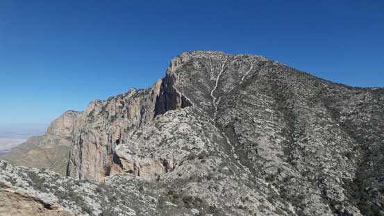
El Capitan seen from the summit of Guadalupe Peak.
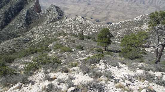
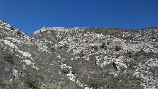
As typical as it gets descending towards the col. It’s not very bushy.
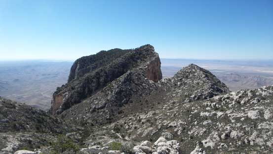
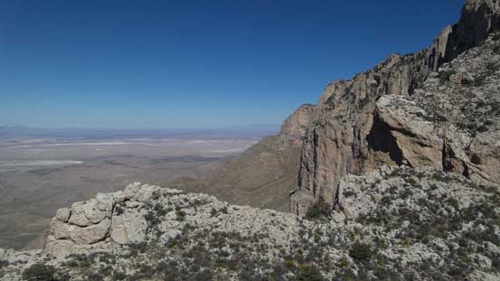
El Capitan starts to look big now.
Looking back at the slope I just descended.
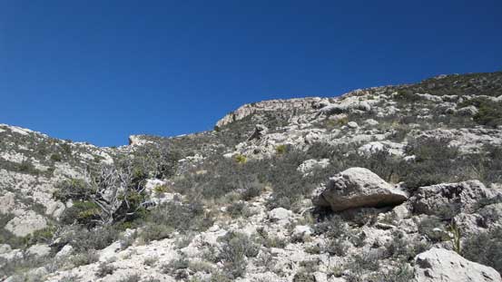
There’s one minor bump which I opted to bypass by some side-hiling. Although unpleasant it did get me rid off some elevation gain and loss. And then it’s a somewhat tedious plod up to the false summit with some brief hands-on moves here and there. To my surprise there’s even one register on this false peak but as a peak-bagger I wouldn’t be satisfied without tagging the true summit so resumed on.
Going towards the El Capitan side now.
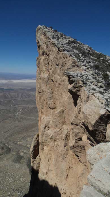
A very attractive feature.
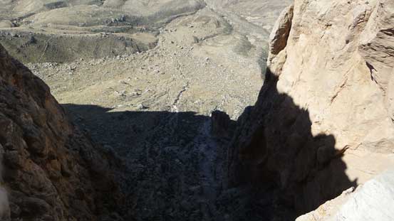
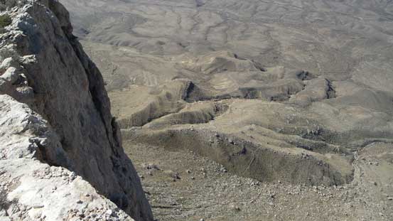
Looking down over the edge. It was actually overhanging.
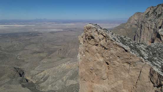
Getting higher than the previous spire now.
Looking back at Guadalupe Peak and the slog I had to re-ascend later.
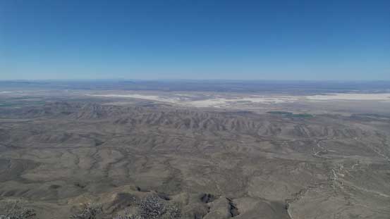
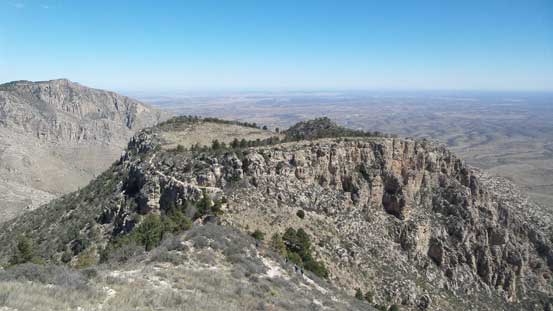
The typical Chihuahuan Desert landscape, from the false summit.
More about the desert landscape.
The type of terrain did not change much. By staying on, or close to the edge most of the bush could be avoided but occasionally I still had to use my hands here and there. The traverse was a bit longer than I thought and the view from the true summit was actually worse than from the false peak. I took a long break regathering some strength as the slog back up Guadalupe’s shoulder would be just as painful as it appeared.

Traversing towards the true summit.
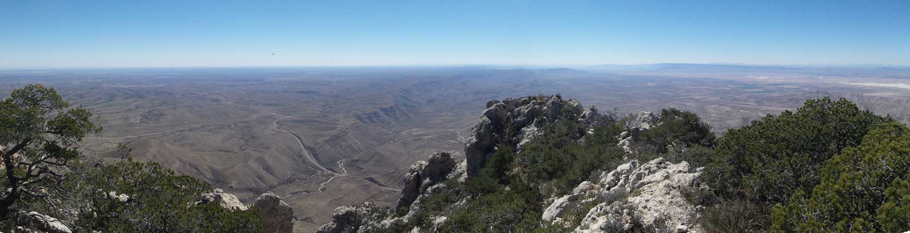
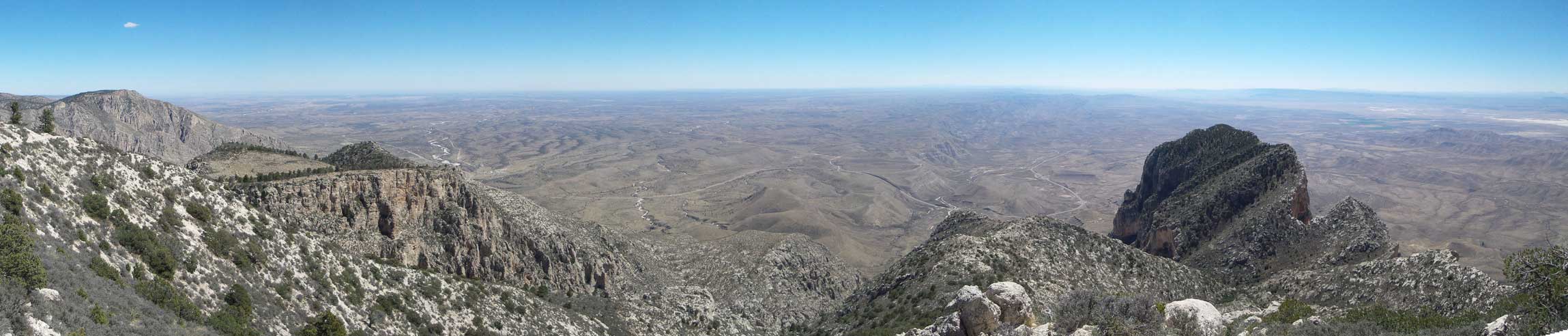
Partial Summit Panorama from El Capitan. Click to view large size.

Partial Summit Panorama from El Capitan. Click to view large size.

Looking back towards Mt. Hunter

Signing the register.
This is what you would expect as a register in America..

Me on the summit of El Capitan.
Eventually it’s time to get going. The plod back across that undulating ridge was not too bad given the constant view looking down the left side.. That drop was massive.. But soon enough I had to face that steep grunt with the Texas sun behind me baking mercilessly. It turned out to be not too terribly bad and once back to the trail I got to change my footwear again which felt incredibly good. And then it’s just a leisure plod down the overly crowded Guadalupe Peak trail back to car. The entire descent was exposed to the sun and was brutally hot.

Going back along the edge. A look at the salt plains near Dell City.

Not looking forwards to the plod back up Guadalupe Peak.

Another look across the cliffs towards the state of New Mexico

That very picturesque spire.
Time to start the grunt…

Slowly gaining height.

Looking back at El Capitan.
Panorama from Guadalupe Peak’s shoulder. Click to view large size.

Another panorama after crossing over an edge. Click to view large size.
This is a broad plateau on the east side of Guadalupe Peak.
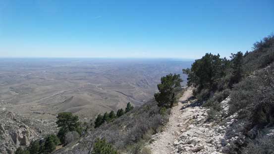
The upper portion of this trail.

You can tell that the Americans are rich…

Another look at this bridge.

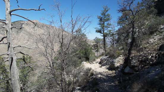
Down, down, down…

Mt. Hunter starts to look big again.

As much as the trail goes.
Just another picture to show the trail.

Pine Springs is somewhere down by that dry creek. There’s literally nothing.

The lower portion of this trail, with Mt. Hunter behind.

Another look at the dry creek and Pine Springs.
There’s no point in lingering at the parking lot as there’s literally nothing to do at Pine Springs and the nearest urban area is El Paso, TX so I had to head back. The 110-mile drive back along SR 62 was a cruise sailing although the surrounding landscape was as “Texas” as it could be.
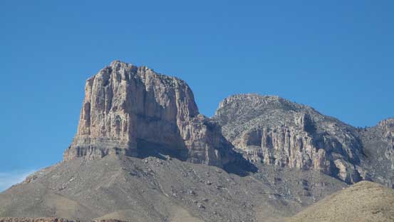
A review shot of El Capitan and Guadalupe Peak.

The typical western Texas scenery.
Checking the time I still had a couple hours to kill before sunset and not wanting to waste the valuable daytime hours I had to make another ascent. I was both mentally and physically tired from the heat so nothing outrageous. It appeared to have a aerial tramway heading right to the summit of Ranger Peak and some basic Google search saw me instantly locking on my objective. It’s only 8 dollars per individual, so why not…
